Old Map Company
Shop
Blog
Gallery
Cart (
0
)
0
Old Map Company
Shop
Blog
Gallery
Contact Us
All items
LIGHTHOUSE PLANS
BIRD'S EYE VIEWS
IRELAND MAPS
NAUTICAL CHARTS
CONNECTICUT MAPS
CALIFORNIA MAPS
MAINE MAPS
MASSACHUSETTS MAPS
MICHIGAN MAPS
NEW HAMPSHIRE MAPS
NEW JERSEY MAPS
NEW YORK MAPS
PENNSYLVANIA MAPS
FLORIDA MAPS + CHARTS
RHODE ISLAND MAPS
PRINTS + POSTERS
WISCONSIN MAPS
VERMONT MAPS
MARYLAND MAPS
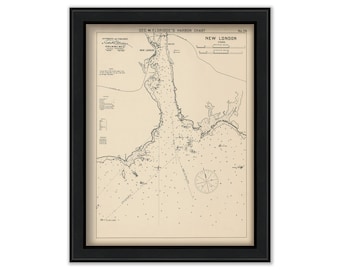
New London, Connecticut - Nautical Chart by George W. Eldridge 1901
$42.00
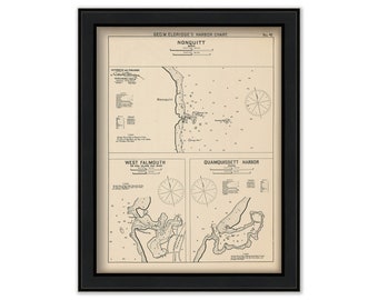
Nonquitt, West Falmouth & Quamquissett Harbors, MA - Nautical Chart by George W. Eldridge 1901
$42.00
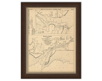
Saybrook Harbor & Black Rock Connecticut - Nautical Chart by George W. Eldridge 1901
$42.00
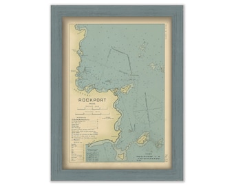
ROCKPORT, Massachusetts 1909 - Nautical Chart by Geo. Eldridge Colored Version
$44.00
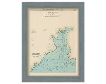
New Haven, Connecticut - Nautical Chart by George W. Eldridge Colored Version
$50.00
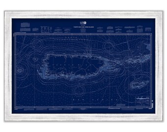
Puerto Rico and VIRGIN ISLANDS - St Thomas, St Croix, St John, Vigin Gorda, Tortola and Josh Van Dyke - 2013 Nautical Chart Blueprint
$38.00
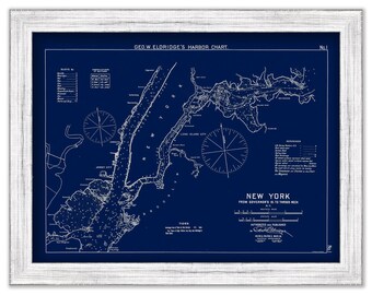
New York City - Blue Print - Nautical Chart by George W. Eldridge 1901
$44.00
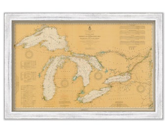
GREAT LAKES - 1916 Nautical Chart
$38.00
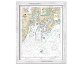
Monhegan Island and Muscongus Bay, Maine - 2018 Nautical Chart
$26.00
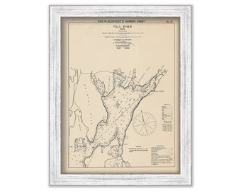
FALL RIVER, Massachusetts - Nautical Chart by George W. Eldridge 1901
$50.00
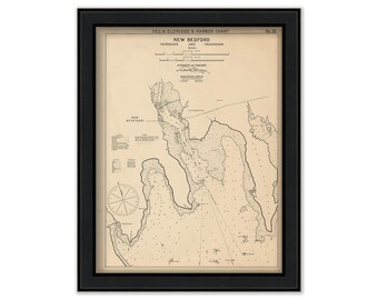
New Bedford, Fair Haven, & Padanaram - Nautical Chart by George W. Eldridge 1901
$42.00
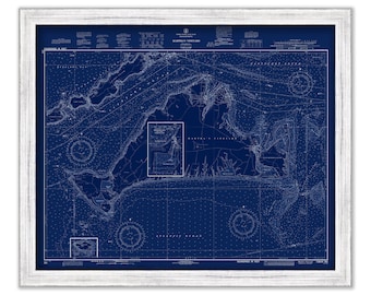
MARTHA'S VINEYARD, Massachusetts - Blueprint Nautical Chart 1972
$44.00
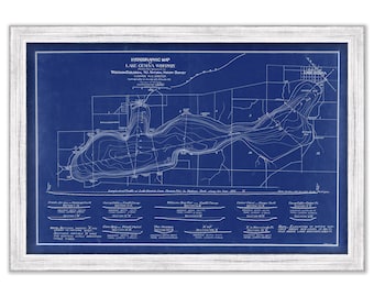
LAKE GENEVA, WISCONSIN - 1898 Nautical Chart
$38.00
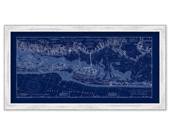
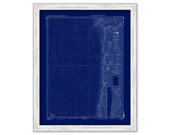
FIRE ISLAND and Jones Beach, Long Island, New York 2003 NOAA Chart Blueprint
$44.00
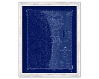
Cape Blanco to Cape Flattery, Washington/Oregon - 2006 Nautical Chart Blueprint
$26.00
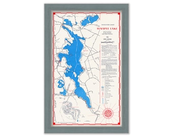
LAKE SUNAPEE, New Hampshire 1961 Nautical Chart
$38.00
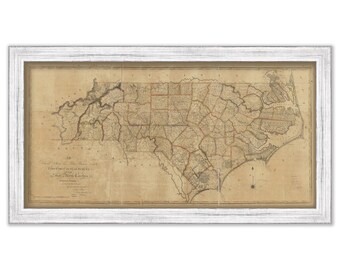
NORTH CAROLINA - 1808 State Map
$44.00
Yaquina Head to Columbia River, Washington/Oregon - 2009 Nautical Chart Blueprint
$26.00
MOBILE, Alabama - 2016 Blueprint Nautical Chart
$30.00
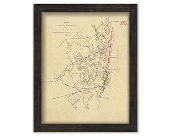
ABSECOM INLET, Atlantic City, New Jersey - 1881 Sketch
$26.00
1
...
5
6
7
8
9
10
11
...
57
0 items in your cart
Close
Keep shopping! :)
Legal imprint
Close