Old Map Company
Shop
Blog
Gallery
Cart (
0
)
0
Old Map Company
Shop
Blog
Gallery
Contact Us
All items
LIGHTHOUSE PLANS
BIRD'S EYE VIEWS
IRELAND MAPS
NAUTICAL CHARTS
CONNECTICUT MAPS
CALIFORNIA MAPS
MAINE MAPS
MASSACHUSETTS MAPS
MICHIGAN MAPS
NEW HAMPSHIRE MAPS
NEW JERSEY MAPS
NEW YORK MAPS
PENNSYLVANIA MAPS
FLORIDA MAPS + CHARTS
RHODE ISLAND MAPS
PRINTS + POSTERS
WISCONSIN MAPS
VERMONT MAPS
MARYLAND MAPS
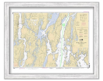
BOOTHBAY HARBOR and VICINITY, Maine - 2012 Nautical Chart
$37.00
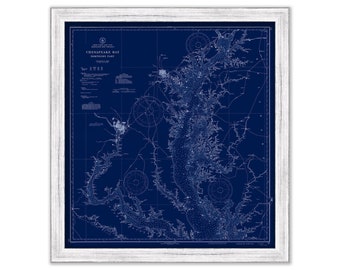
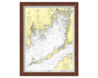
CHESAPEAKE BAY Nautical Chart Blueprint- Northern Section - 1937
$38.00
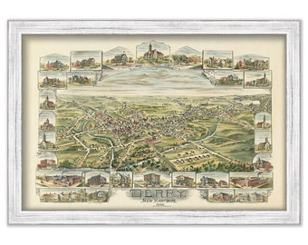
DERRY, New Hampshire - 1898 Bird's Eye View
$38.00
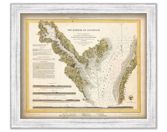
Annapolis Harbor, Maryland 1846 Nautical Chart
$37.00
SAINT LAWRENCE RIVER, Holmes Point to Deer Island, New York - 1993 Nautical Chart Blueprint
$37.00
KENNEBEC RIVER, Maine 1909 - Nautical Chart by Geo. Eldridge Colored Version
$44.00
OUTER BANKS, North Carolina, Northern Section - 2018 Nautical Chart Blueprint
$26.00
Nonquitt, West Falmouth & Quamquissett Harbors, MA - Nautical Chart by George W. Eldridge 1901 0338
$50.00
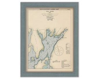
Fall River, Massachusetts - Nautical Chart by George W. Eldridge Colored Version
$50.00
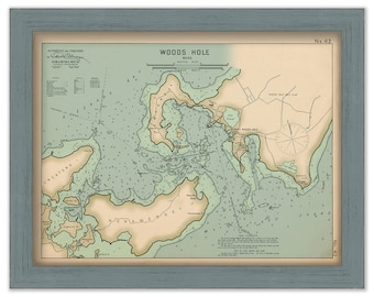
Woods Hole, Falmouth, Massachusetts - Nautical Chart by George W. Eldridge 1901 Colored Version
$40.00
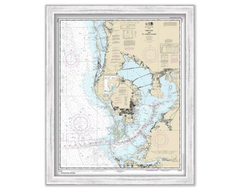
TAMPA BAY, FLORIDA 2015 Nautical Chart
$37.00
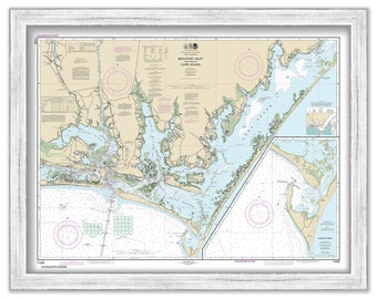
BEAUFORT INLET, North Carolina - 2015 Nautical Chart
$37.00
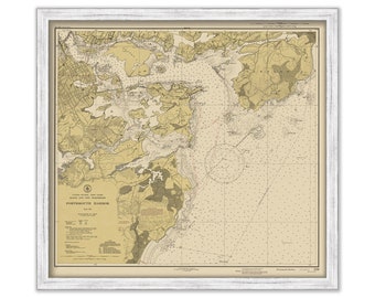
PORTSMOUTH HARBOR 1945 Chart - Maine & New Hampshire
$40.00
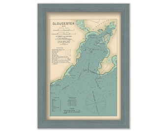
Gloucester Harbor, Massachusetts - Nautical Chart by Geo. Eldridge Colored Version
$44.00
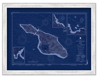
SANTA CATALINA ISLAND, California - 2004 Nautical Chart Blueprint
$40.00
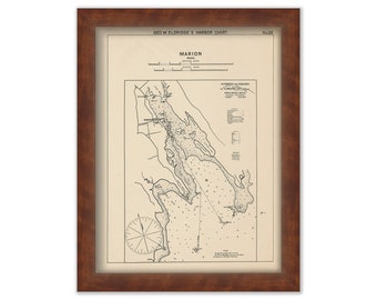
MARION, Massachusetts - Nautical Chart by George W. Eldridge 1901
$50.00
MATTAPOISETT, Massachusetts - Nautical Chart by George W. Eldridge 1901
$50.00
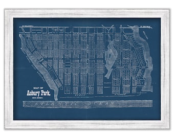
ASBURY PARK, New Jersey Blueprint Map
$40.00
MARION, MATTAPOISETT and FALMOUTH, Massachusetts - Nautical Chart 1971
$38.00
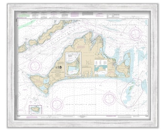
MARTHA'S VINEYARD, Massachusetts - Nautical Chart 2019
$40.00
1
...
8
9
10
11
12
13
14
...
57
0 items in your cart
Close
Keep shopping! :)
Legal imprint
Close