Old Map Company
Shop
Blog
Gallery
Cart (
0
)
0
Old Map Company
Shop
Blog
Gallery
Contact Us
All items
LIGHTHOUSE PLANS
BIRD'S EYE VIEWS
IRELAND MAPS
NAUTICAL CHARTS
CONNECTICUT MAPS
CALIFORNIA MAPS
MAINE MAPS
MASSACHUSETTS MAPS
MICHIGAN MAPS
NEW HAMPSHIRE MAPS
NEW JERSEY MAPS
NEW YORK MAPS
PENNSYLVANIA MAPS
FLORIDA MAPS + CHARTS
RHODE ISLAND MAPS
PRINTS + POSTERS
WISCONSIN MAPS
VERMONT MAPS
MARYLAND MAPS
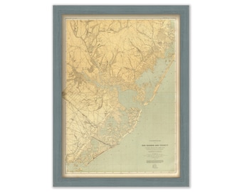
EGG HARBOR and VICINITY, New Jersey - 1888 Topographical Map
$25.00
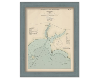
Milford, Connecticut - Nautical Chart by George W. Eldridge Colored Version 0314
$50.00
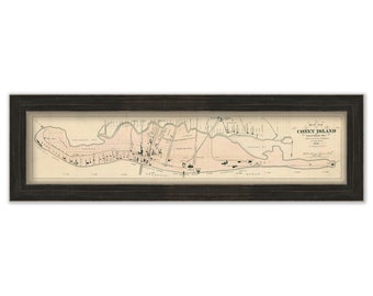
CONEY ISLAND, New York City - 1879 Map
$37.00
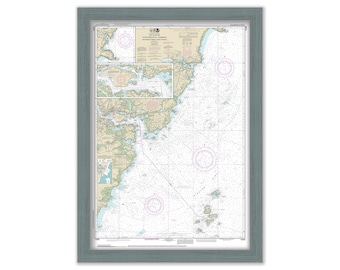
CAMDEN, ROCKPORT and ROCKLAND, Maine - Nautical Chart 2017
$38.00
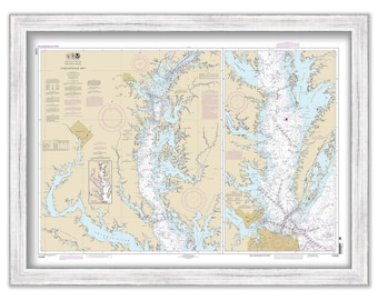
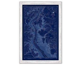
CHESAPEAKE BAY, Maryland/Virginia - 2014 Nautical Chart
$26.00
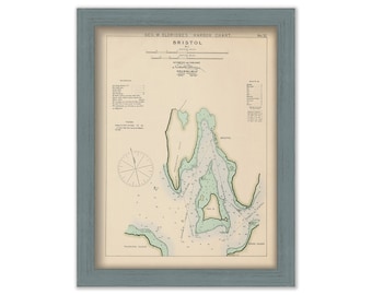
Bristol, Rhode Island - Nautical Chart by George W. Eldridge Colored Version 0329
$50.00
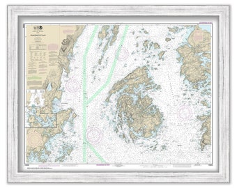
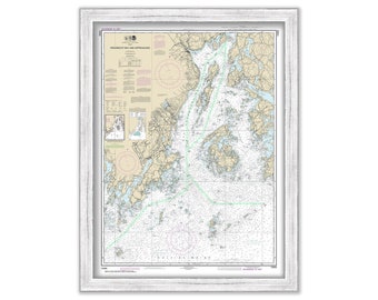
PENOBSCOT BAY and APPROCHES, Maine - Nautical Chart 2017
$37.00
PORTSMOUTH HARBOR, Cape Neddick Harbor and Isles of Shoals, New Hampshire - Nautical Chart 2019
$37.00
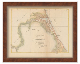
NORTH RIVER, Massachusetts Colored Chart published in 1872
$44.00
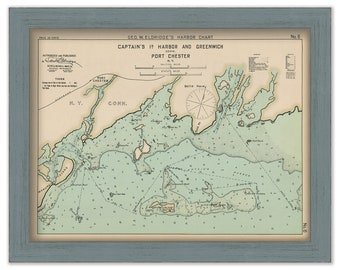
Greenwich, Port Chester, and Captain's Island Harbor - Nautical Chart by George W. Eldridge 1901 0306
$50.00
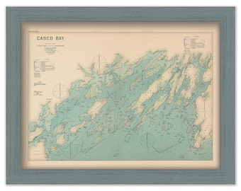
CASCO BAY, Maine 1909 Colored Nautical Chart by Geo. Eldridge
$38.00
APOSTIC ISLANDS, Minnesota - 2014 Nautical Chart
$37.00
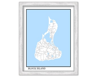
BLOCK ISLAND, Rhode Island - Contemporary Map Poster
$26.00
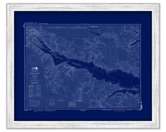
PAMLICO RIVER, North Carolina - 2012 Nautical Chart Blueprint
$38.00
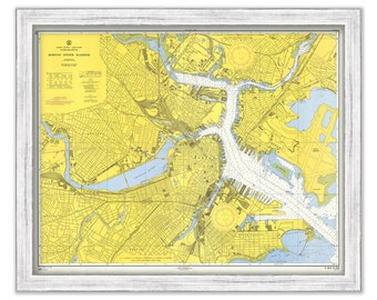
BOSTON INNER HARBOR, Massachusetts - 1954 Nautical Chart
$44.00
DELAWARE RIVER, Delaware and New Jersey - 2017 Nautical Chart Blueprint
$30.00
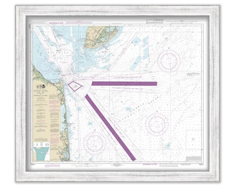
REHOBOTH BEACH, Delaware and Cape May, New Jersey - 2018 Nautical Chart
$30.00
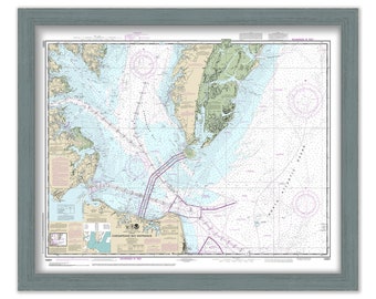
CHESAPEAKE BAY ENTRANCE, Maryland/Virginia - 2021 Nautical Chart
$26.00
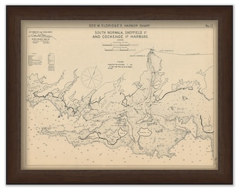
South Norwalk, Sheffield Island, & Cockenoe Island Harbors Connecticut - Nautical Chart by George W. Eldridge 1901
$50.00
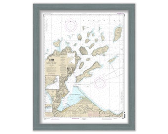
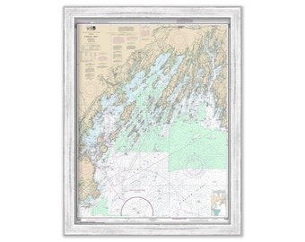
CASCO BAY, Maine - Nautical Chart 2016
$40.00
1
...
27
28
29
30
31
32
33
...
57
0 items in your cart
Close
Keep shopping! :)
Legal imprint
Close