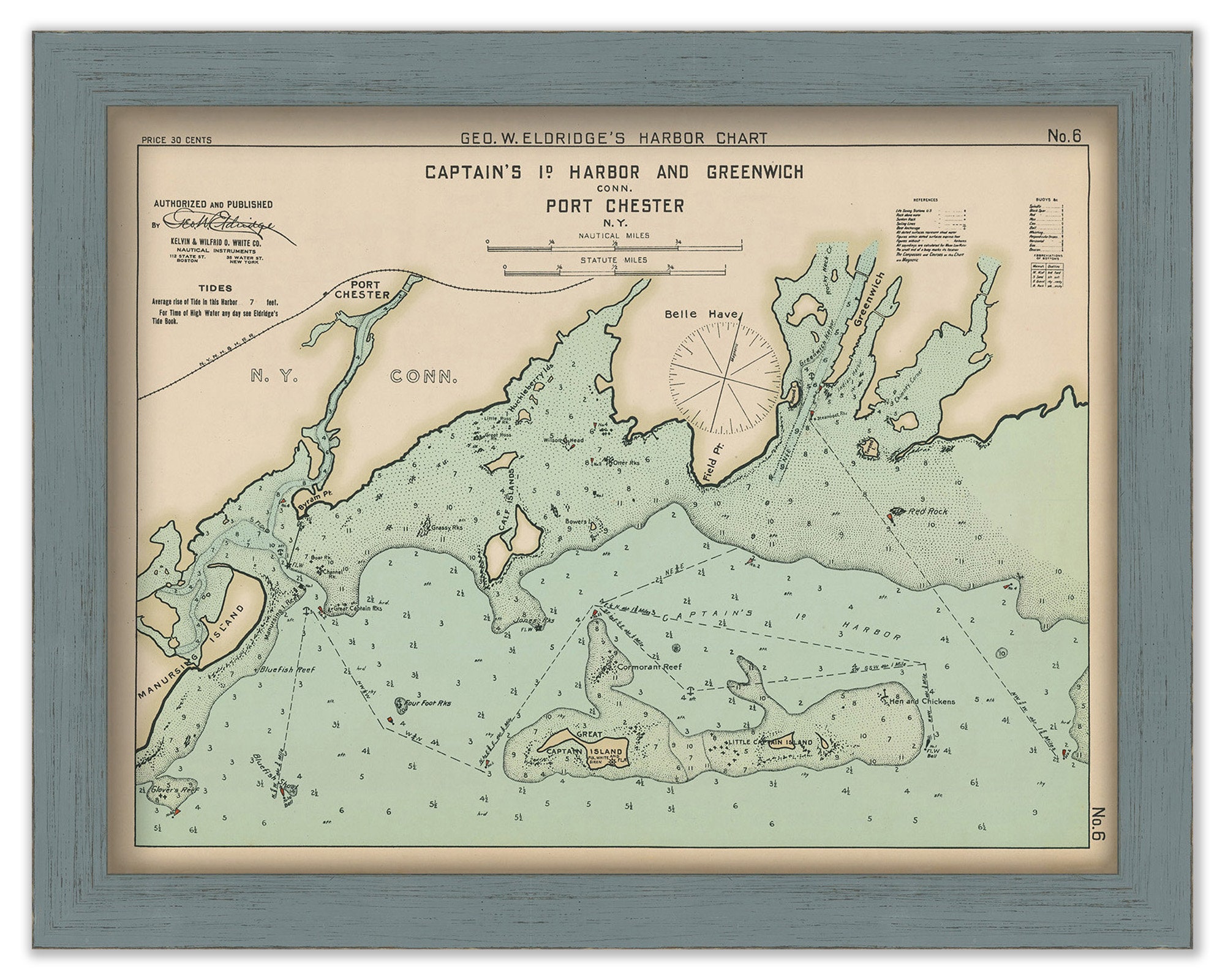
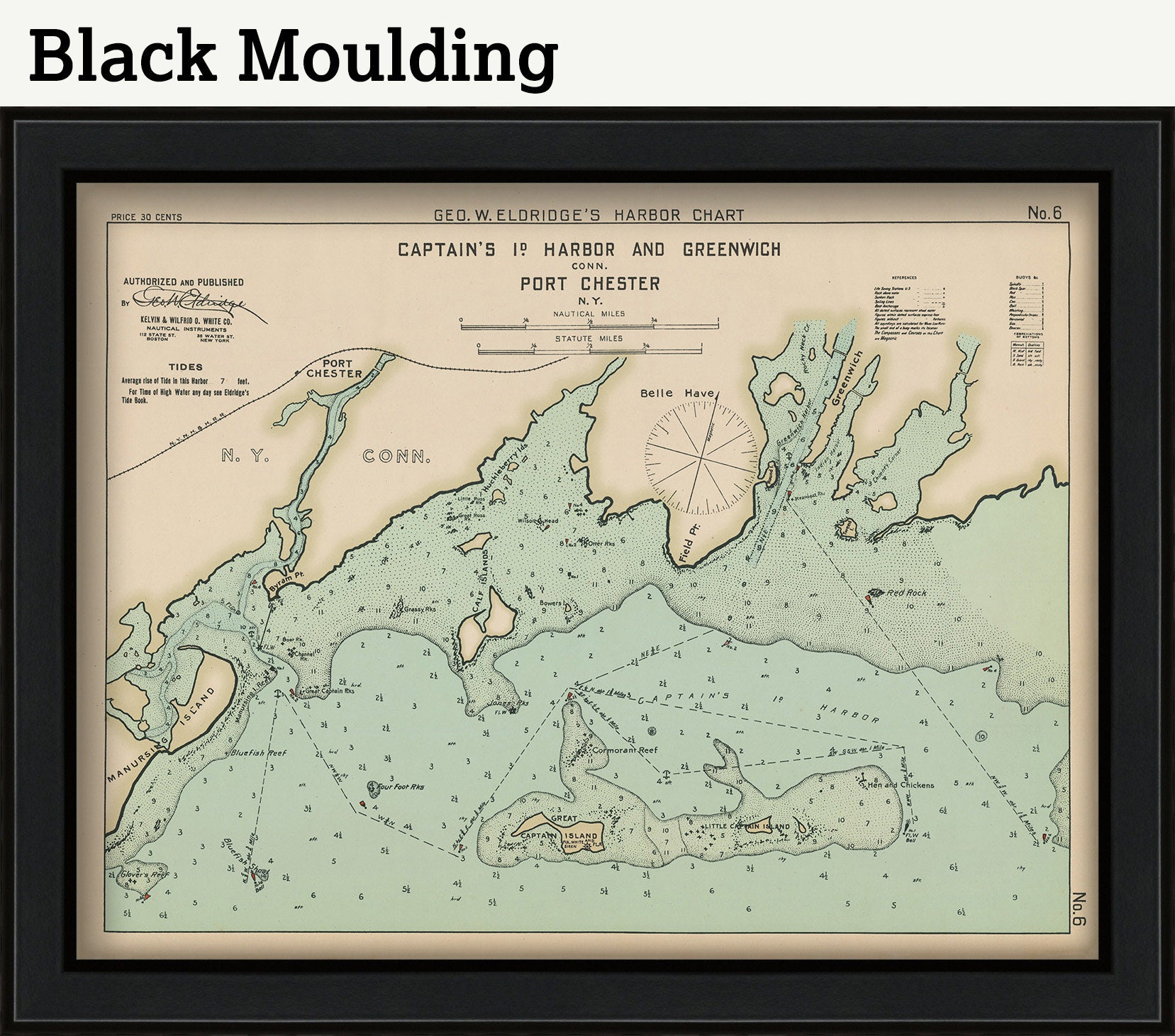
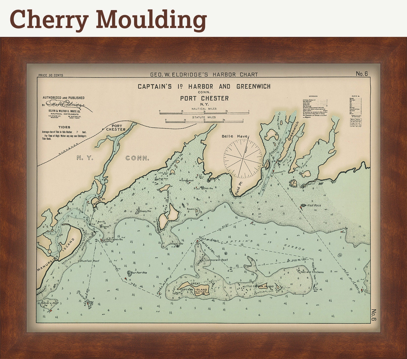
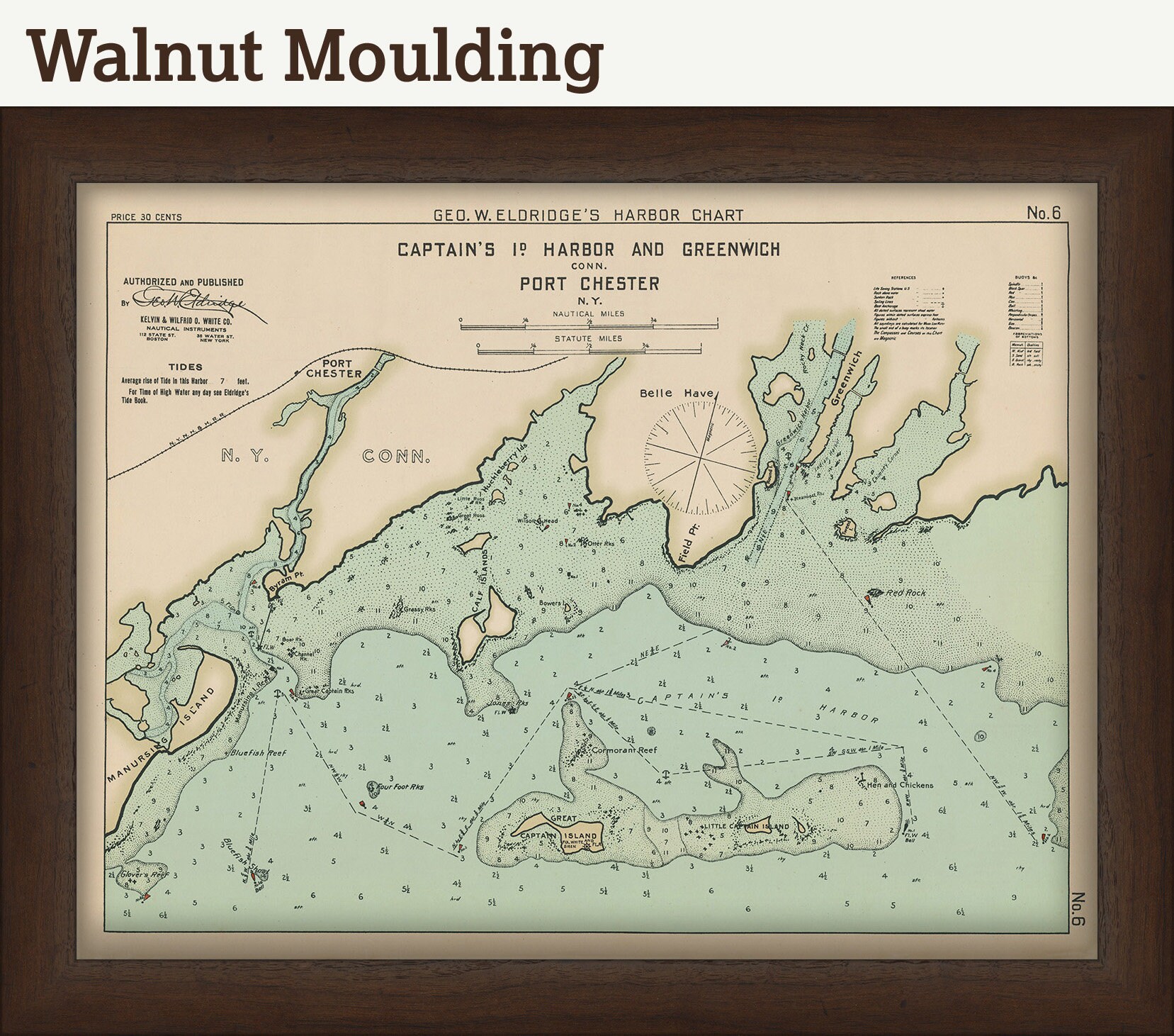

Greenwich, Port Chester, and Captain's Island Harbor - Nautical Chart by George W. Eldridge 1901 0306
$50.00
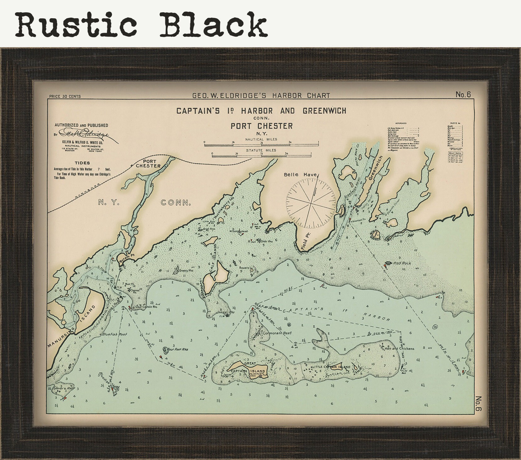
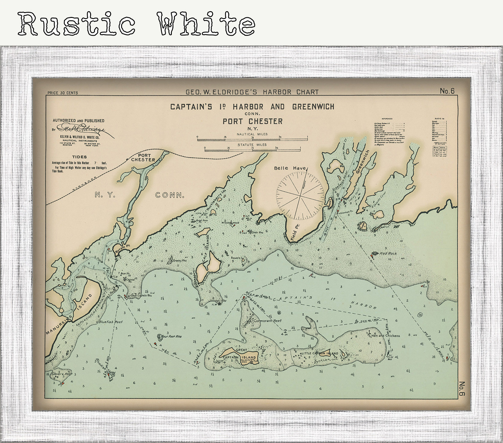
A Nautical Chart of Greenwich, Port Chester, and Captain's Island Harbor by George W. Eldridge originally published in 1901. This map is from the atlas "Geo. W. Eldrige's Harbor-Chart Book, New York to Boston". Eldridge Charts are renowned for bold lines and a clear and concise style.
Dimensions of the Map are: 20" wide by 15" tall
Framed Dimensions are: 23" wide by 18" tall
Custom sizes are available. If you are interested in a custom size, please let us know through the "ask a question" button or send us an email at oldmapcompany [!at] gmail.com
This map has been scanned at 300 dpi using state of the art equipment. The replica map is printed on heavy matte fine art paper using archival pigment inks.
If you would like to inspect a higher resolution version of this map, please copy and paste this url into a new tab in your browser:
http://rmicusec.sirv.com/etsy/nybc006.jpg
The colors in this map are also highly customizable, if you have something different in mind please let us know.
0306
Shipping from United States
Processing time
1-3 business days
Customs and import taxes
Buyers are responsible for any customs and import taxes that may apply. I'm not responsible for delays due to customs.
Payment Options
Returns & Exchanges
Returns & exchanges not accepted
But please contact me if you have problems with your order
I gladly accept cancellations
Request a cancellation within: 1 hours of purchase