Old Map Company
Shop
Blog
Gallery
Cart (
0
)
0
Old Map Company
Shop
Blog
Gallery
Contact Us
All items
LIGHTHOUSE PLANS
BIRD'S EYE VIEWS
IRELAND MAPS
NAUTICAL CHARTS
CONNECTICUT MAPS
CALIFORNIA MAPS
MAINE MAPS
MASSACHUSETTS MAPS
MICHIGAN MAPS
NEW HAMPSHIRE MAPS
NEW JERSEY MAPS
NEW YORK MAPS
PENNSYLVANIA MAPS
FLORIDA MAPS + CHARTS
RHODE ISLAND MAPS
PRINTS + POSTERS
WISCONSIN MAPS
VERMONT MAPS
MARYLAND MAPS
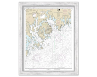
MOUNT DESERT ISLAND, Maine - 2017 Nautical Chart
$38.00
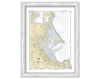
PLYMOUTH, KINGSTON and DUXBURY Harbors, Massachusetts - 2010 Nautical Chart
$37.00
DULUTH - SUPERIOR HARBOR, Minnesota - 2020 Nautical Chart
$26.00
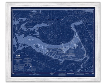
NANTUCKET, Massachusetts - 2019 Nautical Chart Blueprint
$40.00
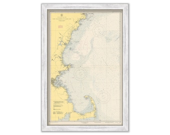
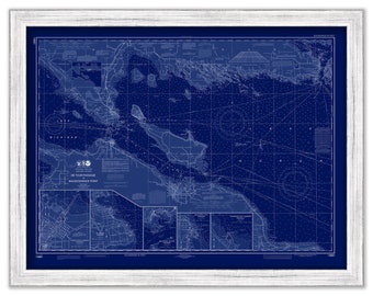
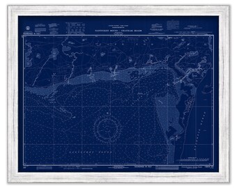
Cape Elizabeth to Cape Cod - 1951 Nautical Chart
$44.00
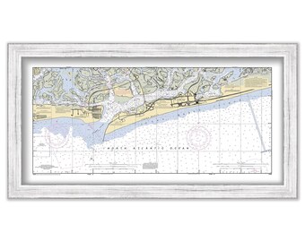
JONES BEACH, Long Island, New York 2003 NOAA Chart
$38.00
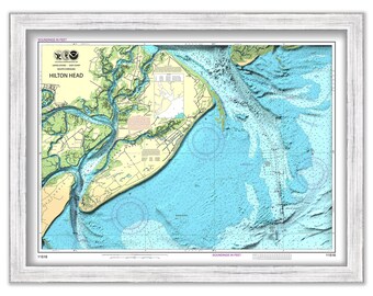
HILTON HEAD, South Carolina - Nautical Chart 2015
$44.00
CHATHAM Harbor and PLEASANT BAY, Massachusetts - 2013 Nautical Chart Blueprint
$44.00
MOUNT HOPE BAY, Rhode Island - Nautical Chart published in 2013
$44.00
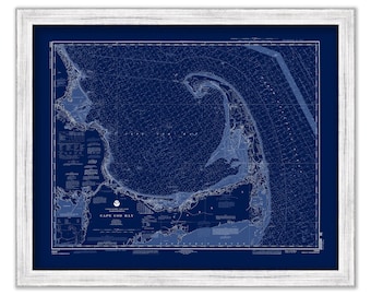
CAPE COD BAY, Massachusetts - 1996 Nautical Chart Blueprint
$44.00
De Tour Passage to Waugoshance Point, Michigan - 2014 Nautical Chart Blueprint
$26.00
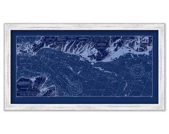
WESTPORT, Massachusetts - Nautical Chart 1973
$44.00
NIAGARA FALLS, New York - 2013 Nautical Chart
$26.00
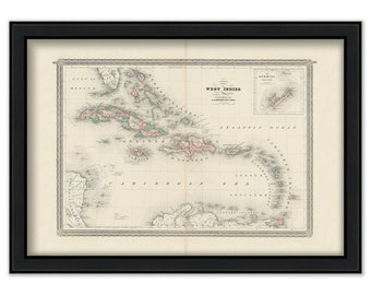
WEST INDIES 1864 Antique Map Reproduction
$48.00
Harbors of CHATHAM, HARWICHPORT and DENNISPORT, Massachusetts - Nautical Chart Blueprint 1972
$44.00
FALMOUTH, POPPONESSET and OSTERVILLE, Massachusetts - 2001 Nautical Chart Blueprint
$38.00
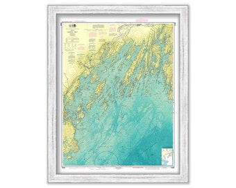
CASCO BAY, Maine - 2019 Bathymetry Nautical Chart
$40.00
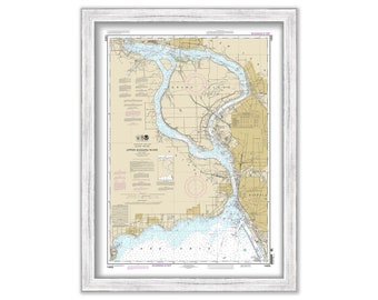
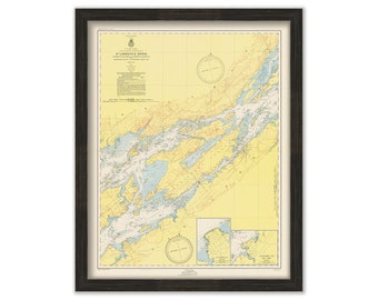
SAINT LAWRENCE RIVER, New York - The Thousand Islands 1953 Nautical Chart
$44.00
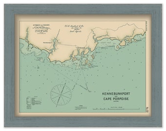
Kennebunkport and Cape Porpoise, Maine 1909 - Nautical Chart by Geo. Eldridge Colored Version
$44.00
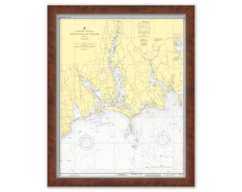
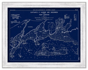
Greenwich and Port Chester - Blue Print - Nautical Chart by George W. Eldridge 1901
$44.00
1
...
26
27
28
29
30
31
32
...
57
0 items in your cart
Close
Keep shopping! :)
Legal imprint
Close