Old Map Company
Shop
Blog
Gallery
Cart (
0
)
0
Old Map Company
Shop
Blog
Gallery
Contact Us
All items
LIGHTHOUSE PLANS
BIRD'S EYE VIEWS
IRELAND MAPS
NAUTICAL CHARTS
CONNECTICUT MAPS
CALIFORNIA MAPS
MAINE MAPS
MASSACHUSETTS MAPS
MICHIGAN MAPS
NEW HAMPSHIRE MAPS
NEW JERSEY MAPS
NEW YORK MAPS
PENNSYLVANIA MAPS
FLORIDA MAPS + CHARTS
RHODE ISLAND MAPS
PRINTS + POSTERS
WISCONSIN MAPS
VERMONT MAPS
MARYLAND MAPS
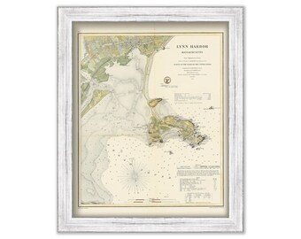
LYNN HARBOR, Massachusetts - Nautical Chart by United States Coast and Geodetic Survey 1859
$50.00
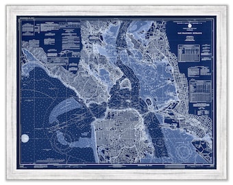
SAN FRANCISCO HARBOR, California - Nautical Chart Blueprint published in 1977
$30.00
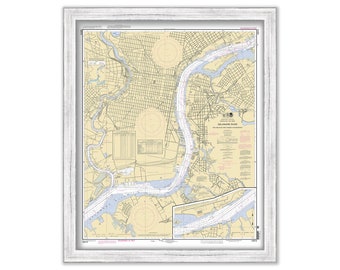
PHILADELPHIA and CAMDEN WATERFRONTS 2012 Nautical Chart
$30.00
PLYMOUTH, KINGSTON, & DUXBURY, Massachusetts 1909 - Black and White - Nautical Chart by Geo. Eldridge
$50.00
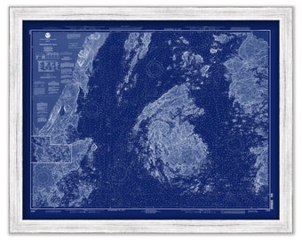
PENOBSCOT BAY, Maine - 1992 Nautical Chart Blueprint
$38.00
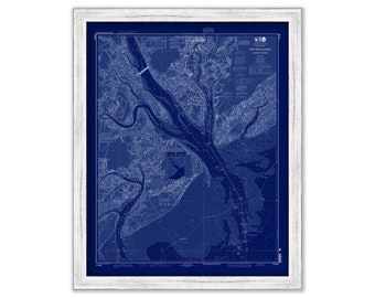
SAVANNAH RIVER, GEORGIA - 2015 Nautical Chart Blueprint
$37.00
CAMDEN and ROCKPORT HARBORS, Maine - 1864 Nautical Chart Blueprint
$26.00
DUTCH ISLAND HARBOR, Narragansett Bay, Rhode Island - Nautical Chart Blueprint by United States Coast and Geodetic Survey 1862
$26.00
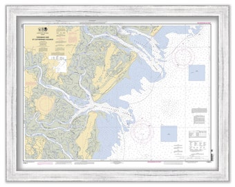
NEW RIVER, North Carolina - 2017 Nautical Chart
$38.00
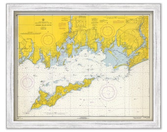
FISHERS ISLAND SOUND 1966 - Nautical Chart
$37.00
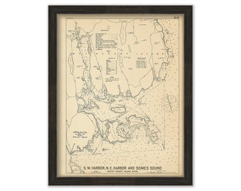
MOUNT DESERT ISLAND-Southwest Harbor and Northeast Harbor, Maine - 1909 Chart by Geo. Eldridge
$38.00
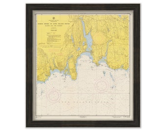
NIANTIC BAY and VICINITY, Connecticut - Nautical Chart published in 1957
$40.00
OSSABAW and St CATHERINE SOUND, Georgia - 2011 Nautical Chart
$38.00
MARCO ISLAND, Florida - 2015 Nautical Chart Blueprint
$38.00
St HELENA and HILTON HEAD Island, South Carolina - 2013 Nautical Chart Blueprint
$26.00
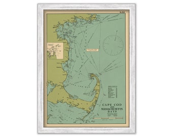
Cape Cod and Massachusetts Bay Map by Eldridge - 1912
$44.00
NAVESINK and SHREWSBURY RIVERS, New Jersey 2017 Nautical Chart Blueprint
$37.00
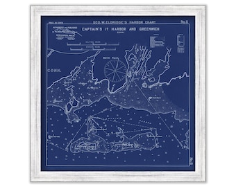
Greenwich and Captain's Island Harbor, Connecticut - Nautical Chart Blueprint by George W. Eldridge 1901
$44.00
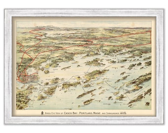
CASCO BAY, Maine - Bird's Eye View published in 1906
$26.00
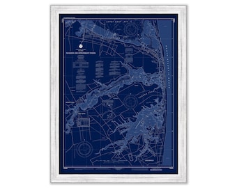
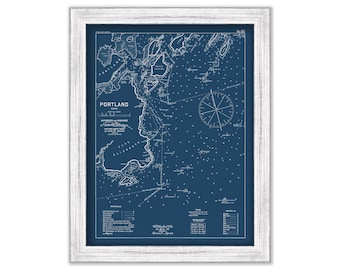
Portland Harbor, Maine 1909 - Nautical Chart by Geo. Eldridge - Blue Print Version
$50.00
1
...
25
26
27
28
29
30
31
...
57
0 items in your cart
Close
Keep shopping! :)
Legal imprint
Close