Old Map Company
Shop
Blog
Gallery
Cart (
0
)
0
Old Map Company
Shop
Blog
Gallery
Contact Us
All items
LIGHTHOUSE PLANS
BIRD'S EYE VIEWS
IRELAND MAPS
NAUTICAL CHARTS
CONNECTICUT MAPS
CALIFORNIA MAPS
MAINE MAPS
MASSACHUSETTS MAPS
MICHIGAN MAPS
NEW HAMPSHIRE MAPS
NEW JERSEY MAPS
NEW YORK MAPS
PENNSYLVANIA MAPS
FLORIDA MAPS + CHARTS
RHODE ISLAND MAPS
PRINTS + POSTERS
WISCONSIN MAPS
VERMONT MAPS
MARYLAND MAPS
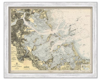
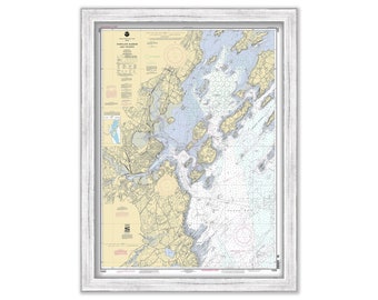
BOSTON HARBOR, Massachusetts - 1944 Nautical Chart
$37.00
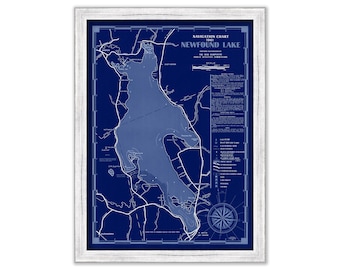
NEWFOUND LAKE, New Hampshire 1961 Nautical Chart Blueprint
$44.00
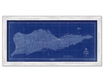
St CROIX, VIRGIN ISLANDS - 1923 Nautical Chart Blueprint
$44.00
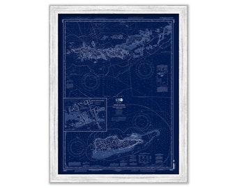
VIRGIN ISLANDS - St Thomas, St Croix, St John, Vigin Gorda, Tortola and Josh Van Dyke - 2013 Nautical Chart Blueprint
$38.00
PORTLAND HARBOR, Maine - Nautical Chart 2002
$44.00
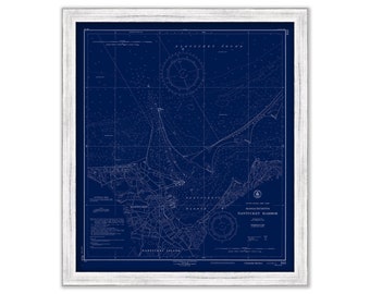
NANTUCKET HARBOR, Massachusetts 1953 Nautical Chart Blueprint
$44.00
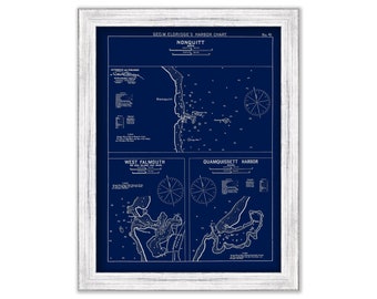
Nonquitt, West Falmouth & Quamquissett Harbors, MA - Blue Print - Nautical Chart by George W. Eldridge 1901
$37.00
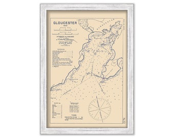
GLOUCESTER HARBOR, Massachusetts - 1909 Nautical Chart by George W. Eldridge
$37.00
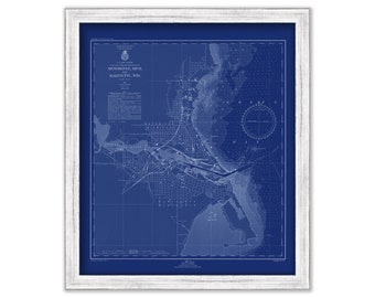
MARINETTE, Wisconsin and MENOMINEE, Michigan - 1947 Nautical Chart Blueprint
$26.00
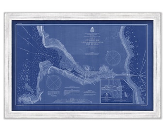
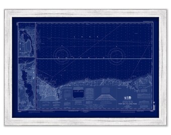
STURGEON BAY, Wisconsin - 1901 Nautical Chart Blueprint
$26.00
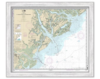
St Helena Sound to Savanannah River 2013 Nautical Chart
$44.00
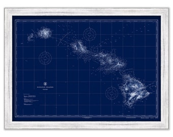
HAWAIIAN ISLANDS - 1917 Nautical Chart Blueprint
$44.00
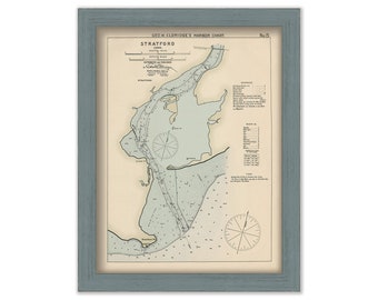
Stratford, Connecticut - Nautical Chart by George W. Eldridge colored version 0313
$50.00
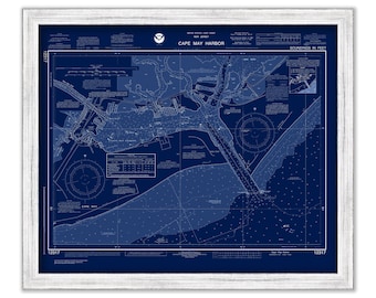
CAPE MAY HARBOR, New Jersey 2017 Nautical Chart Blueprint
$38.00
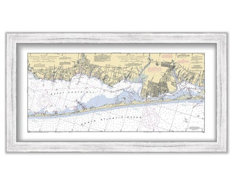
FIRE ISLAND and Great South Beach, Long Island, New York 2003 NOAA Chart
$44.00
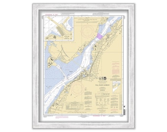
FALL RIVER HARBOR, Massachusetts - Nautical Chart published in 2011
$26.00
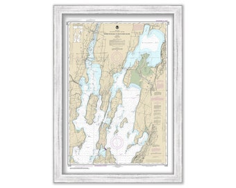
LAKE CHAMPLAIN, Vermont/New York - 2019 Nautical Chart
$26.00
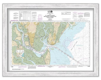
St SIMON and JEKYLL ISLAND, Georgia - 2018 Nautical Chart
$37.00
STURGEON BAY, Wisconsin - 1901 Nautical Chart
$26.00
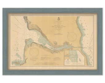
ROCHESTER, New York - 2014 Nautical Chart Blueprint
$26.00
1
...
24
25
26
27
28
29
30
...
57
0 items in your cart
Close
Keep shopping! :)
Legal imprint
Close