Old Map Company
Shop
Blog
Gallery
Cart (
0
)
0
Old Map Company
Shop
Blog
Gallery
Contact Us
All items
LIGHTHOUSE PLANS
BIRD'S EYE VIEWS
IRELAND MAPS
NAUTICAL CHARTS
CONNECTICUT MAPS
CALIFORNIA MAPS
MAINE MAPS
MASSACHUSETTS MAPS
MICHIGAN MAPS
NEW HAMPSHIRE MAPS
NEW JERSEY MAPS
NEW YORK MAPS
PENNSYLVANIA MAPS
FLORIDA MAPS + CHARTS
RHODE ISLAND MAPS
PRINTS + POSTERS
WISCONSIN MAPS
VERMONT MAPS
MARYLAND MAPS
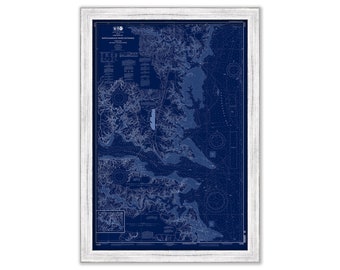
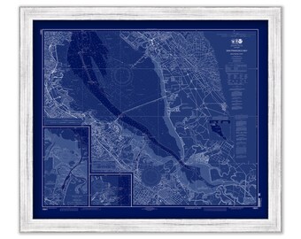
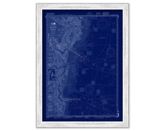
RAPPAHANNOCK RIVER-Chesapeake Bay, Virginia - 2014 Blueprint Nautical Chart
$40.00
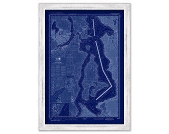
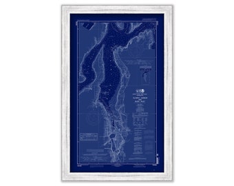
PUGET SOUND-Shilshole to Commencement Bay, Washington - 2015 Nautical Chart Blueprint
$26.00
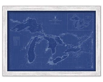
NORTHERN and NORTHWESTERN LAKES - 1944 Nautical Chart Blueprint showing all the Lighthouses on those Lakes
$26.00
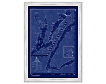
PUGET SOUND-Hood Canal and Dabob Bay, Washington - 2017 Nautical Chart Blueprint
$26.00
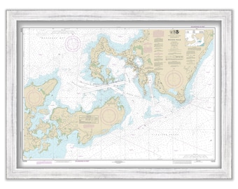
WOODS HOLE, FALMOUTH, Massachusetts - 2019 Nautical Chart
$40.00
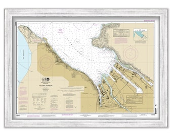
TACOMA HARBOR, Washington - 2013 Nautical Chart
$26.00
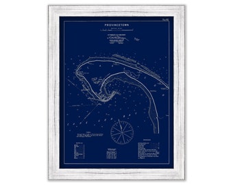
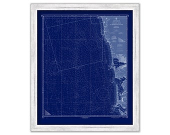
Provincetown, Massachusetts - Blue Print - Nautical Chart by George W. Eldridge 1901
$37.00
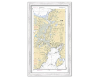
GLOUCESTER HARBOR and Annisquam River, Massachusetts - 2010 Nautical Chart
$31.00
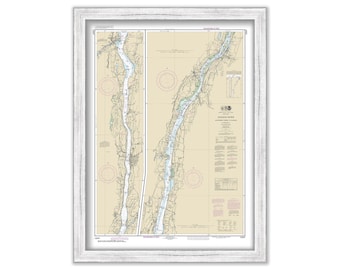
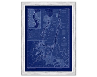
HUDSON RIVER, New York - 2017 Nautical Chart
$26.00
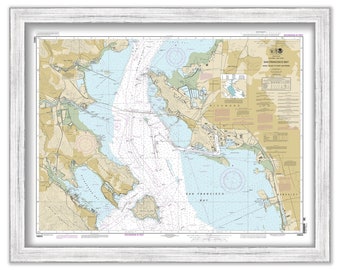
SAN FRANCISCO BAY - Angle Island to Point San Pedro, California - Nautical Chart published in 2012
$26.00
SAN FRANCISCO HARBOR, California - Nautical Chart Blueprint published in 2013
$26.00
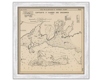
Greenwich and Captain's Island Harbor, Connecticut - Nautical Chart by George W. Eldridge 1901
$26.00
BRUNSWICK, Georgia - 2013 Nautical Chart Blueprint
$26.00
COLUMBIA RIVER to Destruction Island, Oregon/Washington - 1968 Nautical Chart Blueprint
$26.00
COLUMBIA RIVER to Destruction Island, Oregon/Washington - 1968 Nautical Chart
$26.00
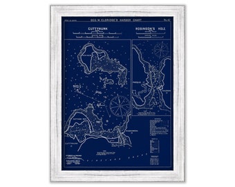
Cuttyhunk & Robinson's Hole, Massachusetts - Blue Print - Nautical Chart by George W. Eldridge 1901
$37.00
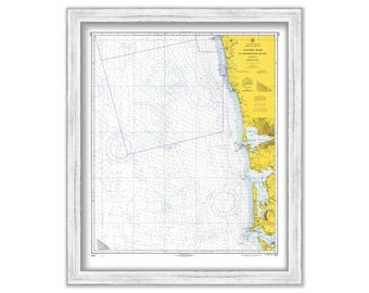
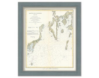
BOOTHBAY HARBOR, Maine - 1863 Nautical Chart
$26.00
OLYMPIA HARBOR and Budd Inlet, Washington - 2010 Nautical Chart Blueprint
$26.00
SAINT CLAIR RIVER, Michigan - 2018 Nautical Chart Blueprint
$38.00
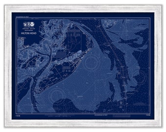
HILTON HEAD, South Carolina - Nautical Chart Blueprint 2015
$44.00
1
2
3
4
5
6
7
8
...
57
0 items in your cart
Close
Keep shopping! :)
Legal imprint
Close