Old Map Company
Shop
Blog
Gallery
Cart (
0
)
0
Old Map Company
Shop
Blog
Gallery
Contact Us
All items
LIGHTHOUSE PLANS
BIRD'S EYE VIEWS
IRELAND MAPS
NAUTICAL CHARTS
CONNECTICUT MAPS
CALIFORNIA MAPS
MAINE MAPS
MASSACHUSETTS MAPS
MICHIGAN MAPS
NEW HAMPSHIRE MAPS
NEW JERSEY MAPS
NEW YORK MAPS
PENNSYLVANIA MAPS
FLORIDA MAPS + CHARTS
RHODE ISLAND MAPS
PRINTS + POSTERS
WISCONSIN MAPS
VERMONT MAPS
MARYLAND MAPS
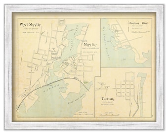
MYSTIC and WEST MYSTIC, Connecticut - 1893 Map
$38.00
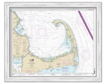
CAPE COD BAY, Massachusetts - 2013 Nautical Chart
$44.00
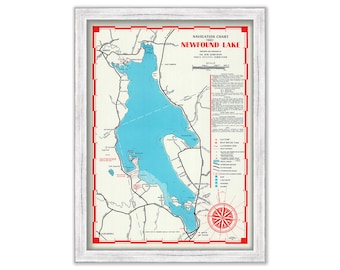
NEWFOUND LAKE, New Hampshire 1961 Nautical Chart
$38.00
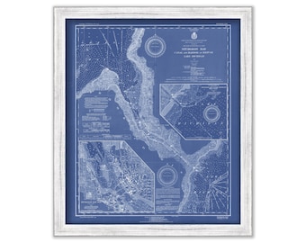
STURGEON BAY - Canal and Harbor Refuge, Wisconsin - 1930 Nautical Chart Blueprint
$26.00
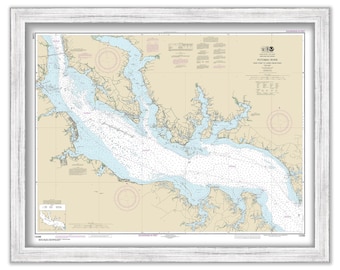
POTOMAC RIVER, Maryland/Virginia - 2017 Nautical Chart
$38.00
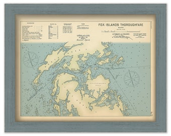
FOX ISLANDS THOROUGHFARE, Maine 1909 - Nautical Chart by Geo. Eldridge Colored Version
$44.00
GLOUCESTER HARBOR and Annisquam River, Massachusetts - 2010 Nautical Chart Blueprint
$33.00
GREENWICH and COS COB, Connecticut - Nautical Chart Blueprint published in 2015
$44.00
CONNECTICUT RIVER MOUTH, Connecticut - Nautical Chart published in 2010
$44.00
PROVINCETOWN HARBOR and TRURO, Massachusetts - Nautical Chart 2007
$37.00
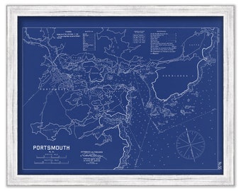
PORTSMOUTH, New Hampshire - 1909 Nautical Chart Blueprint by Geo. Eldridge
$38.00
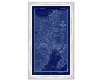
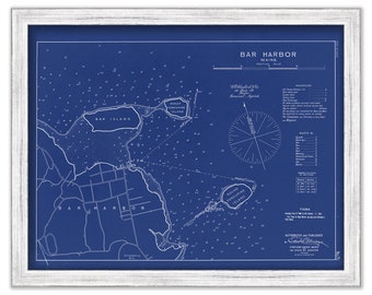
BAR HARBOR, Maine 1909 Blueprint Nautical Chart by Geo. Eldridge
$38.00
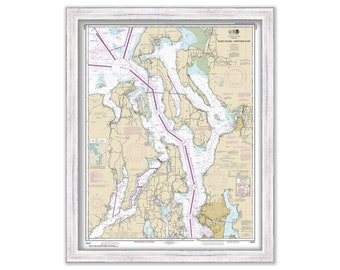
SEATTLE and PUGET SOUND, Washington - Nautical Chart published in 2017
$44.00
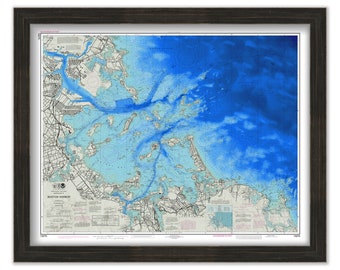
BOSTON HARBOR, Massachusetts - Nautical Chart 2018
$44.00
CHARLESTON, South Carolina - Minimalist Map on Blue
$26.00
HOUSATONIC RIVER, Connecticut - Nautical Chart published in 2012
$40.00
OYSTER and HUNTINGTON BAYS, Long Island, New York - Nautical Chart published in 2014
$44.00
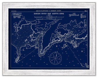
Darien River & Scotts Cove, Connecticut - Blue Print - Nautical Chart by George W. Eldridge 1901
$37.00
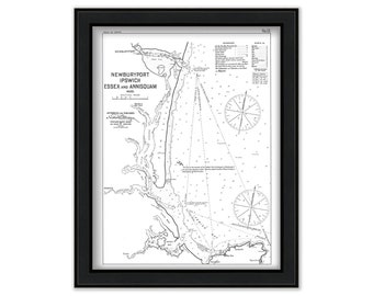
Newburyport, Ipswich, Essex and Annisquam, Massachusetts 1909 - Black and White - Nautical Chart by Geo. Eldridge
$50.00
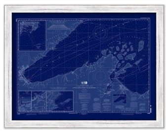
Little Girls Point to Silver Bay, Michigan - 2014 Nautical Chart Blueprint
$26.00
1
...
49
50
51
52
53
54
55
...
57
0 items in your cart
Close
Keep shopping! :)
Legal imprint
Close