Old Map Company
Shop
Blog
Gallery
Cart (
0
)
0
Old Map Company
Shop
Blog
Gallery
Contact Us
All items
LIGHTHOUSE PLANS
BIRD'S EYE VIEWS
IRELAND MAPS
NAUTICAL CHARTS
CONNECTICUT MAPS
CALIFORNIA MAPS
MAINE MAPS
MASSACHUSETTS MAPS
MICHIGAN MAPS
NEW HAMPSHIRE MAPS
NEW JERSEY MAPS
NEW YORK MAPS
PENNSYLVANIA MAPS
FLORIDA MAPS + CHARTS
RHODE ISLAND MAPS
PRINTS + POSTERS
WISCONSIN MAPS
VERMONT MAPS
MARYLAND MAPS
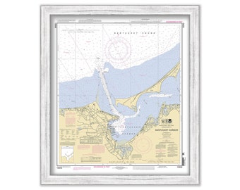
NANTUCKET HARBOR, Massachusetts - Nautical Chart published in 2011
$38.00
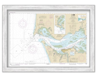
COLUMBIA RIVER, Washington/Oregon - 2012 Nautical Chart
$38.00
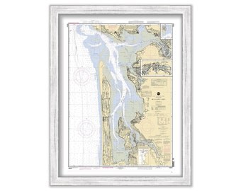
WILLAPA BAY, Washington - 2006 Nautical Chart
$38.00
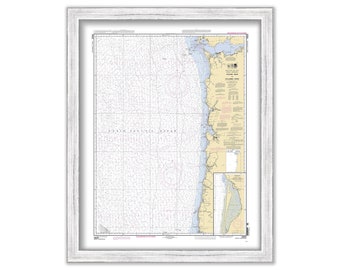
Yaquina Head to Columbia River, Washington/Oregon - 2009 Nautical Chart
$38.00
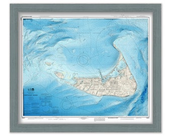
NANTUCKET, Massachusetts - Enhanced Nautical Chart
$25.00
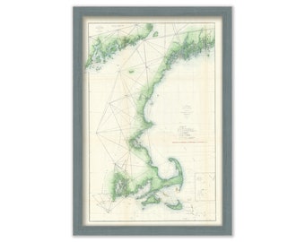
NEW ENGLAND COAST 1855 Nautical Chart
$26.00
NEW ENGLAND COAST 1859 Colored Nautical Chart
$26.00
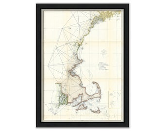
Cape Cod, Martha's Vineyard and Nantucket, Massachusetts Chart 1857
$53.00
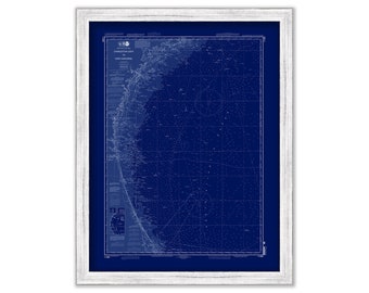
Charleston, South Carolina to Cape Canaveral, Florida - 2010 Nautical Chart Blueprint
$38.00
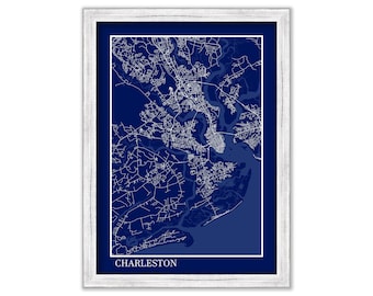
CHARLESTON, South Carolina - Minimalist Map Blueprint
$38.00
CHESAPEAKE BAY, Annapolis, Sever and Magothy Rivers, Maryland/Virginia - Enhanced Nautical Chart
$25.00
Martha's Vineyard to Block Island - 2018 Nautical Chart
$37.00
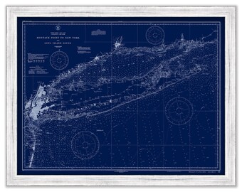
MONTAUK to NEW YORK, Long Island, New York - Nautical Chart Blueprint published in 1931
$44.00
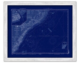
Little Egg Harbor to Hereford Inlet, New Jersey - 2010 Nautical Chart Blueprint
$26.00
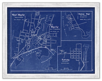
MYSTIC and WEST MYSTIC, Connecticut - 1893 Blueprint Map
$26.00
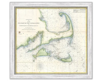
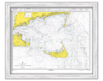
NANTUCKET SOUND & APPROACHES 1968 U. S. Coast and Geodetic Survey Chart
$44.00
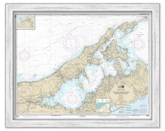
SHELTER ISLAND SOUND, Long Island, New York - Nautical Chart published in 2017
$44.00
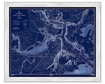
BOSTON INNER HARBOR, Massachusetts - 1954 Nautical Chart Blueprint
$44.00
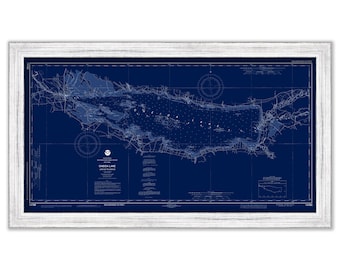
ONEIDA LAKE, New York - 2019 Blueprint Nautical Chart
$39.00
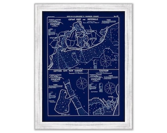
Cotuit Port, Osterville, Chatham and Cottage City, Massachusetts - Nautical Chart Blueprint by George W. Eldridge 1901
$50.00
1
...
46
47
48
49
50
51
52
...
57
0 items in your cart
Close
Keep shopping! :)
Legal imprint
Close