Old Map Company
Shop
Blog
Gallery
Cart (
0
)
0
Old Map Company
Shop
Blog
Gallery
Contact Us
All items
LIGHTHOUSE PLANS
BIRD'S EYE VIEWS
IRELAND MAPS
NAUTICAL CHARTS
CONNECTICUT MAPS
CALIFORNIA MAPS
MAINE MAPS
MASSACHUSETTS MAPS
MICHIGAN MAPS
NEW HAMPSHIRE MAPS
NEW JERSEY MAPS
NEW YORK MAPS
PENNSYLVANIA MAPS
FLORIDA MAPS + CHARTS
RHODE ISLAND MAPS
PRINTS + POSTERS
WISCONSIN MAPS
VERMONT MAPS
MARYLAND MAPS
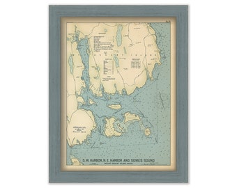
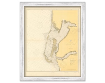
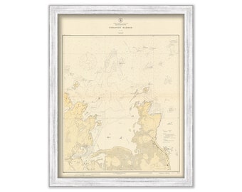
MOUNT DESERT ISLAND, Maine 1909 - Nautical Chart by Geo. Eldridge Colored Version
$44.00
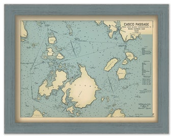
CASCO PASSAGE, Mount Desert Island, Maine 1909 - Nautical Chart by Geo. Eldridge Colored Version
$44.00
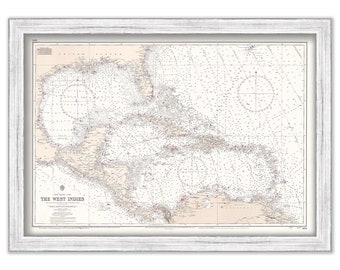
CARIBBEAN and WEST INDIES Nautical Chart 1966
$42.00
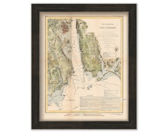
NEW LONDON Harbor, Connecticut - 1848 Colored Nautical Chart
$48.00
BOCA GRANDE, Florida 1918 Nautical Chart
$26.00
NORWALK, NORTON and SAUGATUCK, Connecticut - 1957 Nautical Chart Blueprint
$38.00
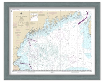
Bay of Fundy to Cape Cod, Maine/New Hampshire/Massachusetts - 2020 Nautical Chart
$38.00
GALVESTON to the RIO GRAND, Texas - 2018 Nautical Chart
$26.00
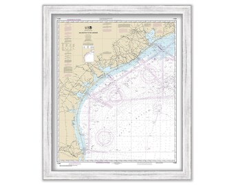
COHASSET HARBOR, Massachusetts - 1926 Nautical Chart
$38.00
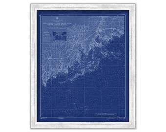
Ipswich Bay to Gloucester Harbor 1958 - The U. S. Coast and Geodetic Survey - Blue Print Edition
$44.00
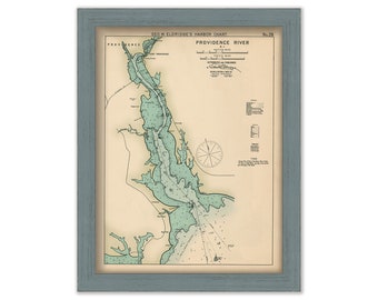
Providence River, Rhode Island - Nautical Chart by George W. Eldridge Colored Version 0326
$50.00
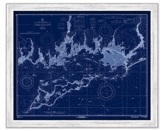
FISHERS ISLAND SOUND 1966 - Blueprint Nautical Chart
$44.00
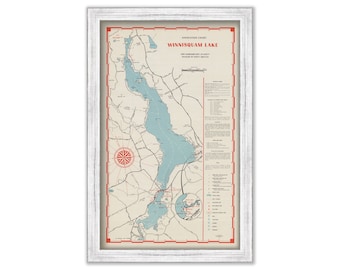
LAKE WINNISQUAM, New Hampshire 1964 Nautical Chart
$40.00
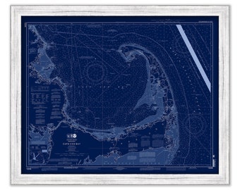
CAPE COD BAY, Massachusetts - 2013 Nautical Chart Blueprint
$44.00
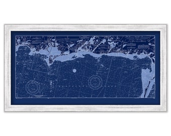
CHATHAM, HARWICHPORT and DENNISPORT, Massachusetts - 2001 Nautical Chart Blueprint
$38.00
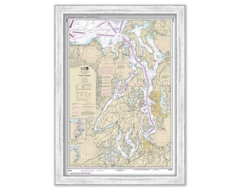
SEATTLE - TACOMA and Puget Sound, Washington - Nautical Chart published in 2017
$38.00
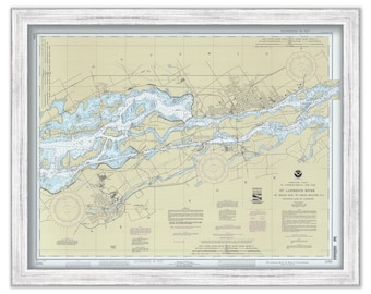
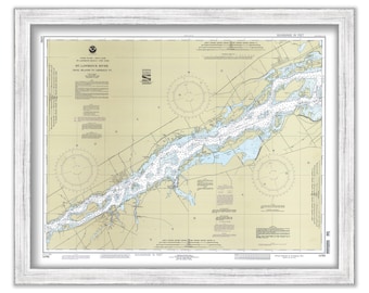
SAINT LAWRENCE RIVER, Saint Regis, Quebec to Croil Islands, New York - 1992 Nautical Chart
$38.00
SAINT LAWRENCE RIVER, Croil Islands to Leishman Point, New York - 1992 Nautical Chart
$38.00
Hilton Head and Port Royal - BEAUFORT DISTRICT, South Carolina - Nautical Chart 1825
$44.00
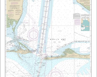
FORT MORGAN, Alabama - 2016 Nautical Chart
$40.00
1
...
44
45
46
47
48
49
50
...
57
0 items in your cart
Close
Keep shopping! :)
Legal imprint
Close