Old Map Company
Shop
Blog
Gallery
Cart (
0
)
0
Old Map Company
Shop
Blog
Gallery
Contact Us
All items
LIGHTHOUSE PLANS
BIRD'S EYE VIEWS
IRELAND MAPS
NAUTICAL CHARTS
CONNECTICUT MAPS
CALIFORNIA MAPS
MAINE MAPS
MASSACHUSETTS MAPS
MICHIGAN MAPS
NEW HAMPSHIRE MAPS
NEW JERSEY MAPS
NEW YORK MAPS
PENNSYLVANIA MAPS
FLORIDA MAPS + CHARTS
RHODE ISLAND MAPS
PRINTS + POSTERS
WISCONSIN MAPS
VERMONT MAPS
MARYLAND MAPS
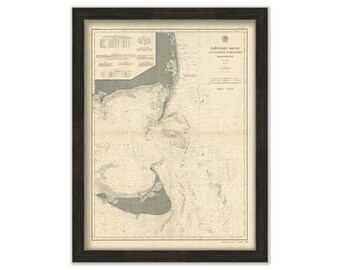
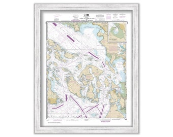
Nantucket Sound Eastern Approaches, Massachusetts - 1900 Nautical Chart
$26.00
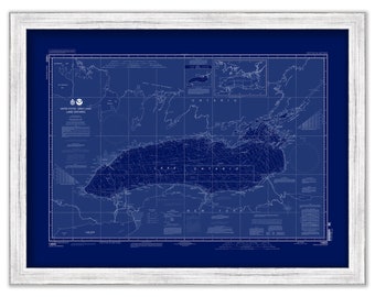
LAKE ONTARIO - 2005 Nautical Chart
$37.00
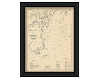
Portland Harbor, Maine 1909 - Nautical Chart by Geo. Eldridge
$50.00
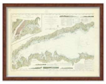
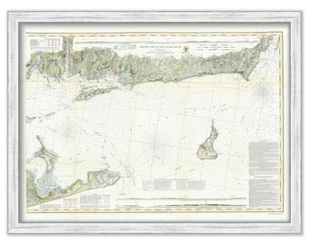
Long Island Sound, New York-Western Sheet 1855 Nautical Chart
$42.00
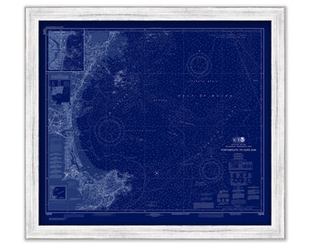
PORTSMOUTH to CAPE ANN, New Hampshire/Massachusetts - Blueprint Nautical Chart published in 2020
$37.00
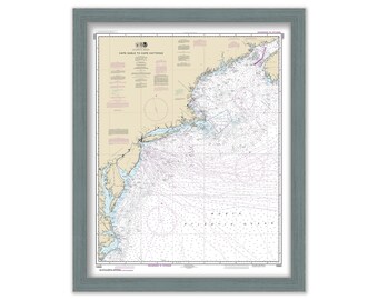
Cape Sable to Cape Hatteras - 2015 Nautical Chart
$26.00
Long Island Sound-Eastern Sheet 1855 Nautical Chart
$44.00
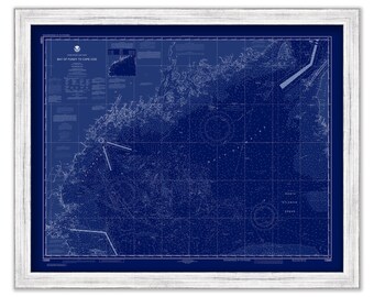
Bay of Fundy to Cape Cod, Maine/New Hampshire/Massachusetts - 2020 Nautical Chart Blueprint
$38.00
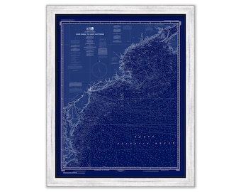
Cape Sable to Cape Hatteras - 2015 Nautical Chart Blueprint
$26.00
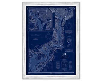
WASHINGTON HARBOR, Washington D. C. - Nautical Chart Blueprint published in 2015
$26.00
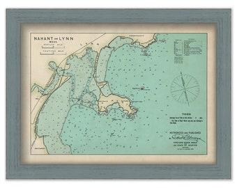
NAHANT and LYNN, Massachusetts 1909 Nautical Chart by Geo. Eldridge Colored Version
$39.00
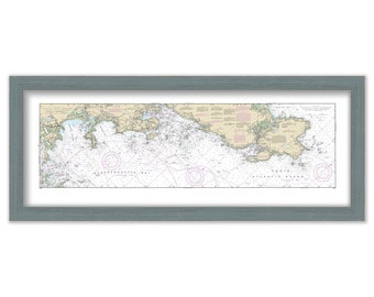
CAPE ANN and MARBLEHEAD, Massachusetts - 2018 Nautical Chart
$37.00
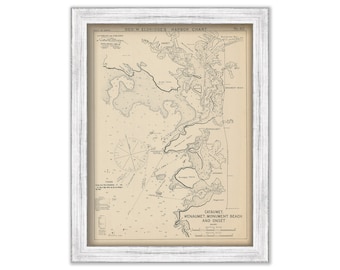
Cataumet, Wenaumet, Monument Beach & Onset, Massachusetts - Nautical Chart by George W. Eldridge 1901
$50.00
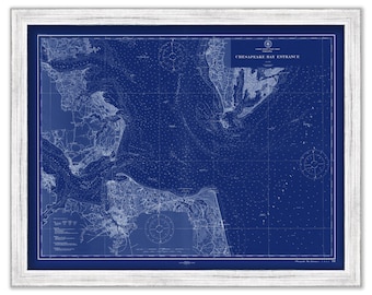
CHESAPEAKE BAY ENTRANCE, Virginia - 1911 Nautical Chart Blueprint
$26.00
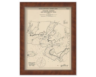
Cos Cob Harbor & Greenwich Cove, Connecticut - Nautical Chart by George W. Eldridge 1901
$50.00
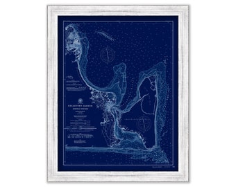
Edgartown, Martha's Vineyard, Massachusetts 1894 Nautical Chart Blueprint
$53.00
South Norwalk, Sheffield Island, & Cockenoe Island Harbors Connecticut - Nautical Chart by George W. Eldridge Colored Version
$50.00
Strait of Georgia and Strait of Juan De Fuca, Washington - 2017 Nautical Chart
$38.00
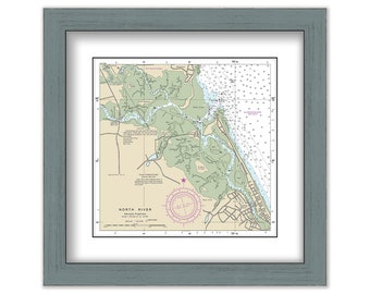
NORTH RIVER, Massachusetts - NOAA Chart published in 2013
$40.00
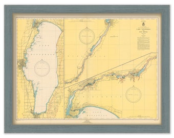
LAKE WINNEBAGO, Minnesota - 1949 Nautical Chart
$37.00
1
...
41
42
43
44
45
46
47
...
57
0 items in your cart
Close
Keep shopping! :)
Legal imprint
Close