Old Map Company
Shop
Blog
Gallery
Cart (
0
)
0
Old Map Company
Shop
Blog
Gallery
Contact Us
All items
LIGHTHOUSE PLANS
BIRD'S EYE VIEWS
IRELAND MAPS
NAUTICAL CHARTS
CONNECTICUT MAPS
CALIFORNIA MAPS
MAINE MAPS
MASSACHUSETTS MAPS
MICHIGAN MAPS
NEW HAMPSHIRE MAPS
NEW JERSEY MAPS
NEW YORK MAPS
PENNSYLVANIA MAPS
FLORIDA MAPS + CHARTS
RHODE ISLAND MAPS
PRINTS + POSTERS
WISCONSIN MAPS
VERMONT MAPS
MARYLAND MAPS
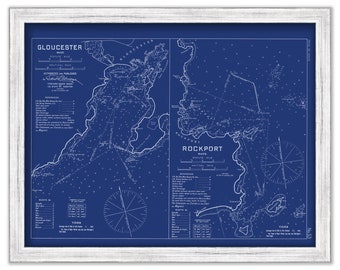
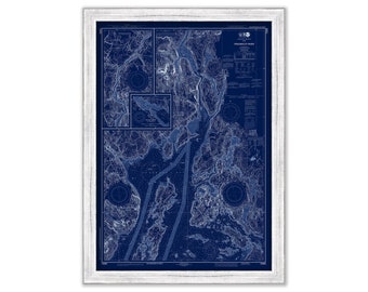
GLOUCESTER and ROCKPORT HARBORS, Massachusetts - 1909 Nautical Chart Blueprint by Geo. Eldridge
$50.00
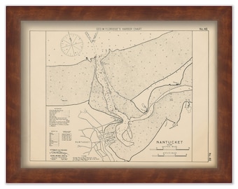
Nantucket Harbor - Nautical Chart by George W. Eldridge 1901
$50.00
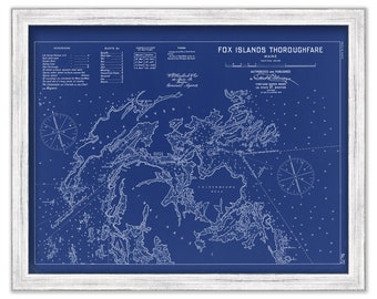
FOX ISLANDS THOROUGHFARE, Maine - 1909 Nautical Chart Blueprint by Geo. Eldridge
$26.00
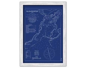
GLOUCESTER HARBOR, Massachusetts - 1909 Nautical Chart Blueprint by George W. Eldridge
$26.00
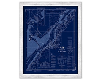
FALL RIVER HARBOR, Massachusetts - Nautical Chart Blueprint published in 2011
$38.00
ROANOKE ISLAND, North Carolina - 2009 Nautical Chart Blueprint
$26.00
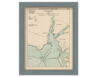
Bridgeport, Connecticut - Nautical Chart by George W. Eldridge colored version 0312
$50.00
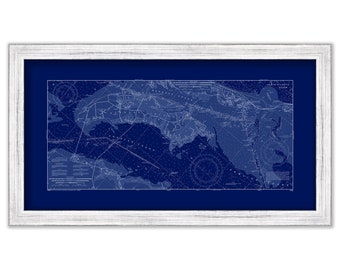
Long Island Sound in 1855 - Colored Nautical Chart - Framed Triptych - 113" x 27" - Modern Reproduction
$862.00
PENOBSCOT RIVER, Maine - Nautical Chart Blueprint 2019
$38.00
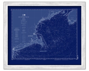
West Quoddy Head to New York - 2012 Nautical Chart Blueprint
$26.00
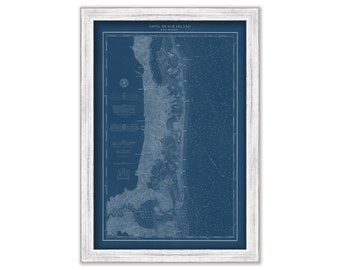
LONG BEACH ISLAND, New Jersey 1879 Nautical Chart Blueprint
$44.00
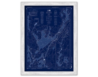
MOUNT HOPE BAY, Rhode Island - Nautical Chart Blueprint published in 2013
$44.00
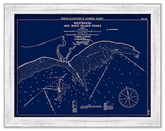
Westbrook and Duck Island Roads, Connecticut - Blue Print - Nautical Chart by George W. Eldridge 1901
$37.00
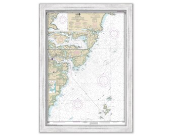
PORTSMOUTH HARBOR, Cape Neddick Harbor and Isles of Shoals, New Hampshire - Nautical Chart 1998
$25.00
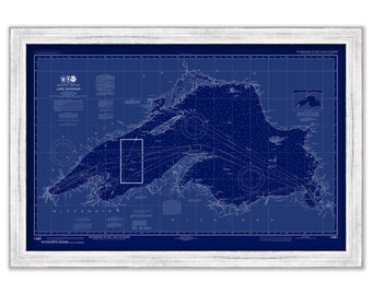
LAKE SUPERIOR - 2016 Nautical Chart Blueprint
$38.00
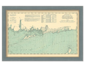
Niantic Bay, Connecticut to Rocky Point, Rhode Island - Long Island Sound 1893 Nautical Chart
$53.00
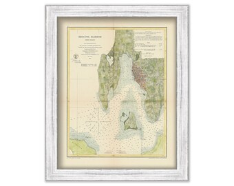
A Replica of a Chart of BRISTOL HARBOR, Rhode Island - Nautical Chart by United States Coast and Geodetic Survey 1864
$50.00
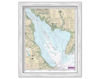
DELAWARE BAY, Delaware and New Jersey - 2017 Nautical Chart
$38.00
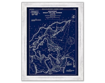
Shelter Island, Sag Harbor, Orient, and Greenport - Blue Print - Nautical Chart by George W. Eldridge 1901
$38.00
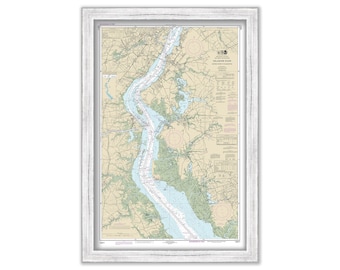
DELAWARE RIVER, Delaware and New Jersey - 2017 Nautical Chart
$30.00
1
...
40
41
42
43
44
45
46
...
57
0 items in your cart
Close
Keep shopping! :)
Legal imprint
Close