Old Map Company
Shop
Blog
Gallery
Cart (
0
)
0
Old Map Company
Shop
Blog
Gallery
Contact Us
All items
LIGHTHOUSE PLANS
BIRD'S EYE VIEWS
IRELAND MAPS
NAUTICAL CHARTS
CONNECTICUT MAPS
CALIFORNIA MAPS
MAINE MAPS
MASSACHUSETTS MAPS
MICHIGAN MAPS
NEW HAMPSHIRE MAPS
NEW JERSEY MAPS
NEW YORK MAPS
PENNSYLVANIA MAPS
FLORIDA MAPS + CHARTS
RHODE ISLAND MAPS
PRINTS + POSTERS
WISCONSIN MAPS
VERMONT MAPS
MARYLAND MAPS
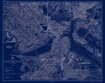
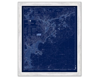
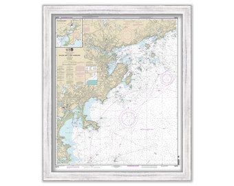
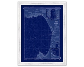
BOSTON HARBOR, Massachusetts - 1927 Nautical Chart Blueprint
$37.00
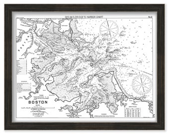
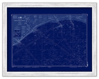
Boston Harbor, Massachusetts - Black + White - Nautical Chart by George W. Eldridge 1908
$38.00
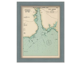
New London, Connecticut - Nautical Chart by George W. Eldridge Colored Version
$50.00
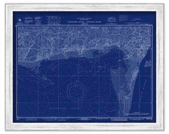
Harbors of CHATHAM, HARWICHPORT and DENNISPORT, Massachusetts - 1972 Nautical Chart Blueprint
$26.00
MOUNT DESERT ISLAND, Maine - 2017 Nautical Chart Blueprint
$26.00
SALEM and LYNN HARBORS, Massachusetts - 2013 Nautical Chart Blueprint
$30.00
BOOTHBAY HARBOR and VICINITY, Maine - 2012 Nautical Chart Blueprint
$26.00
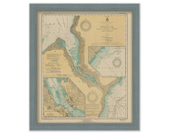
STURGEON BAY - Canal and Harbor Refuge, Wisconsin - 1930 Nautical Chart
$26.00
SALEM and LYNN HARBORS, Massachusetts - 2013 Nautical Chart
$40.00
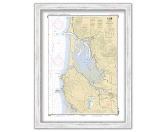
TILLAMOOK BAY, Oregon - 2012 Nautical Chart
$38.00
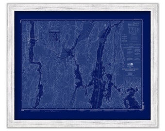
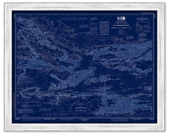
SAINT LAWRENCE RIVER, New York - The Thousand Islands 2019 Nautical Chart Blueprint
$44.00
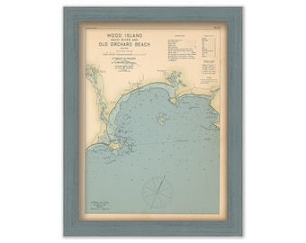
Wood Island, Saco River and Old Orchard Beach, Maine 1909 - Nautical Chart by Geo. Eldridge Colored Version
$44.00
MONTERREY BAY, California - 2012 Nautical Chart Blueprint
$38.00
GALVESTON ISLAND, Texas - 2011 Nautical Chart Blueprint
$26.00
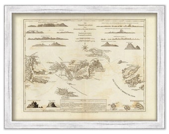
VIRGIN ISLANDS - St Thomas, St Croix, St John, Virgin Gorda, Tortola and Josh Van Dyke - 1775 Nautical Chart
$36.00
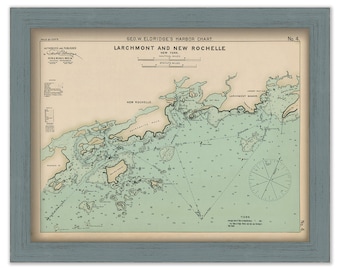
Larchmont, and New Rochelle, New York - Nautical Chart by George W. Eldridge 1901 colored version
$50.00
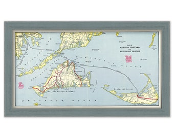
MARTHA's VINEYARD and NANTUCKET Ferry and Railroad Map
$38.00
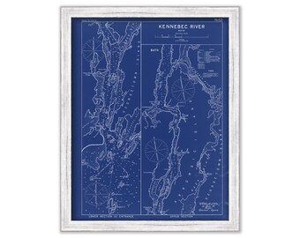
KENNEBEC RIVER, Maine - 1909 Nautical Chart Blueprint by Geo. Eldridge
$26.00
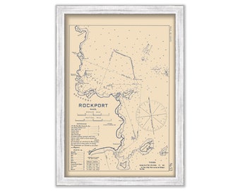
ROCKPORT HARBOR, Massachusetts - 1909 Nautical Chart by George W. Eldridge
$26.00
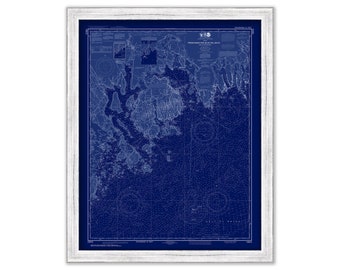
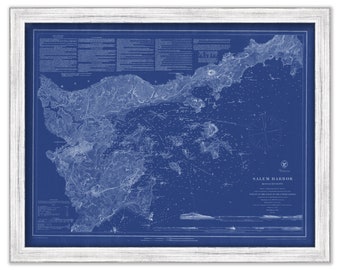
SALEM HARBOR, Massachusetts - 1869 Nautical Chart Blueprint
$38.00
1
...
39
40
41
42
43
44
45
...
57
0 items in your cart
Close
Keep shopping! :)
Legal imprint
Close