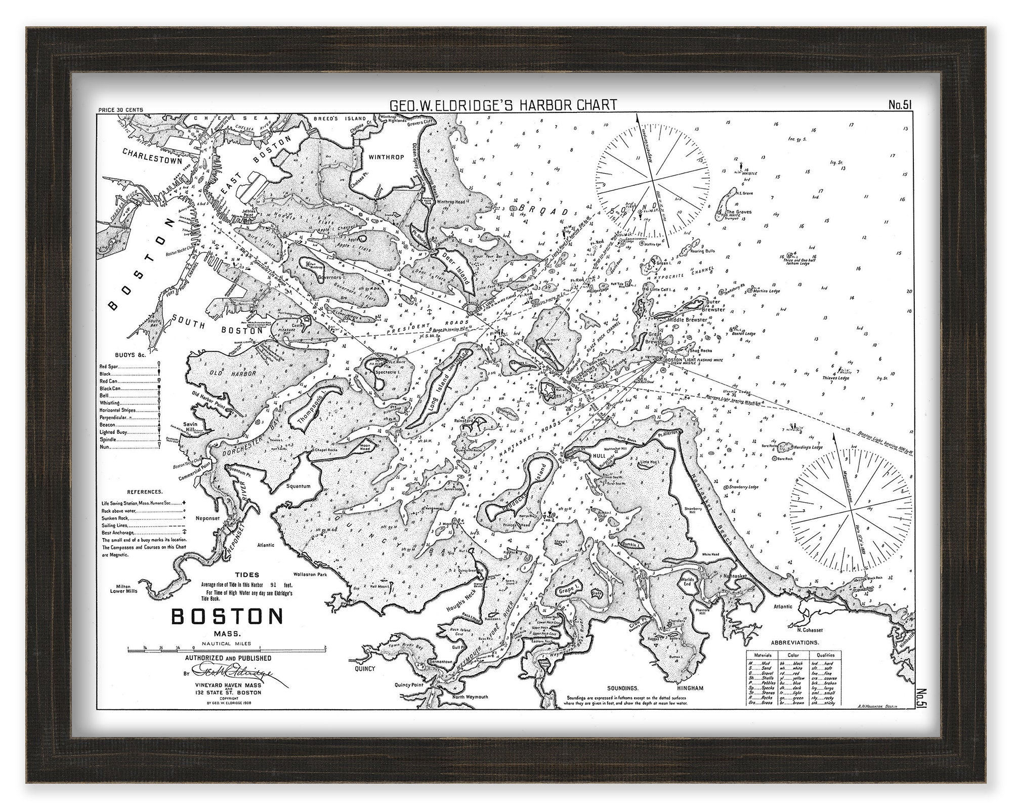
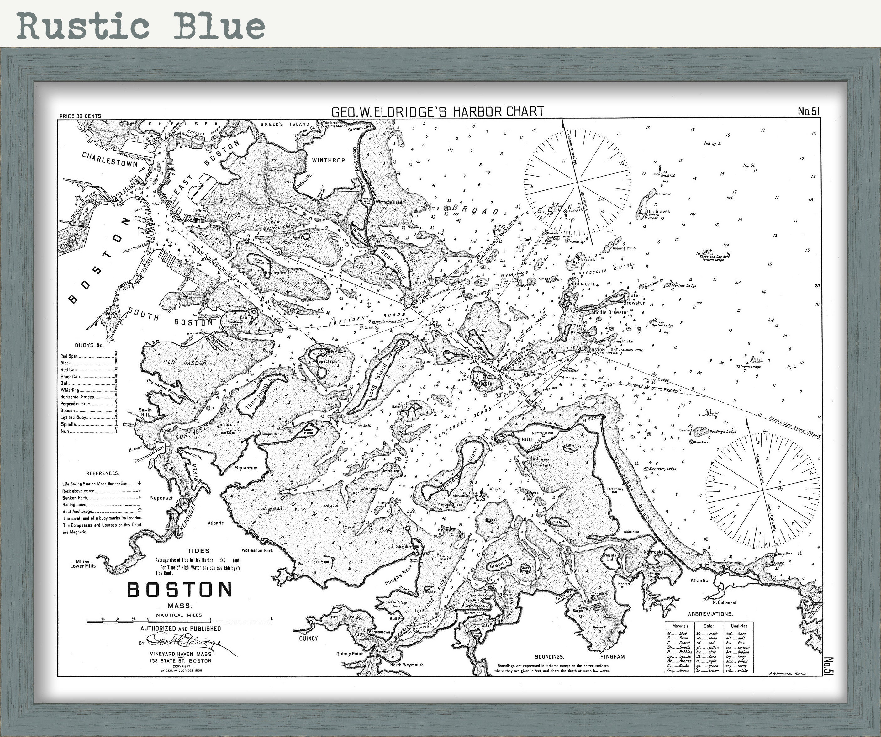
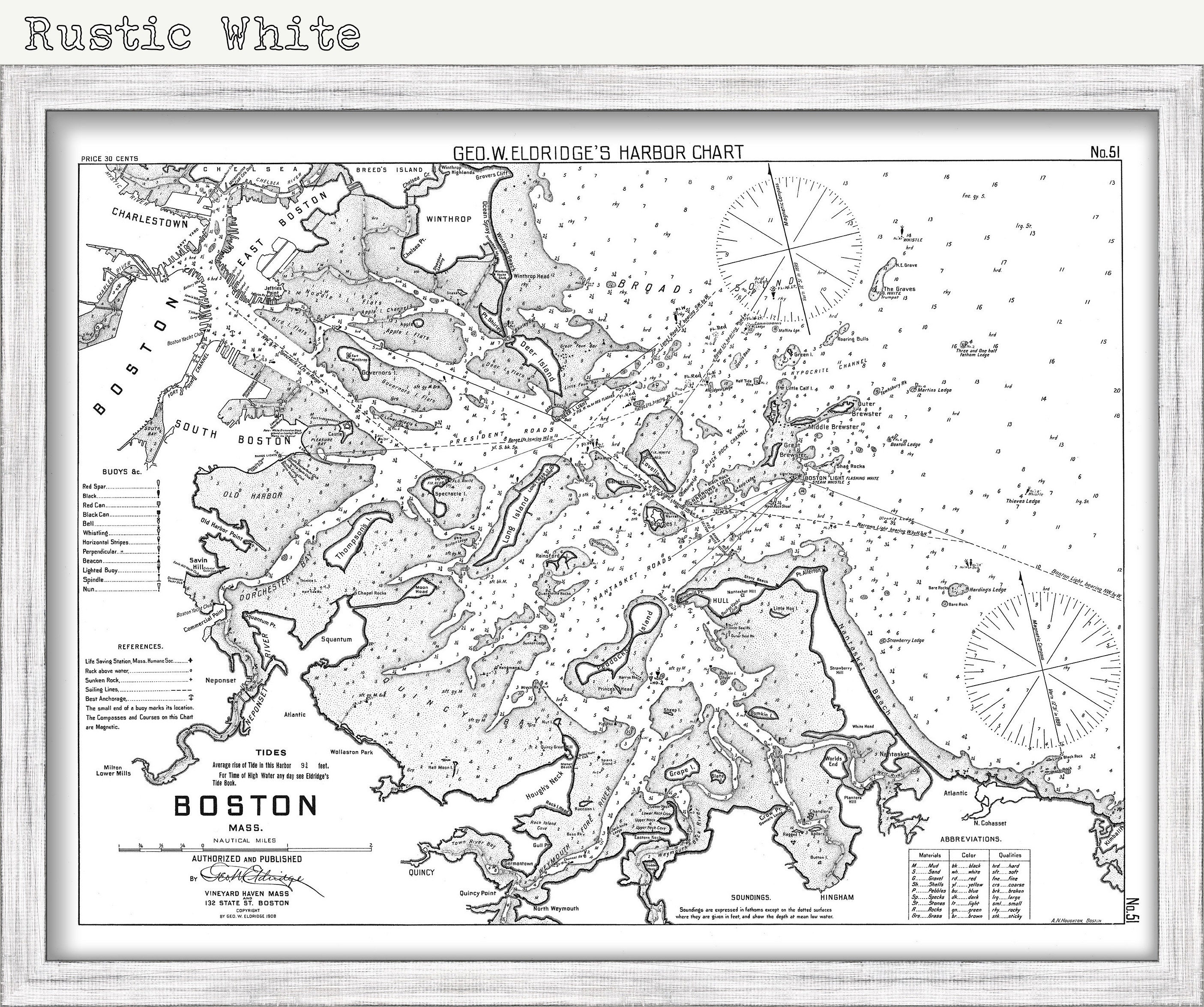
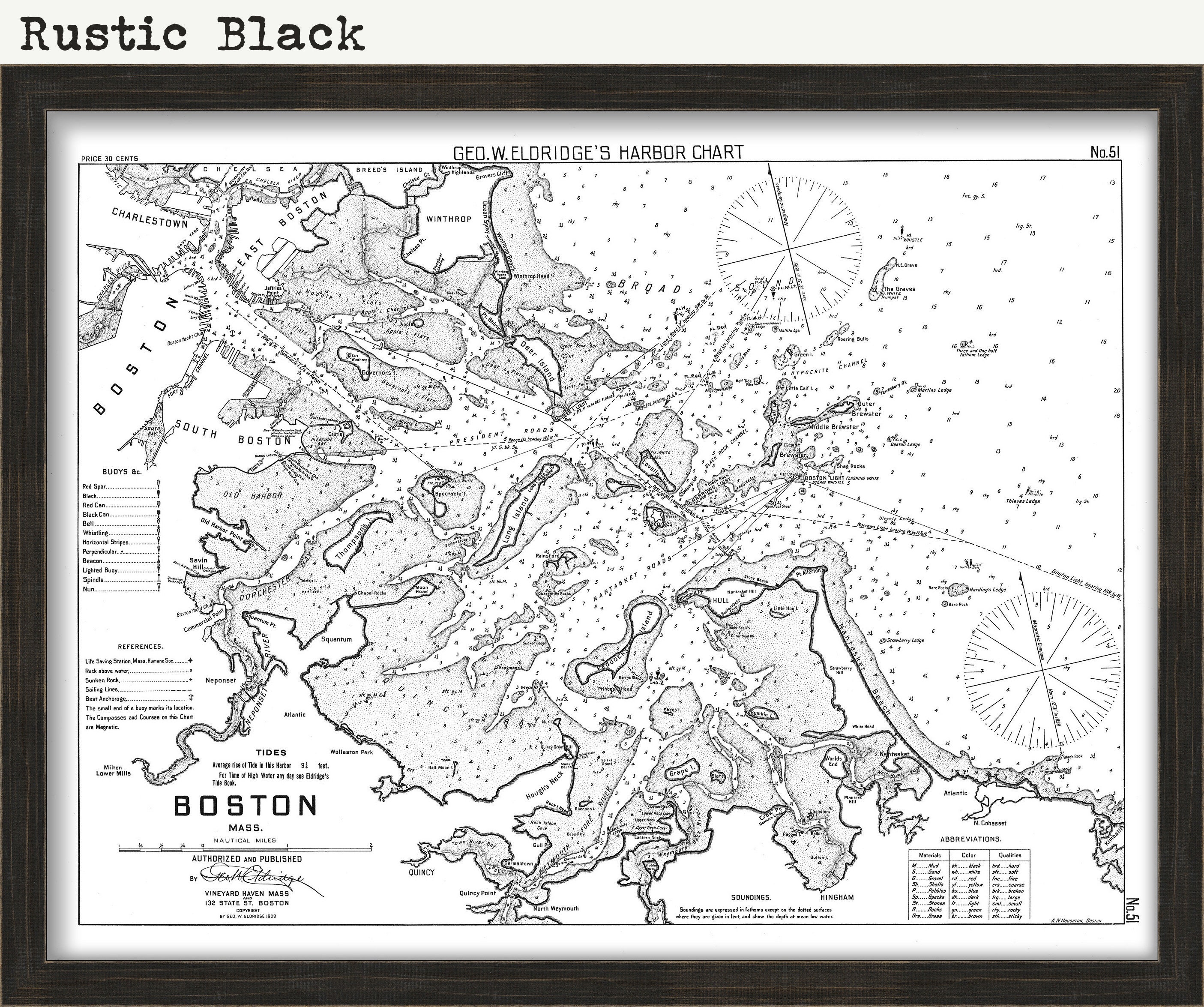
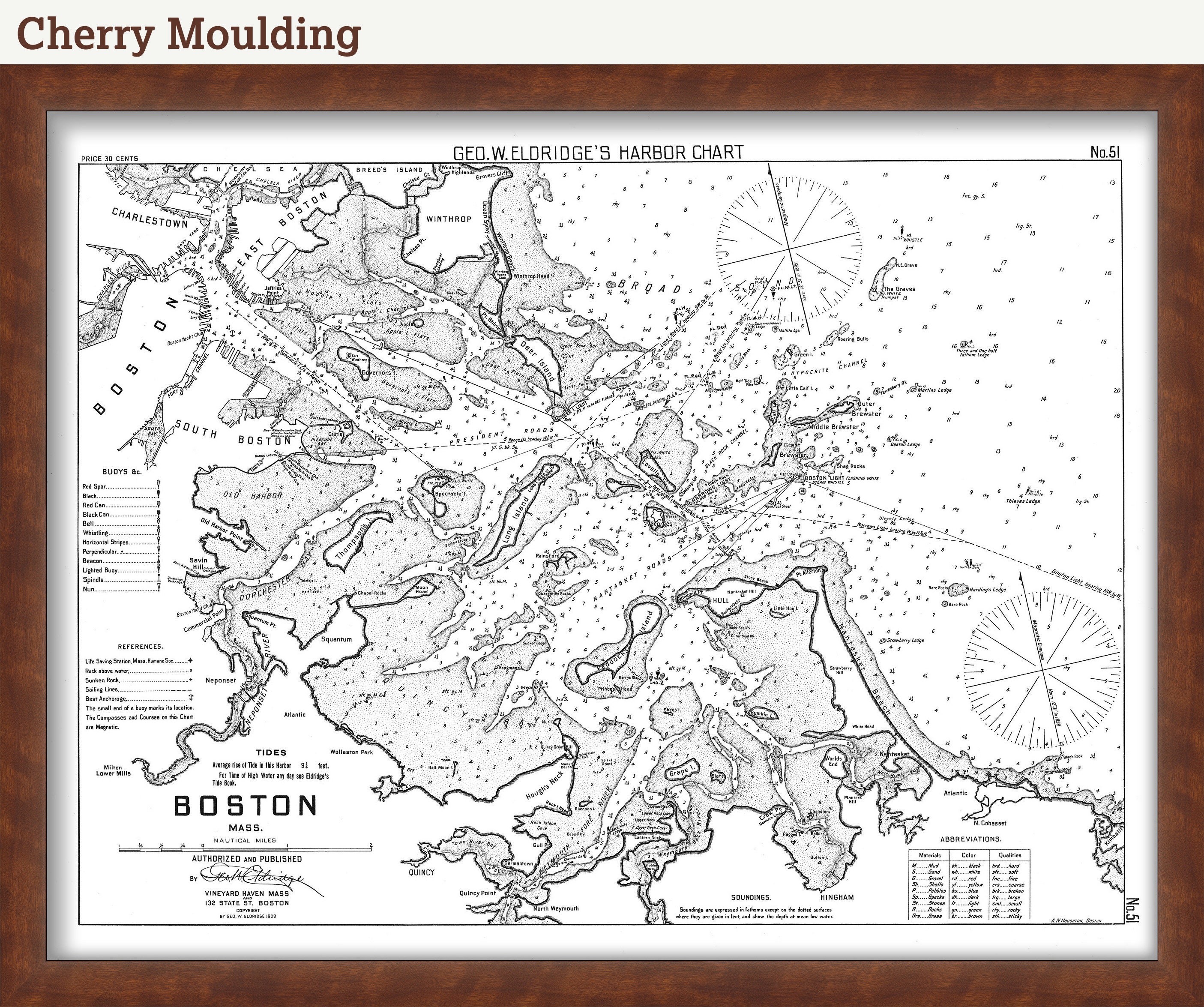
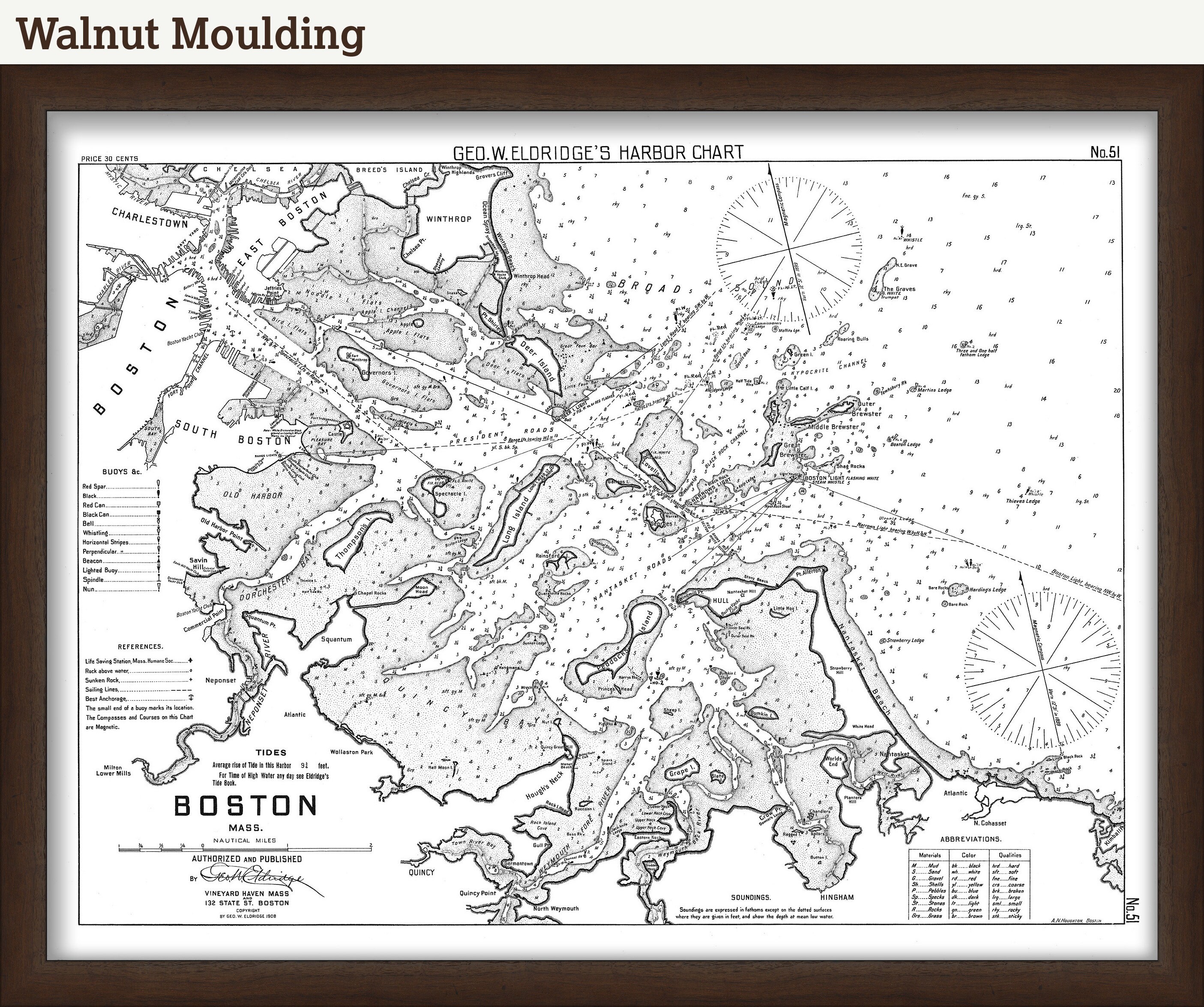
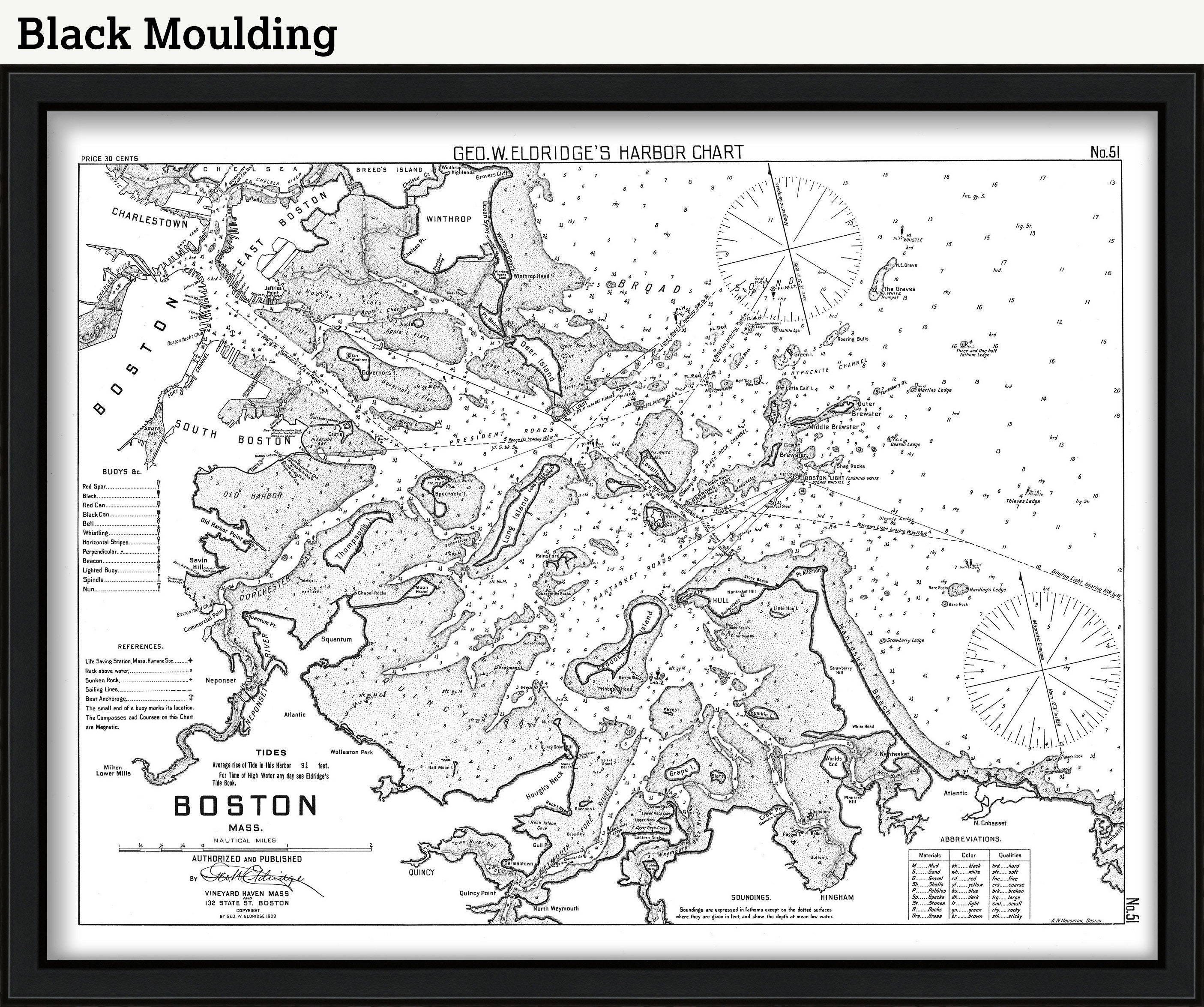
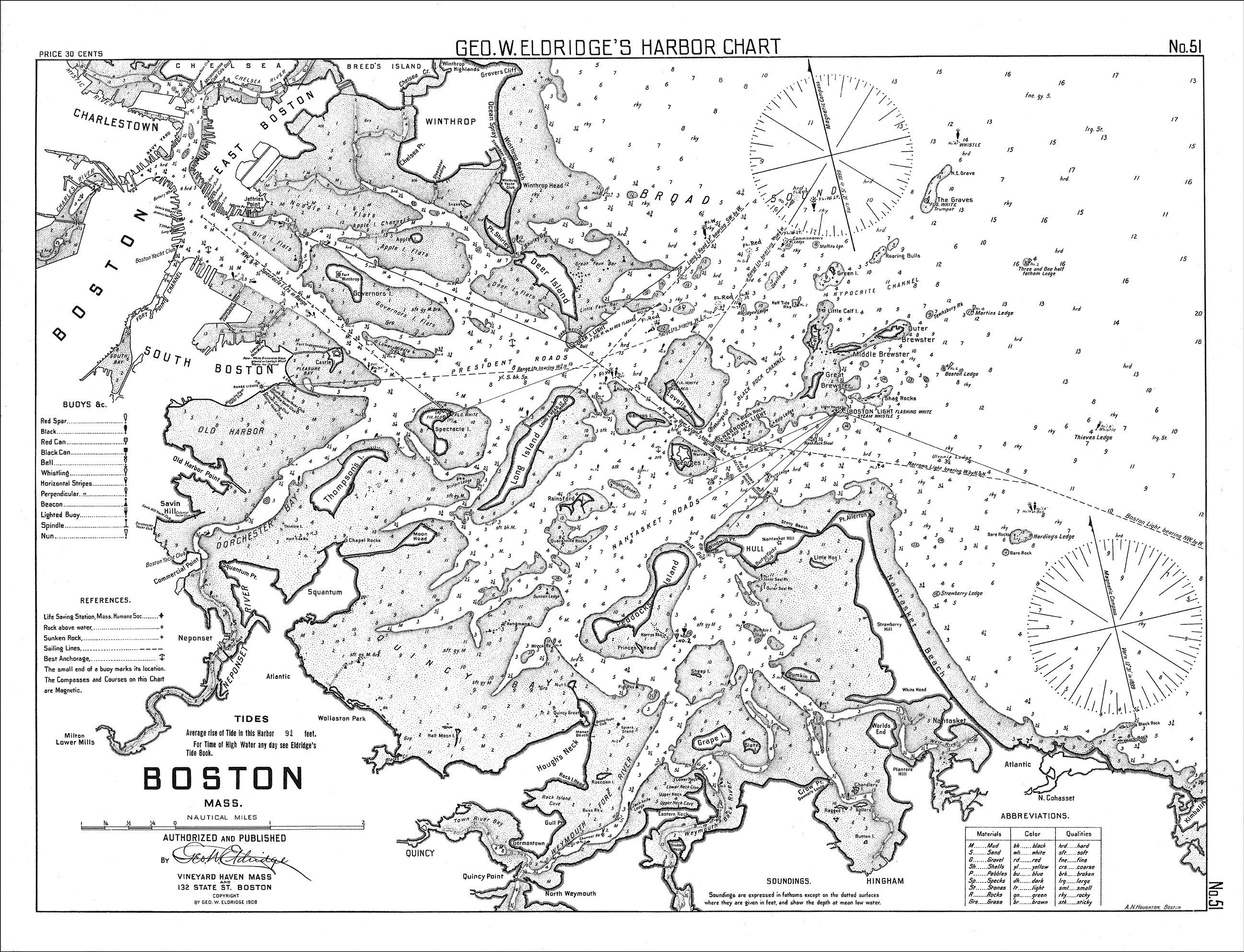
Boston Harbor, Massachusetts - Black + White - Nautical Chart by George W. Eldridge 1908
$38.00
A Nautical Chart of Boston Harbor by George W. Eldridge originally published in 1908. This map is from the atlas "Geo. W. Eldrige's Harbor-Chart Book, New York to Boston". Eldridge Charts are renowned for bold lines and a clear and concise style.
Custom sizes are available. If you are interested in a custom size, please let us know through the "ask a question" button in this listing.
Framed maps will be approximately 3" larger than the listed sizes.
This map has been scanned From The ORIGINAL at 600 dpi using state of the art equipment {a Contex Large Format Scanner}. The replica map is printed on heavy matte fine art paper using archival pigment inks. This is one of over 5000 Original maps, charts and posters in our collection.
Many reproduction maps that are available on Etsy are taken directly from public domain sources {NY Public Library, Library of Congress, etc}. Although great for research purposes, these image files frequently suffer from poor color accuracy, lens blur and distortion. The maps in our collection have been scanned from the ORIGINAL, flat, at high resolution and with precisely calibrated color. This allows us to prints replicas that are virtually indistinguishable from the original maps.
If you would like to inspect a higher resolution version of this map, please copy and paste this url into a new tab in your browser:
http://rmicusec.sirv.com/etsy/nybbw051.jpg
The colors in this map are also highly customizable, if you have something different in mind please let us know.
0487
Shipping from United States
Processing time
1-3 business days
Customs and import taxes
Buyers are responsible for any customs and import taxes that may apply. I'm not responsible for delays due to customs.
Payment Options
Returns & Exchanges
Returns & exchanges not accepted
But please contact me if you have problems with your order
I gladly accept cancellations
Request a cancellation within: 1 hours of purchase