Old Map Company
Shop
Blog
Gallery
Cart (
0
)
0
Old Map Company
Shop
Blog
Gallery
Contact Us
All items
LIGHTHOUSE PLANS
BIRD'S EYE VIEWS
IRELAND MAPS
NAUTICAL CHARTS
CONNECTICUT MAPS
CALIFORNIA MAPS
MAINE MAPS
MASSACHUSETTS MAPS
MICHIGAN MAPS
NEW HAMPSHIRE MAPS
NEW JERSEY MAPS
NEW YORK MAPS
PENNSYLVANIA MAPS
FLORIDA MAPS + CHARTS
RHODE ISLAND MAPS
PRINTS + POSTERS
WISCONSIN MAPS
VERMONT MAPS
MARYLAND MAPS
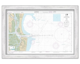
CAPE FEAR RIVER, North Carolina - 2015 Nautical Chart Blueprint
$38.00
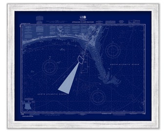
AMELIA ISLAND, Florida - 2015 Nautical Chart
$38.00
YARMOUTH, HYANNIS and CENTERVILLE, Massachusetts - Nautical Chart 1972
$30.00
MOUNT DESERT ISLAND and Blue Hill Bay, Maine 2014 Nautical Chart
$44.00
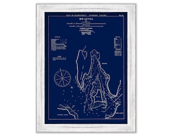
Bristol, Rhode Island - Blue Print - Nautical Chart by George W. Eldridge 0329BP
$37.00
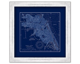
NORTH RIVER, Massachusetts - NOAA Blueprint Chart published in 2013
$40.00
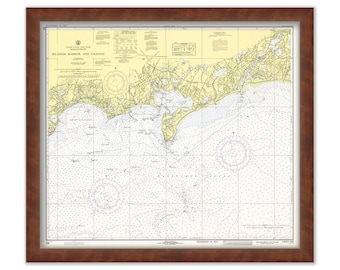
SACO BAY and VICINITY, Maine - 2004 Nautical Chart
$37.00
Vineyard Haven and Oak Bluffs, Martha's Vineyard, Massachusetts - 1961 Nautical Chart
$26.00
PORTLAND, Oregon - Nautical Chart Blueprint published in 2016
$30.00
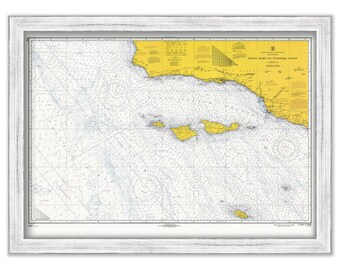
Santa Cruz, Santa Rosa, San Miguell, San Nicolas, Santa Barbara and Anacapa Islands, California - 1967 Nautical Chart
$40.00
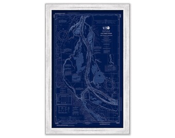
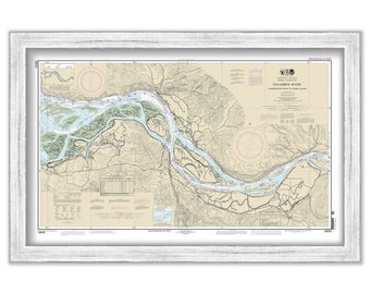
COLUMBIA RIVER - Harrington Point to Crims Island, Washington/Oregon - 2013 Nautical Chart
$38.00
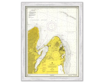
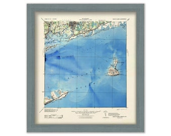
BLOCK ISLAND SOUND - Topographic Nautical Chart
$38.00
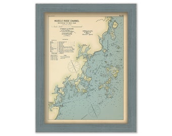
MUSCLE RIDGE CHANNEL, Maine 1909 - Whitehead to Owls Head - Nautical Chart by Geo. Eldridge Colored Version
$44.00
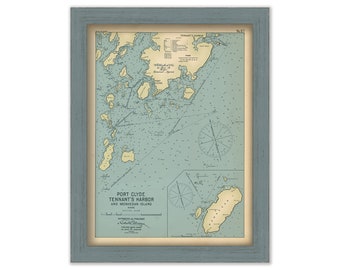
Port Clyde, Tennant's Harbor and Monhegan Island, Maine 1909 - Nautical Chart by Geo. Eldridge Colored Version
$44.00
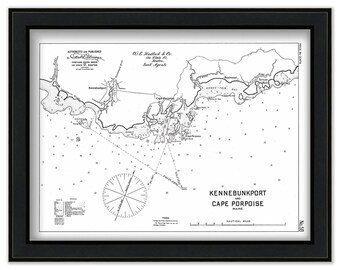
Kennebunkport and Cape Porpoise, Maine 1909 - Nautical Chart by Geo. Eldridge - Black+White Version
$50.00
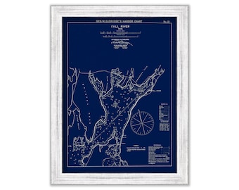
Fall River, Massachusetts - Blue Print - Nautical Chart by George W. Eldridge 1901
$37.00
STATE of FLORIDA - 1870 Map Blueprint
$37.00
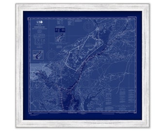
CHESAPEAKE BAY, Sandy Point to Susquehanna River, Maryland - 2020 Nautical Chart Blueprint
$26.00
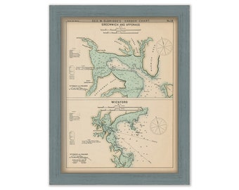
Greenwich, Apponaug, & Wickford, Rhode Island - Nautical Chart by George W. Eldridge 1901 Colored Version
$50.00
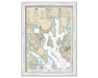
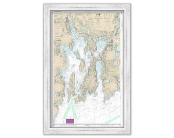
NARRAGANSETT BAY, Rhode Island - Nautical Chart by NOAA 2018
$38.00
1
...
17
18
19
20
21
22
23
...
57
0 items in your cart
Close
Keep shopping! :)
Legal imprint
Close