Old Map Company
Shop
Blog
Gallery
Cart (
0
)
0
Old Map Company
Shop
Blog
Gallery
Contact Us
All items
LIGHTHOUSE PLANS
BIRD'S EYE VIEWS
IRELAND MAPS
NAUTICAL CHARTS
CONNECTICUT MAPS
CALIFORNIA MAPS
MAINE MAPS
MASSACHUSETTS MAPS
MICHIGAN MAPS
NEW HAMPSHIRE MAPS
NEW JERSEY MAPS
NEW YORK MAPS
PENNSYLVANIA MAPS
FLORIDA MAPS + CHARTS
RHODE ISLAND MAPS
PRINTS + POSTERS
WISCONSIN MAPS
VERMONT MAPS
MARYLAND MAPS
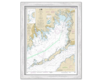
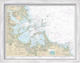
BUZZARDS BAY, Massachusetts - 2017 Nautical Chart
$44.00
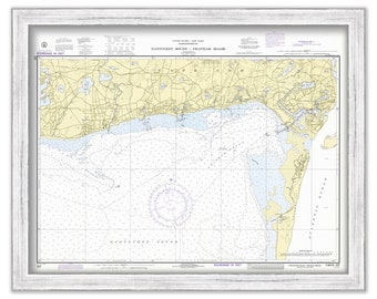
Harbors of CHATHAM, HARWICHPORT and DENNISPORT, Massachusetts - Nautical Chart 1972
$44.00
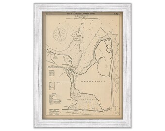
Edgartown Martha's Vineyard - Nautical Chart by George W. Eldridge 1901
$50.00
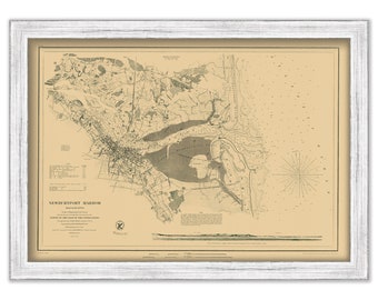
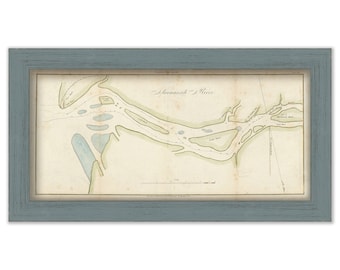
NEWBURYPORT HARBOR, Massachusetts 1855 Nautical Chart by The U. S. Coast and Geodetic Survey
$30.00
SAVANNAH RIVER, GEORGIA - 1822 Nautical Chart
$26.00
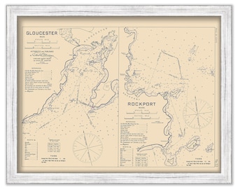
GLOUCESTER and ROCKPORT HARBORS, Massachusetts - 1909 Nautical Chart by Geo. Eldridge
$26.00
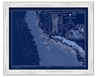
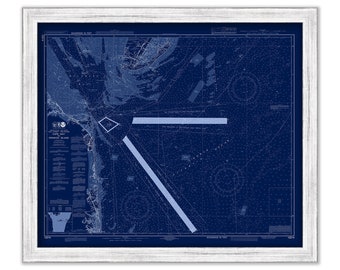
NAPLES and MARCO ISLAND, Florida 2017 Nautical Chart Blueprint
$37.00
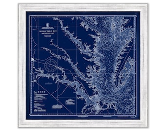
CHESAPEAKE BAY Nautical Chart Blueprint - Southern Section - 1937
$38.00
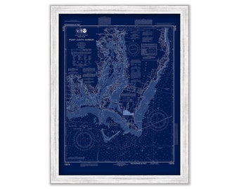
POINT JUDITH, Rhode Island - Blueprint Nautical Chart by NOAA 2014
$44.00
Edgartown, Martha's Vineyard, Massachusetts - 1961 Nautical Chart Blueprint
$38.00
PLEASANT BAY and CHATHAM Harbor, Massachusetts - 1902 Nautical Chart
$38.00
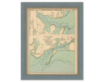
Saybrook Harbor & Black Rock Connecticut - Nautical Chart by George W. Eldridge Colored Version
$50.00
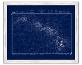
HAWAIIAN ISLANDS 2010 Nautical Chart Blueprint
$44.00
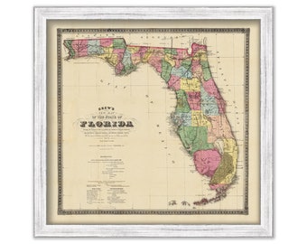
STATE of FLORIDA - 1870 Map
$26.00
HINGHAM HARBOR, Massachusetts Nautical Chart Blueprint - NOAA - 2019
$38.00
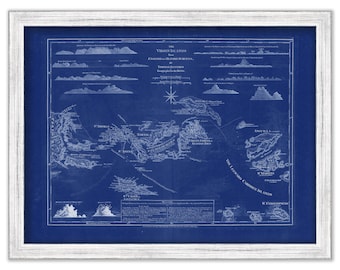
VIRGIN ISLANDS - St Thomas, St Croix, St John, Vigin Gorda, Tortola and Josh Van Dyke - 1775 Nautical Chart Blueprint
$26.00
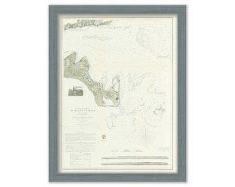
Muskeget Channel, Martha's Vineyard, Massachusetts 1855 Nautical Chart
$50.00
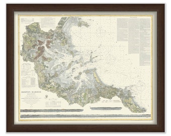
BOSTON HARBOR, Massachusetts - Nautical Chart 2018
$44.00
REHOBOTH BEACH, Delaware and Cape May, New Jersey - 2018 Nautical Chart Blueprint
$30.00
Boston Harbor 1872 - Nautical Chart
$40.00
1
...
15
16
17
18
19
20
21
...
57
0 items in your cart
Close
Keep shopping! :)
Legal imprint
Close