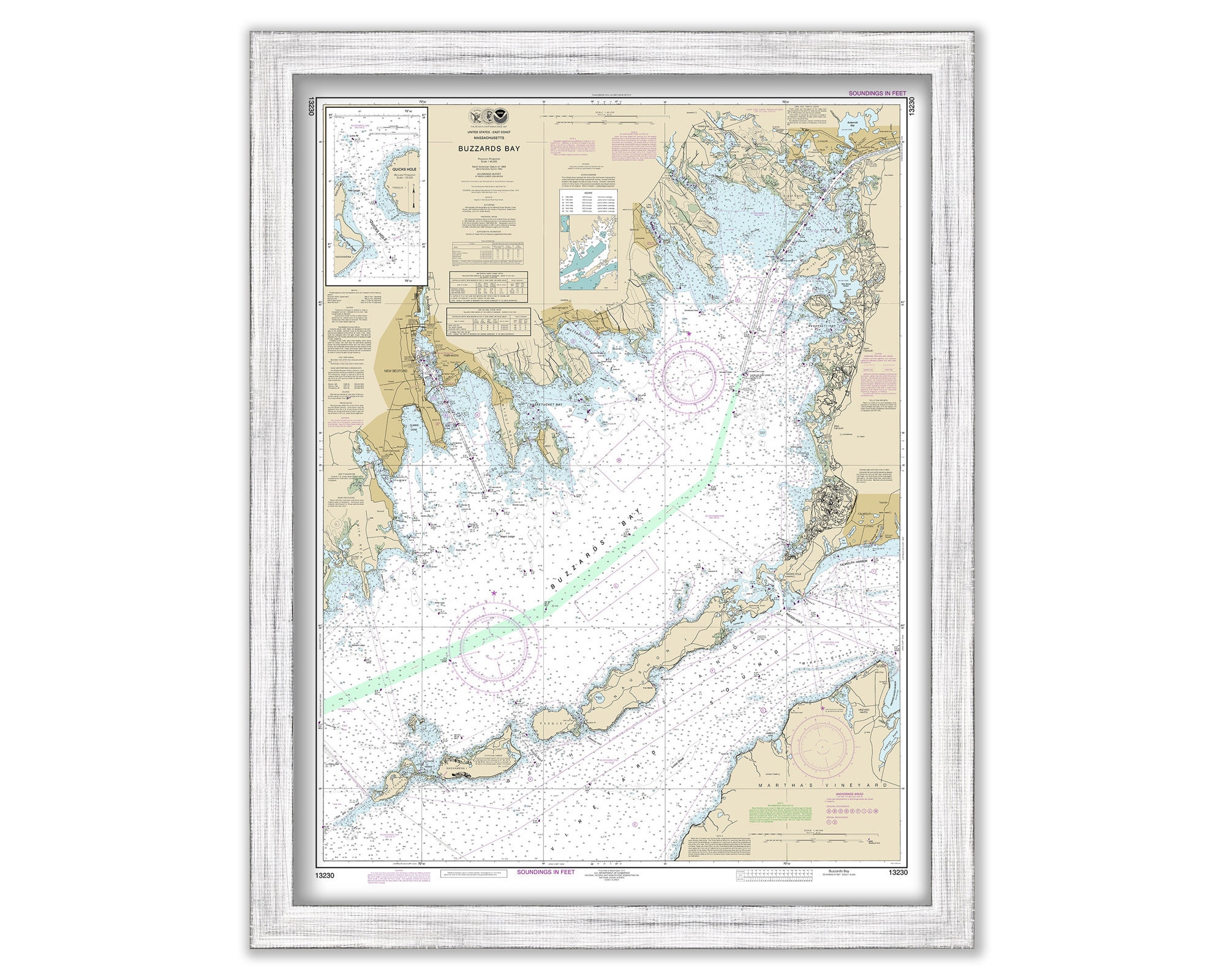
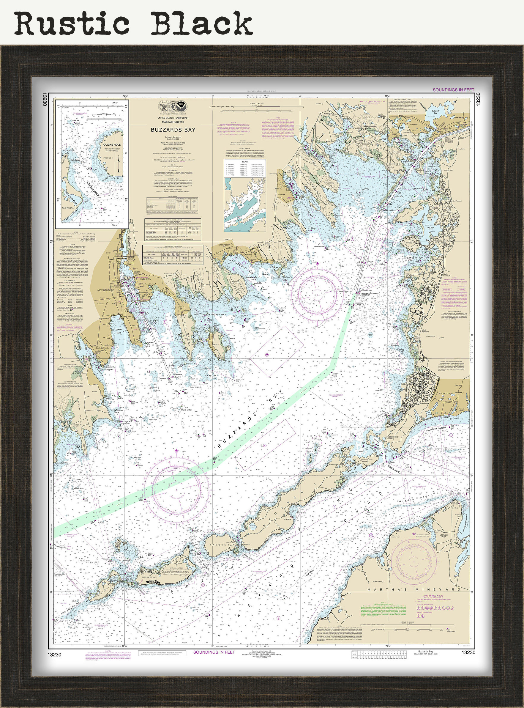
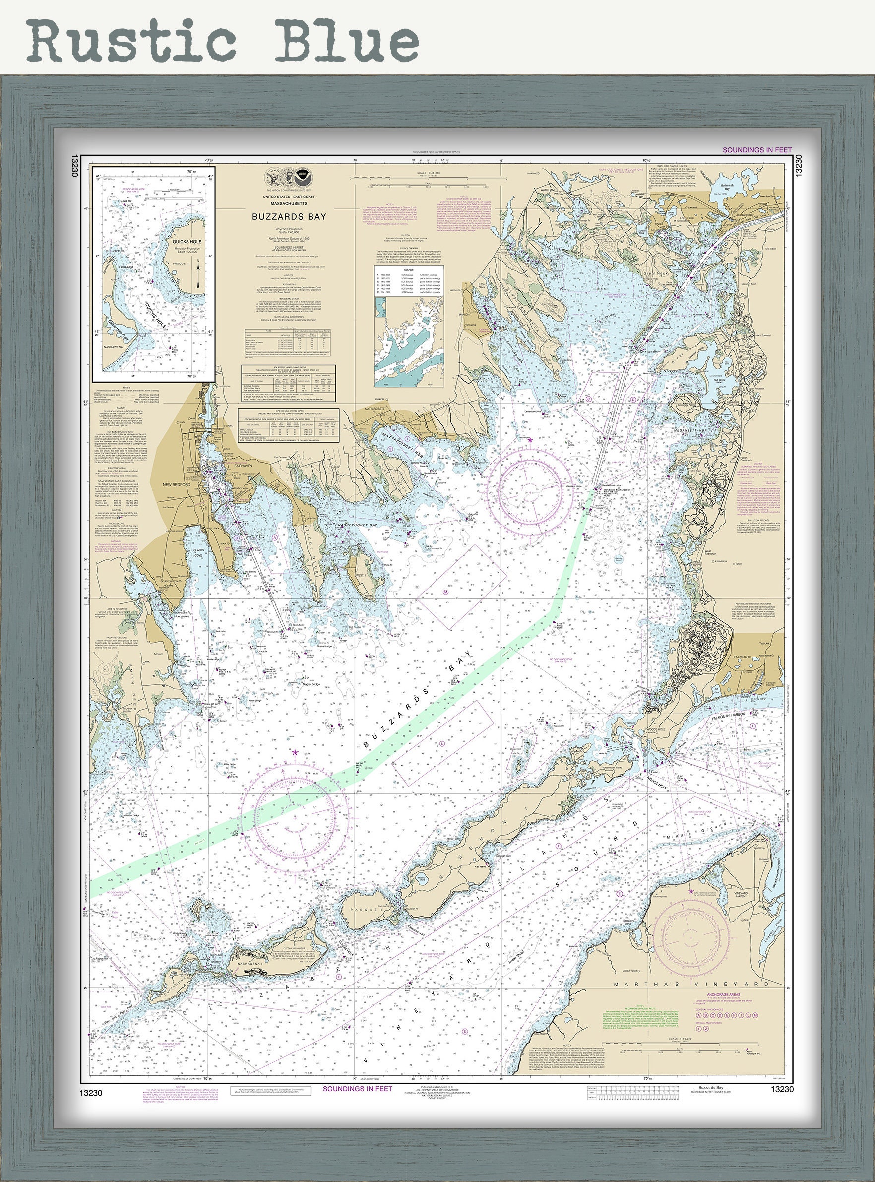
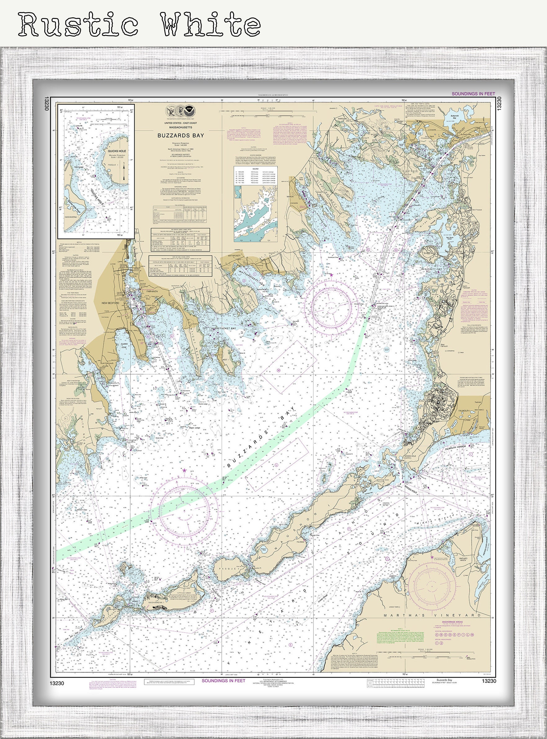
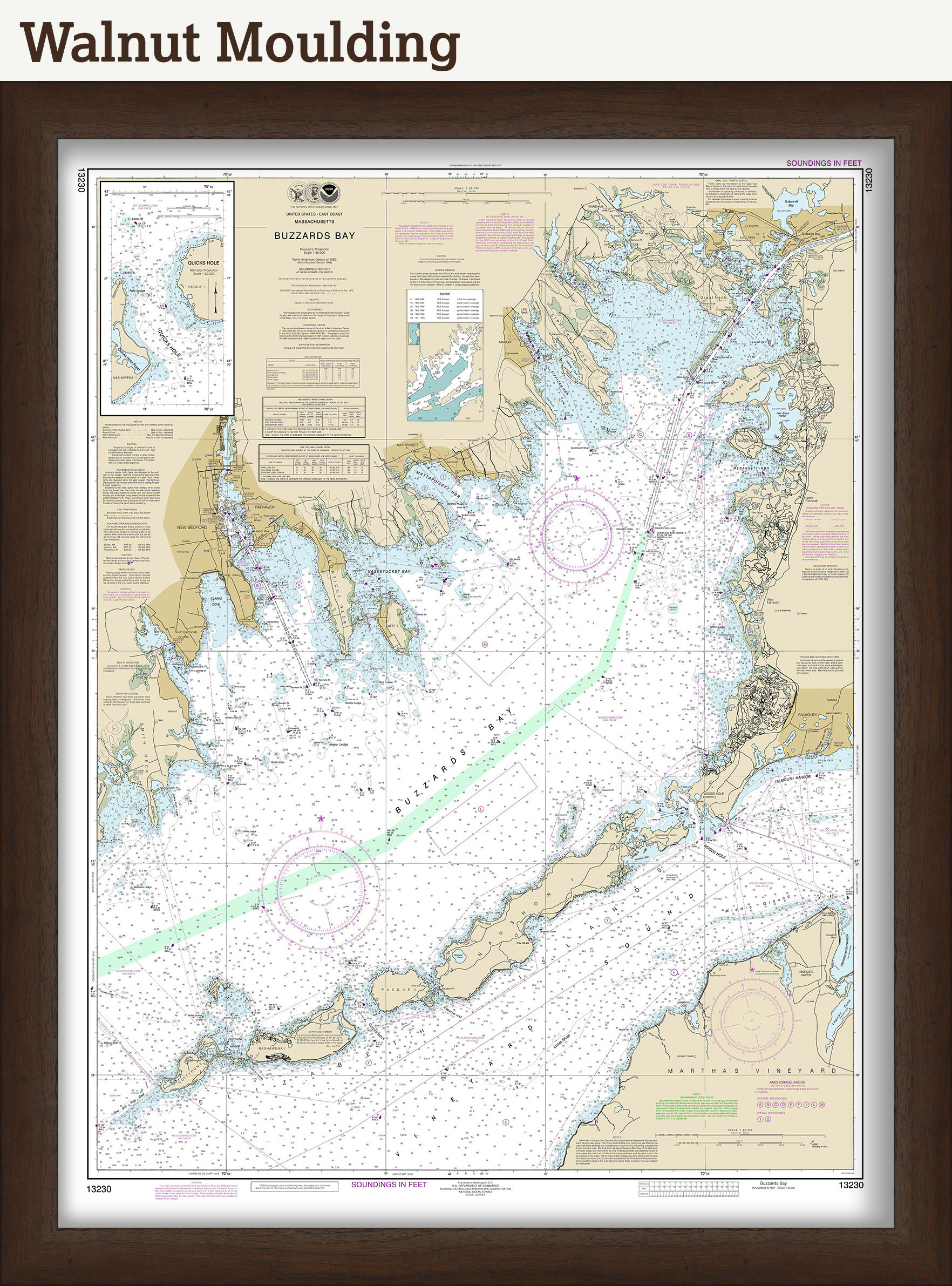
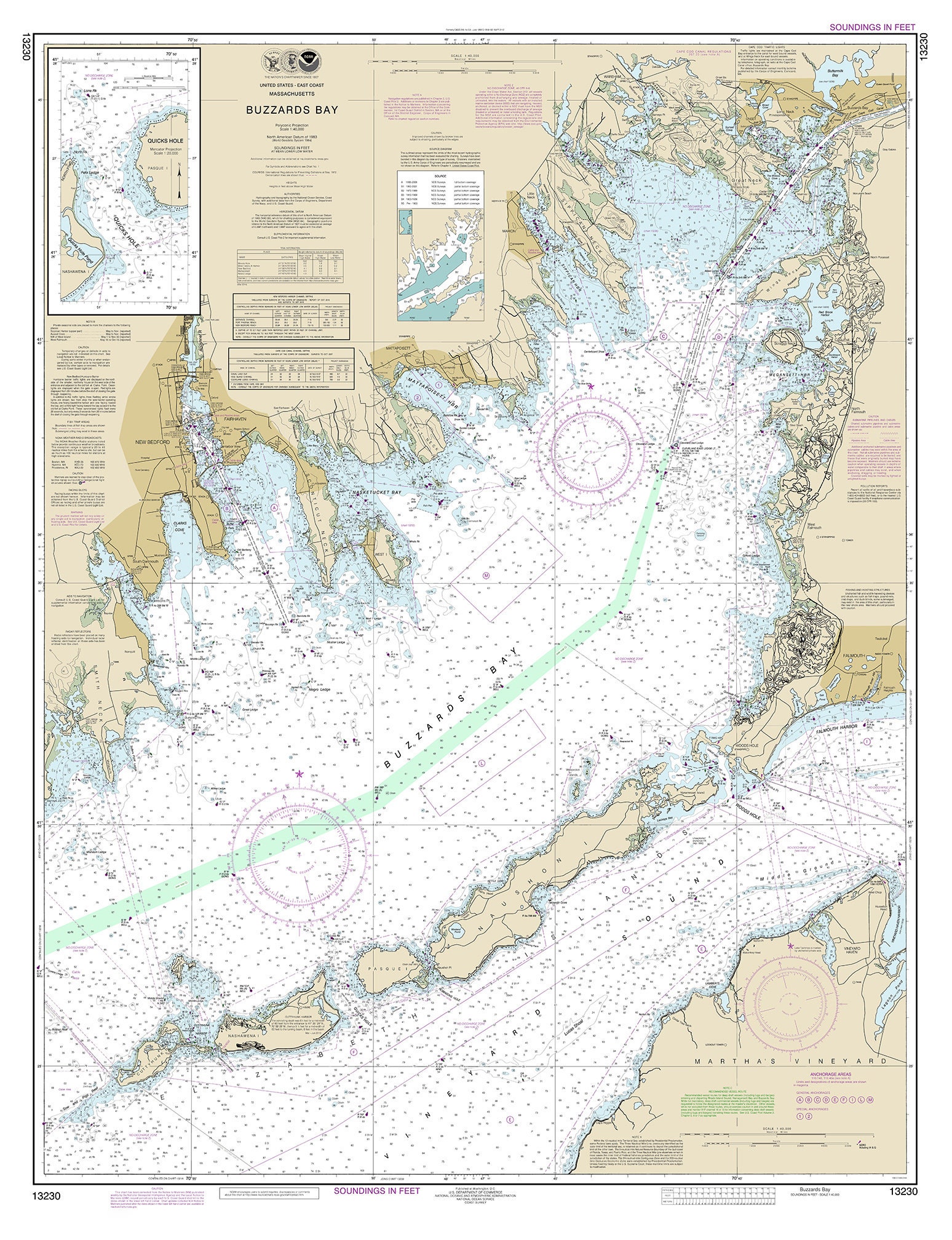
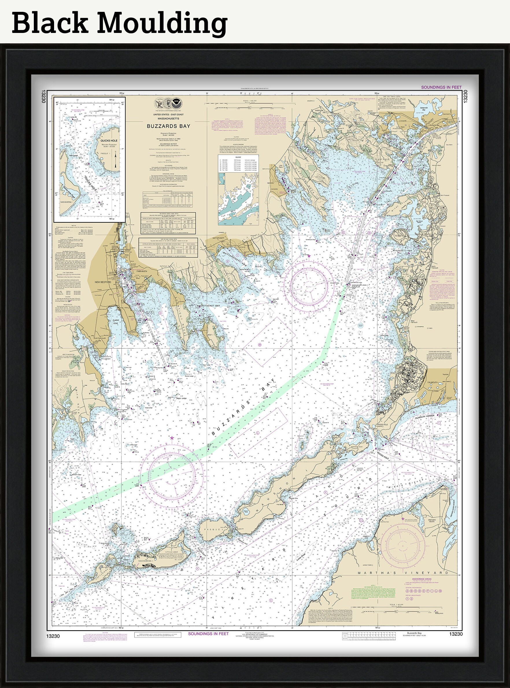
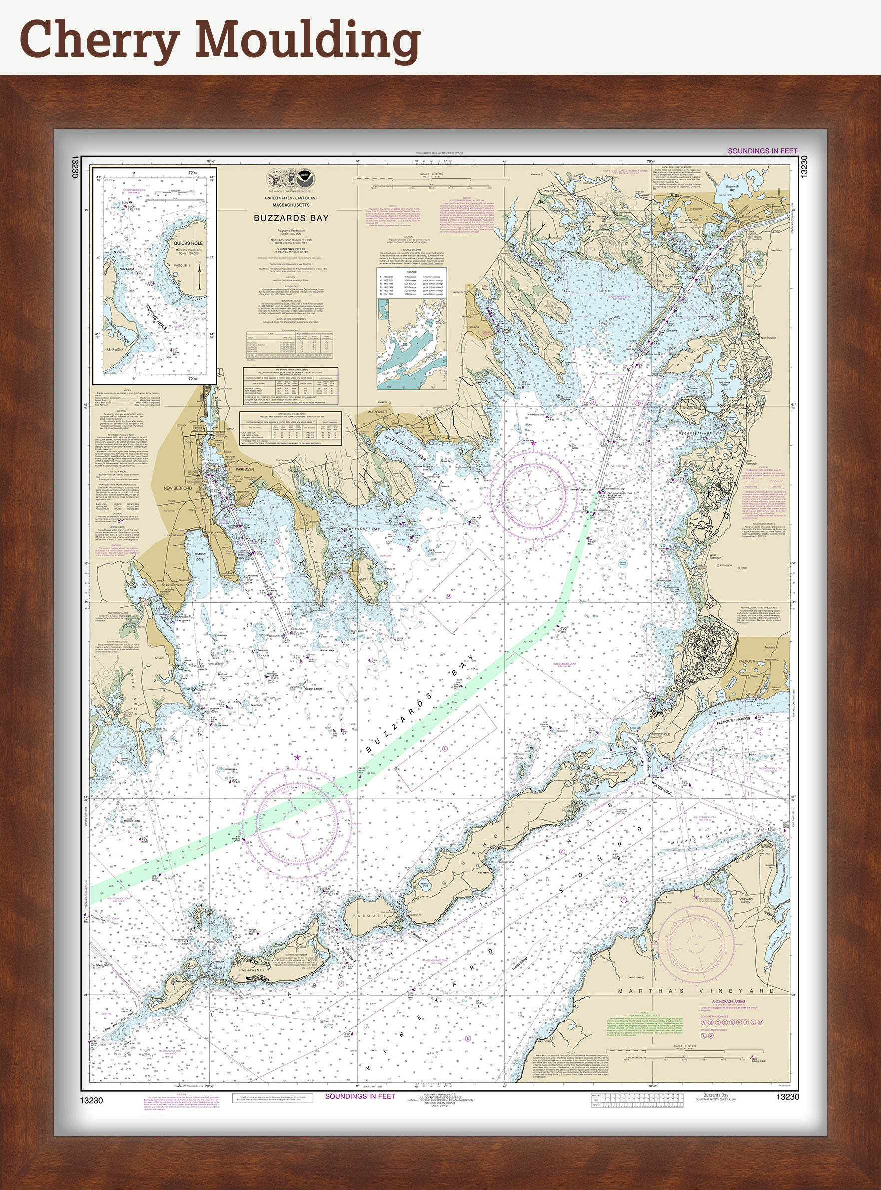
A Nautical Chart of BUZZARDS BAY, Massachusetts - by NOAA originally published in 2017.
Custom sizes are available. If you are interested in a custom size, please let us know through the "ask a question" button in this listing.
This image is printed on heavy matte fine art paper with archival inks. Framing is available. Framed charts include drymounting, UV filtering glass, and your choice of six mouldings, wired and ready to hang upon delivery. All mouldings are approximately 1.5" wide. Please factor in an additional 3" to the listed size for framed items.
Retailers who would like to carry our Maps and Prints, please contact us through the "ask a question" button in this listing, for information and discounts.
1454
Shipping from United States
Processing time
1-3 business days
Customs and import taxes
Buyers are responsible for any customs and import taxes that may apply. I'm not responsible for delays due to customs.
Payment Options
Returns & Exchanges
Returns & exchanges not accepted
But please contact me if you have problems with your order
I gladly accept cancellations
Request a cancellation within: 1 hours of purchase
Reviews (10)
Average:
Jan 4, 2026
I gave this framed map as a gift and it was a big hit
Alex Shore
Aug 31, 2024
This map turned out nicely framed, but I accidentally ordered the wrong color frame. It is deceiving that the thumbnail picture on the order in the cart, and even here in the past purchases section, shows a white frame - which is what I wanted, but it came in walnut. It can't be returned as it is a custom order so that was disappointing. But - it was my fault.
Meg Andrews
Jun 10, 2024
The piece was beautiful, as pictured and arrived on time. Thank you!!
Suzanne McCarthy
Jan 15, 2024
Great quality, fast processing and shipping.
Nancy LeVangie
Jan 10, 2024
Fantastic quality! Better than expected
Patrick