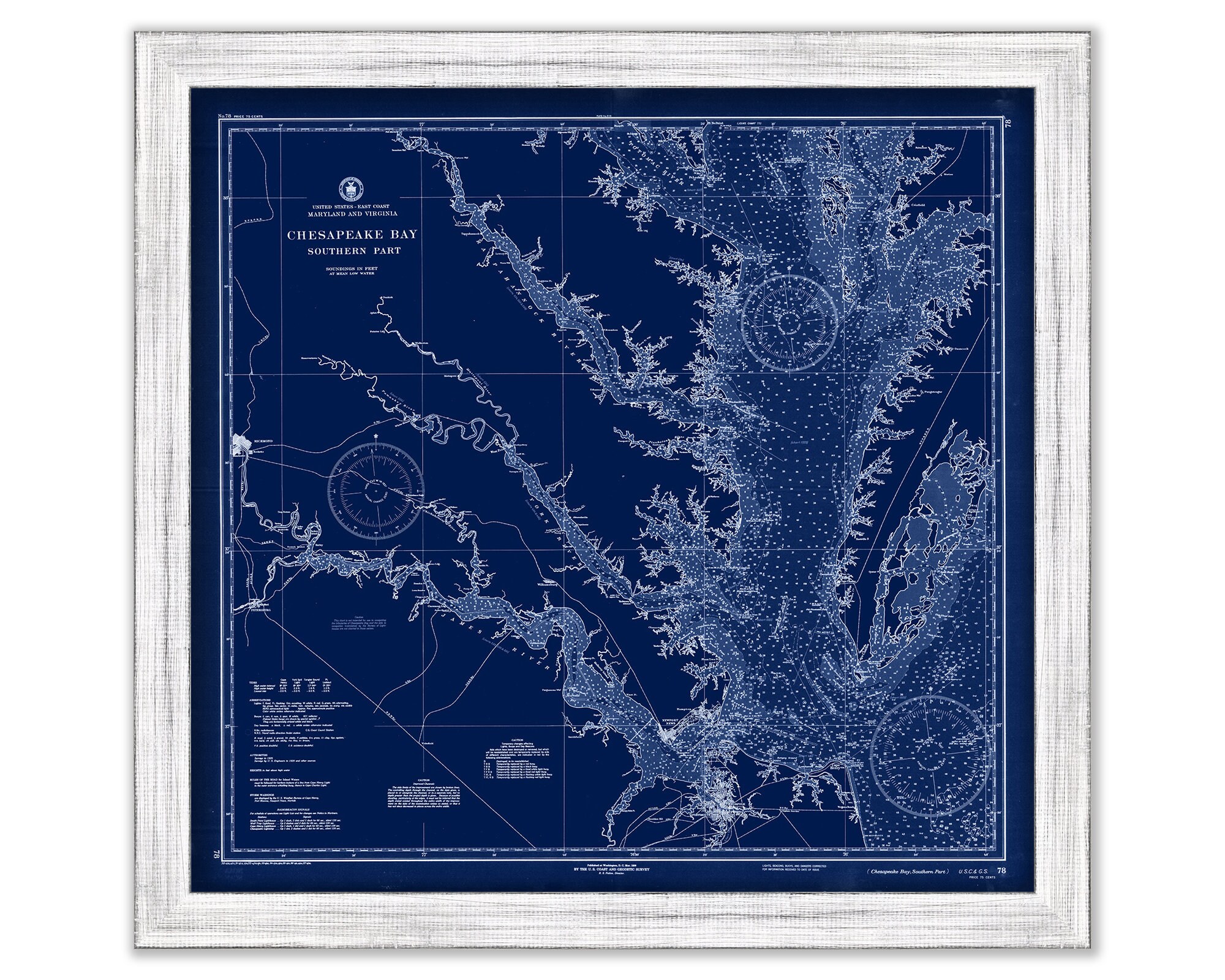
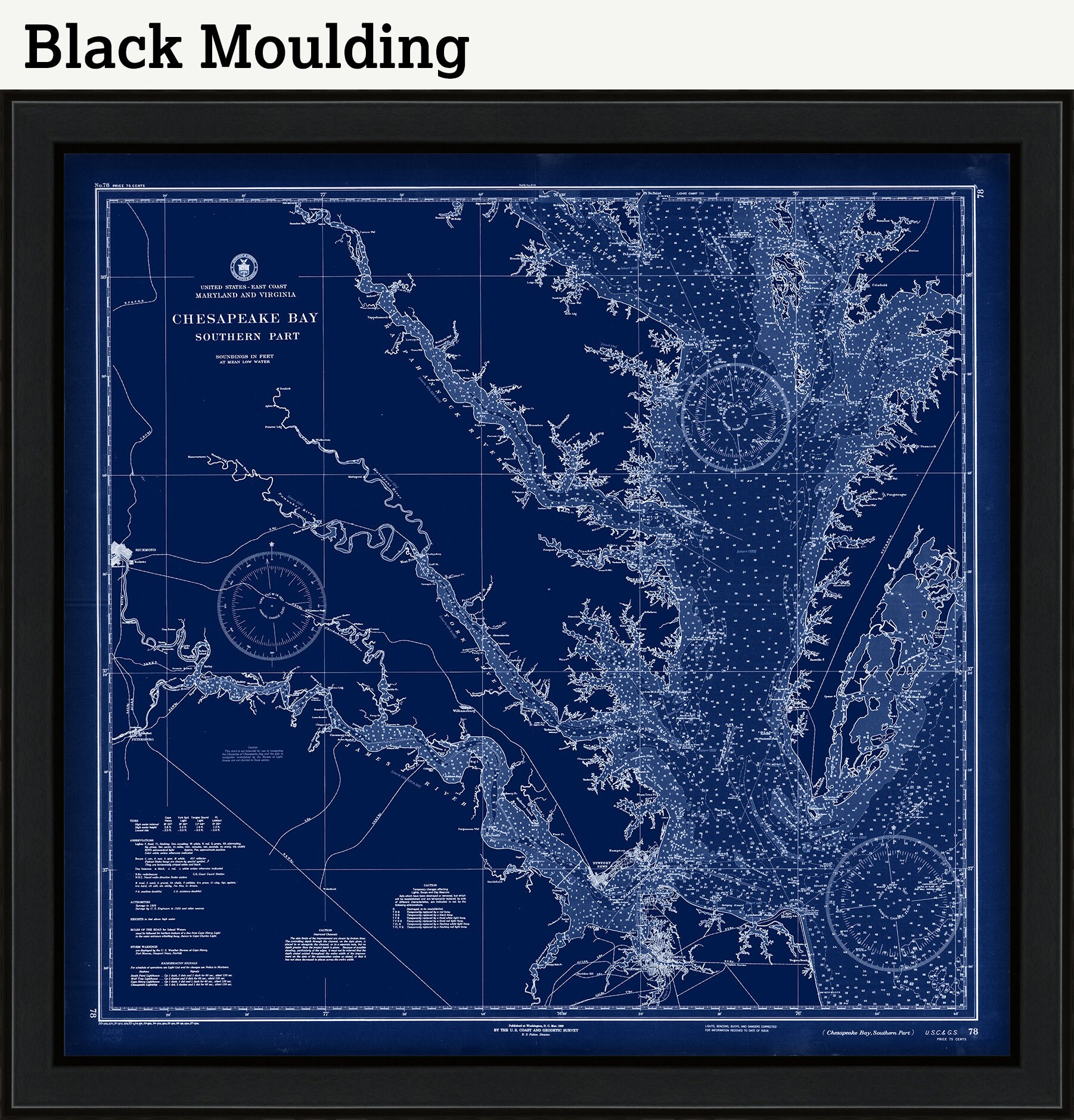
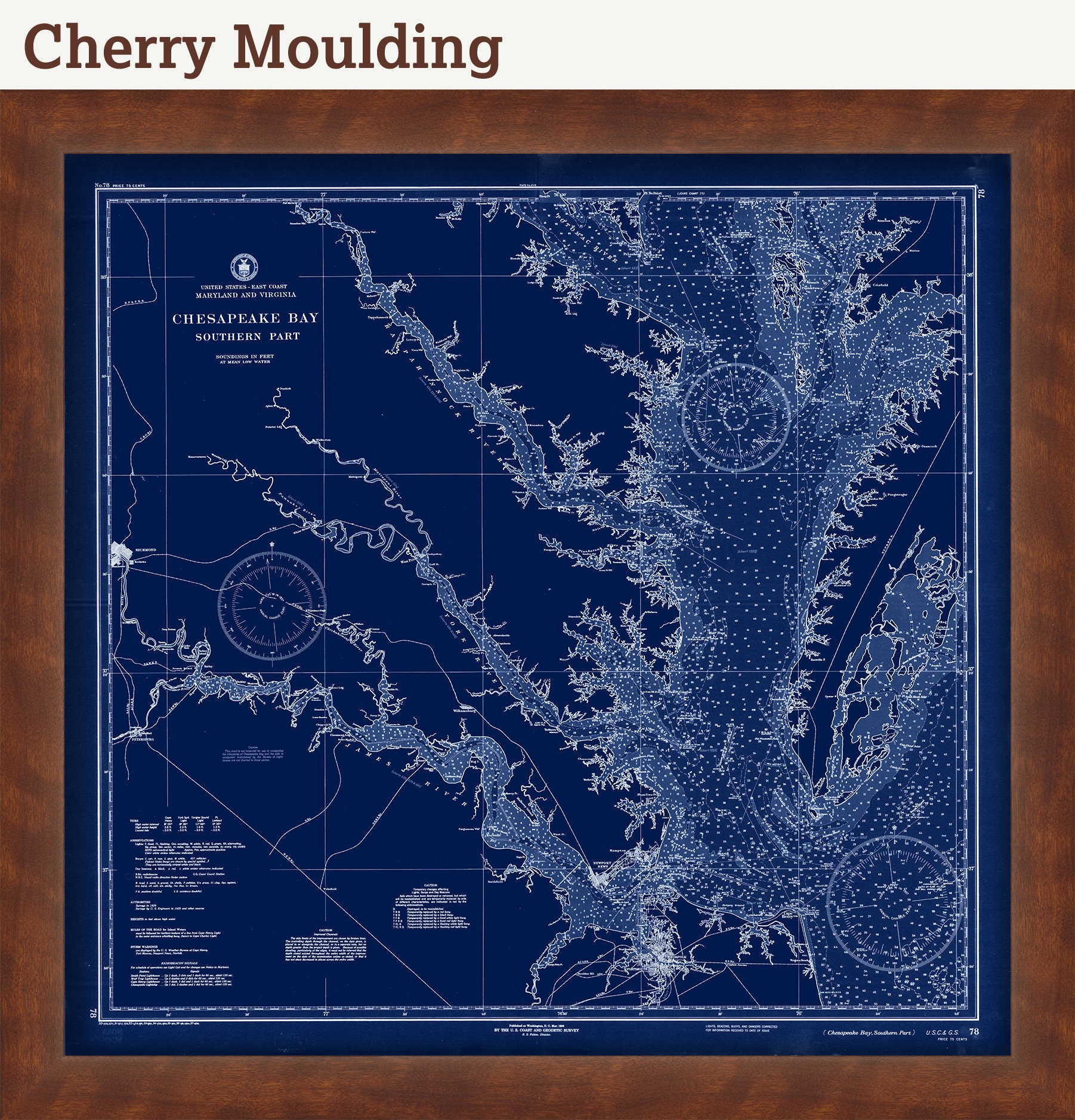
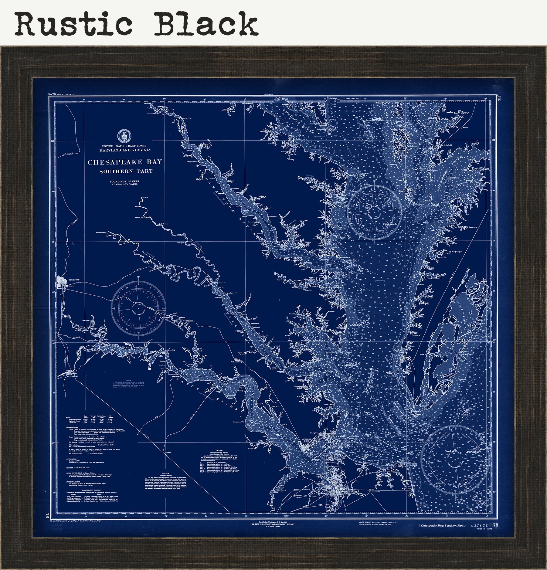
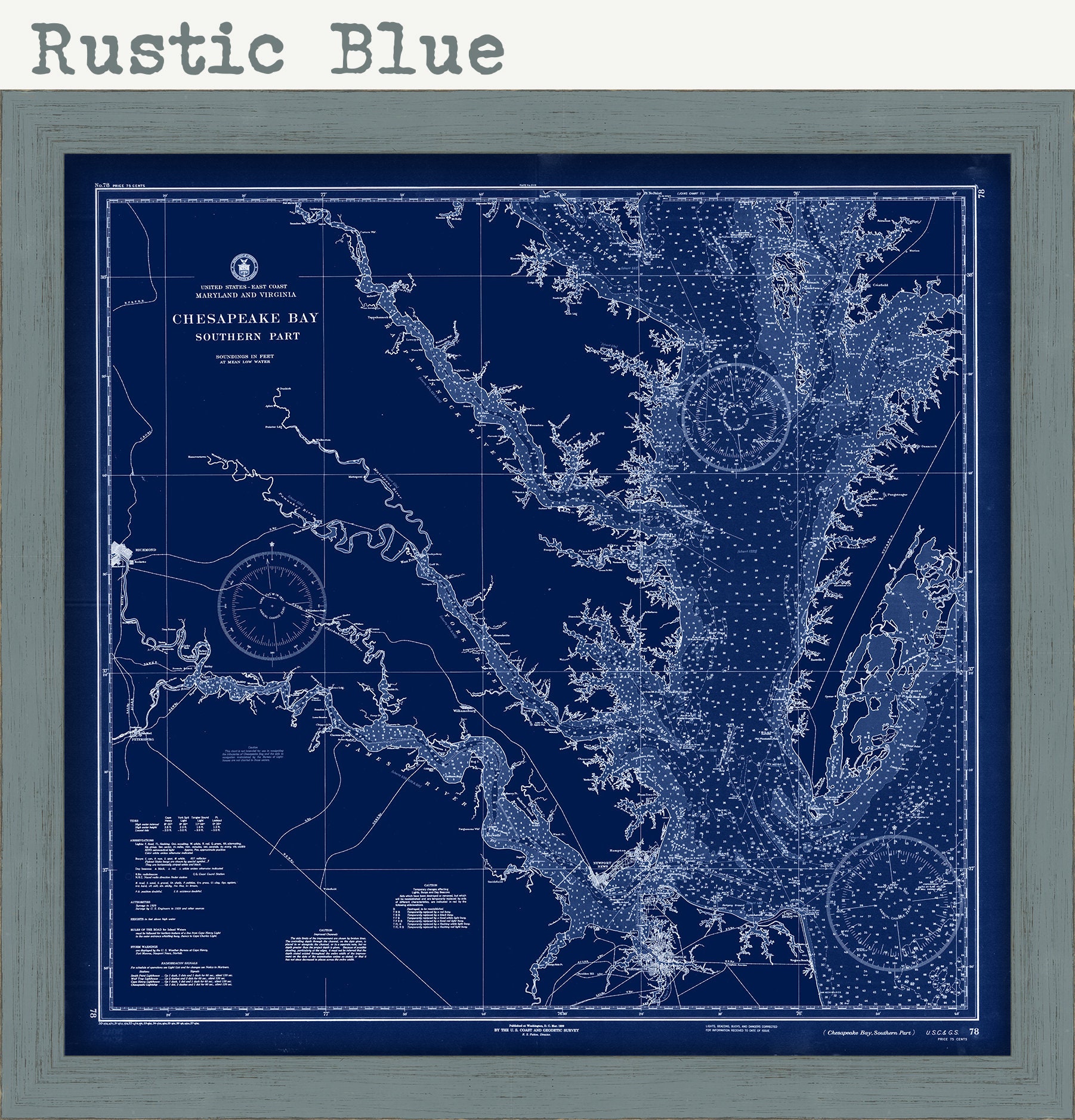
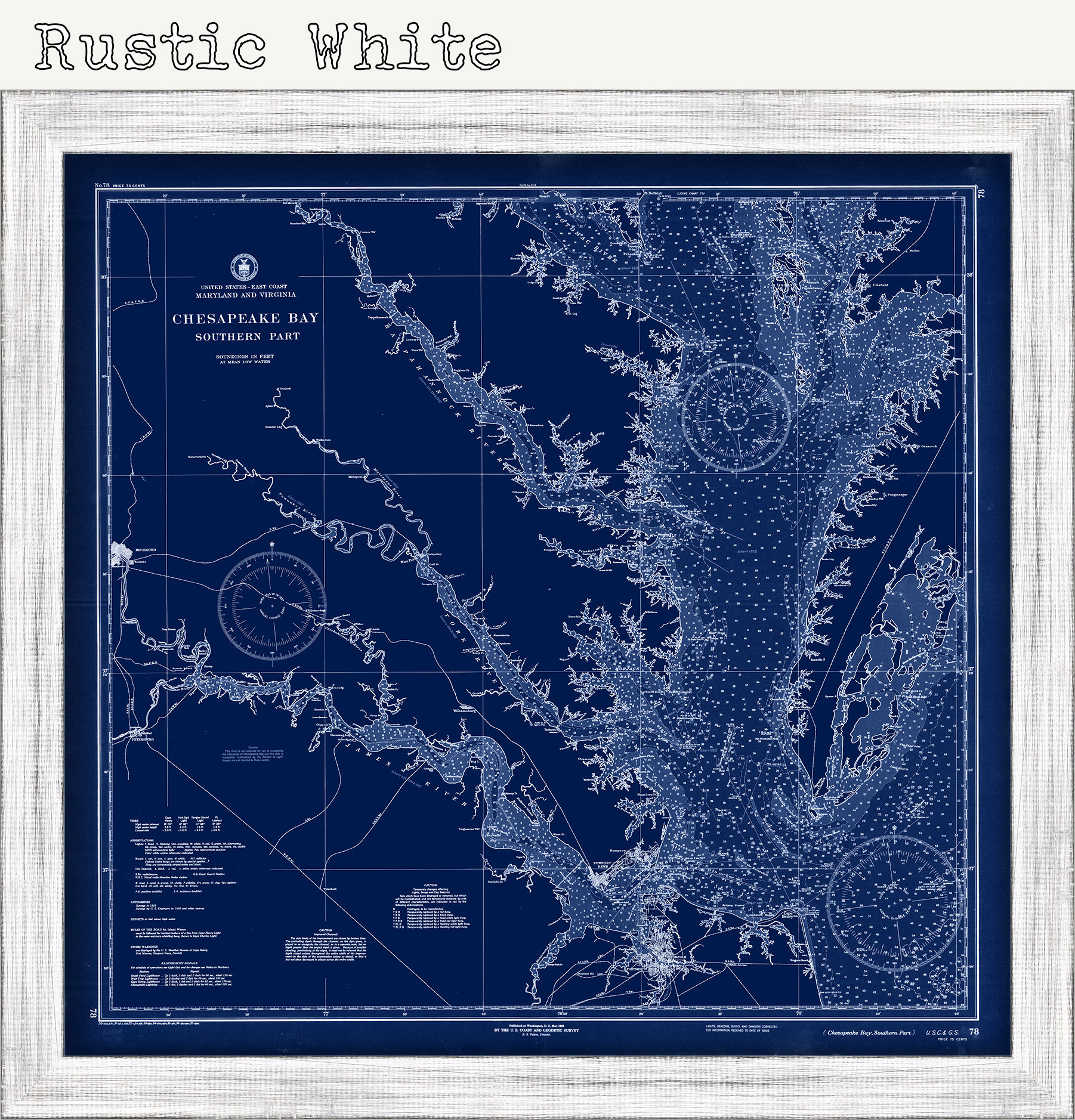
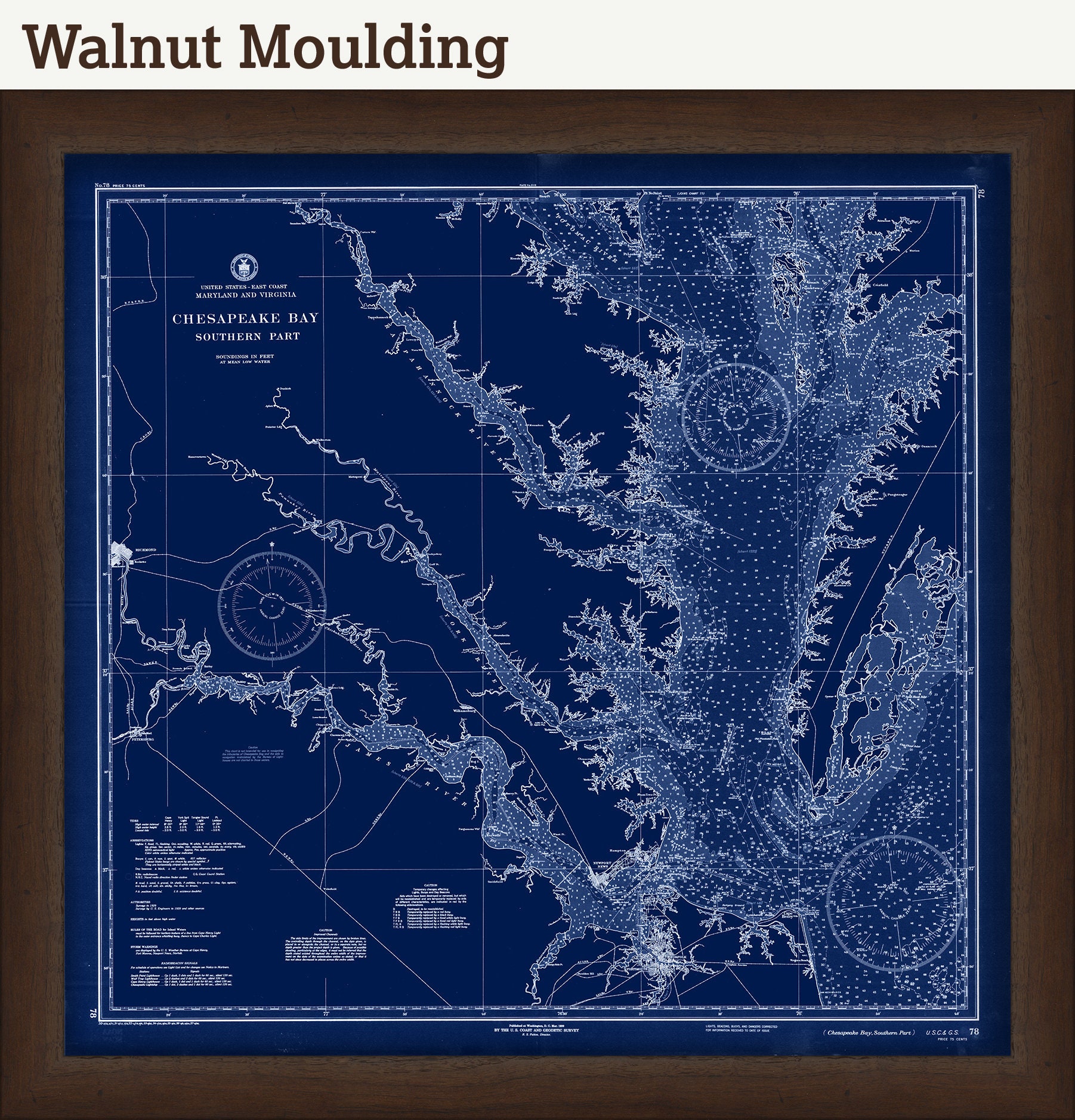
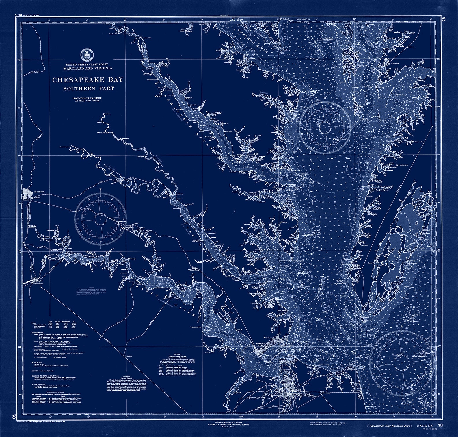


CHESAPEAKE BAY Nautical Chart Blueprint - Southern Section - 1937
$38.00
A nautical chart blueprintof CHESAPEAKE BAY originally published in 1937 by the United States Coast and Geodetic Survey. This chart depicts the Southern section of Chesapeake Bay including the James, York and Potomac Rivers.
Framed maps include drymounting, UV filtering glass, and your choice of six mouldings, wired and ready to hang upon delivery. All mouldings are approximately 1.5" wide. Please factor in an additional 3" to the listed size for framed items.
This map has been scanned From The ORIGINAL at 600 dpi using state of the art equipment {a Contex Large Format Scanner}. The replica map is printed on heavy matte fine art paper using archival pigment inks. This is one of over 5000 Original maps, charts and posters in our collection.
Many reproduction maps that are available on Etsy are taken directly from public domain sources {NY Public Library, Library of Congress, etc}. Although great for research purposes, these image files frequently suffer from poor color accuracy, lens blur and distortion. The maps in our collection have been scanned from the ORIGINAL, flat, at high resolution and with precisely calibrated color. This allows us to prints replicas that are virtually indistinguishable from the original maps.
Custom sizes are available. If you are interested in a custom size, please let us know through the "ask a question" button in this listing.
Retailers who would like to carry our Maps, please contact us through the "ask a question" button in this listing, for information and discounts.
1326BP
Shipping from United States
Processing time
1-3 business days
Customs and import taxes
Buyers are responsible for any customs and import taxes that may apply. I'm not responsible for delays due to customs.
Payment Options
Returns & Exchanges
Returns & exchanges not accepted
But please contact me if you have problems with your order
I gladly accept cancellations
Request a cancellation within: 1 hours of purchase
Reviews (5)
Average:
Jun 8, 2023
Fantastic map! Arrived quickly and in excellent condition!
tara
Jun 29, 2021
The map is absolutely beautiful- the blue is brilliant, even better than I had hoped. SO very pleased with this purchase! Thank you!!!
Heather Manlove
Jan 13, 2021
This is the second of this type of print that I have purchased from Old Map Company. It's based on a nautical chart. The southern section of the bay is really striking, showing all of the tributaries very vividly. The packaging and shipping were done exceptionally carefully. Thanks for the great work.
Andrew Olek
Nov 30, 2020
Toni Roussel
Sep 9, 2020
klanderson26