Old Map Company
Shop
Blog
Gallery
Cart (
0
)
0
Old Map Company
Shop
Blog
Gallery
Contact Us
All items
LIGHTHOUSE PLANS
BIRD'S EYE VIEWS
IRELAND MAPS
NAUTICAL CHARTS
CONNECTICUT MAPS
CALIFORNIA MAPS
MAINE MAPS
MASSACHUSETTS MAPS
MICHIGAN MAPS
NEW HAMPSHIRE MAPS
NEW JERSEY MAPS
NEW YORK MAPS
PENNSYLVANIA MAPS
FLORIDA MAPS + CHARTS
RHODE ISLAND MAPS
PRINTS + POSTERS
WISCONSIN MAPS
VERMONT MAPS
MARYLAND MAPS
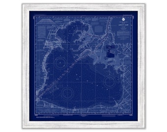
LAKE SAINT CLAIRE, Michigan - 2018 Nautical Chart Blueprint
$26.00
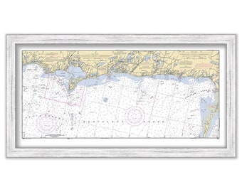
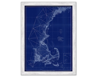
CHATHAM, HARWICHPORT and DENNISPORT, Massachusetts - 2001 Nautical Chart
$38.00
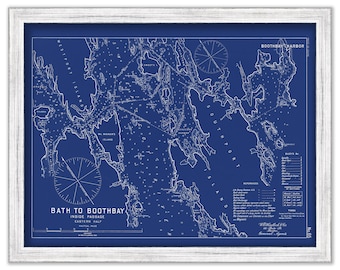
BATH to BOOTHBAY, Maine - 1909 Nautical Chart Blueprint by Geo. Eldridge
$26.00
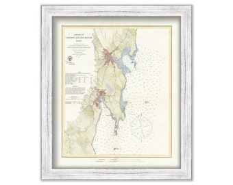
CAMDEN and ROCKPORT HARBORS, Maine - 1864 Nautical Chart
$37.00
0481-Long Island Sound Nautical Chart - New York to Norwalk Islands
$53.00
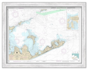
MONTAUK and GARDINIER BAY, Long Island, New York - Nautical Chart published in 2017
$26.00
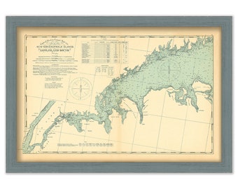
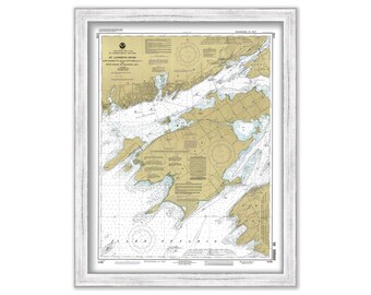
SAINT LAWRENCE RIVER, Cape Vincent to Allan Otty Shoal, New York and Howe Island to Kingston, Ontario - 1993 Nautical Chart
$26.00
POINT JUDITH, Rhode Island - Nautical Chart by NOAA 2014
$44.00
CAPE ANN and MARBLEHEAD, Massachusetts - 2018 Nautical Chart Blueprint
$26.00
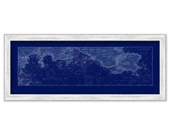
NEW ENGLAND COAST - 1855 Nautical Chart Blueprint
$50.00
JONES BEACH, Long Island, New York 2003 NOAA Chart Blueprint
$44.00
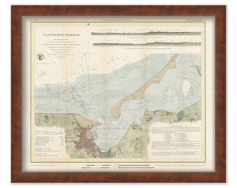
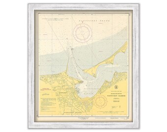
NANTUCKET HARBOR, Massachusetts 1848 Colored Nautical Chart
$44.00
NANTUCKET HARBOR, Massachusetts 1953 Nautical Chart
$44.00
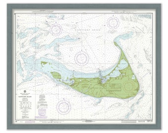
Nantucket Island Chart 1971- Sea Spray Green
$38.00
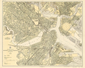
BOSTON HARBOR, Massachusetts - 1927 Nautical Chart
$37.00
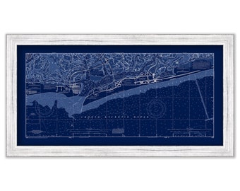
Ipswich Bay to Gloucester Harbor; Rockport Harbor 2013 - Nautical Chart Blueprint
$44.00
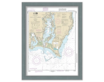
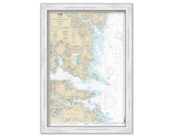
RAPPAHANNOCK RIVER-Chesapeake Bay, Virginia - 2014 Nautical Chart
$38.00
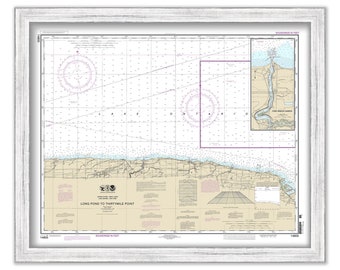
Long Pond to Thirty Mile Point and Point Breeze Harbor, New York - 2014 Nautical Chart
$26.00
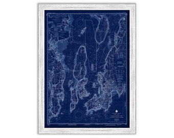
Narragansett Bay and Newport Harbor, Rhode Island - Nautical Chart Blueprint by NOAA 1991
$44.00
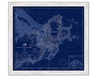
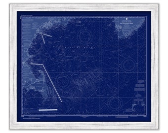
Gulf of Maine and Georges Bank, Maine/New Hampshire/Massachusetts - 2018 Nautical Chart Blueprint
$38.00
1
...
18
19
20
21
22
23
24
...
57
0 items in your cart
Close
Keep shopping! :)
Legal imprint
Close