Old Map Company
Shop
Blog
Gallery
Cart (
0
)
0
Old Map Company
Shop
Blog
Gallery
Contact Us
All items
LIGHTHOUSE PLANS
BIRD'S EYE VIEWS
IRELAND MAPS
NAUTICAL CHARTS
CONNECTICUT MAPS
CALIFORNIA MAPS
MAINE MAPS
MASSACHUSETTS MAPS
MICHIGAN MAPS
NEW HAMPSHIRE MAPS
NEW JERSEY MAPS
NEW YORK MAPS
PENNSYLVANIA MAPS
FLORIDA MAPS + CHARTS
RHODE ISLAND MAPS
PRINTS + POSTERS
WISCONSIN MAPS
VERMONT MAPS
MARYLAND MAPS
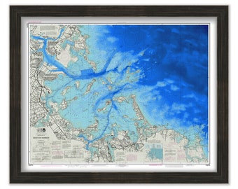
BOSTON HARBOR, Massachusetts - Nautical Chart 2018
$44.00
BEAUFORT INLET, South Carolina - 1978 Nautical Chart
$25.00
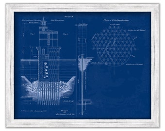
BALTIMORE HARBOR LIGHTHOUSE, Baltimore, Maryland - Blueprint Drawing and Plan of the Lighthouse as it was Proposed in 1897.
$25.00
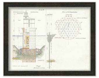
BALTIMORE HARBOR LIGHTHOUSE, Baltimore, Maryland - Drawing and Plan of the Lighthouse as it was Proposed in 1897.
$25.00
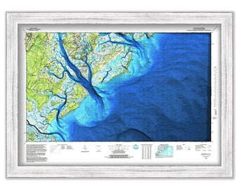
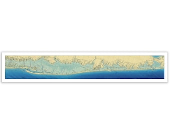
Great South Bay to Shinnecock Bay - Nautical Chart - Enhanced Bathymetry Data Visualization
$37.00
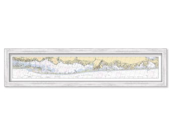
Great South Bay to Shinnecock Bay - Nautical Chart
$37.00
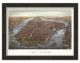
NEW YORK CITY 1873 Bird's Eve View
$25.00
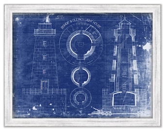
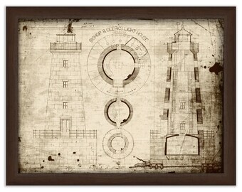
BISHOP and CLERKS LIGHTHOUSE, Barnstable, Massachusetts - Blueprint Plan of the Lighthouse in 1854
$25.00
BISHOP and CLERKS LIGHTHOUSE, Barnstable, Massachusetts - Plan of the Lighthouse in 1854
$25.00
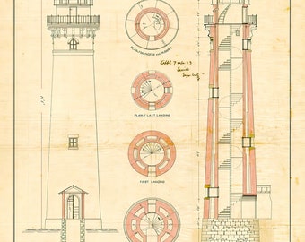
SABLE POINT LIGHTHOUSE, Illinois - Blueprint Plan of the Lighthouse in 1873
$25.00
SABLE POINT LIGHTHOUSE, Illinois - Plan of the Lighthouse in 1873
$36.00
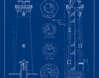
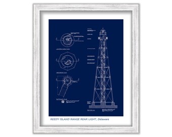
REEDY ISLAND Range Rear Light, Delaware - Blueprint Drawing and Plan Poster
$25.00
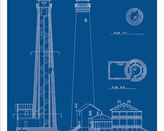
PENSACOLA LIGHTHOUSE, Florida - Drawing and Plan of the Lighthouse as it was in 1863
$25.00
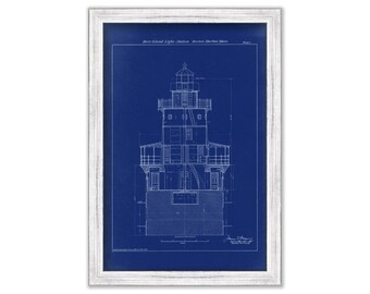
DEER ISLAND LIGHTHOUSE, Boston Harbor, Massachusetts - 1888 Architectural Drawings Blueprint
$38.00
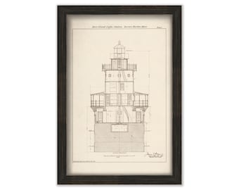
DEER ISLAND LIGHTHOUSE, Boston Harbor, Massachusetts - 1888 Architectural Drawings
$38.00
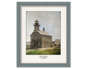
Block Island's North Light, Rhode Island - Colorized Old Photo circa 1890
$25.00
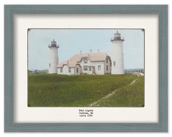
CHATHAM'S TWIN LIGHTS, Chatham, Massachusetts - Colorized Old Photo of the Lighthouse as it was circa 1900
$38.00
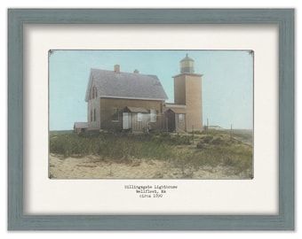
BILLINGSGATE ISLAND LIGHTHOUSE, Wellfleet, Massachusetts - Colorized Old Photo of the Lighthouse as it was circa 1900
$37.00
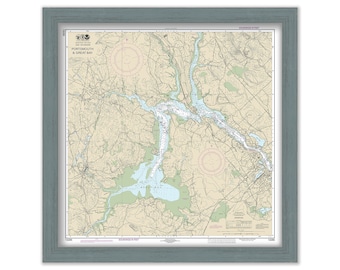
GREAT BAY, New Hampshire - Nautical Chart
$44.00
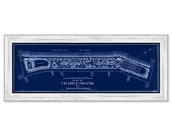
Blueprint Plan of CHARLESBANK 1902, Boston, Massachusetts by Frederick Law Olmstead
$38.00
1
2
3
4
5
6
7
8
...
287
0 items in your cart
Close
Keep shopping! :)
Legal imprint
Close