Old Map Company
Shop
Blog
Gallery
Cart (
0
)
0
Old Map Company
Shop
Blog
Gallery
Contact Us
All items
LIGHTHOUSE PLANS
BIRD'S EYE VIEWS
IRELAND MAPS
NAUTICAL CHARTS
CONNECTICUT MAPS
CALIFORNIA MAPS
MAINE MAPS
MASSACHUSETTS MAPS
MICHIGAN MAPS
NEW HAMPSHIRE MAPS
NEW JERSEY MAPS
NEW YORK MAPS
PENNSYLVANIA MAPS
FLORIDA MAPS + CHARTS
RHODE ISLAND MAPS
PRINTS + POSTERS
WISCONSIN MAPS
VERMONT MAPS
MARYLAND MAPS
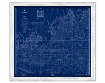
OSTERVILLE, COTUIT and FALMOUTH, Massachusetts - Nautical Chart Blueprint 1971
$40.00
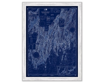
DAMARISCOTTA, SHEEPSCOT and KENNEBEC Rivers, Maine 2019 Nautical Chart Blueprint
$38.00
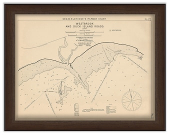
Westbrook and Duck Island Roads, Connecticut - Nautical Chart by George W. Eldridge 1901
$42.00
PLYMOUTH, KINGSTON and DUXBURY Harbors, Massachusetts - 1920 Nautical Chart Blueprint
$44.00
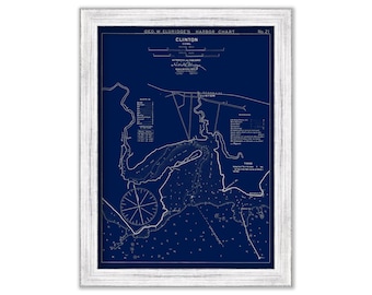
Clinton, Connecticut - Blue Print - Nautical Chart by George W. Eldridge 1901
$37.00
TAMPA BAY and St PETERSBURG, Florida - Nautical Chart 2015
$38.00
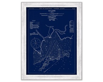
Guilford, Connecticut - Blue Print - Nautical Chart by George W. Eldridge 1901
$37.00
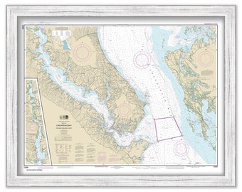
CHESAPEAKE BAY, Patuxent River, Maryland - 2016 Nautical Chart
$26.00
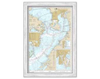
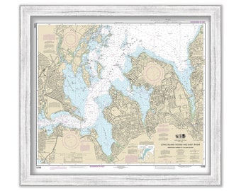
HEMPSTEAD HARBOR, Long Island, New York - Nautical Chart published in 2014
$44.00
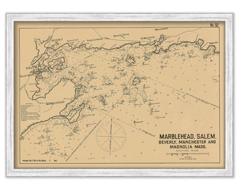
Salem, Marblehead and Beverly Harbors, Massachusetts 1909 - Nautical Chart by Geo. Eldridge Colored Version
$44.00
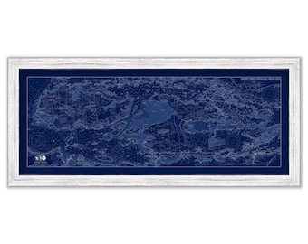
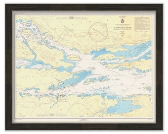
Grindstone Island, Wellesley Island and Hill Island, SAINT LAWRENCE SEAWAY, New York - 2019 Nautical Chart Blueprint
$48.00
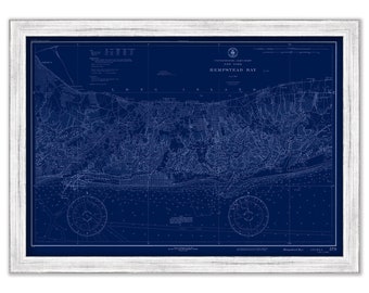
HAMPSTEAD BAY, Long Island, New York - Nautical Chart Blueprint published in 1934
$44.00
NEW LONDON HARBOR, Connecticut - Nautical Chart published in 2016
$44.00
SAINT LAWRENCE RIVER, New York - The Thousand Islands 1945 Nautical Chart
$30.00
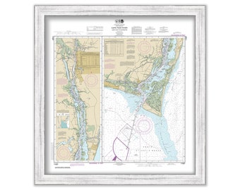
CAPE FEAR RIVER, North Carolina - 2015 Nautical Chart
$37.00
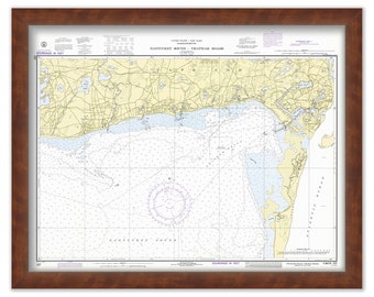
Harbors of CHATHAM, HARWICHPORT and DENNISPORT, Massachusetts - Nautical Chart 1972
$38.00
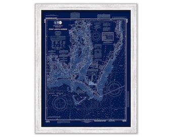
POINT JUDITH HARBOR, Rhode Island - Nautical Chart Blueprint published in 2014
$44.00
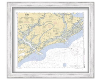
KIAWAH and FOLLY ISLANDS, South Carolina - 2010 Nautical Chart
$44.00
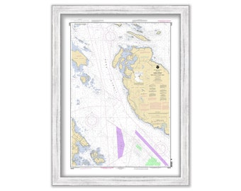
HARO STRAIT, Washington - 2005 Nautical Chart
$26.00
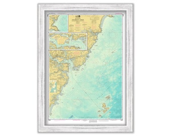
PORTSMOUTH HARBOR, Cape Neddick Harbor and Isles of Shoals, New Hampshire - Enhanced Nautical Chart
$25.00
1
...
34
35
36
37
38
39
40
...
57
0 items in your cart
Close
Keep shopping! :)
Legal imprint
Close