Old Map Company
Shop
Blog
Gallery
Cart (
0
)
0
Old Map Company
Shop
Blog
Gallery
Contact Us
All items
LIGHTHOUSE PLANS
BIRD'S EYE VIEWS
IRELAND MAPS
NAUTICAL CHARTS
CONNECTICUT MAPS
CALIFORNIA MAPS
MAINE MAPS
MASSACHUSETTS MAPS
MICHIGAN MAPS
NEW HAMPSHIRE MAPS
NEW JERSEY MAPS
NEW YORK MAPS
PENNSYLVANIA MAPS
FLORIDA MAPS + CHARTS
RHODE ISLAND MAPS
PRINTS + POSTERS
WISCONSIN MAPS
VERMONT MAPS
MARYLAND MAPS
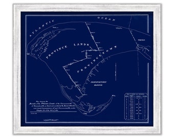
PROVINCETOWN, Bounds of the Province Lands, Massachusetts - Blueprint - Published in 1893
$44.00
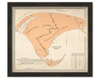
PROVINCETOWN, Bounds of the Province Lands, Massachusetts - Published in 1893
$30.00
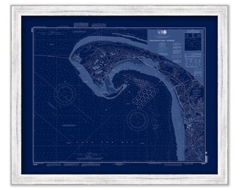
PROVINCETOWN HARBOR and TRURO, Massachusetts - Nautical Chart Blueprint 2007
$44.00
PROVINCETOWN HARBOR and TRURO, Massachusetts - Nautical Chart 2007
$37.00
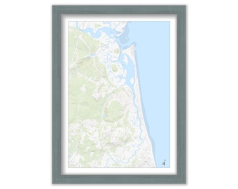
HUMAROCK and parts of SCITUATE and MARSHFIELD adjoining the North/South River, Massachusetts Topographic Map
$38.00
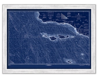
Santa Cruz, Santa Rosa, San Miguell, San Nicolas, Santa Barbara and Anacapa Islands, California - 1967 Nautical Chart Blueprint
$40.00
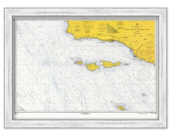
Santa Cruz, Santa Rosa, San Miguell, San Nicolas, Santa Barbara and Anacapa Islands, California - 1967 Nautical Chart
$40.00
SANTA CATALINA ISLAND, California - 2004 Nautical Chart Blueprint
$40.00
SANTA CATALINA ISLAND, California - 2004 Nautical Chart
$25.00
SANTA CATALINA ISLAND, California - 1992 Nautical Chart Blueprint
$40.00
SANTA CATALINA ISLAND, California - 1992 Nautical Chart
$25.00
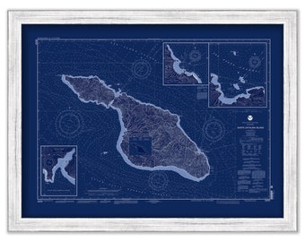
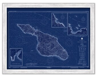
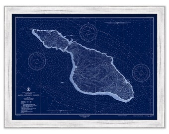
SANTA CATALINA ISLAND, California - 1948 Nautical Chart Blueprint
$40.00
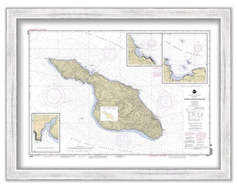
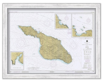
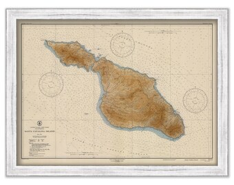
SANTA CATALINA ISLAND, California - 1948 Nautical Chart
$40.00
GREEN BAY, Wisconsin - 2015 Nautical Chart Blueprint by NOAA
$40.00
GREEN BAY, Wisconsin - 2015 Nautical Chart by NOAA
$26.00
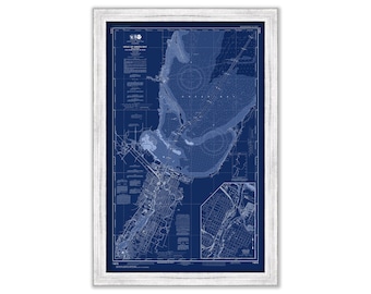
MILWAUKEE, Wisconsin - 2012 Nautical Chart Blueprint by NOAA
$40.00
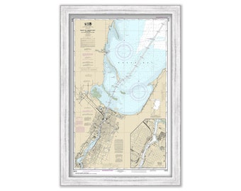
MILWAUKEE, Wisconsin - 2012 Nautical Chart by NOAA
$40.00
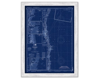
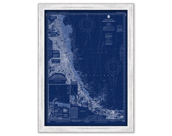
CHICAGO Lake Front, Illinois - 2016 Nautical Chart Blueprint by NOAA
$40.00
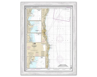
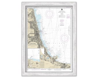
CHICAGO Lake Front, Illinois - 2016 Nautical Chart by NOAA
$38.00
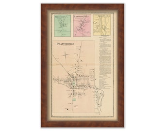
Village of PRATTSBURGH, New York 1873 Map, Replica or Genuine ORIGINAL
$44.00
1
...
74
75
76
77
78
79
80
...
287
0 items in your cart
Close
Keep shopping! :)
Legal imprint
Close