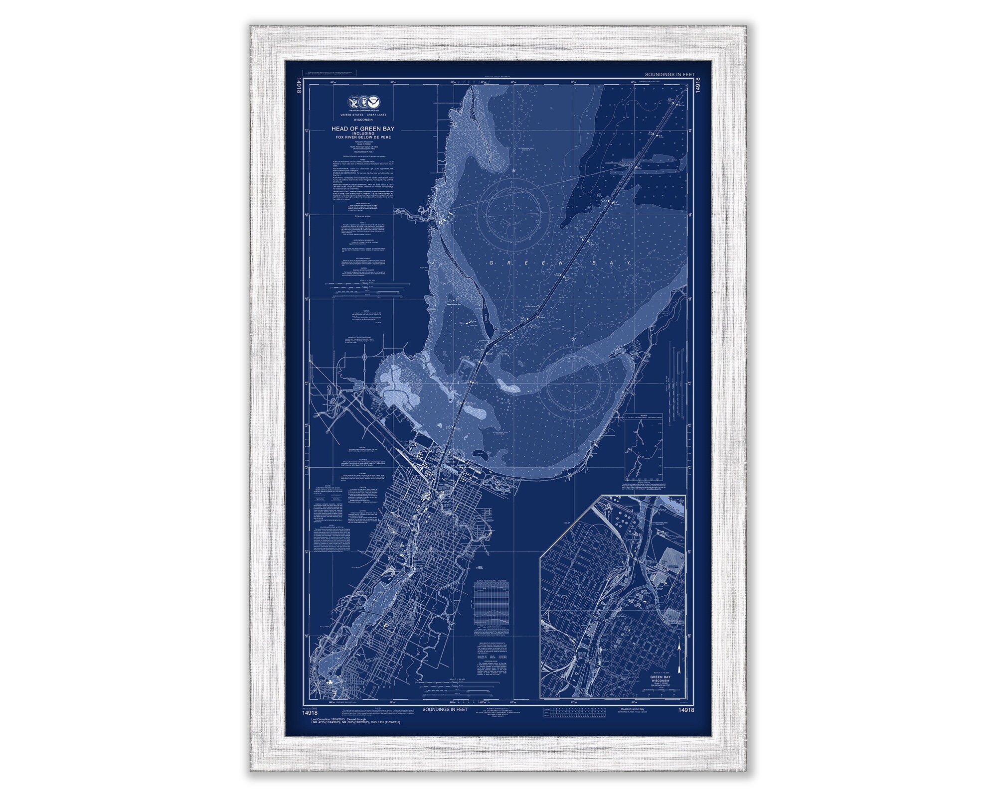
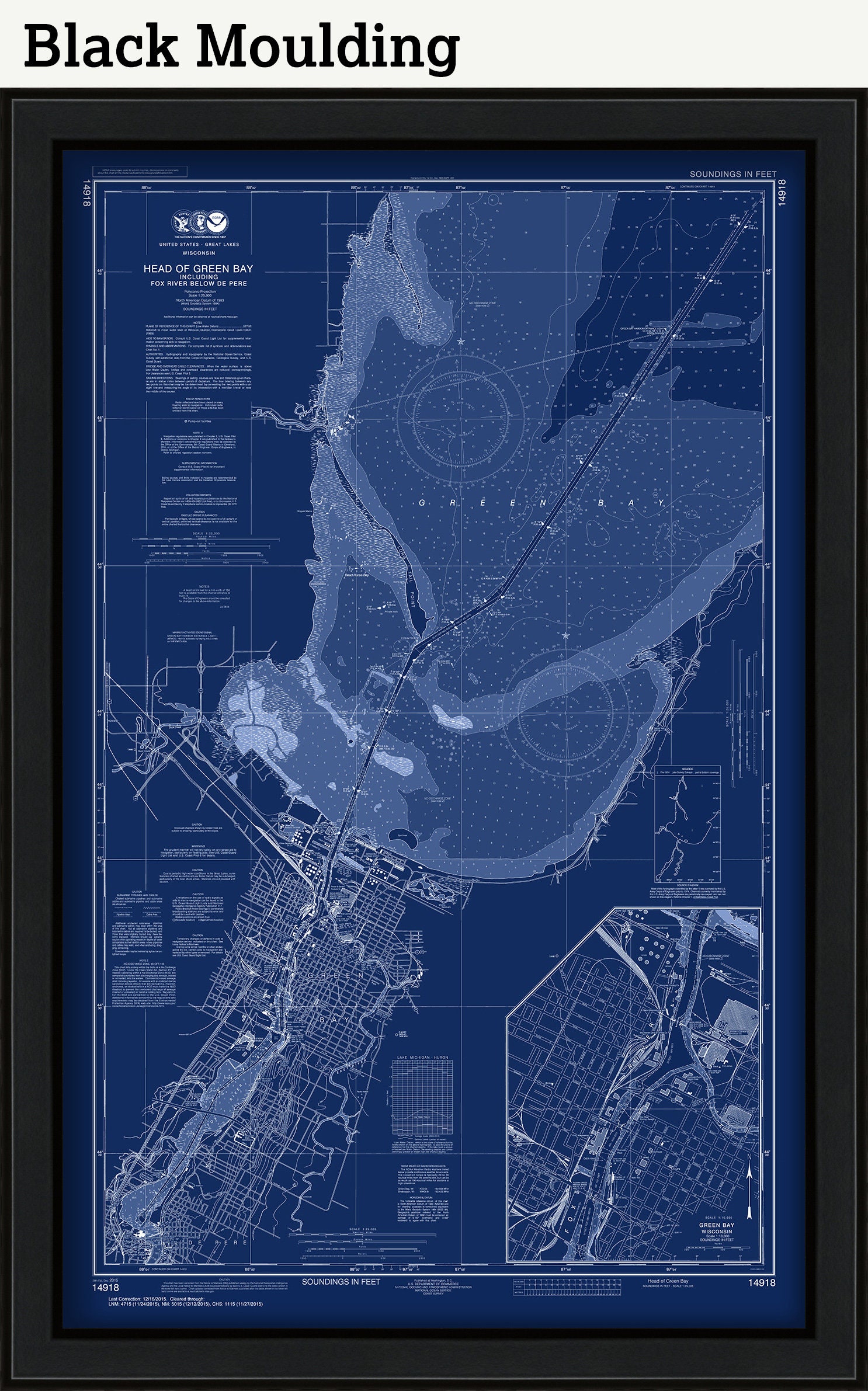
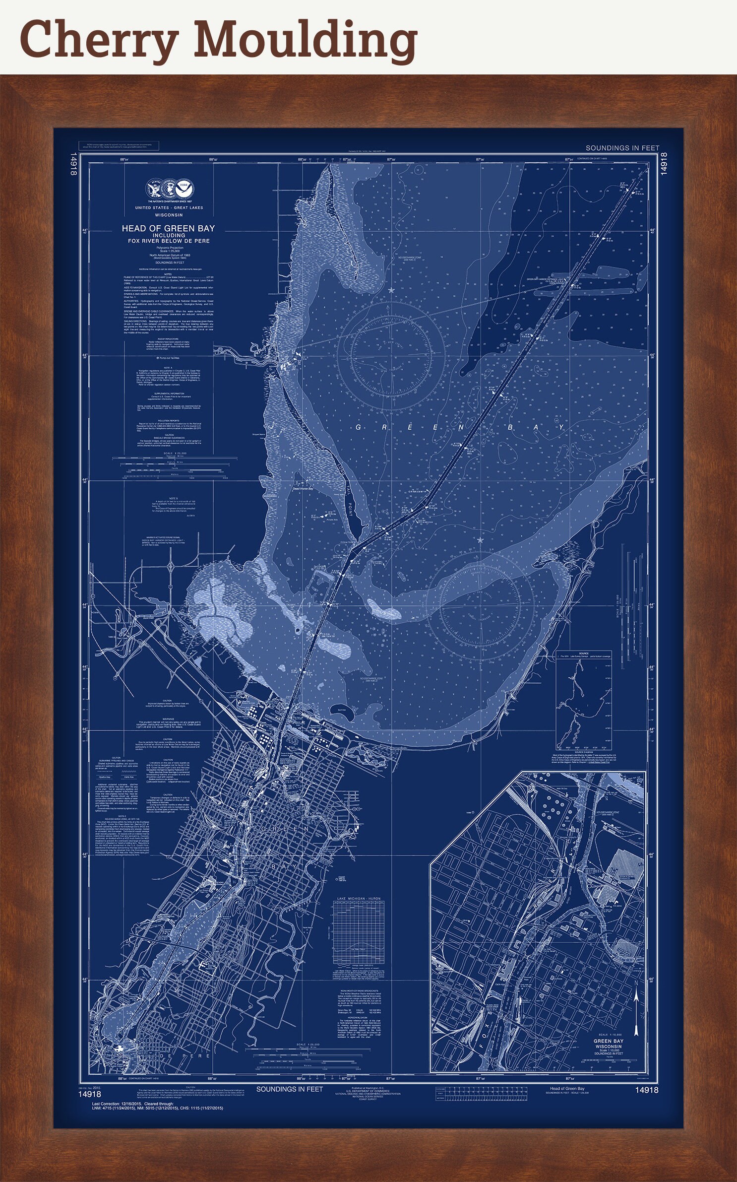
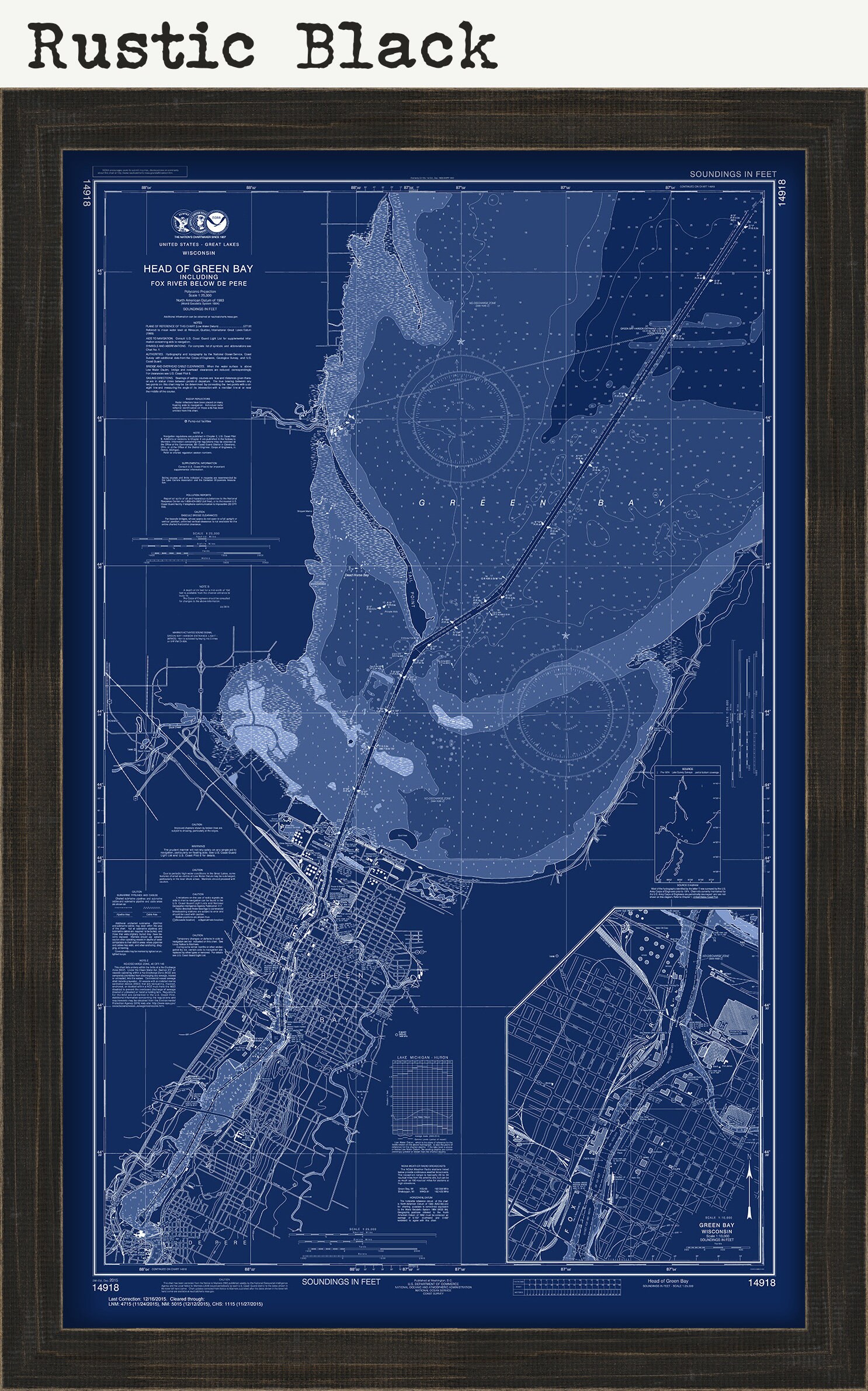

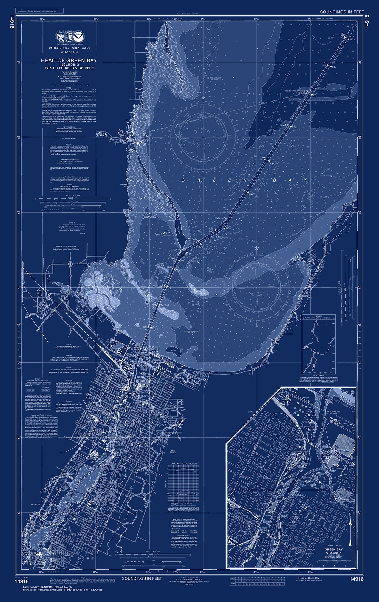
GREEN BAY, Wisconsin - 2015 Nautical Chart Blueprint by NOAA
$40.00
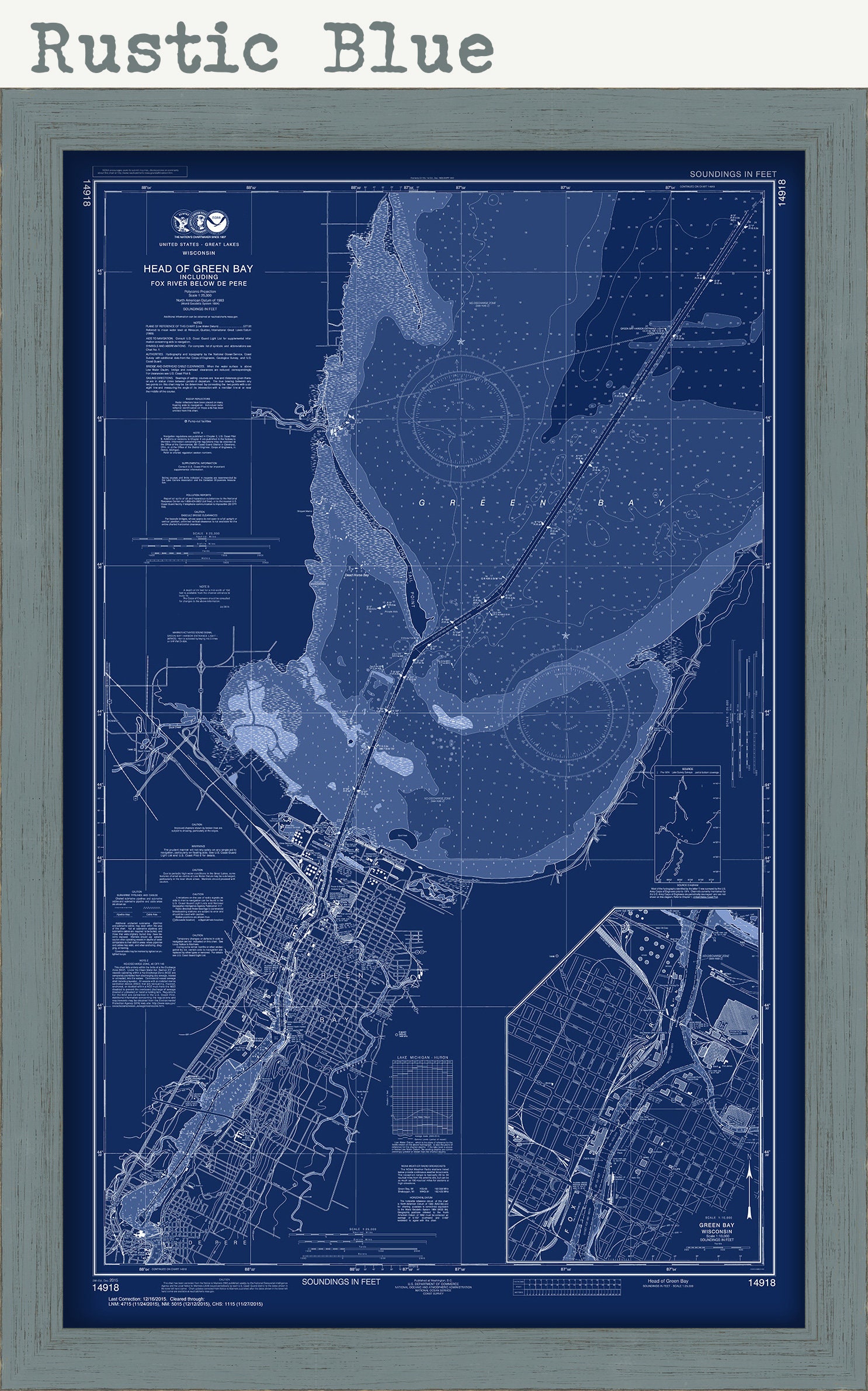
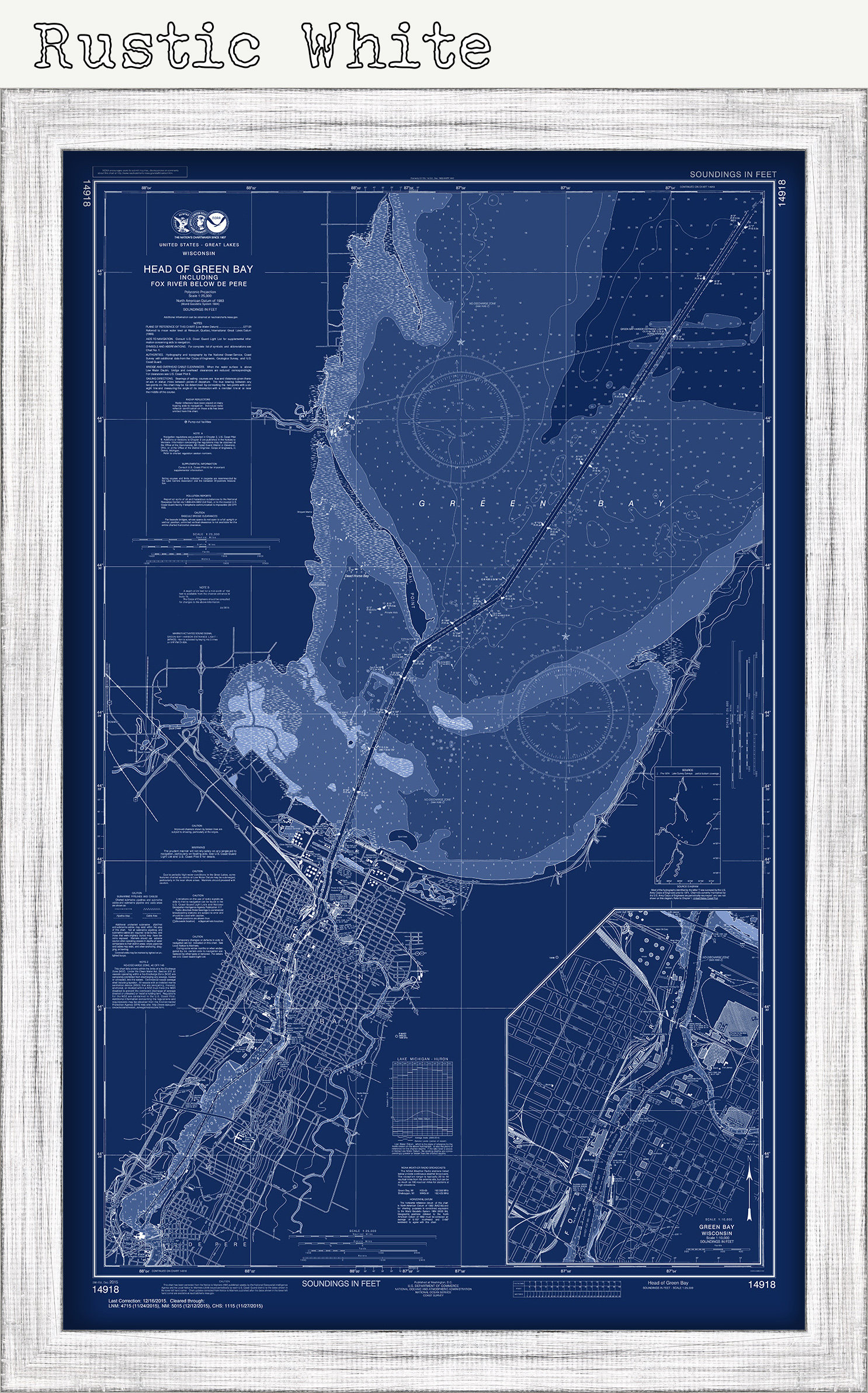
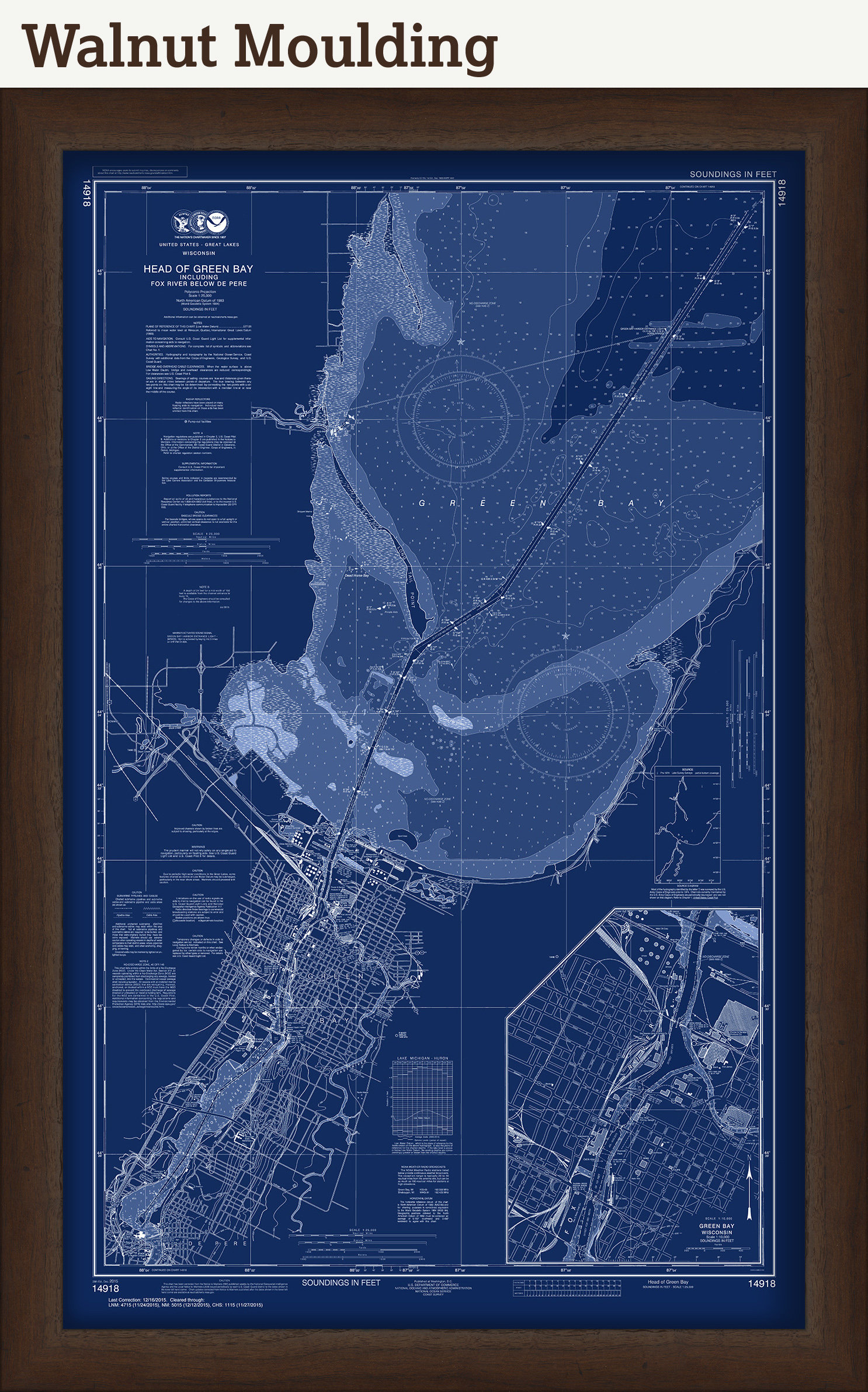
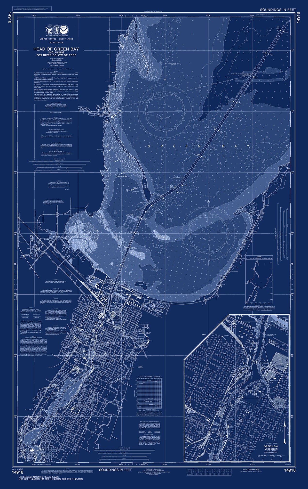
A Blueprint Nautical Chart of GREEN BAY, Wisconsin - Nautical Chart by NOAA published in 2015.
In 1807, President Thomas Jefferson signed a bill for the "Survey of the Coast," thus establishing the United States Coast Survey. In its early decades, the Coast Survey was responsible for charting the coastlines. In 1970 NOAA was established, bringing C&GS into the new scientific agency. Today, the Office of Coast Survey continues its traditional commitment to employing the highest levels of science and technology to improve marine safety and to tackle the new challenges of the 21st century.
This Chart is printed on heavy matte fine art paper with archival inks.
Framed maps include drymounting, UV filtering glass, and your choice of six mouldings, wired and ready to hang upon delivery. All mouldings are approximately 1.5" wide. Please factor in an additional 3" to the listed size for framed items.
Custom sizes are available. If you are interested in a custom size, please let us know through the "ask a question" button in this listing.
Retailers who would like to carry our Maps, please contact us through the "ask a question" button in this listing, for information and discounts.
1338BP
Shipping from United States
Processing time
1-3 business days
Customs and import taxes
Buyers are responsible for any customs and import taxes that may apply. I'm not responsible for delays due to customs.
Payment Options
Returns & Exchanges
Returns & exchanges not accepted
But please contact me if you have problems with your order
I gladly accept cancellations
Request a cancellation within: 1 hours of purchase