Old Map Company
Shop
Blog
Gallery
Cart (
0
)
0
Old Map Company
Shop
Blog
Gallery
Contact Us
All items
LIGHTHOUSE PLANS
BIRD'S EYE VIEWS
IRELAND MAPS
NAUTICAL CHARTS
CONNECTICUT MAPS
CALIFORNIA MAPS
MAINE MAPS
MASSACHUSETTS MAPS
MICHIGAN MAPS
NEW HAMPSHIRE MAPS
NEW JERSEY MAPS
NEW YORK MAPS
PENNSYLVANIA MAPS
FLORIDA MAPS + CHARTS
RHODE ISLAND MAPS
PRINTS + POSTERS
WISCONSIN MAPS
VERMONT MAPS
MARYLAND MAPS
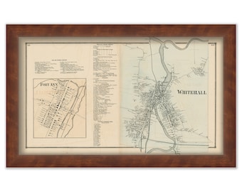
Village of WHITEHALL and FORT ANNE, New York 1866 Map
$50.00
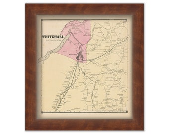
Town of WHITEHALL, New York 1866 Map
$44.00
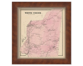
Town of WHITE CREEK, New York 1866 Map
$44.00
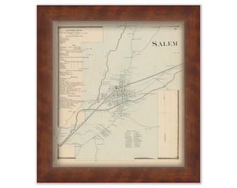
Village of SALEM, New York 1866 Map
$44.00
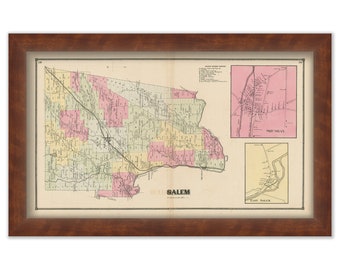
Town of SALEM, New York 1866 Map
$50.00
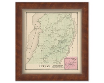
Town of PUTNAM, New York 1866 Map
$44.00
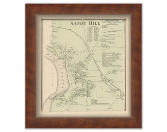
Village of SANDY HILL, New York 1866 Map
$44.00
Town of KINGSBURY, New York 1866 Map
$44.00
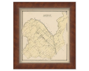
Town of JACKSON, New York 1866 Map
$44.00
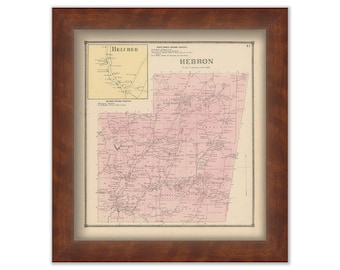
Town of HEBRON, New York 1866 Map
$44.00
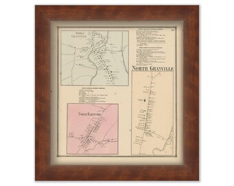
Villages of GRANDVILLE, New York 1866 Map
$44.00
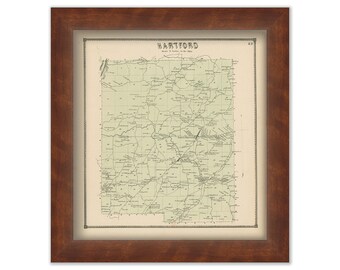
Town of HARTFORD, New York 1866 Map
$44.00
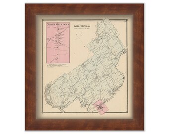
Town of GREENWICH, New York 1866 Map
$44.00
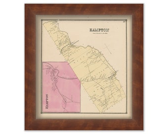
Town of HAMPTON, New York 1866 Map
$44.00
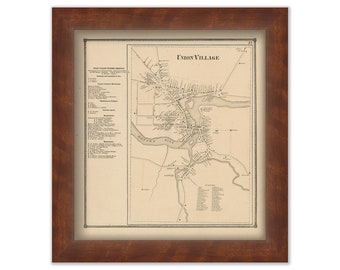
UNION VILLAGE, New York 1866 Map
$44.00
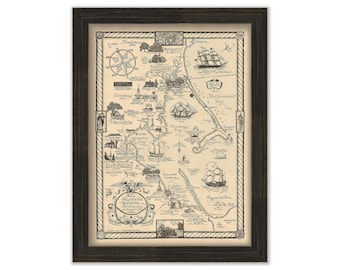
Plymouth, Kingston and Duxbury, Massachusetts 1929 Pictorial Map - by Beulah Locke Sherburne
$40.00
South Norwalk, Sheffield Island, & Cockenoe Island Harbors Connecticut - Nautical Chart by George W. Eldridge Colored Version
$50.00
MINOT'S LEDGE, Cohasset, Massachusetts - 1853 Nautical Chart
$37.00
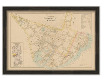
SWANSEA and SOMERSET, Massachusetts 1895 Map - Replica or GENUINE Original
$40.00
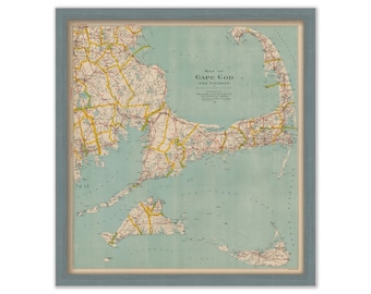
Cape Cod, Martha's Vineyard and Nantucket - by Geo. H. Walker published in 1917
$40.00
1
...
177
178
179
180
181
182
183
...
287
0 items in your cart
Close
Keep shopping! :)
Legal imprint
Close