Old Map Company
Shop
Blog
Gallery
Cart (
0
)
0
Old Map Company
Shop
Blog
Gallery
Contact Us
All items
LIGHTHOUSE PLANS
BIRD'S EYE VIEWS
IRELAND MAPS
NAUTICAL CHARTS
CONNECTICUT MAPS
CALIFORNIA MAPS
MAINE MAPS
MASSACHUSETTS MAPS
MICHIGAN MAPS
NEW HAMPSHIRE MAPS
NEW JERSEY MAPS
NEW YORK MAPS
PENNSYLVANIA MAPS
FLORIDA MAPS + CHARTS
RHODE ISLAND MAPS
PRINTS + POSTERS
WISCONSIN MAPS
VERMONT MAPS
MARYLAND MAPS
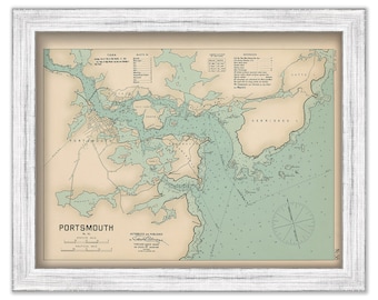
PORTSMOUTH HARBOR, New Hampshire - 1909 Nautical Chart by George W. Eldridge - Colored Version
$50.00
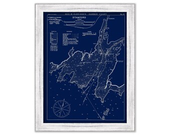
Stamford, Connecticut - Blue Print - Nautical Chart by George W. Eldridge 1901
$44.00
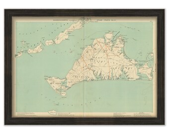
MARTHA'S VINEYARD and the ELIZABETH Islands, Massachusetts, 1904 Map/Chart - Replica or Genuine Original
$44.00
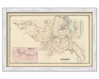
IPSWICH, Massachusetts 1872 Map - Replica or Genuine Original
$40.00
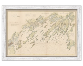
Casco Bay, Maine Nautical Chart 1870 - Colored land - U.S. Coast Survey
$44.00
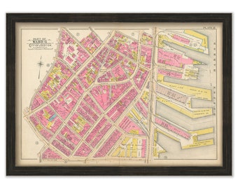
BOSTON 1902 Map, Plate 8, North End, Waterfront
$44.00
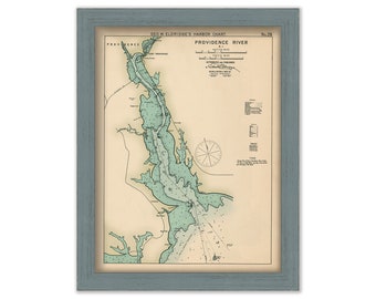
Providence River, Rhode Island - Nautical Chart by George W. Eldridge Colored Version 0326
$50.00
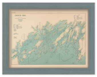
CASCO BAY, Maine 1909 Colored Nautical Chart by Geo. Eldridge
$38.00
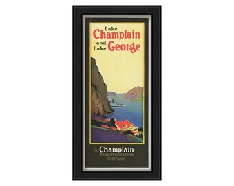
The Champlain Transportation Company Poster 1914
$44.00
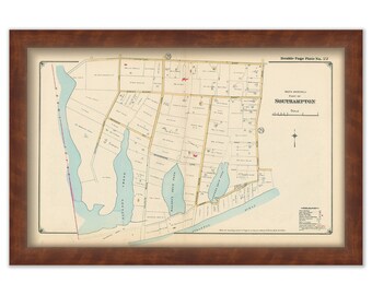
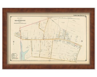
South Hampton Map, South Western Part 1916, Heady Creek, Taylor's Creek, Cooper's Neck Pond - 0056
$32.00
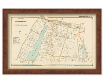
South Hamption Map, South Eastern Part 1916, Agawam Lake, Old Town Pond - 0058
$32.00
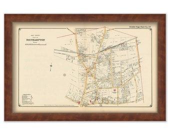
South Hampton Map, North Eastern Part 1916, North Sea Road, Windmill Lane, David White's Lane - 0057
$32.00
South Hamption Map, Northwestern Part 1916, Art Village and Heady Creek to First Neck Road - 0055
$32.00
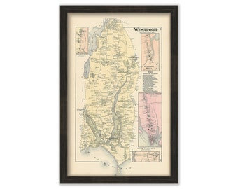
WESTPORT, Massachusetts 1871 Map - Replica or Genuine ORIGINAL
$44.00
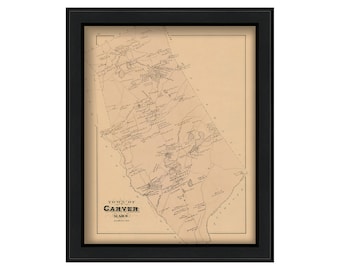
TOWN of CARVER, Massachusetts Map 1879-Colored Reproduction
$44.00
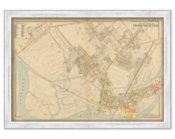
DORCHESTER, Massachusetts 1899 map, Plate 8 - Replica or GENUINE ORIGINAL
$44.00
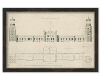
NAVESINK TWIN LIGHTS, Middletown, New Jersey - Drawing and Plans of the Lighthouses as it was in 1861.
$44.00
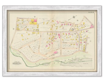
BROOKLINE, Massachusetts 1900 map, Plate 17 - Pond Ave, High St, Olmstead Park
$40.00
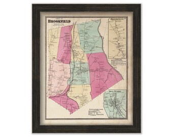
BROOKFIELD, Connecticut Map 1867
$44.00
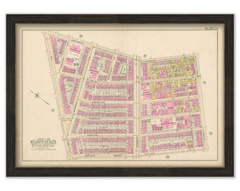
BOSTON 1902 Map, Plate 25, South End
$44.00
1
...
172
173
174
175
176
177
178
...
287
0 items in your cart
Close
Keep shopping! :)
Legal imprint
Close