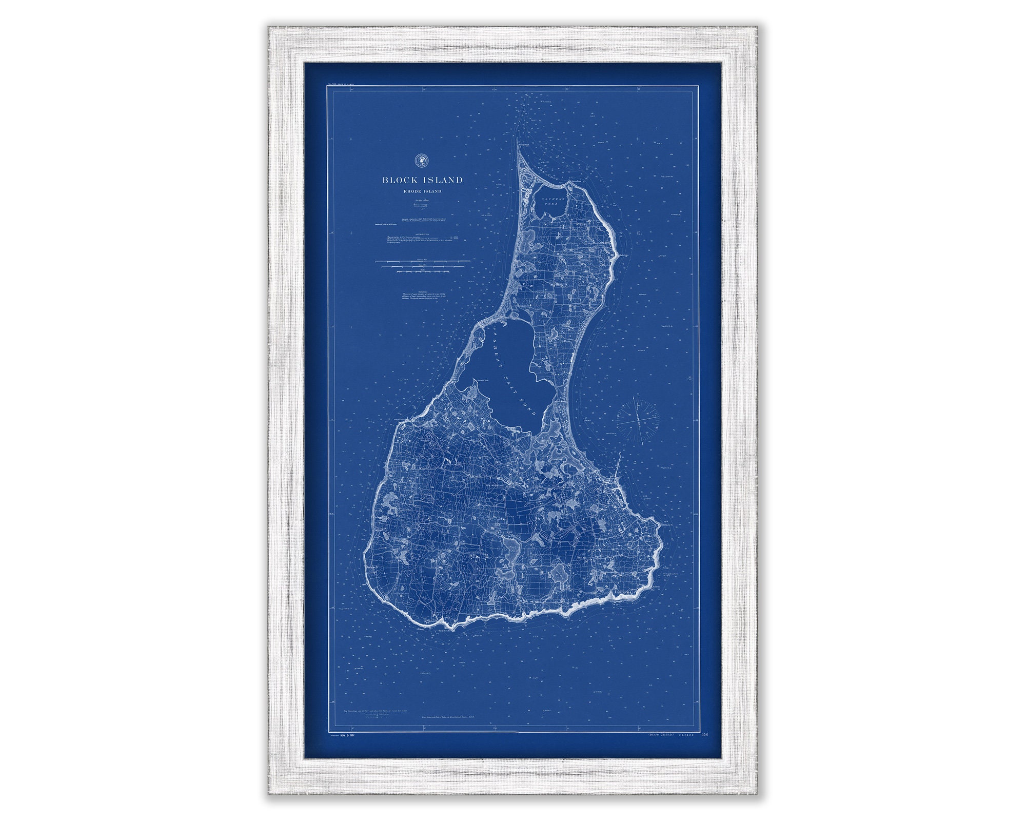
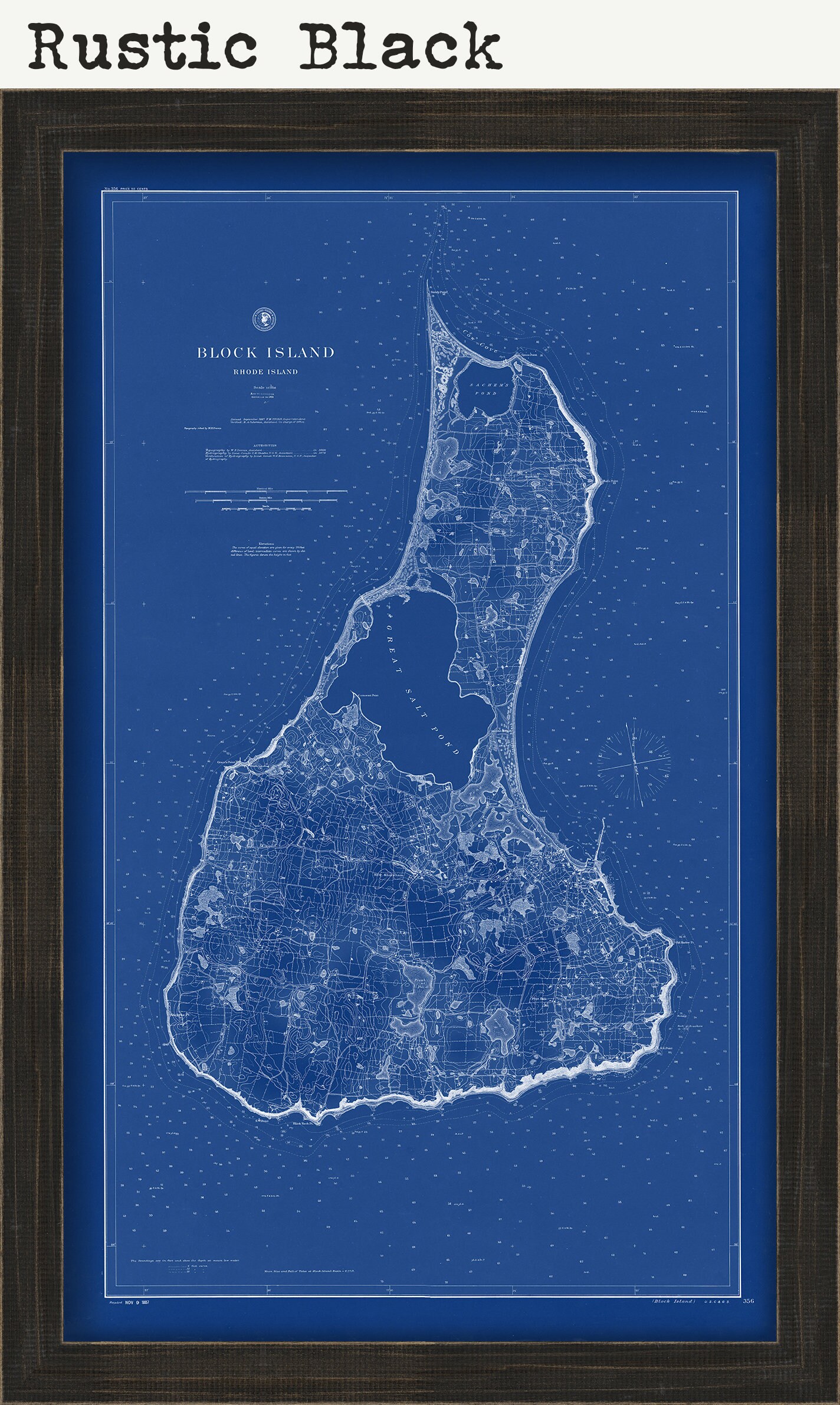
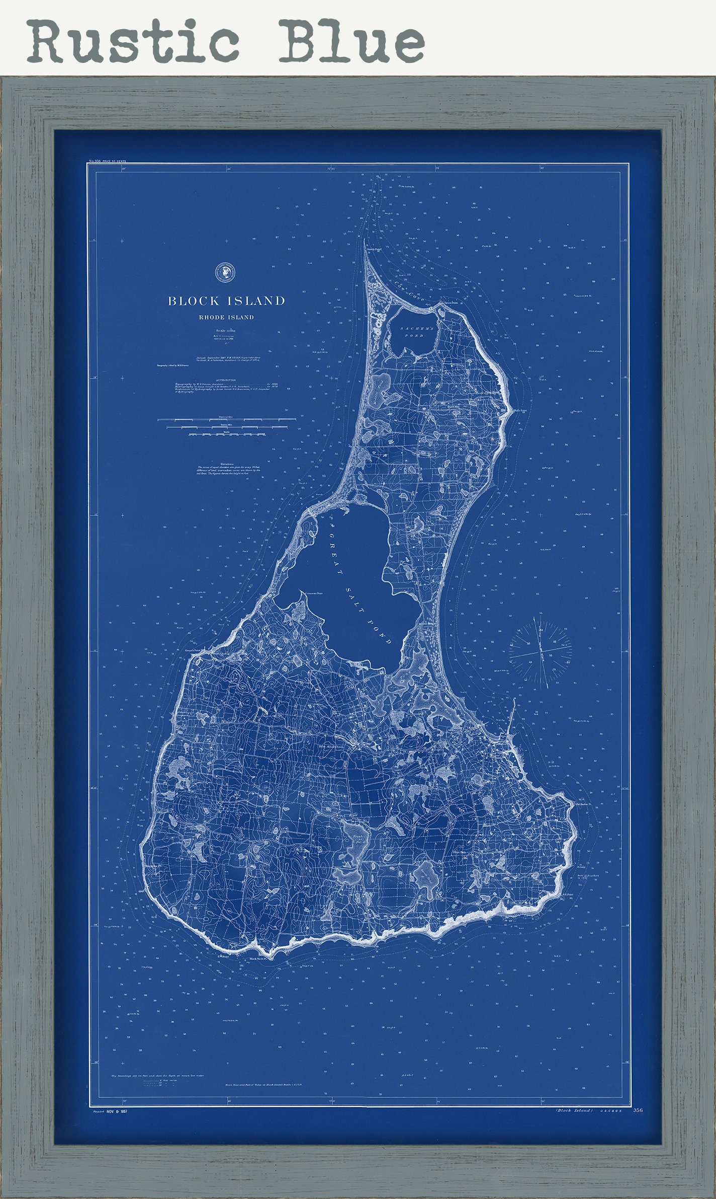
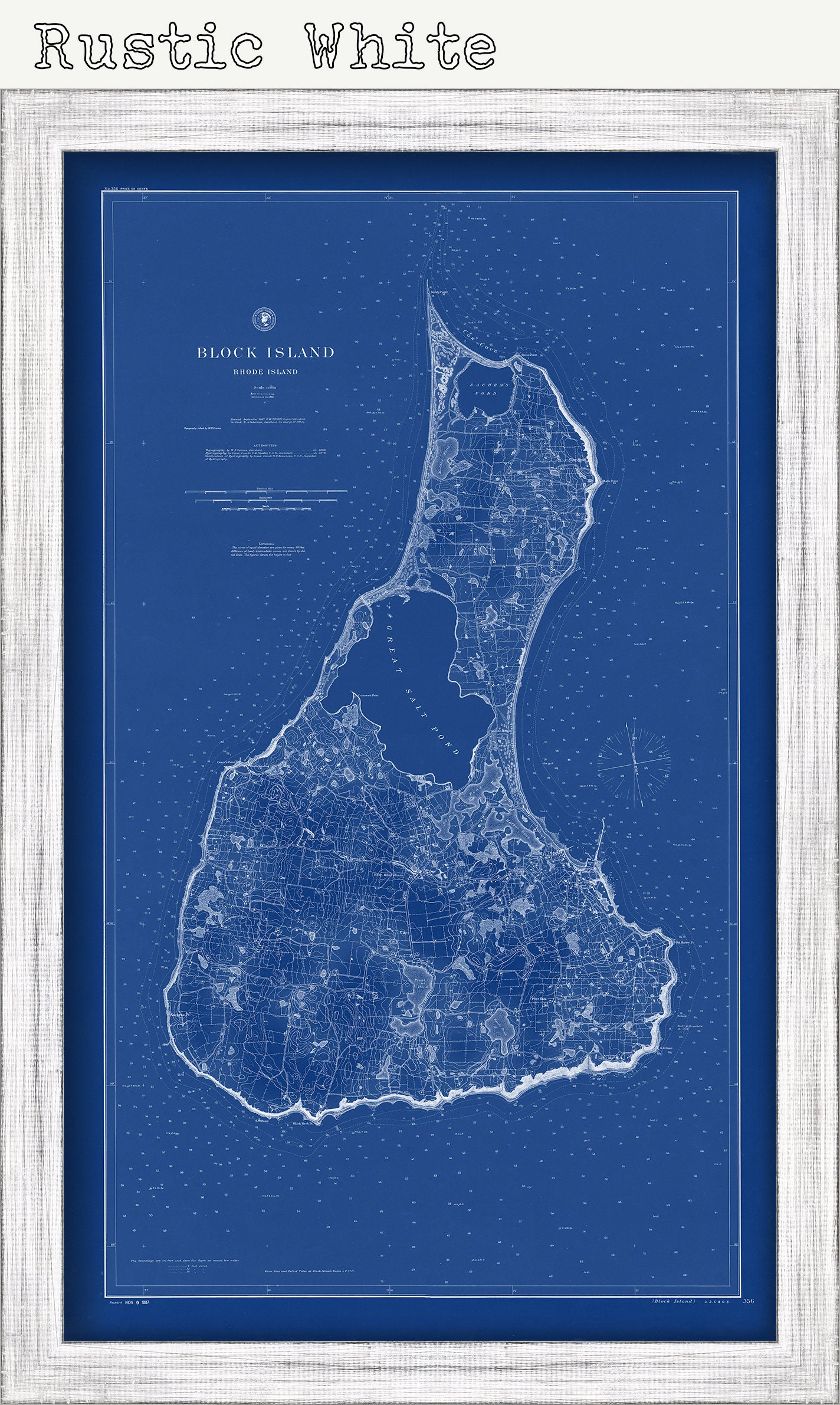
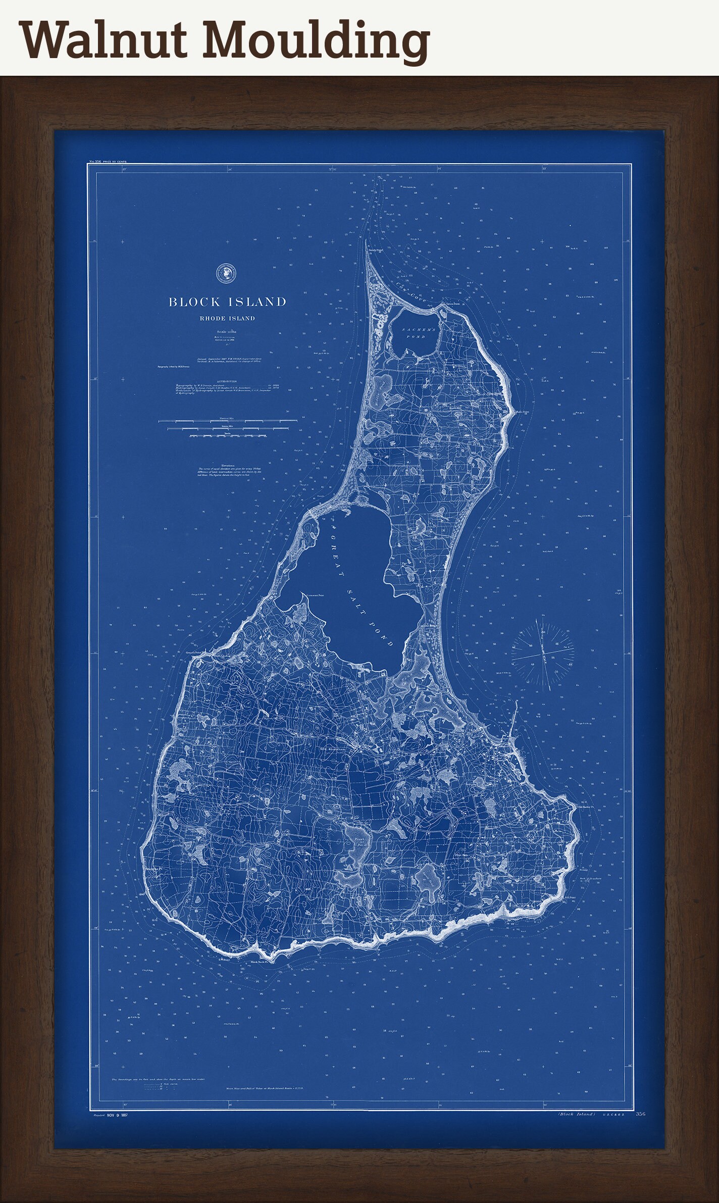
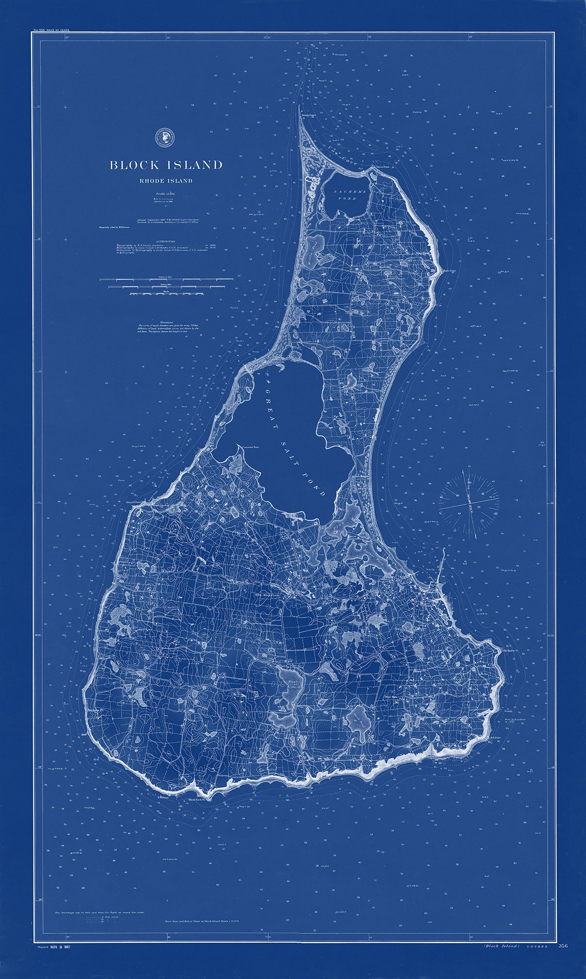
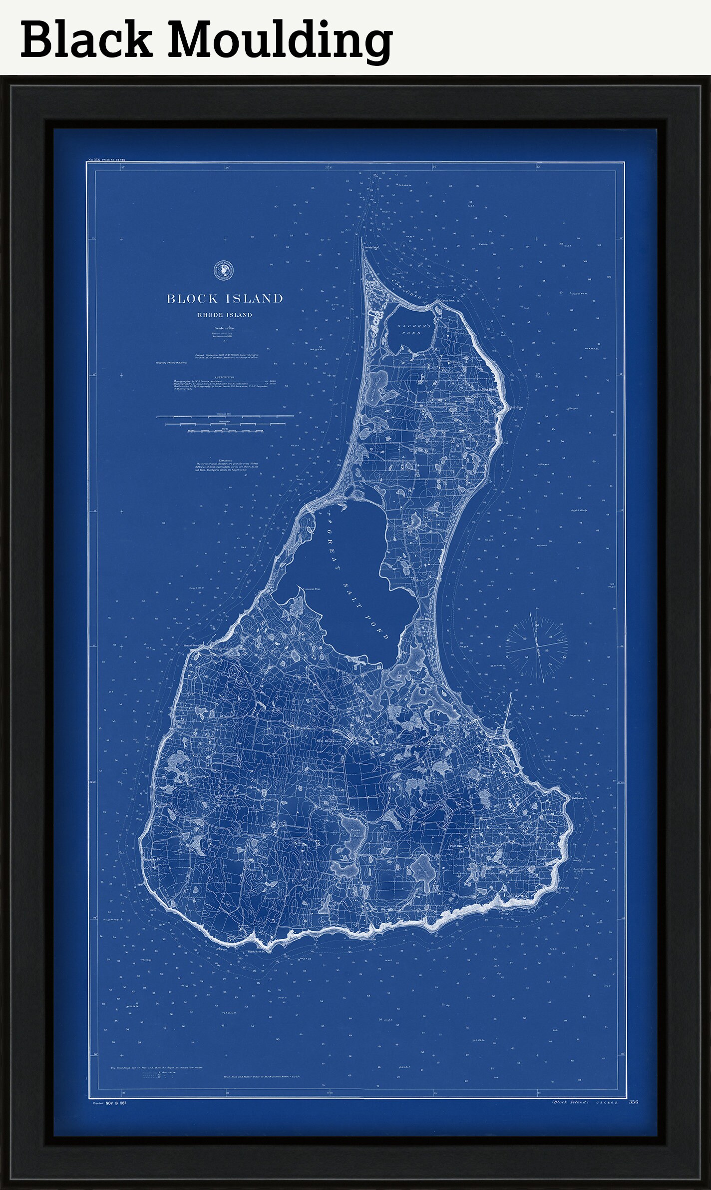
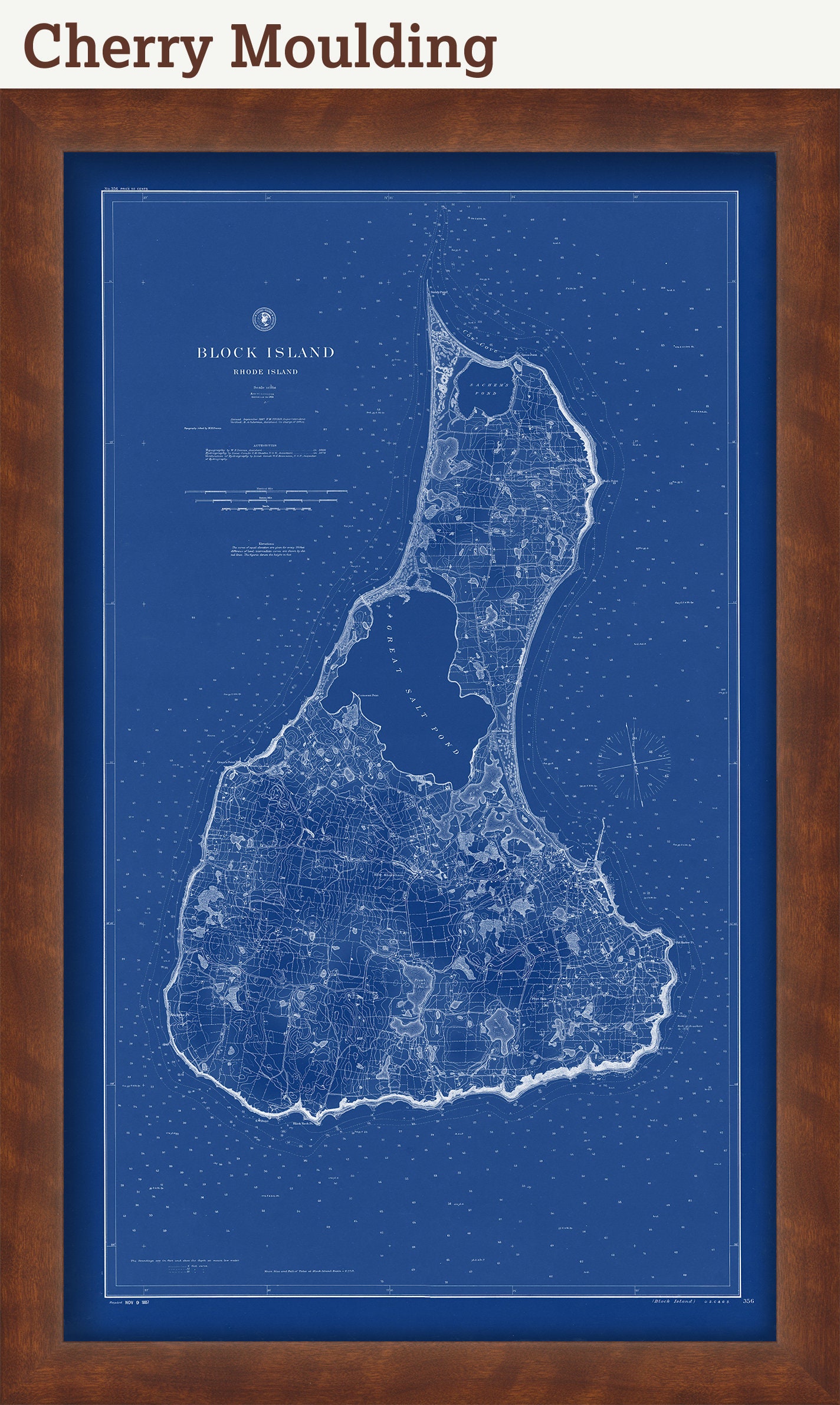

BLOCK ISLAND, Rhode Island - 1887 Nautical Chart Blueprint
$26.00
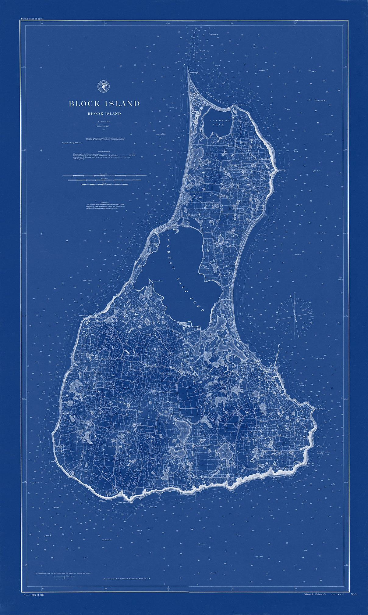
A replica of an antique Nautical Chart Blueprint of BLOCK ISLAND, Rhode Island. This chart was originally published in 1887 by the office of the United States Coast and Geodetic Survey. A point of interest in this chart: Great Salt Pond is not directly accessible from the Atlantic Ocean. The channel connecting the two bodies of water was not successfully dredged until 1895.
This chart is printed on heavy matte fine art paper with archival inks
Framed posters include drymounting, UV filtering glass, and your choice of six mouldings, wired and ready to hang upon delivery. All mouldings are approximately 1.5" wide. Please factor in an additional 3" to the listed size for framed items.
Retailers who would like to carry our Maps, please contact us through the "ask a question" button in this listing, for information and discounts.
2006BP
Shipping from United States
Processing time
1-3 business days
Customs and import taxes
Buyers are responsible for any customs and import taxes that may apply. I'm not responsible for delays due to customs.
Payment Options
Returns & Exchanges
Returns & exchanges not accepted
But please contact me if you have problems with your order
I gladly accept cancellations
Request a cancellation within: 1 hours of purchase