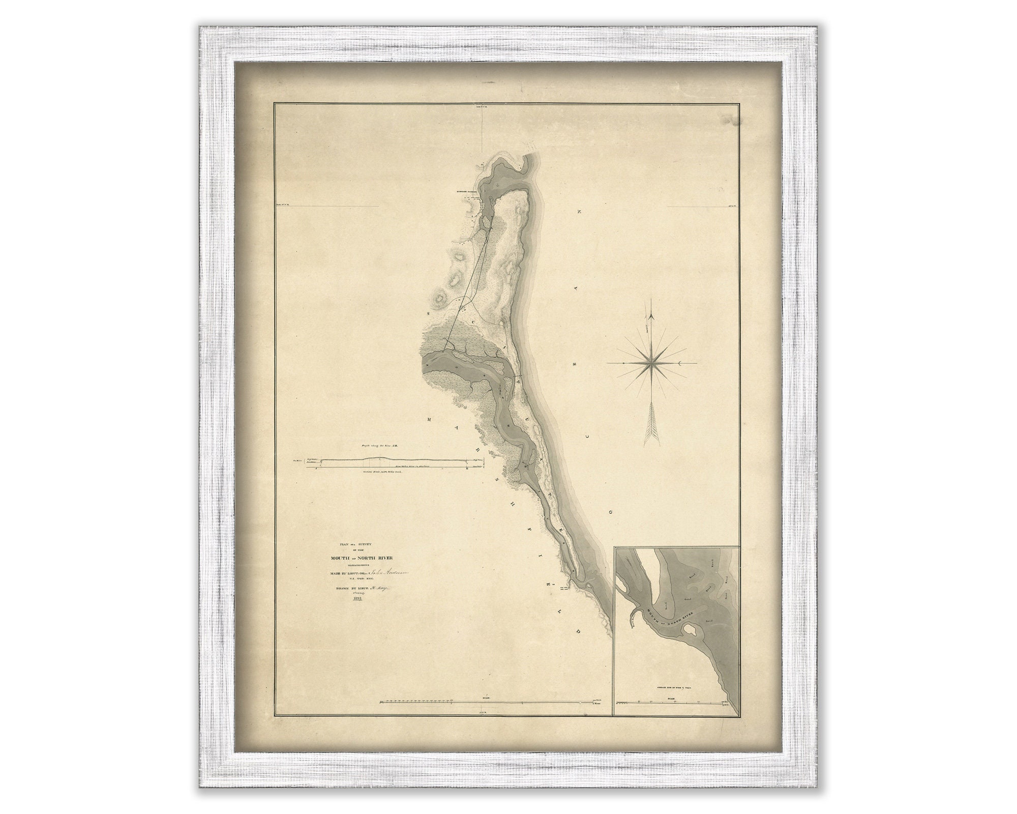
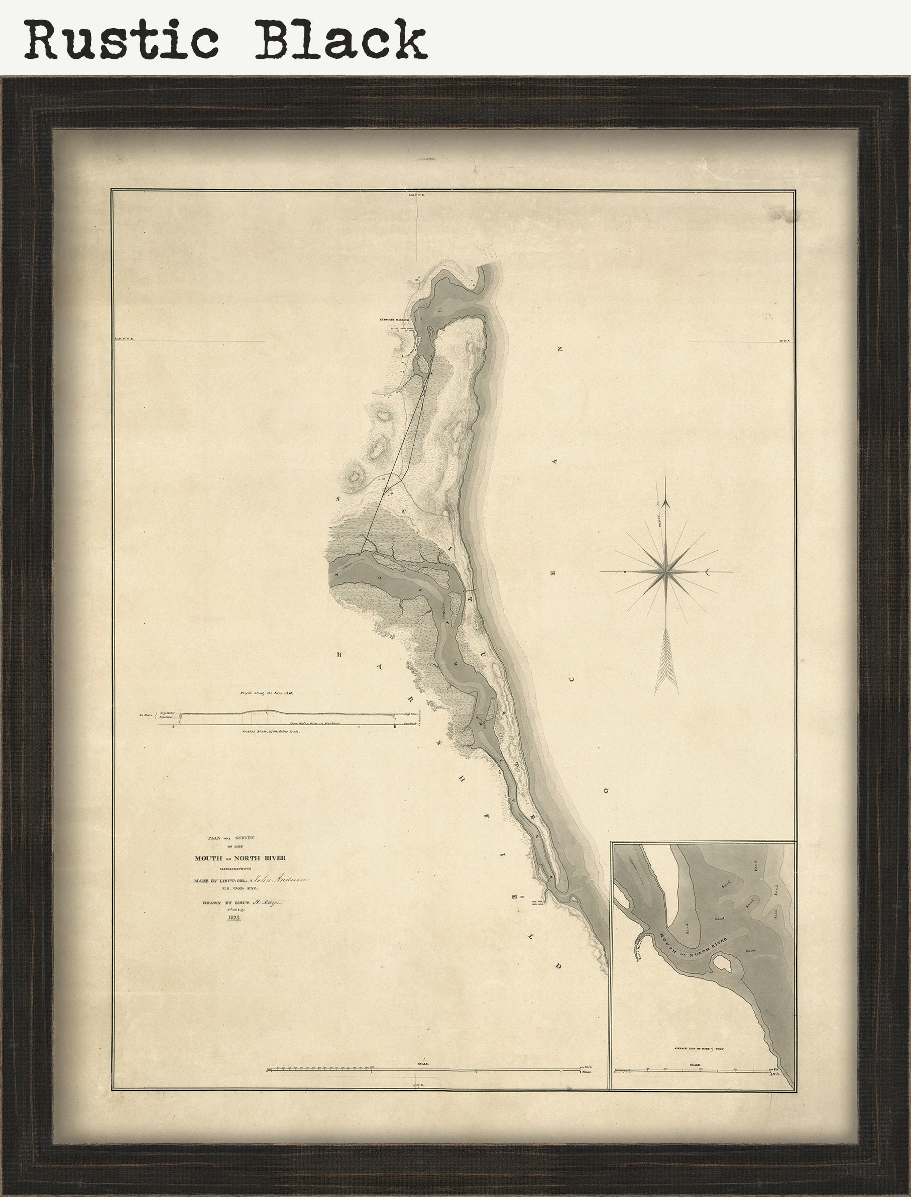
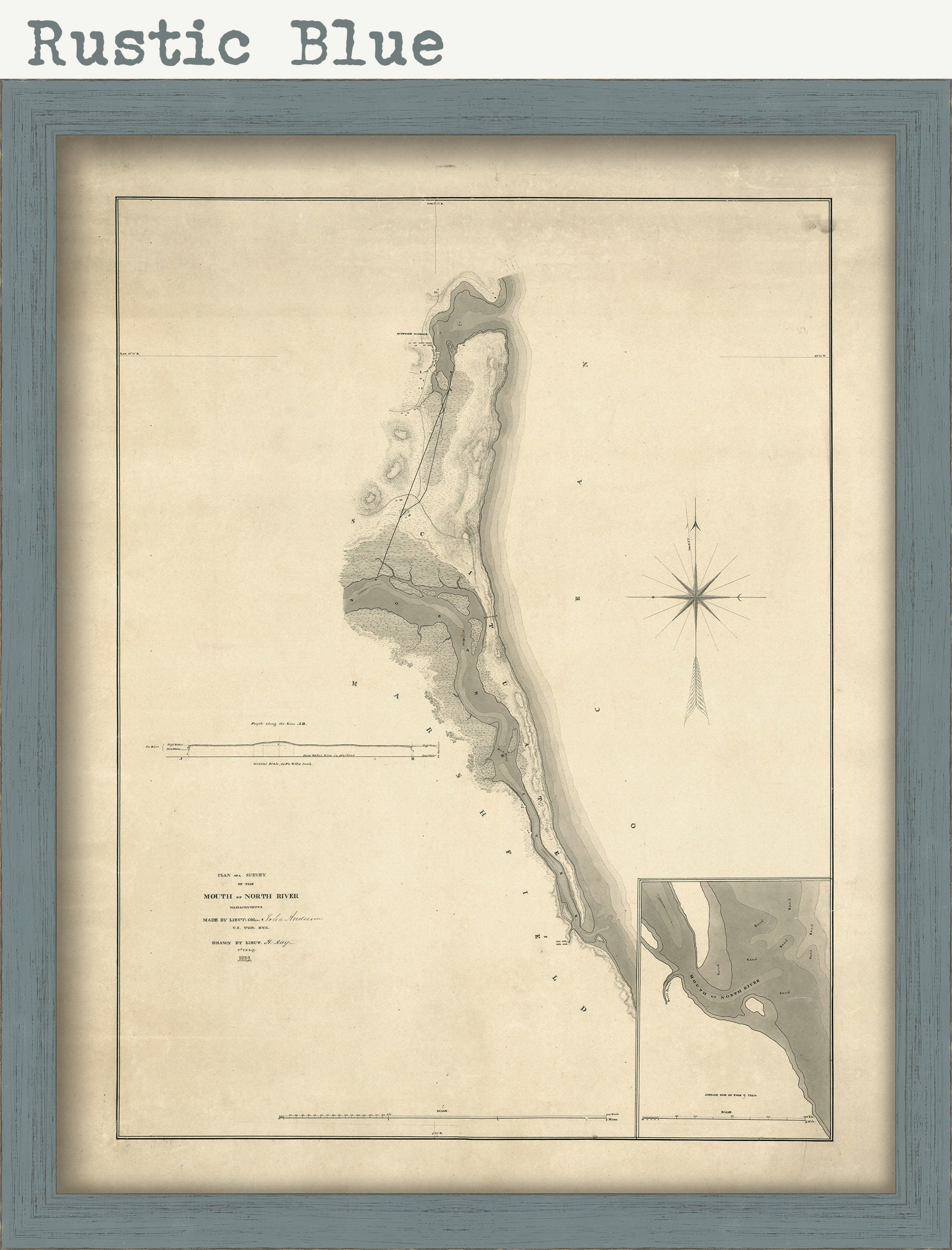
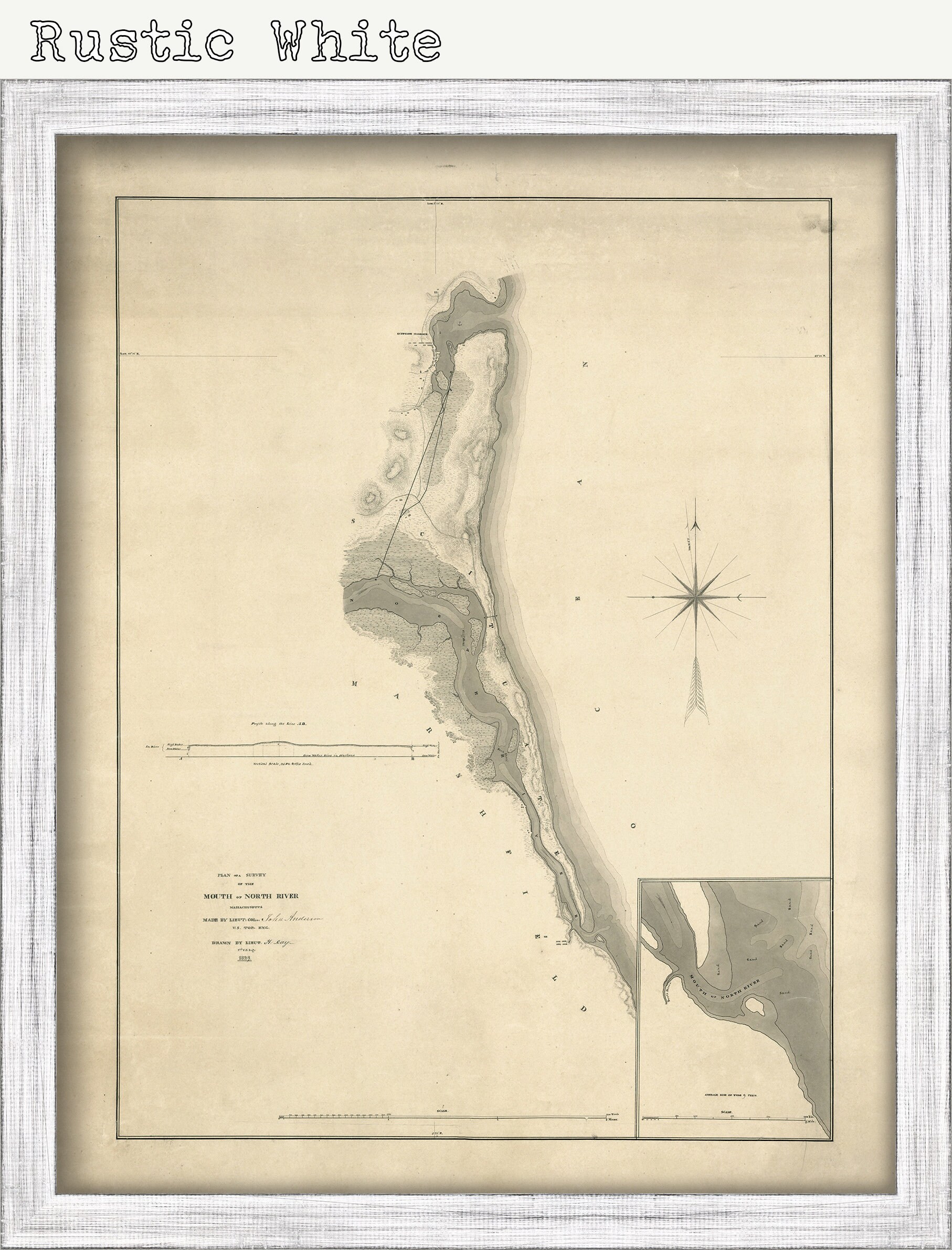
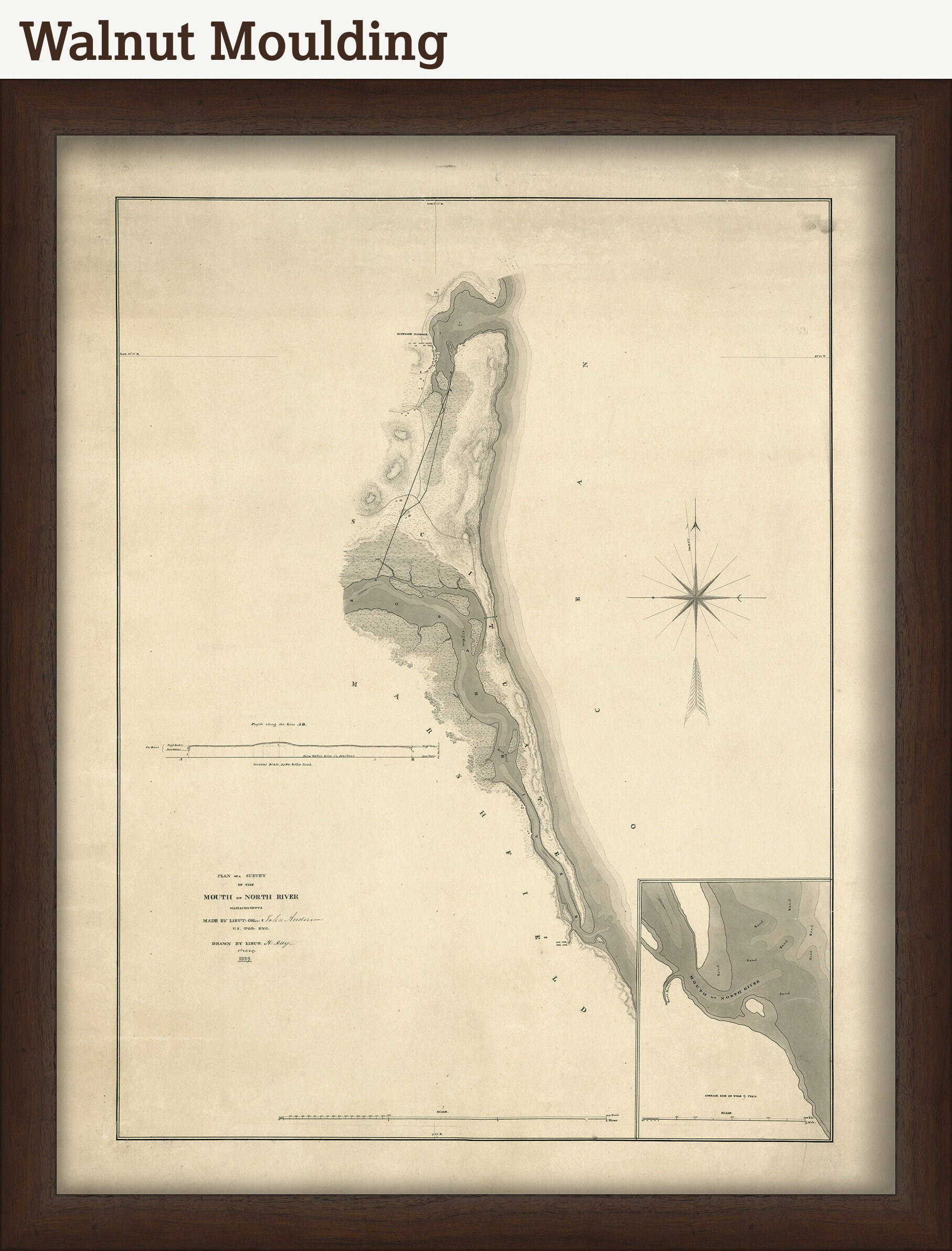
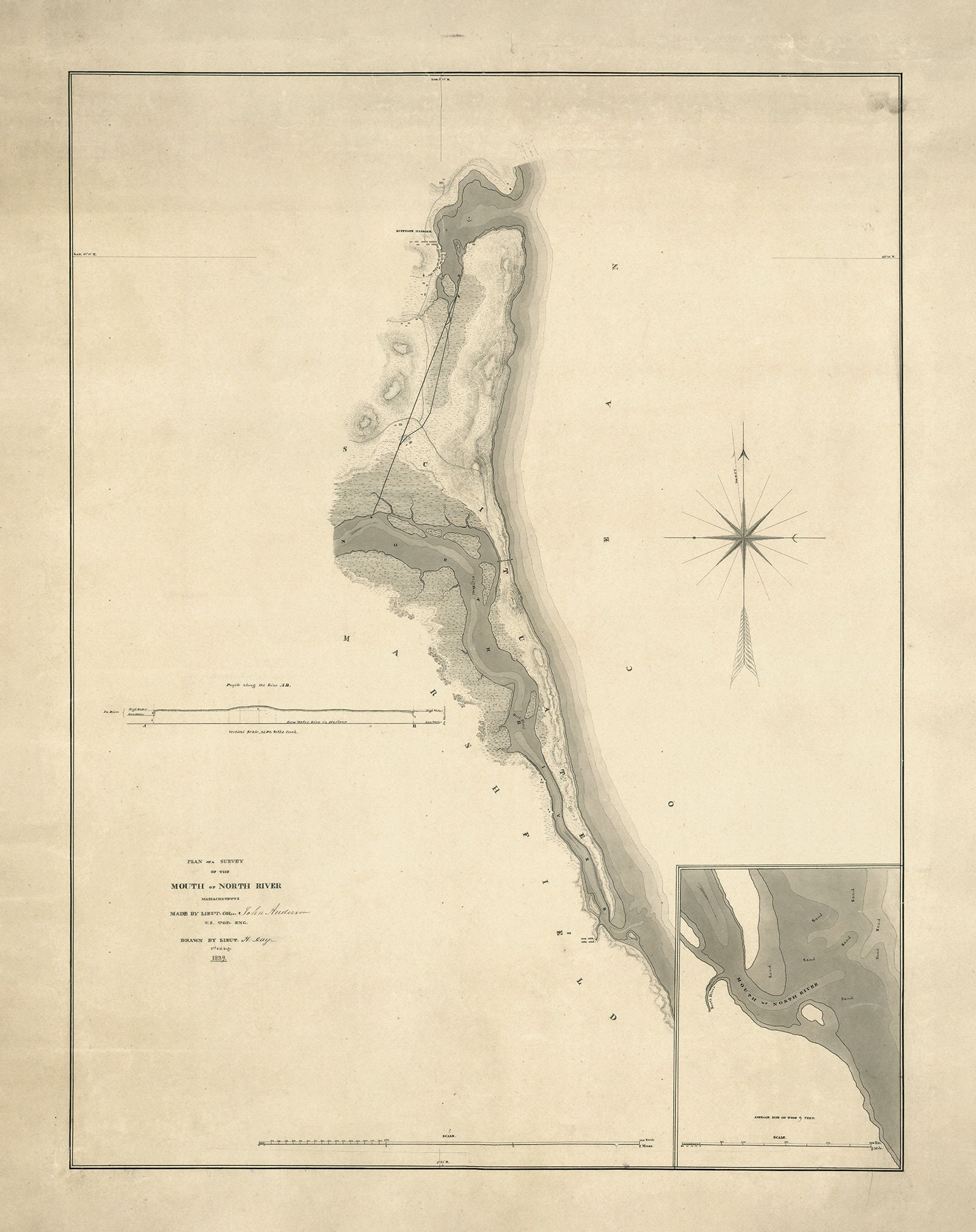
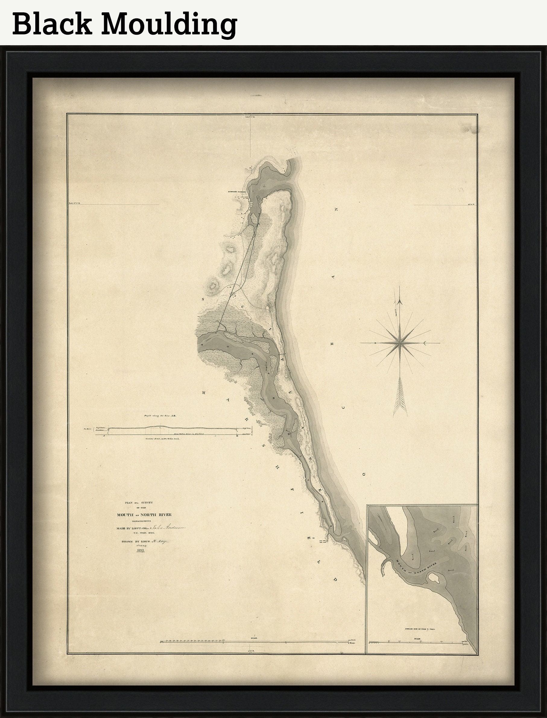
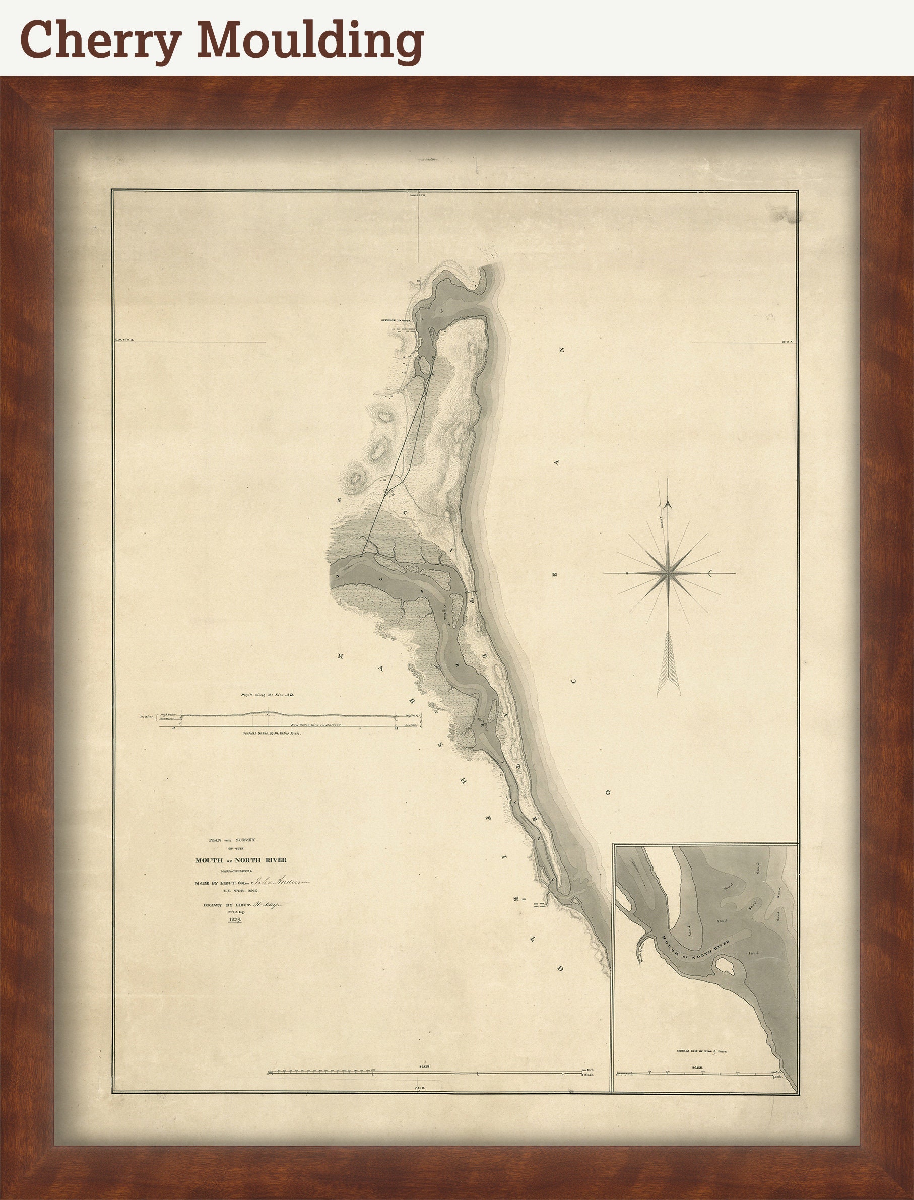
Mouth of the NORTH RIVER, Massachusetts - 1829 Plan of Survey
$44.00
A Reproduction of a 1829 Plan of Survey of HUMAROCK and parts of SCITUATE and MARSHFIELD adjoining the North/South River, Massachusetts. Prior to the Portland Gale of 1898, the North River flowed south between Scituate's Humarock section and Marshfield, Massachusetts, joining the South River and entering the ocean several miles to the south of the current opening. The storm breached a thin strip of beach, which connected Scituate's Third and Fourth Cliffs, leaving Humarock an island. Eventually the old inlet has silted in, forcing the South River to flow north between Marshfield and Humarock, where it now joins the North River to enter the ocean between Third and Fourth Cliffs.
This Map is printed on heavy matte fine art paper with archival inks.
Framed maps include drymounting, UV filtering glass, and your choice of five mouldings, wired and ready to hang upon delivery.
Custom sizes are available. If you are interested in a custom size, please let us know through the "ask a question" button in this listing.
Retailers who would like to carry our Maps, please contact us through the "ask a question" button in this listing, for information and discounts.
1977
Shipping from United States
Processing time
1-3 business days
Customs and import taxes
Buyers are responsible for any customs and import taxes that may apply. I'm not responsible for delays due to customs.
Payment Options
Returns & Exchanges
Returns & exchanges not accepted
But please contact me if you have problems with your order
I gladly accept cancellations
Request a cancellation within: 1 hours of purchase