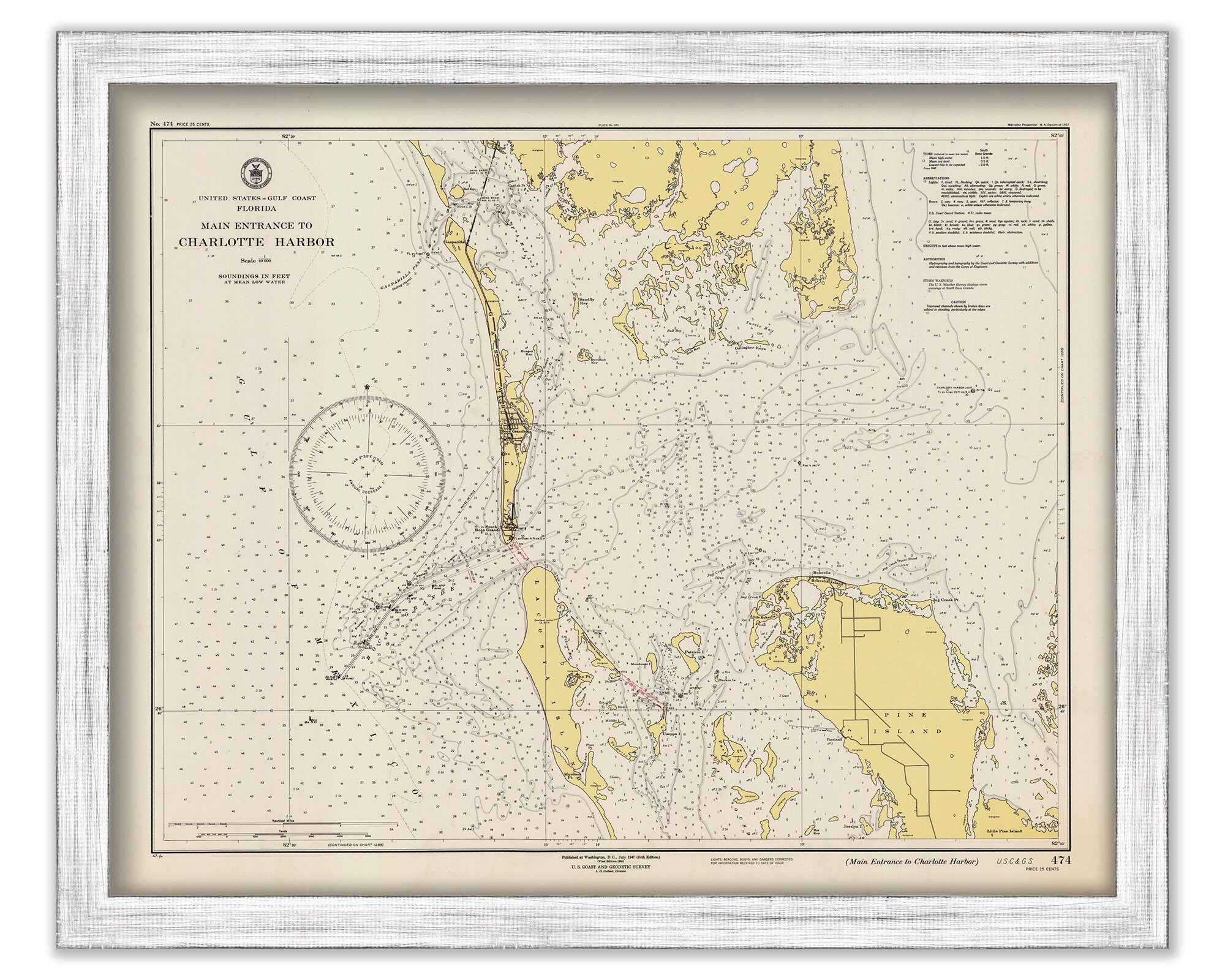
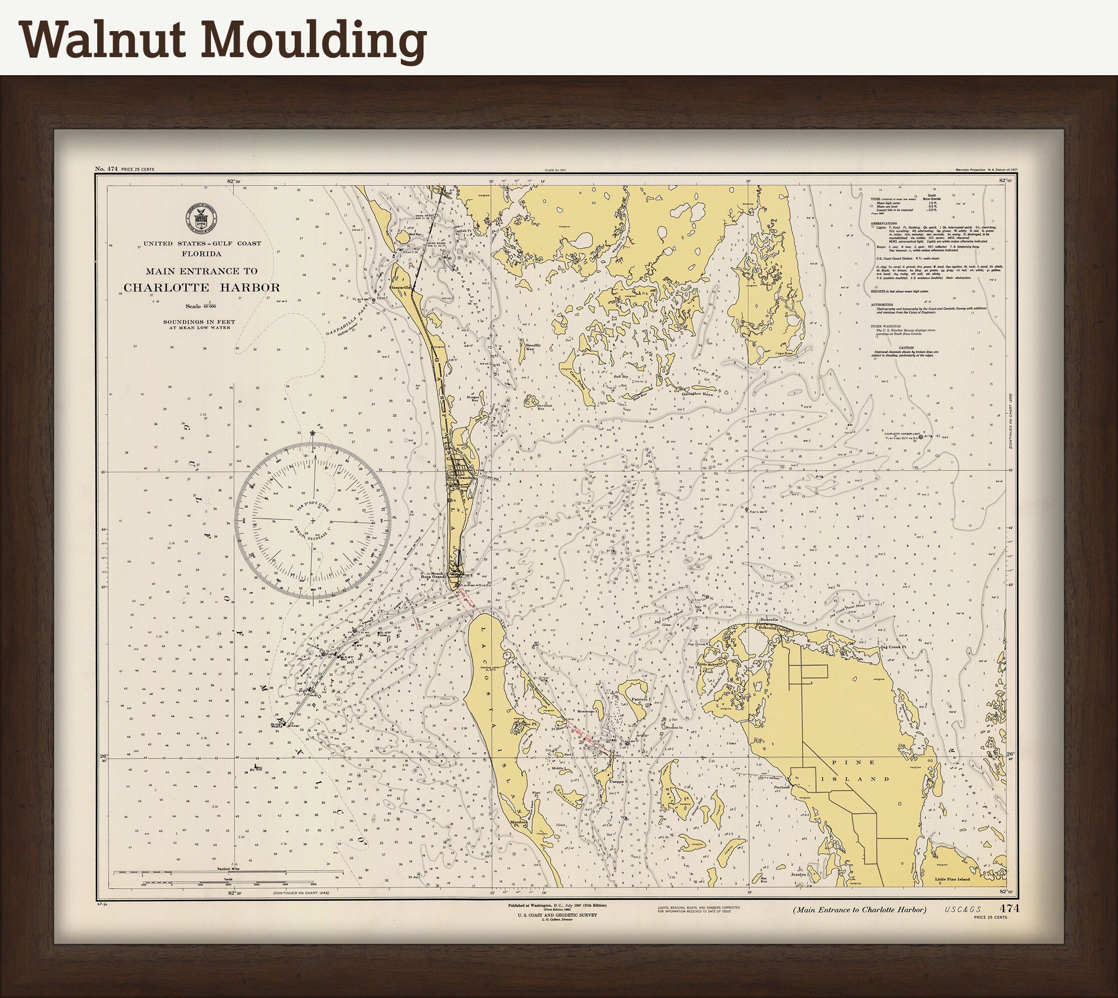
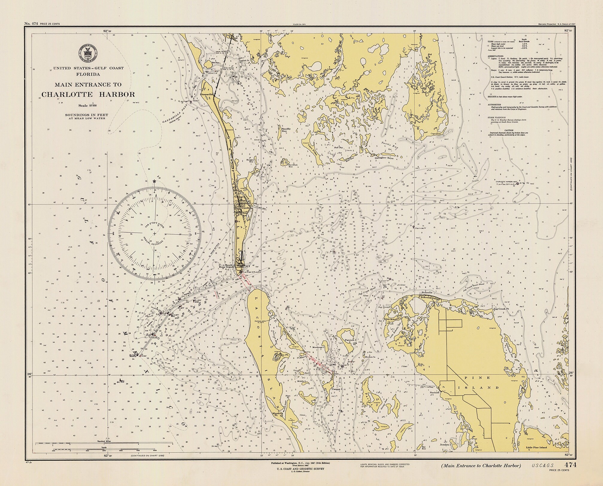
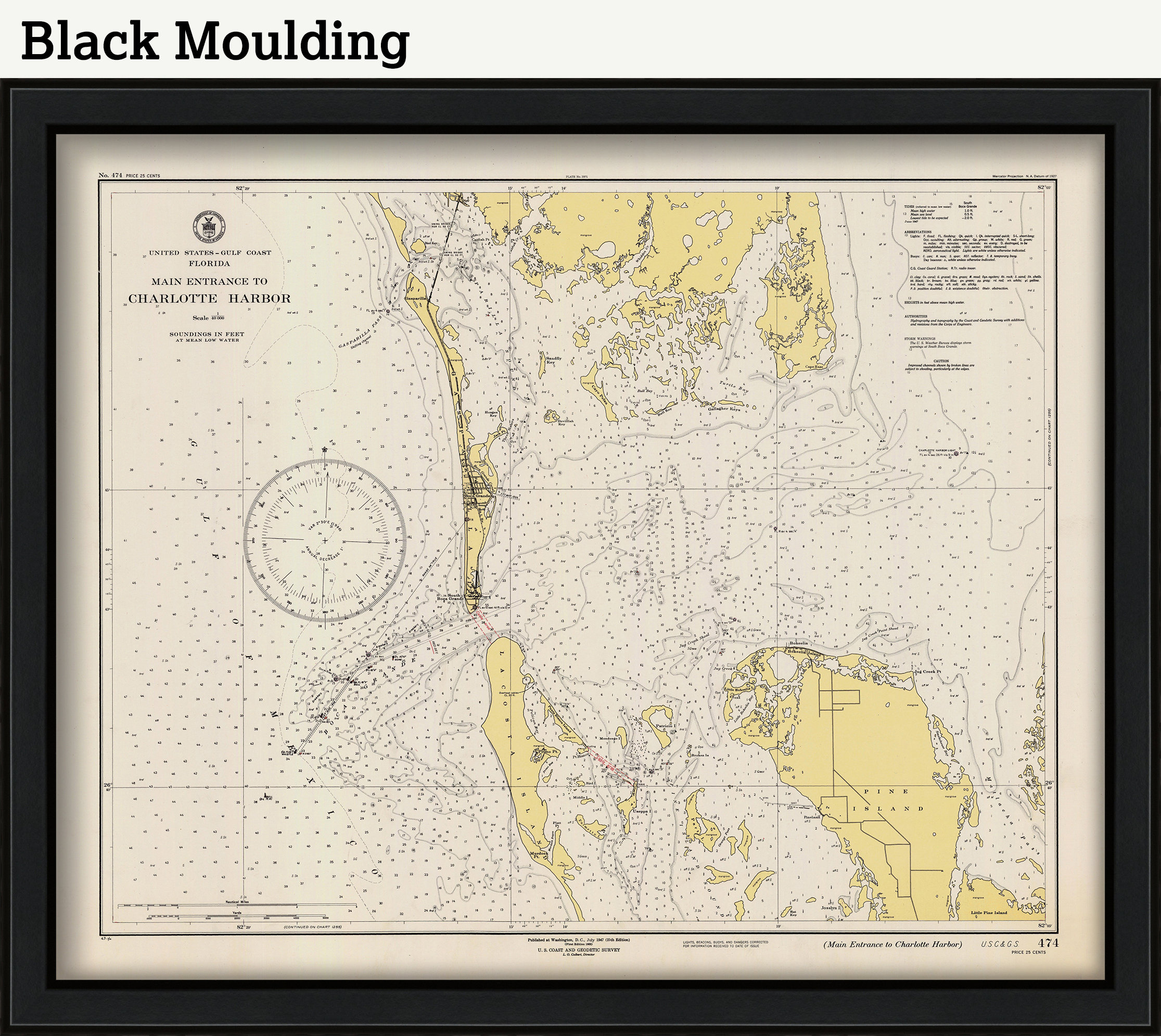
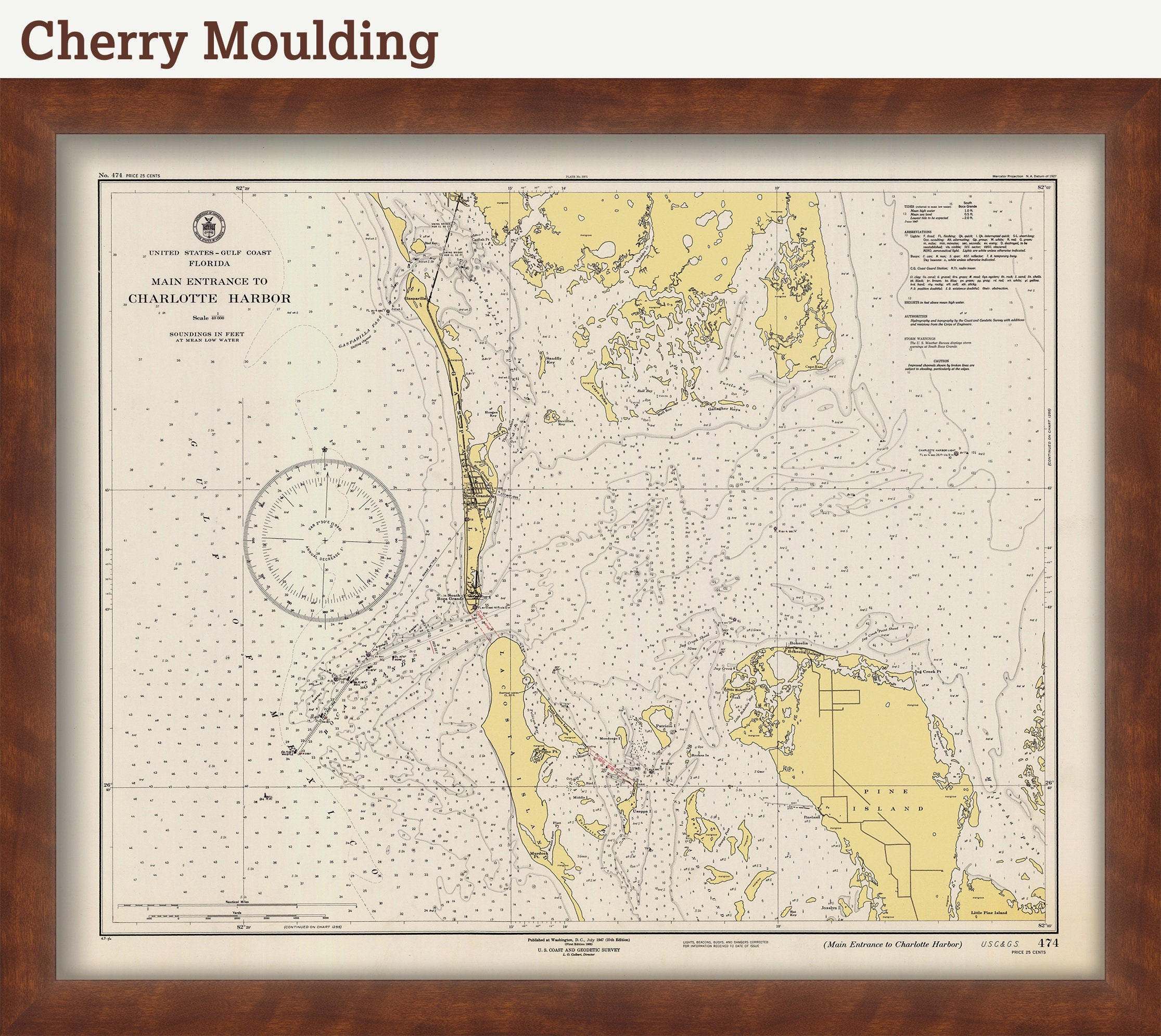
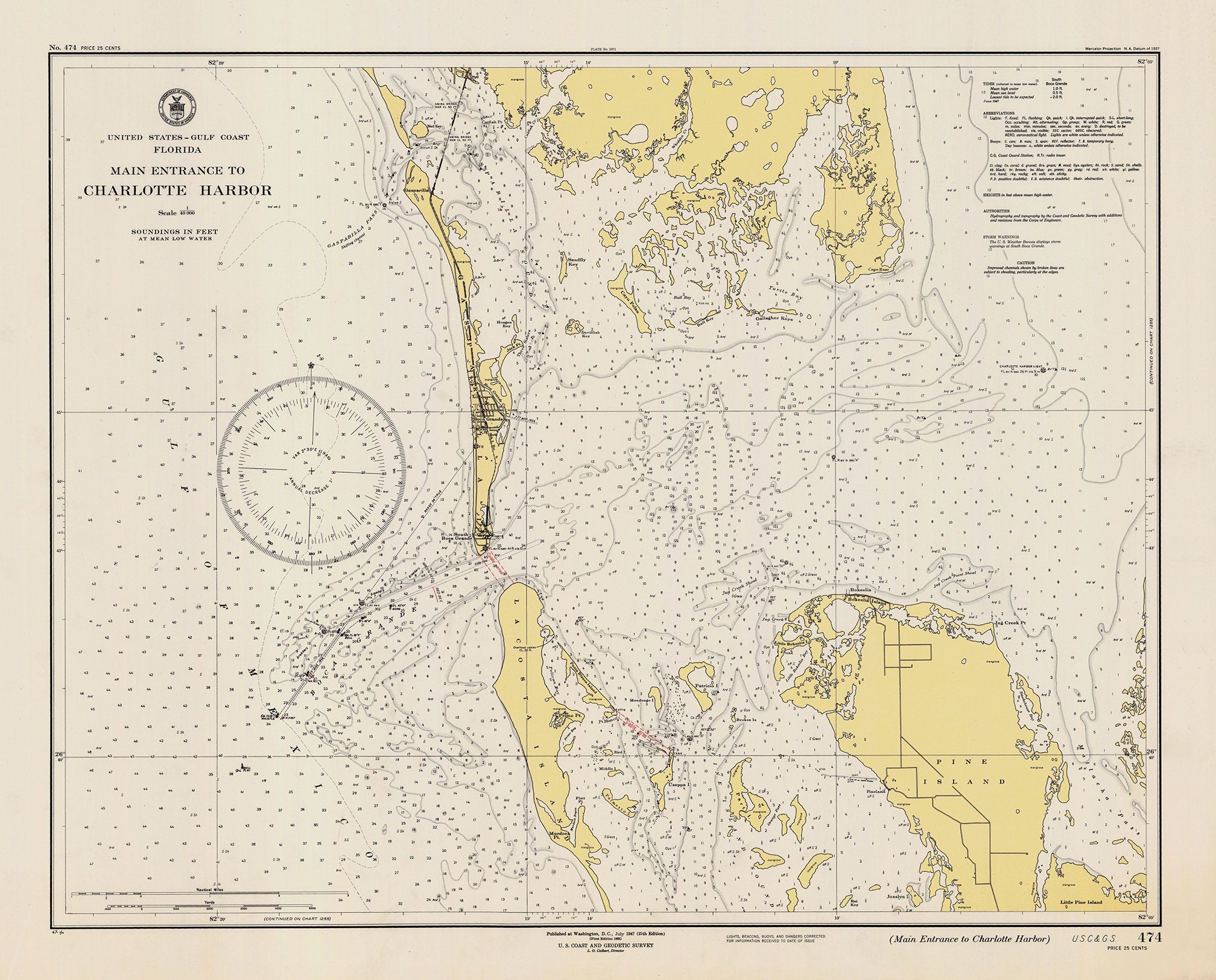
A reproduction of a Nautical Chart of BOCA GRANDE, FLORIDA originally published in 1947 by United States Coast Survey.
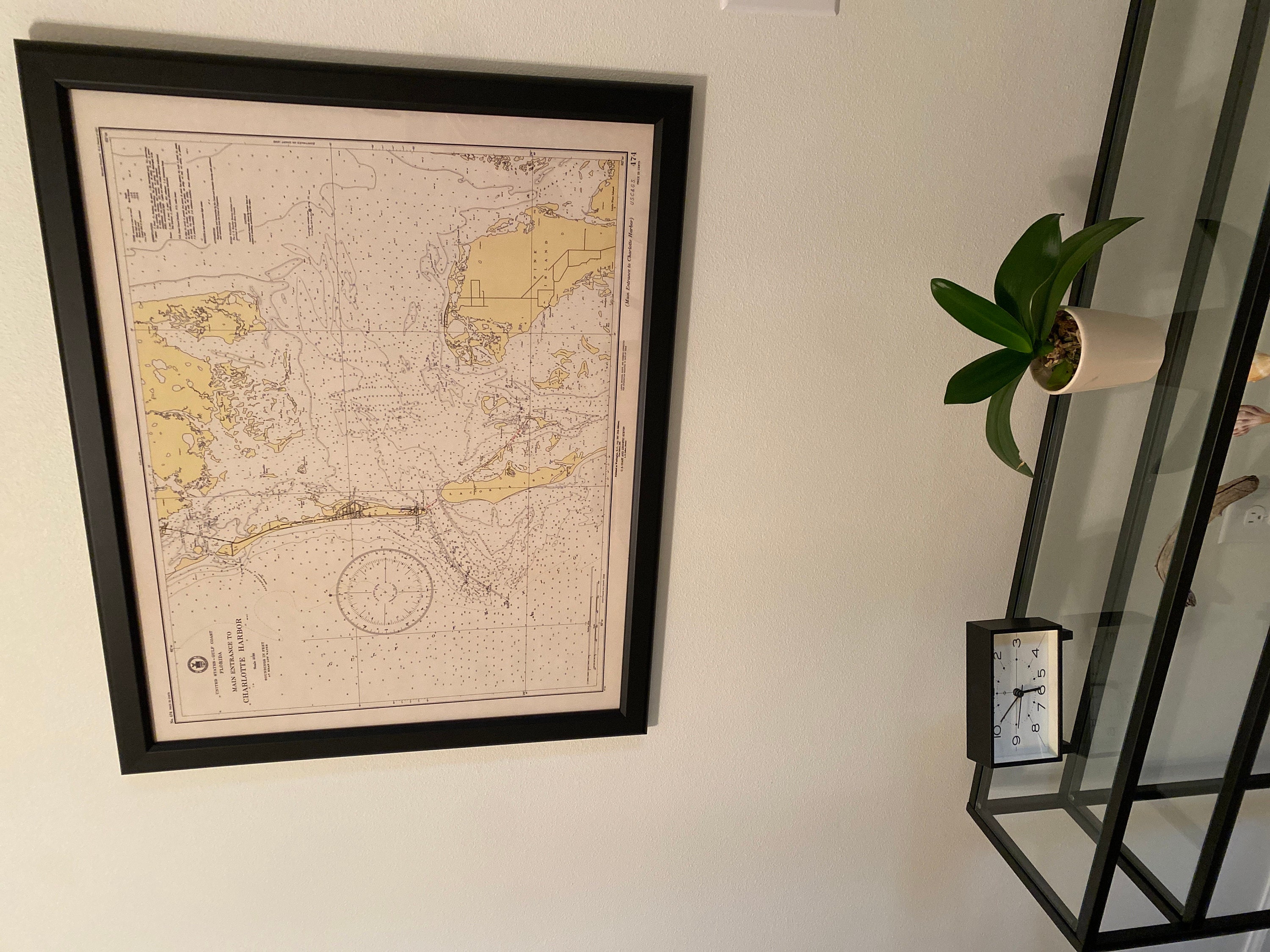
This MAP is printed on heavy matte fine art paper with archival inks.
This image is printed on heavy matte fine art paper with archival inks. Framing is available. Framed charts include drymounting, UV filtering glass, and your choice of six mouldings, wired and ready to hang upon delivery. All mouldings are approximately 1.5" wide. Please factor in an additional 3" to the listed size for framed items.
Custom sizes are available. If you are interested in a custom size, please let us know through the "ask a question" button in this listing.
In 1807, President Thomas Jefferson signed a bill for the "Survey of the Coast," thus establishing the United States Coast Survey. In its early decades, the Coast Survey was responsible for charting the coastlines. In 1970 the Coast Survey became part of NOAA.
Retailers who would like to carry our Maps and Prints, please contact us through the "ask a question" button in this listing, for information and discounts
1563
Shipping from United States
Processing time
1-3 business days
Customs and import taxes
Buyers are responsible for any customs and import taxes that may apply. I'm not responsible for delays due to customs.
Payment Options
Returns & Exchanges
Returns & exchanges not accepted
But please contact me if you have problems with your order
I gladly accept cancellations
Request a cancellation within: 1 hours of purchase
Reviews (5)
Average:
Nov 1, 2025
Love the map and love that it came framed. Looks great
Kate McNaught
Aug 31, 2025
Beautiful quality it will make a great gift
Janet Cernoch
Jan 13, 2024
Always great products and service from this shop- I love it!
Robin McConnell
May 16, 2023
The framed map that I purchased was just as described. The frame was beautiful! I emailed the seller and he responded very quickly and answered my question. It was packaged very well and shipped quickly. I was very pleased with my purchase.
Terry
May 20, 2021
Devin Spencer