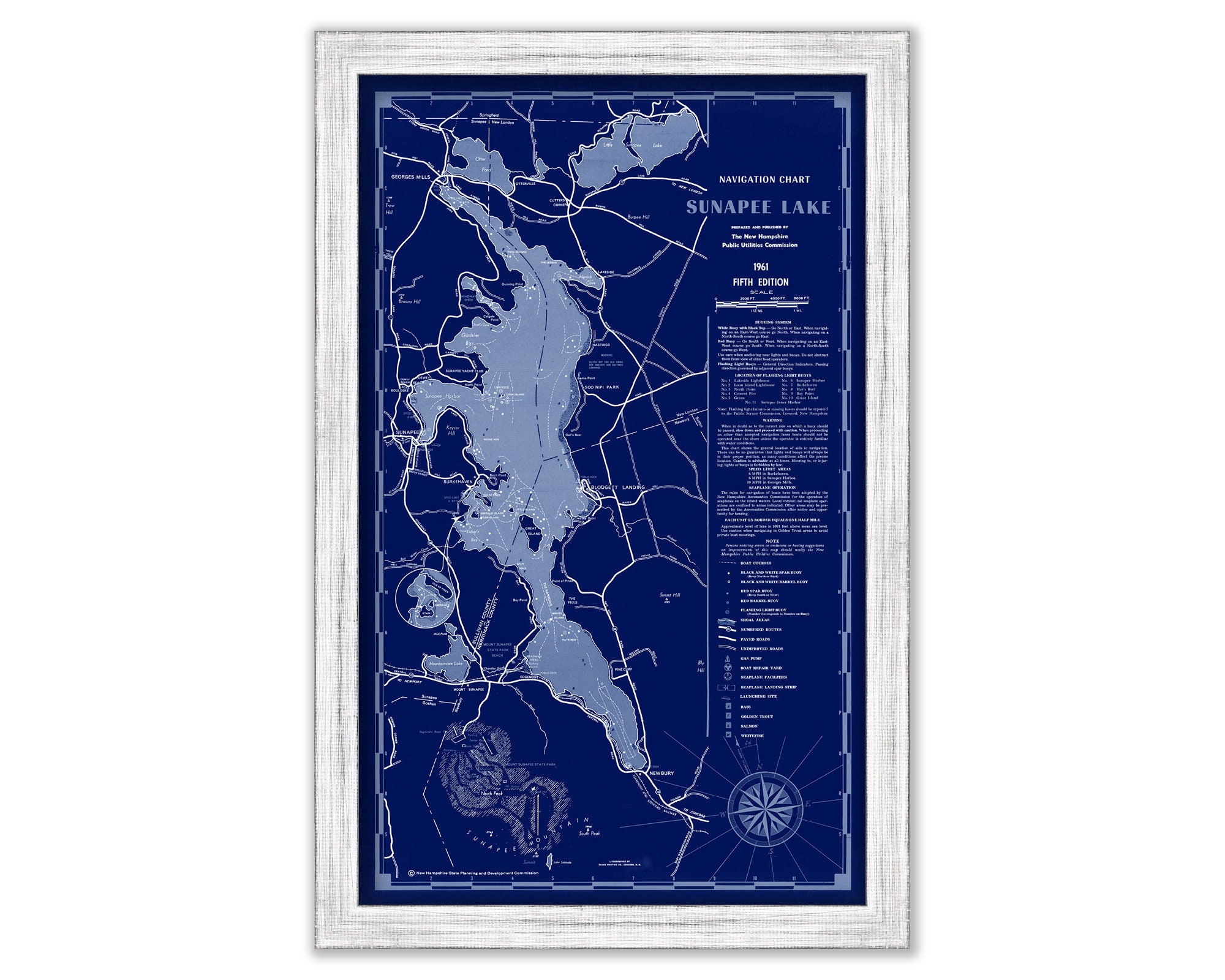
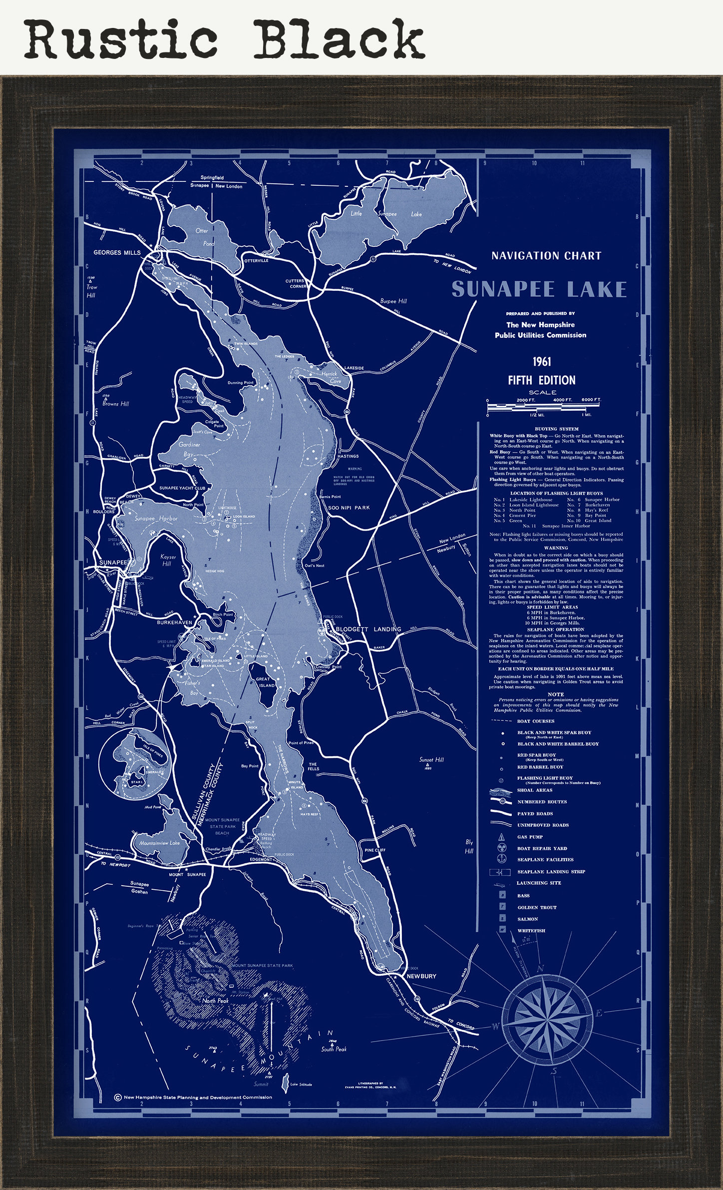
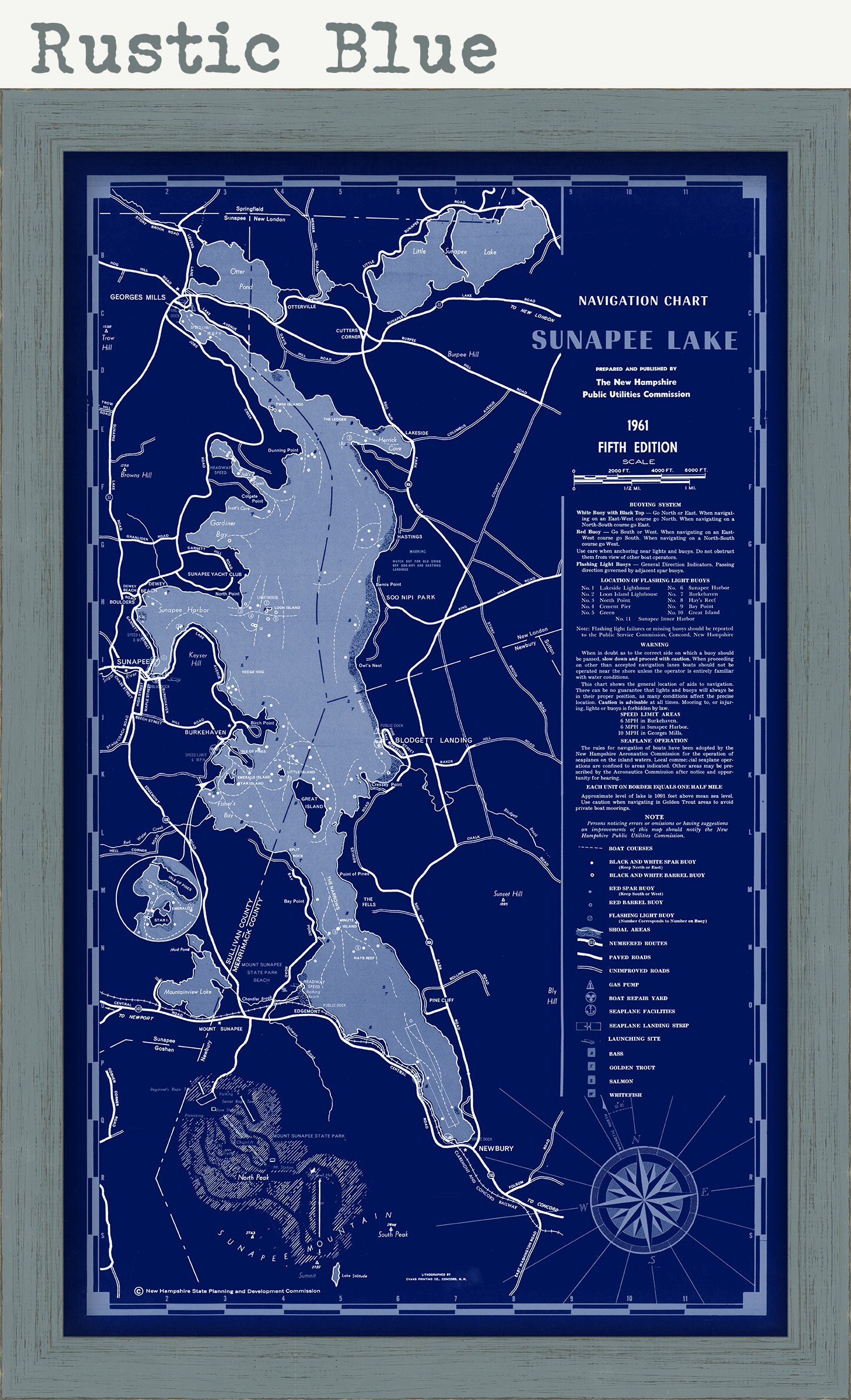
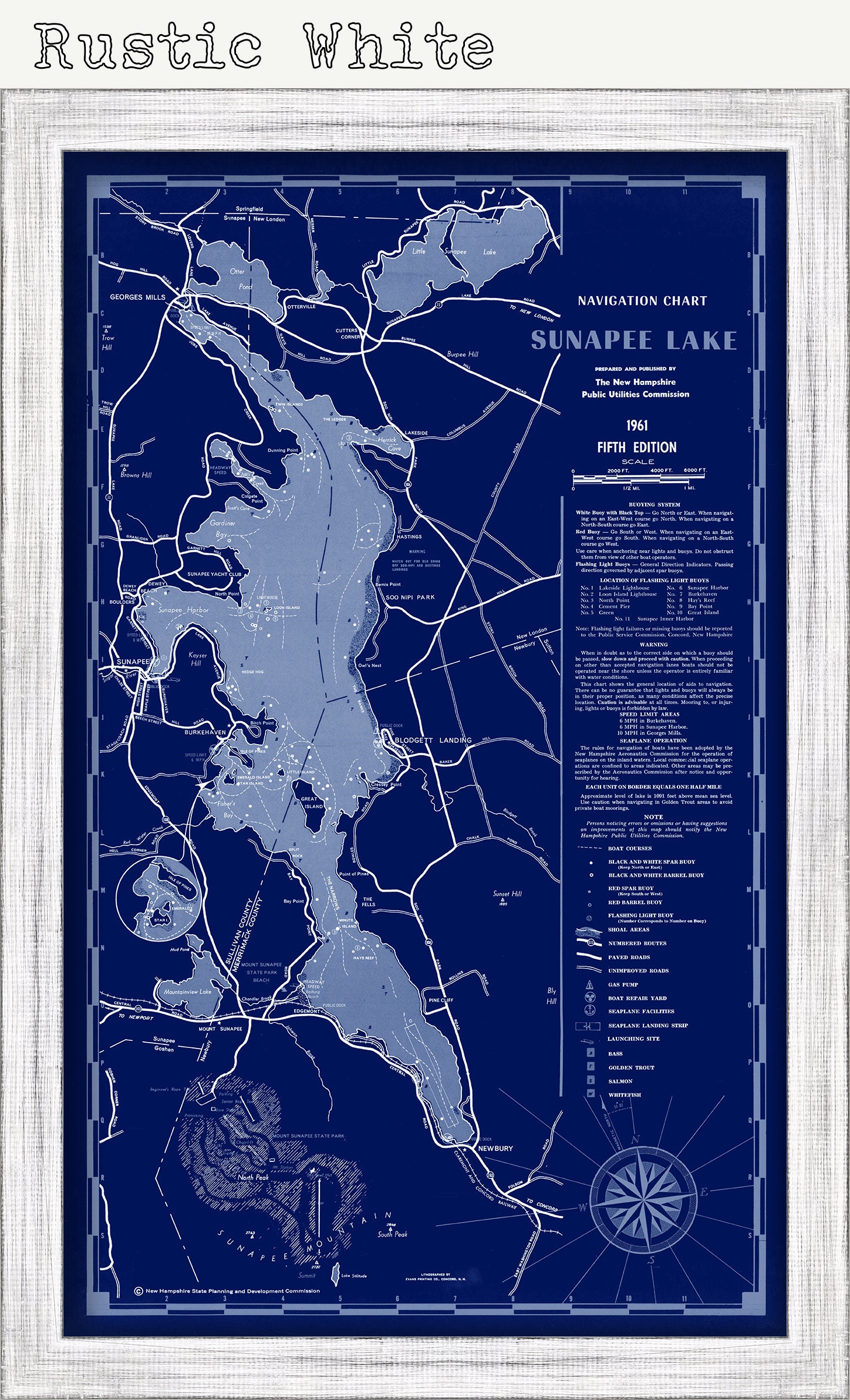
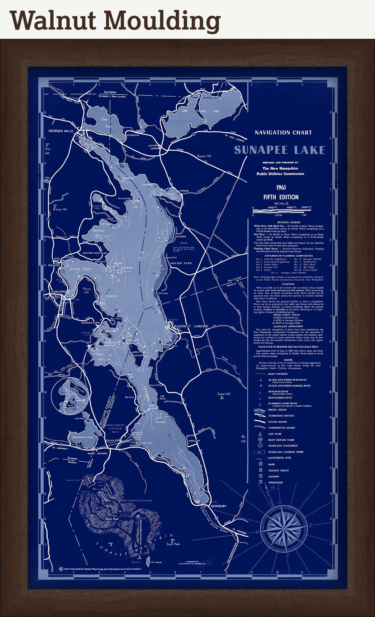
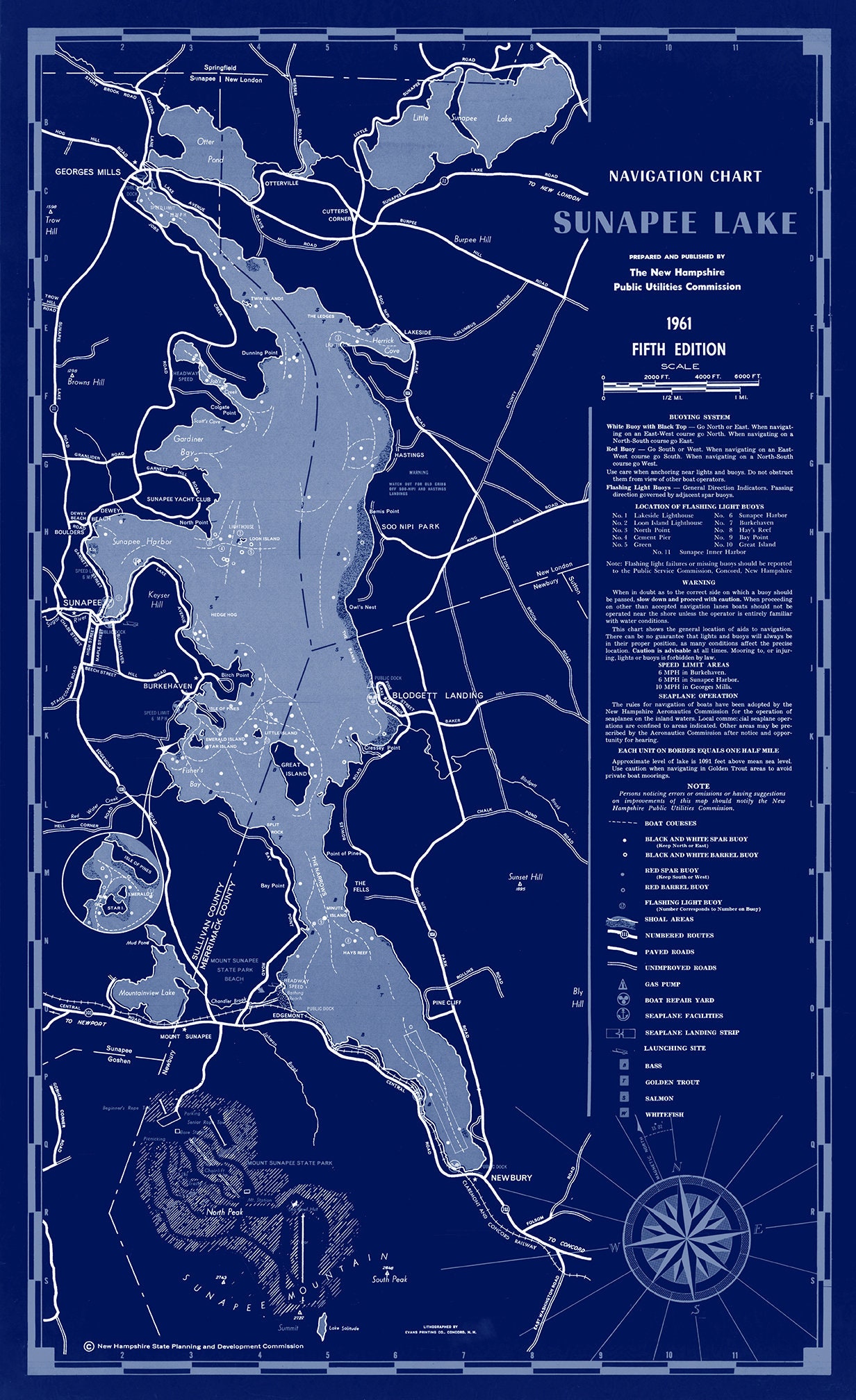
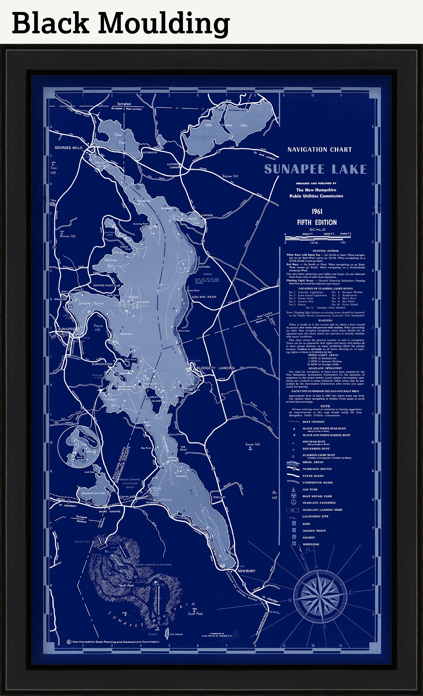
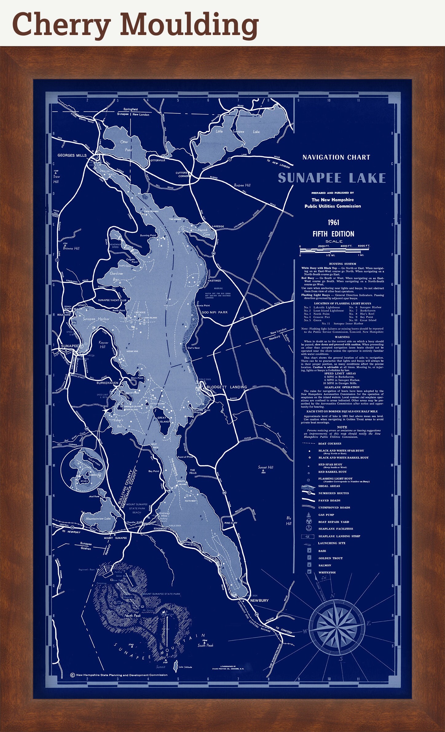
LAKE SUNAPEE, New Hampshire 1961 Nautical Chart Blueprint
$44.00
A reproduction of a Nautical Chart Blueprint of LAKE SUNAPEE, New Hampshire published in 1961 by the state of New Hampshire.
Framed maps include dry mounting, UV filtering glass, and your choice of six mouldings, wired and ready to hang upon delivery. All mouldings are approximately 1.5" wide. Please factor in an additional 3" to the listed size for framed items.
Custom sizes or larger sizes are available. If you are interested in a custom size or larger size, please let us know through the "ask a question" button in this listing.
All sizes are approximate, we round up or down to the nearest inch
Retailers who would like to carry our Maps, please contact us through the "ask a question" button in this listing, for information and discounts.
1512BP
Shipping from United States
Processing time
1-3 business days
Customs and import taxes
Buyers are responsible for any customs and import taxes that may apply. I'm not responsible for delays due to customs.
Payment Options
Returns & Exchanges
Returns & exchanges not accepted
But please contact me if you have problems with your order
I gladly accept cancellations
Request a cancellation within: 1 hours of purchase
Reviews (1)
Average:
Jul 19, 2023
Excellent product and amazing communication and shipping by the seller. Highly recommend & will buy from again:)
Timothy Meyers