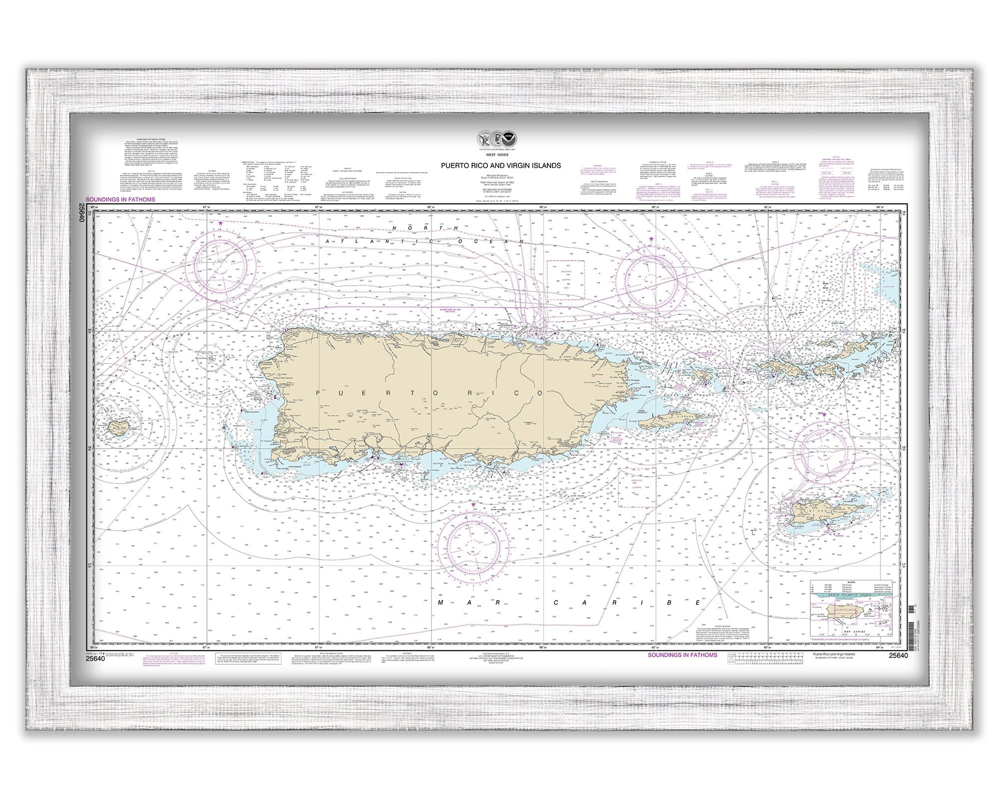
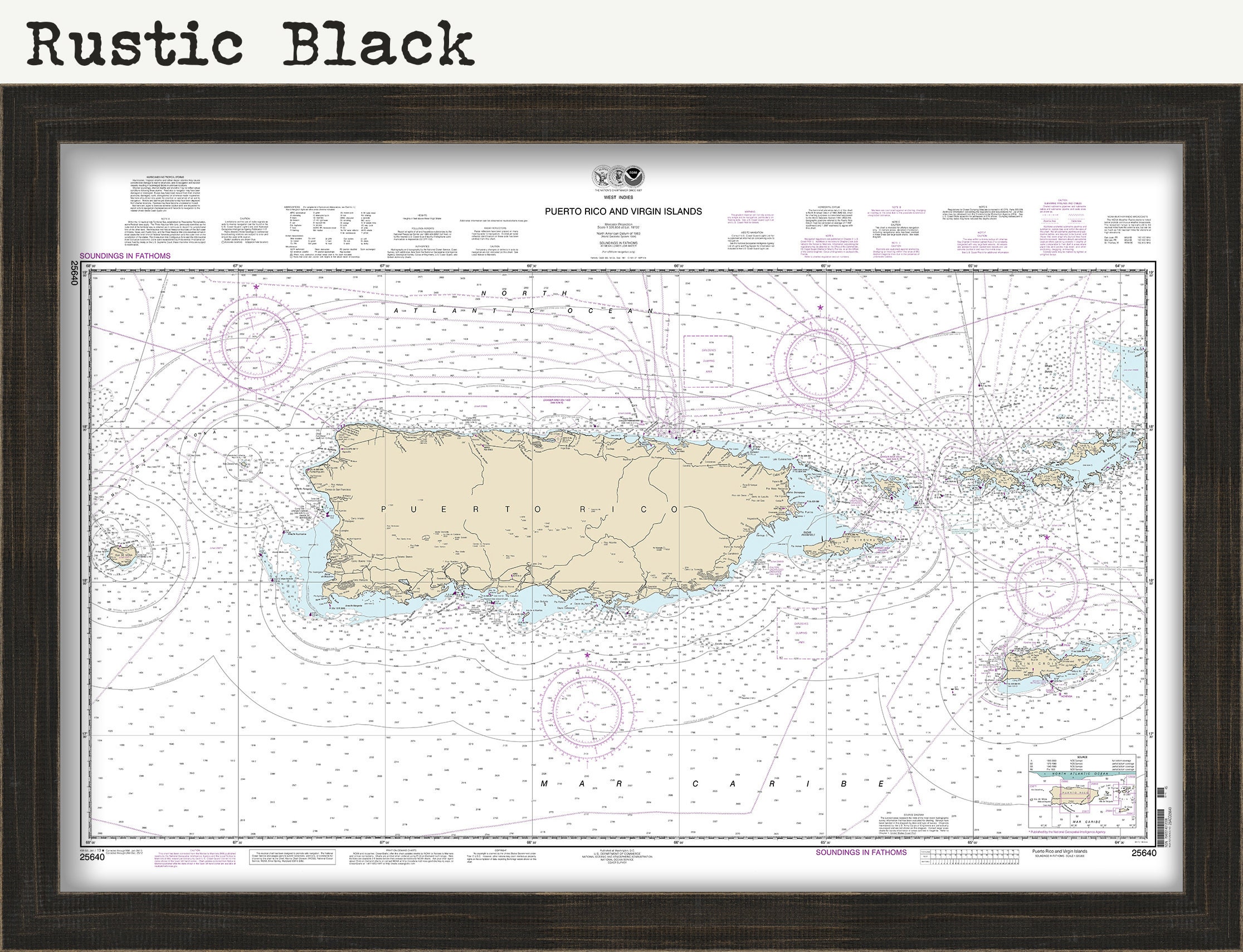
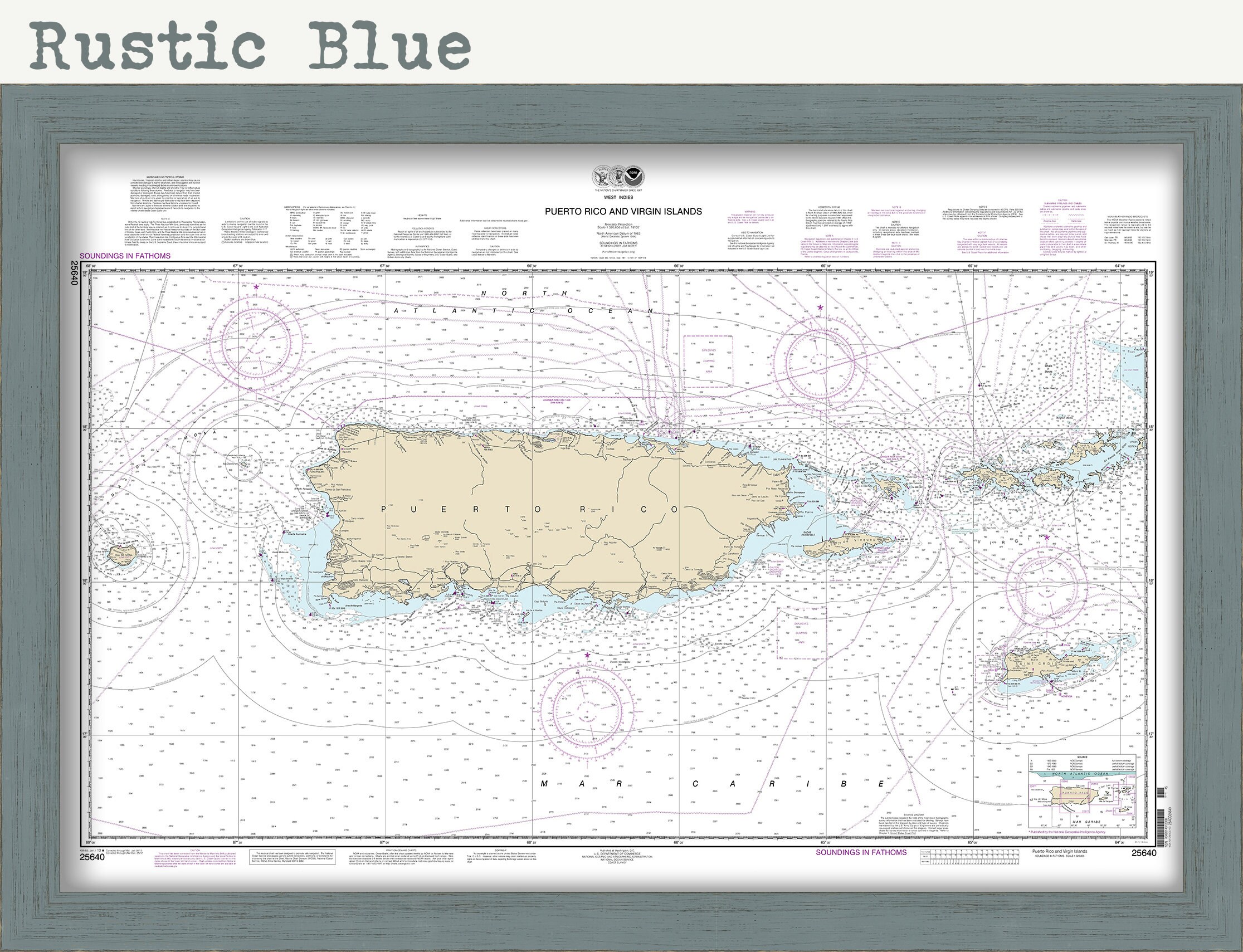
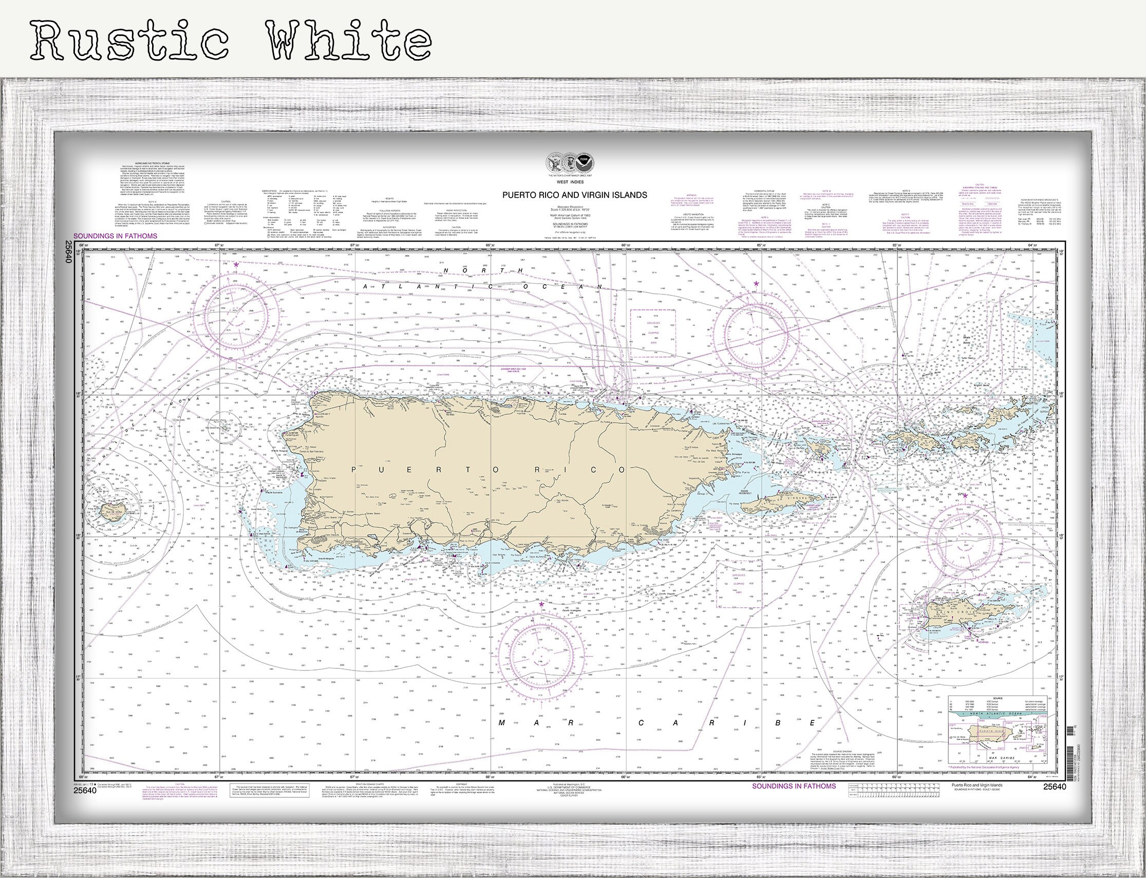
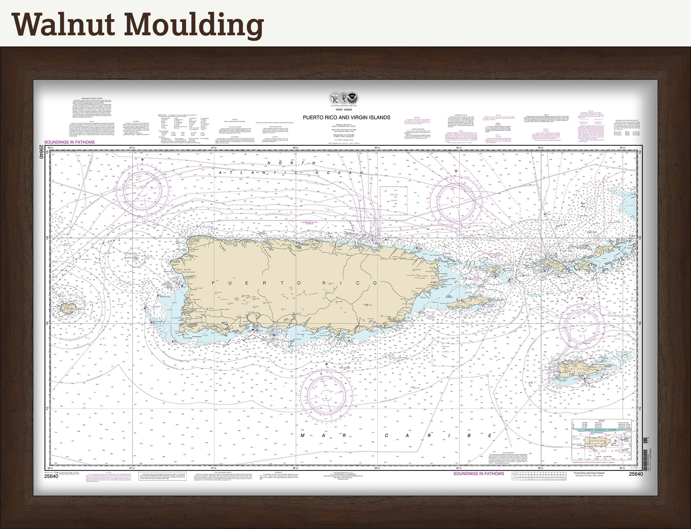
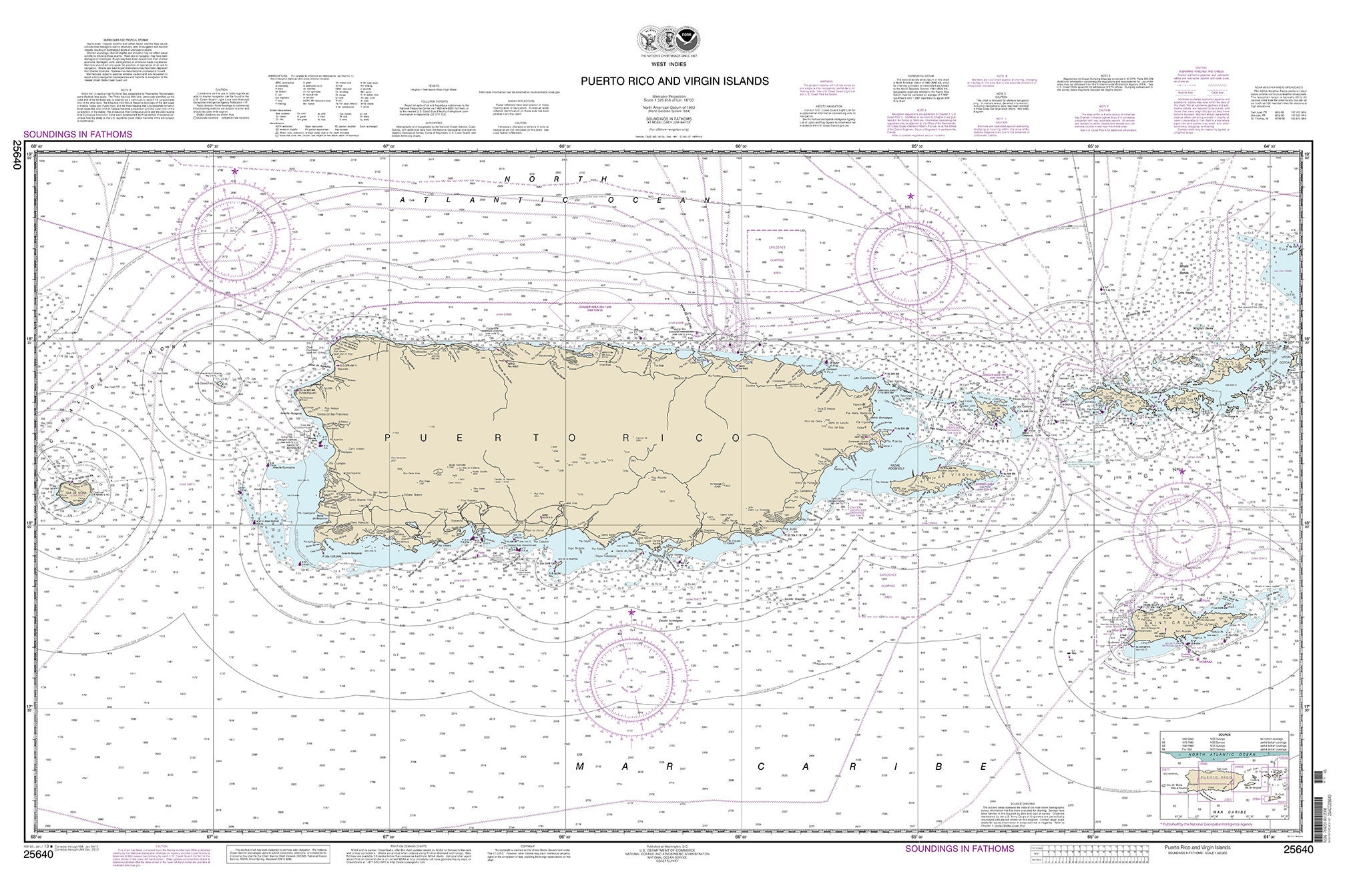
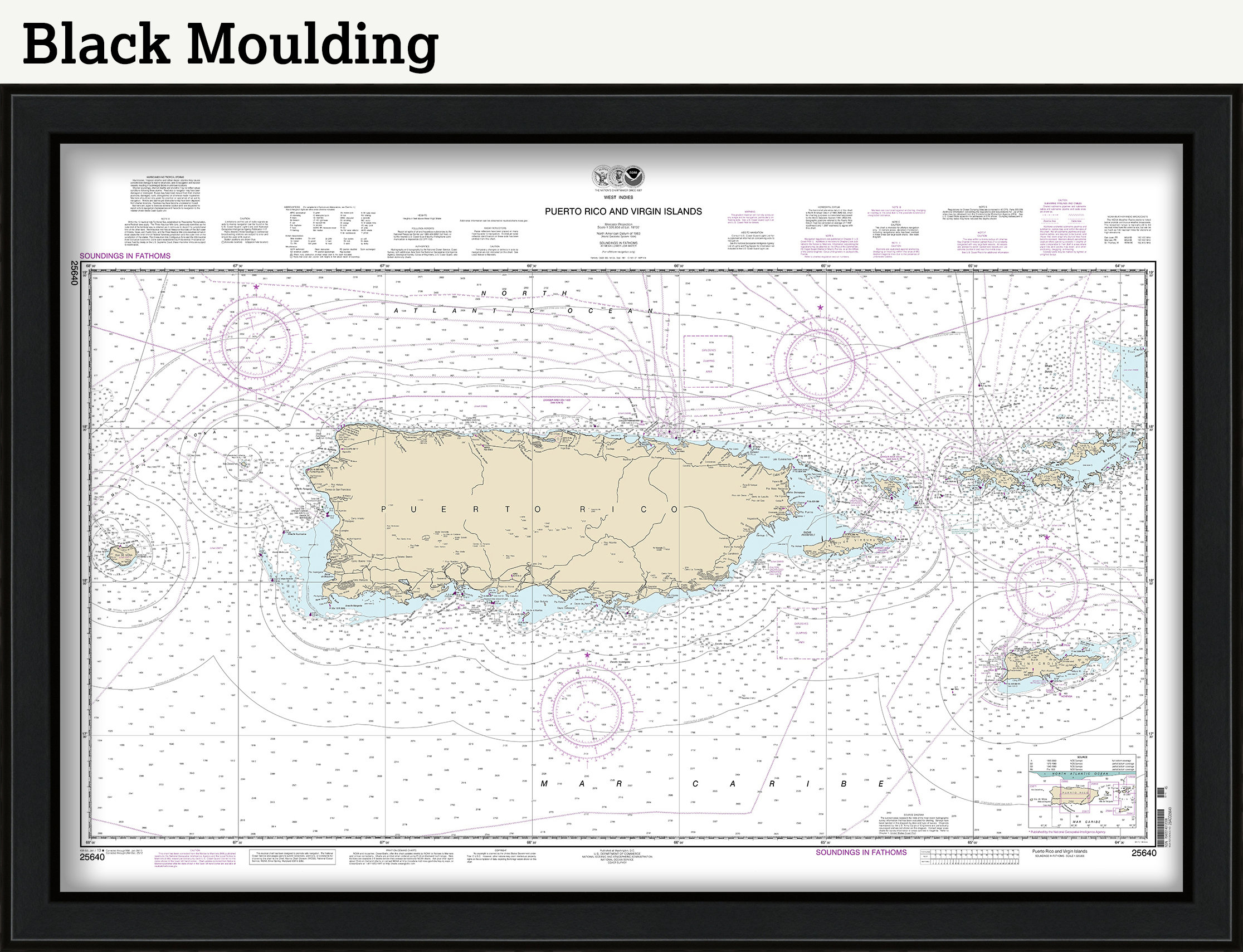
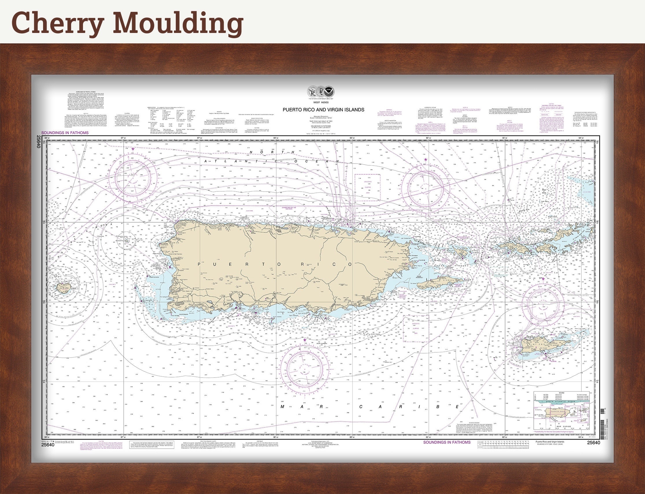


Puerto Rico and VIRGIN ISLANDS - St Thomas, St Croix, St John, Virgin Gorda, Tortola and Josh Van Dyke - 2013 Nautical Chart
$38.00
A Replica of a Nautical Chart of the VIRGIN ISLANDS and PUERTO RICO - by NOAA originally published in 2013.
The U.S. Virgin Islands are a group of Caribbean islands and islets. A U.S. territory, it's known for white-sand beaches, reefs and verdant hills. St. Thomas island is home to the capital, Charlotte Amalie. To the east is the island of St. John, most of which comprises Virgin Islands National Park. St. Croix island and its historic towns, Christiansted and Frederiksted, are to the south.
This image is printed on heavy matte fine art paper with archival inks.
Framing is available.
Framed replica maps include dry mounting, UV filtering glass, and your choice of six mouldings, wired and ready to hang upon delivery. All mouldings are approximately 1.5" wide. Please factor in an additional 3" to the listed size for framed items.
Custom sizes or larger sizes are available. If you are interested in a custom size or larger size, please let us know through the "ask a question" button in this listing.
Retailers who would like to carry our Maps and Prints, please contact us through the "ask a question" button in this listing, for information and discounts.
1300
Shipping from United States
Processing time
1-3 business days
Customs and import taxes
Buyers are responsible for any customs and import taxes that may apply. I'm not responsible for delays due to customs.
Payment Options
Returns & Exchanges
Returns & exchanges not accepted
But please contact me if you have problems with your order
I gladly accept cancellations
Request a cancellation within: 1 hours of purchase