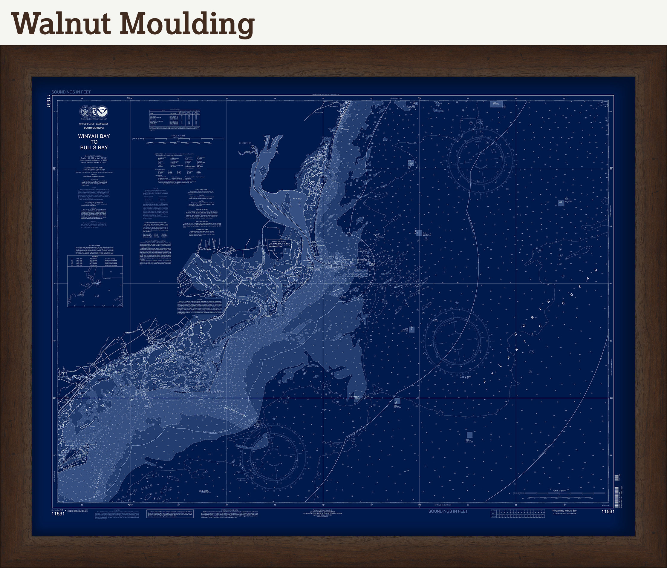
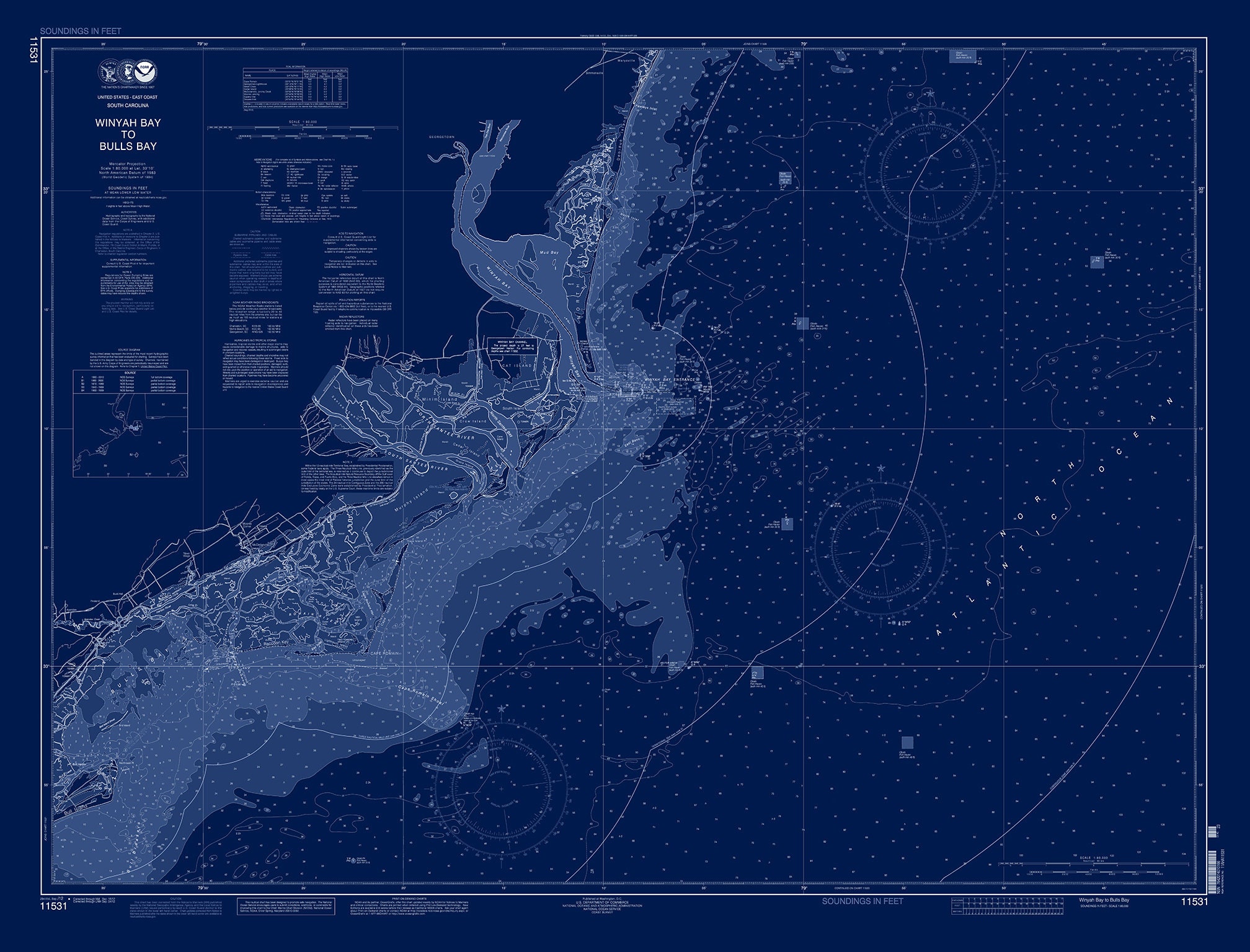
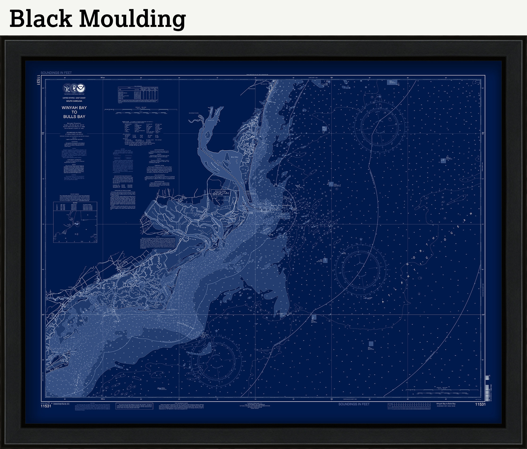
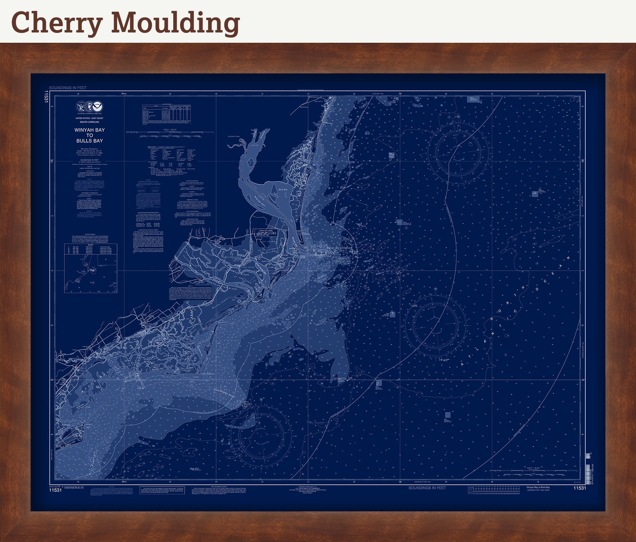

Winyah Bay to Bulls Bay, South Carolina - 2012 Nautical Chart Blueprint
$44.00
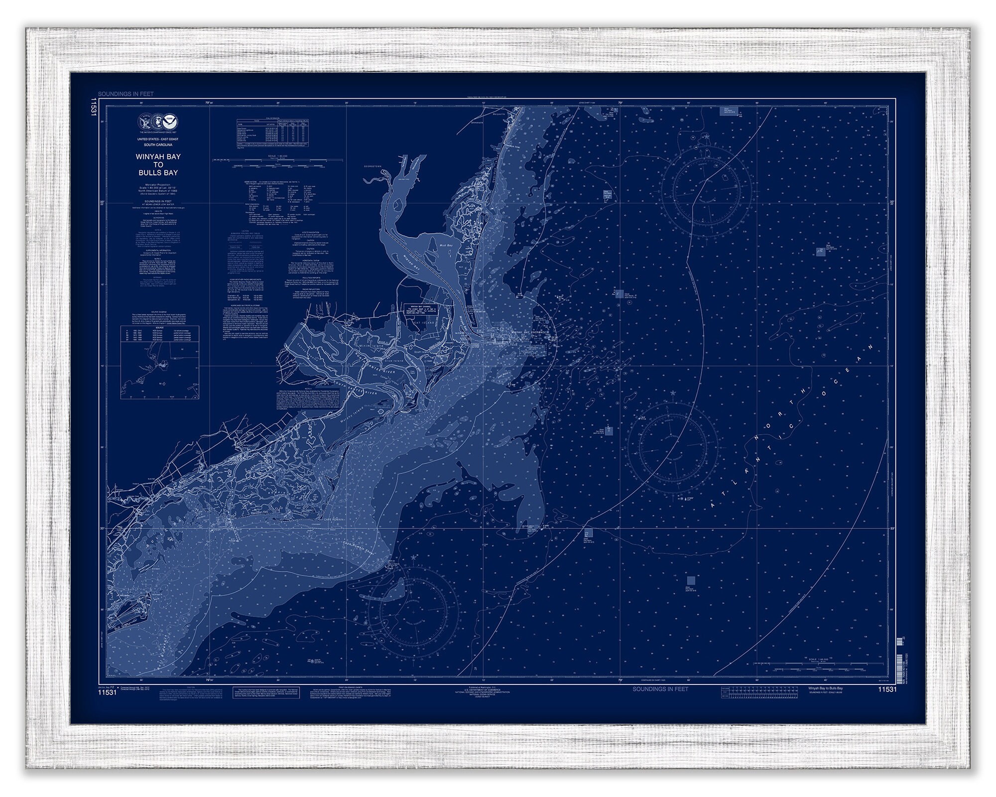
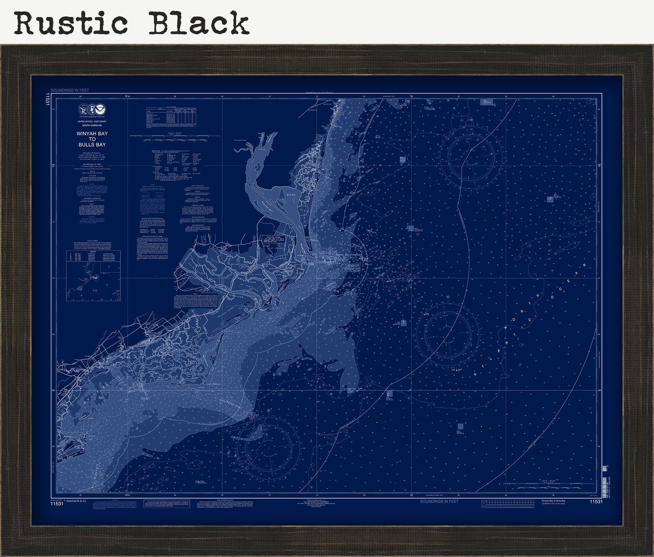
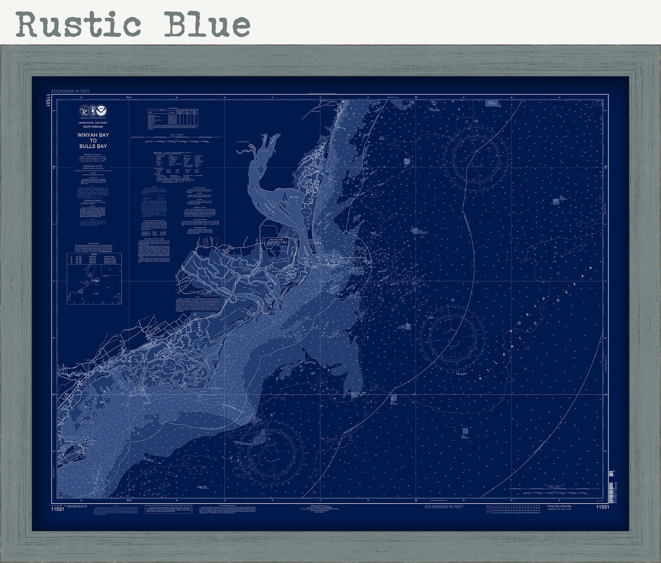
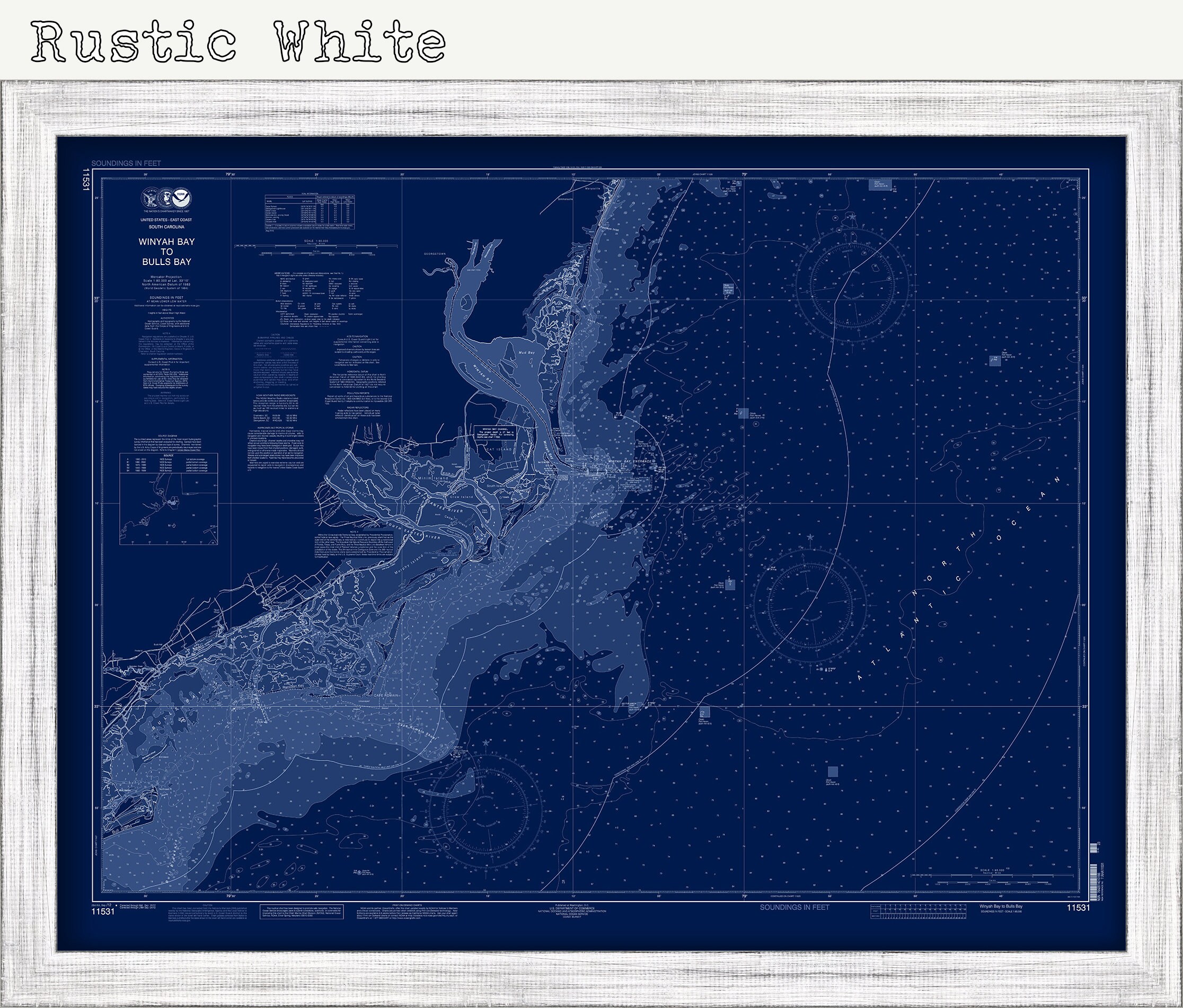
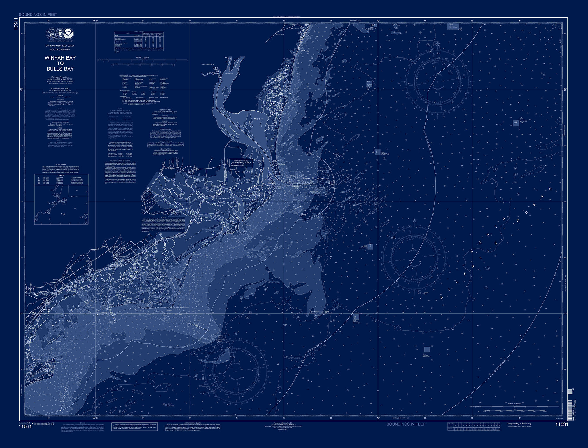
A Blueprint Nautical Chart of Winyah Bay to Bulls Bay, South Carolina, South Carolina originally published in 2012 by NOAA.
This image is printed on heavy matte fine art paper with archival inks.
Framing is available.
Framed replica maps include dry mounting, UV filtering glass, and your choice of six mouldings, wired and ready to hang upon delivery. All mouldings are approximately 1.5" wide. Please factor in an additional 3" to the listed size for framed items.
Custom sizes or larger sizes are available. If you are interested in a custom size or larger size, please let us know through the "ask a question" button in this listing.
Retailers who would like to carry our Maps and Prints, please contact us through the "ask a question" button in this listing, for information and discount
1258BP
Shipping from United States
Processing time
1-3 business days
Customs and import taxes
Buyers are responsible for any customs and import taxes that may apply. I'm not responsible for delays due to customs.
Payment Options
Returns & Exchanges
Returns & exchanges not accepted
But please contact me if you have problems with your order
I gladly accept cancellations
Request a cancellation within: 1 hours of purchase