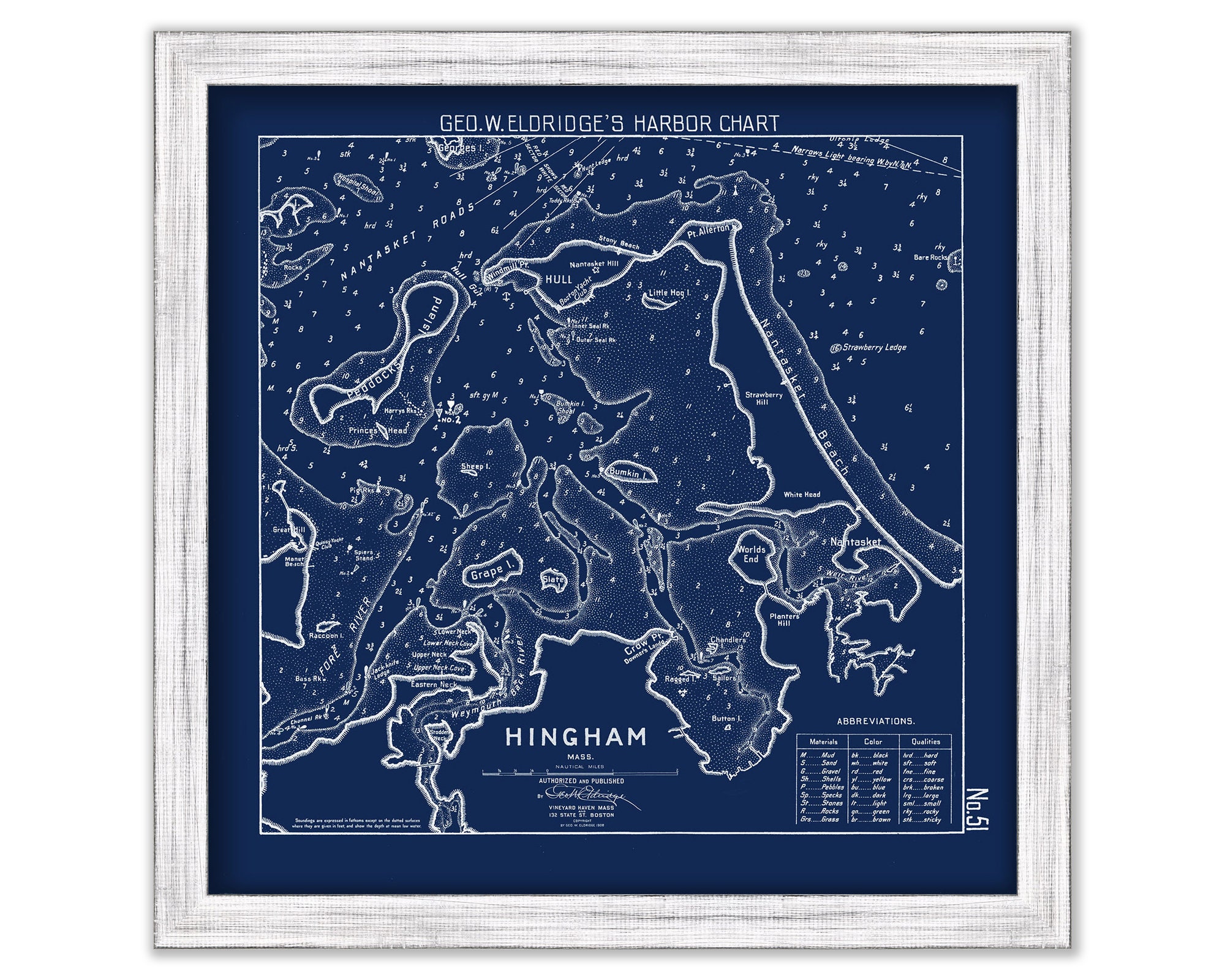
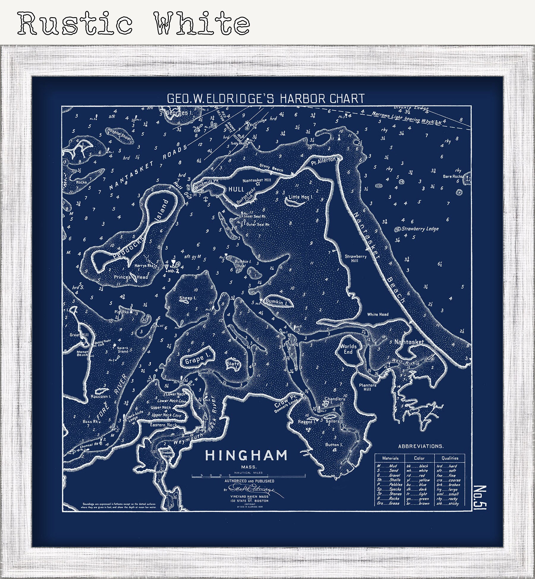
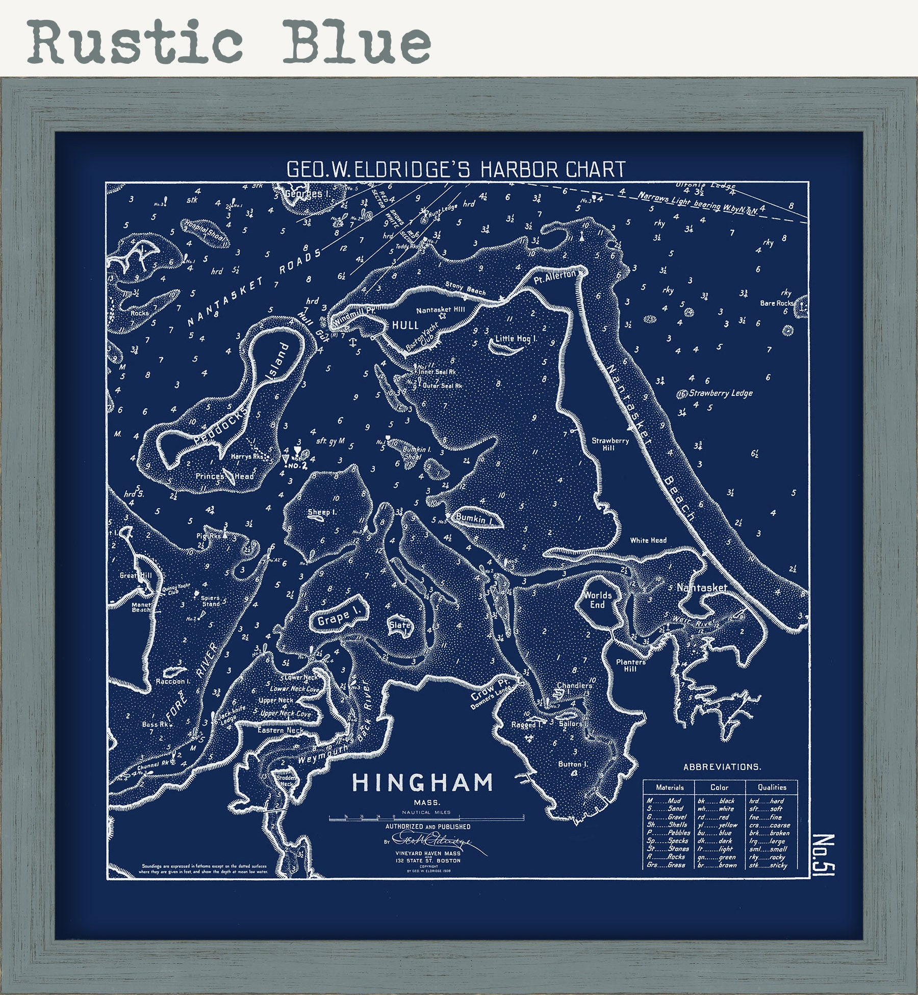
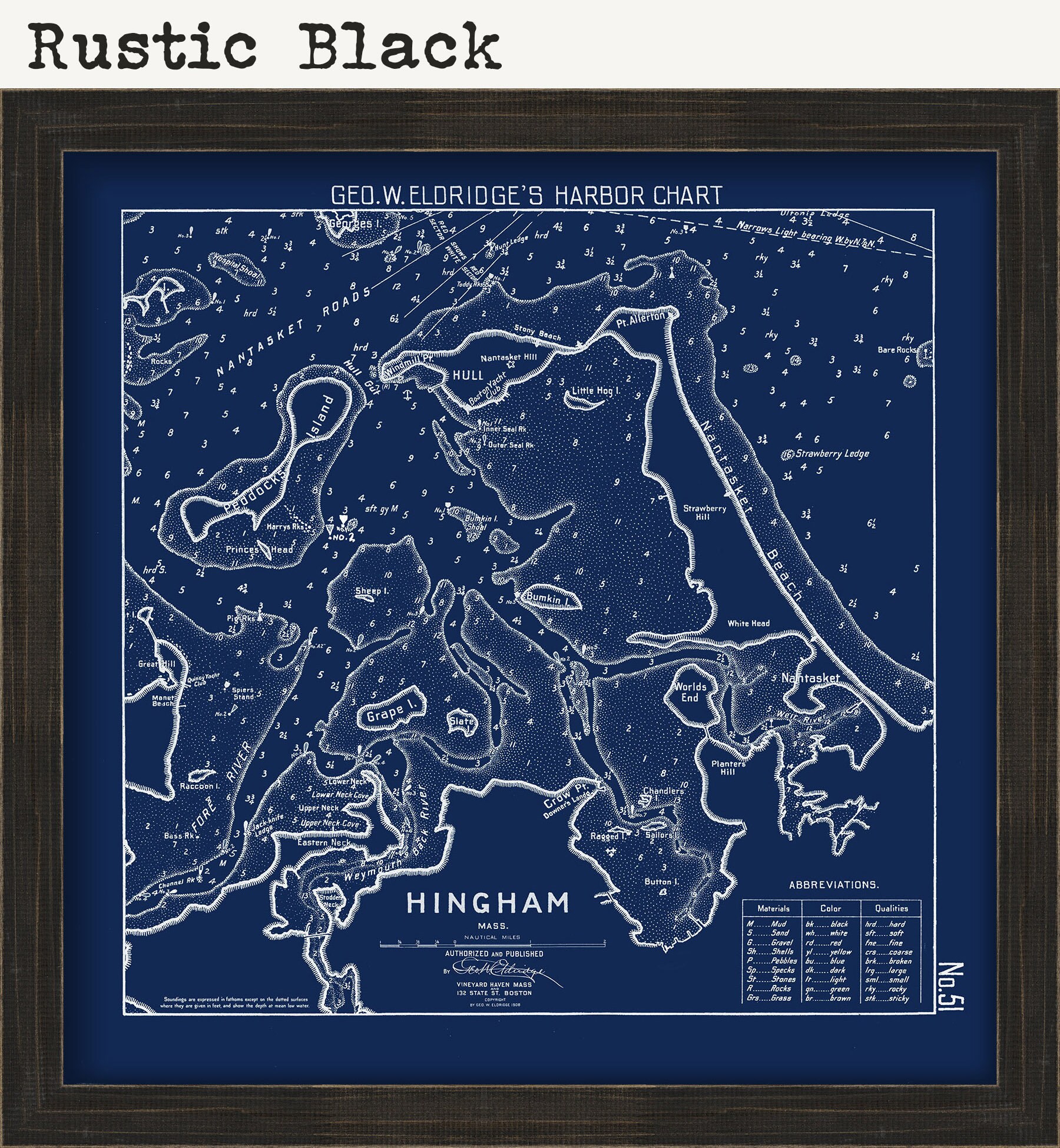
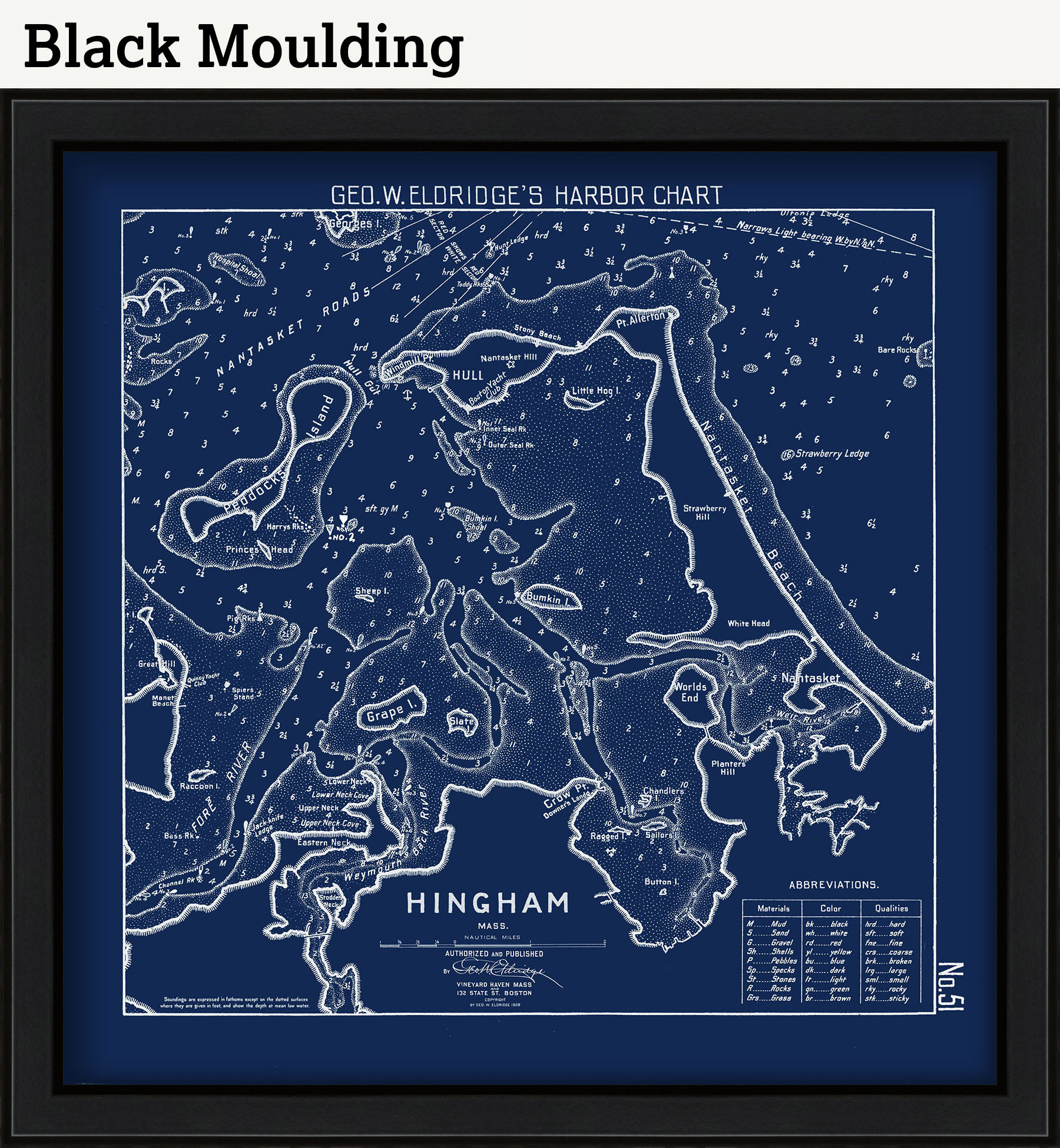
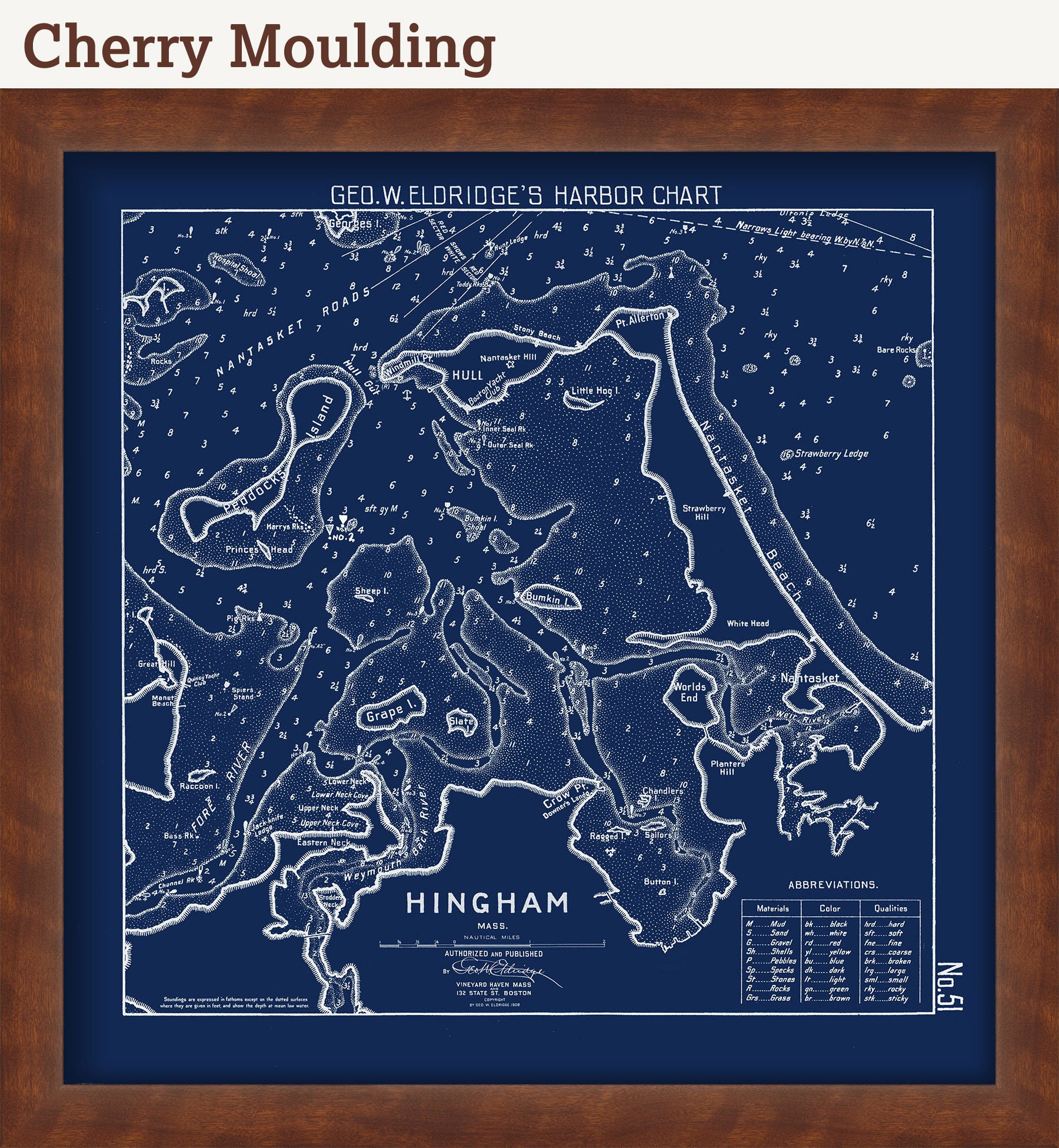
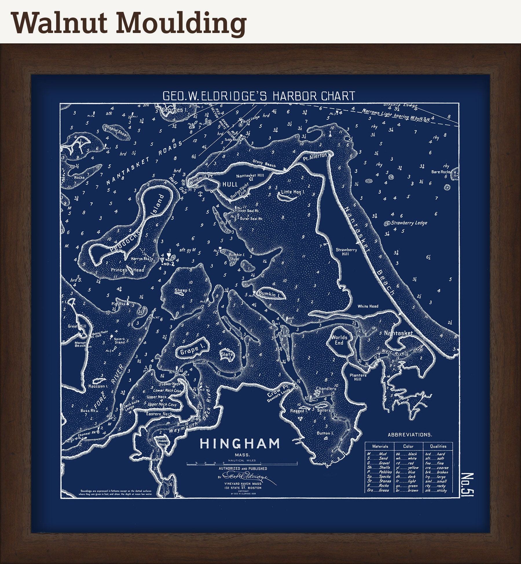
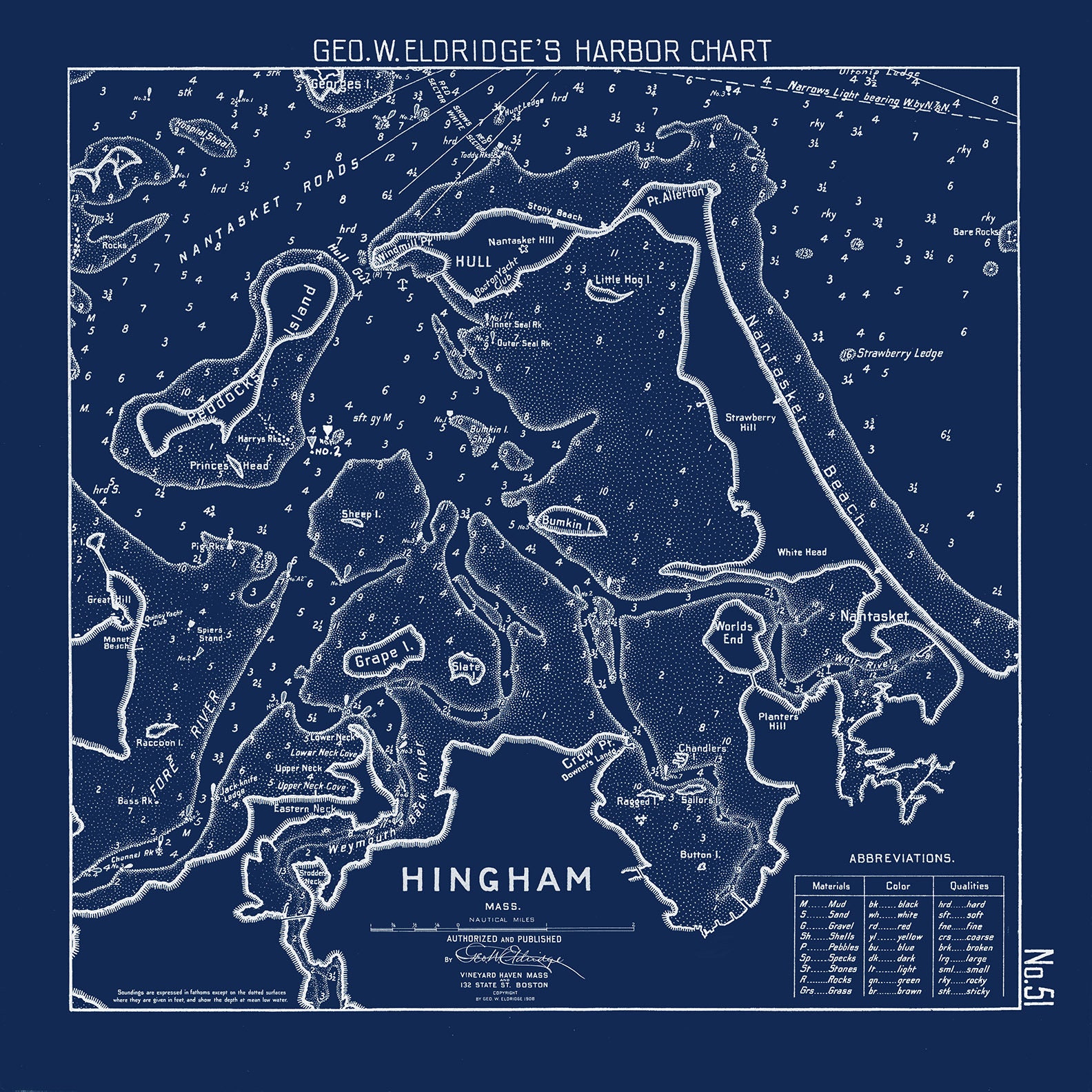
HINGHAM HARBOR and BAY, Massachusetts - Nautical Chart by Geo. W Eldridge 1908
$38.00
A reproduction of a BLUEPRINT of a 1908 Harbor Chart of HINGHAM HARBOR and BAY, Massachusetts. This map is from the atlas "Geo. W. Eldrige's Harbor-Chart Book, Boston to Bar Harbor". Eldridge Charts are renowned for bold lines and a clear and concise style.
This map has been scanned From The ORIGINAL image and is printed on heavy matte fine art paper with archival inks.
Framing is available.
Framed replica maps include dry mounting, UV filtering glass, and your choice of six mouldings, wired and ready to hang upon delivery. All mouldings are approximately 1.5" wide. Please factor in an additional 3" to the listed size for framed items.
Custom sizes or larger sizes are available. If you are interested in a custom size or larger size, please let us know through the "ask a question" button in this listing.
Retailers who would like to carry our Maps and Prints, please contact us through the "ask a question" button in this listing, for information and discounts.
All sizes are approximate, WITH THE EXCEPTION OF STANDARD SIZES, we round up or down to the nearest inch.
1065BP
Shipping from United States
Processing time
1-3 business days
Customs and import taxes
Buyers are responsible for any customs and import taxes that may apply. I'm not responsible for delays due to customs.
Payment Options
Returns & Exchanges
Returns & exchanges not accepted
But please contact me if you have problems with your order
I gladly accept cancellations
Request a cancellation within: 1 hours of purchase
Reviews (3)
Average:
Apr 26, 2023
Prints are gorgeous. Arrived quickly. Will definitely order more for myself and as gifts
Jeanne Ficociello
Aug 20, 2022
Beautiful map, wonderful color and fast shipping. Thank you!
Stephanie Urban
Jun 23, 2021
Arrived quickly, just as described
Heather Seeley