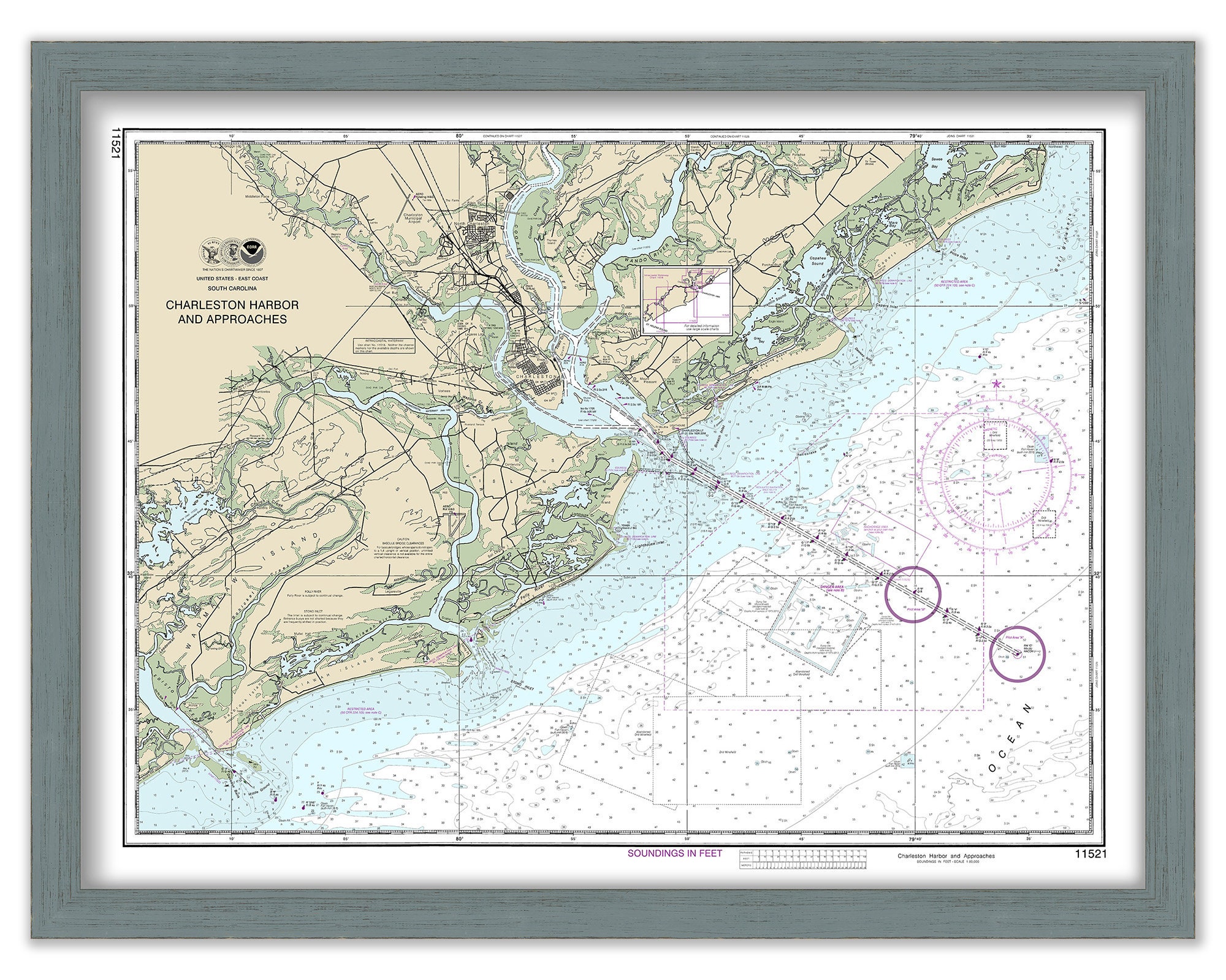
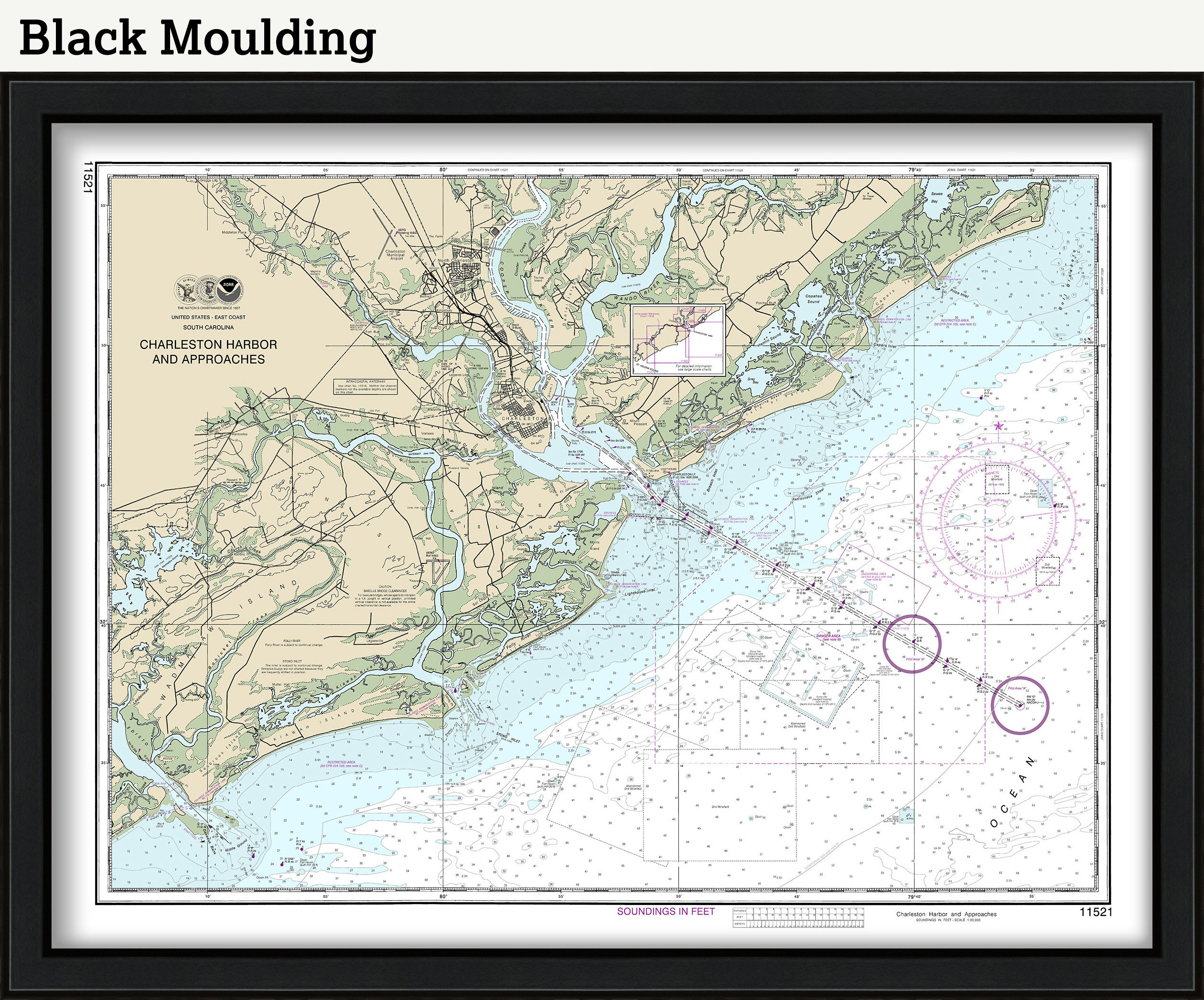
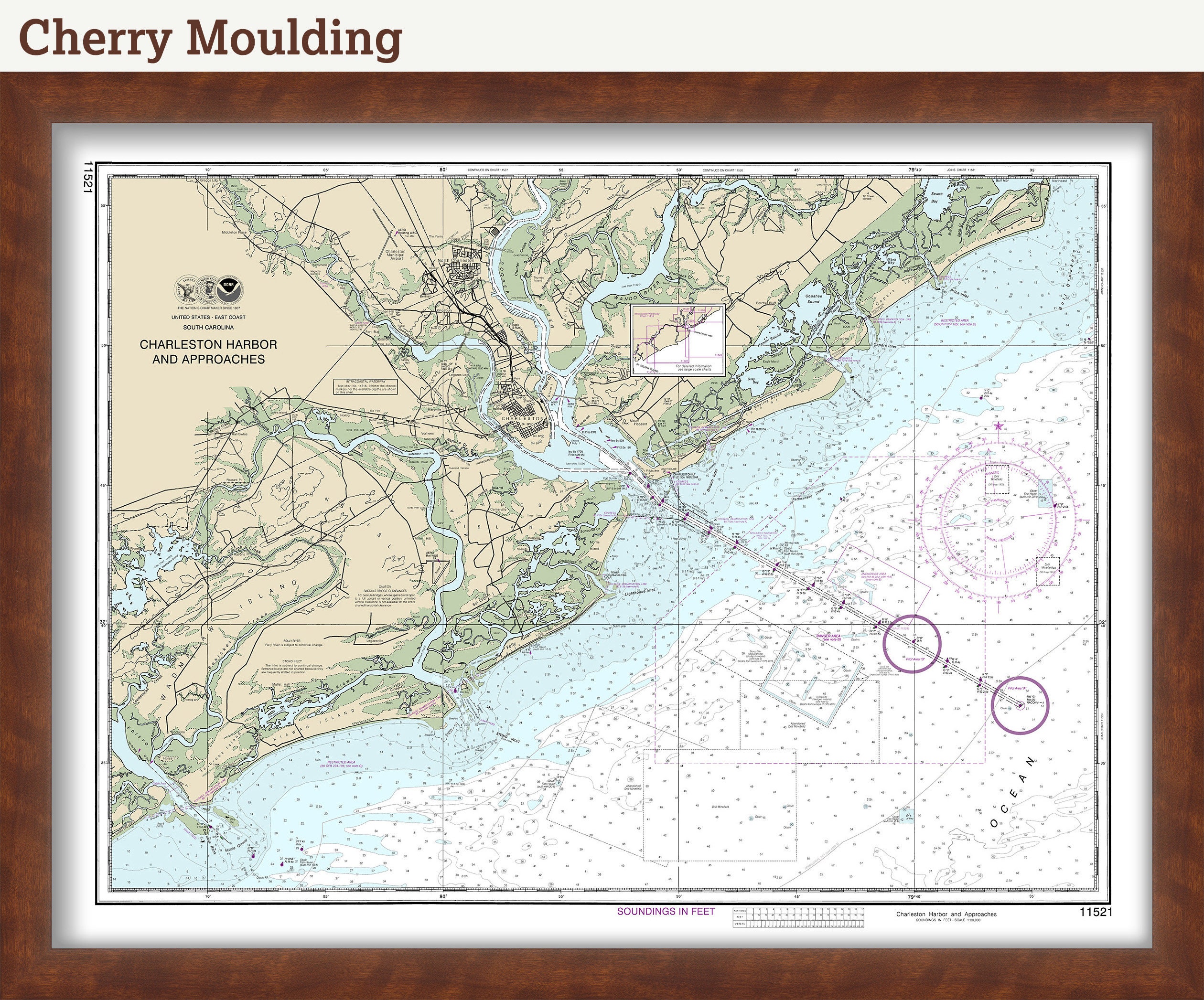
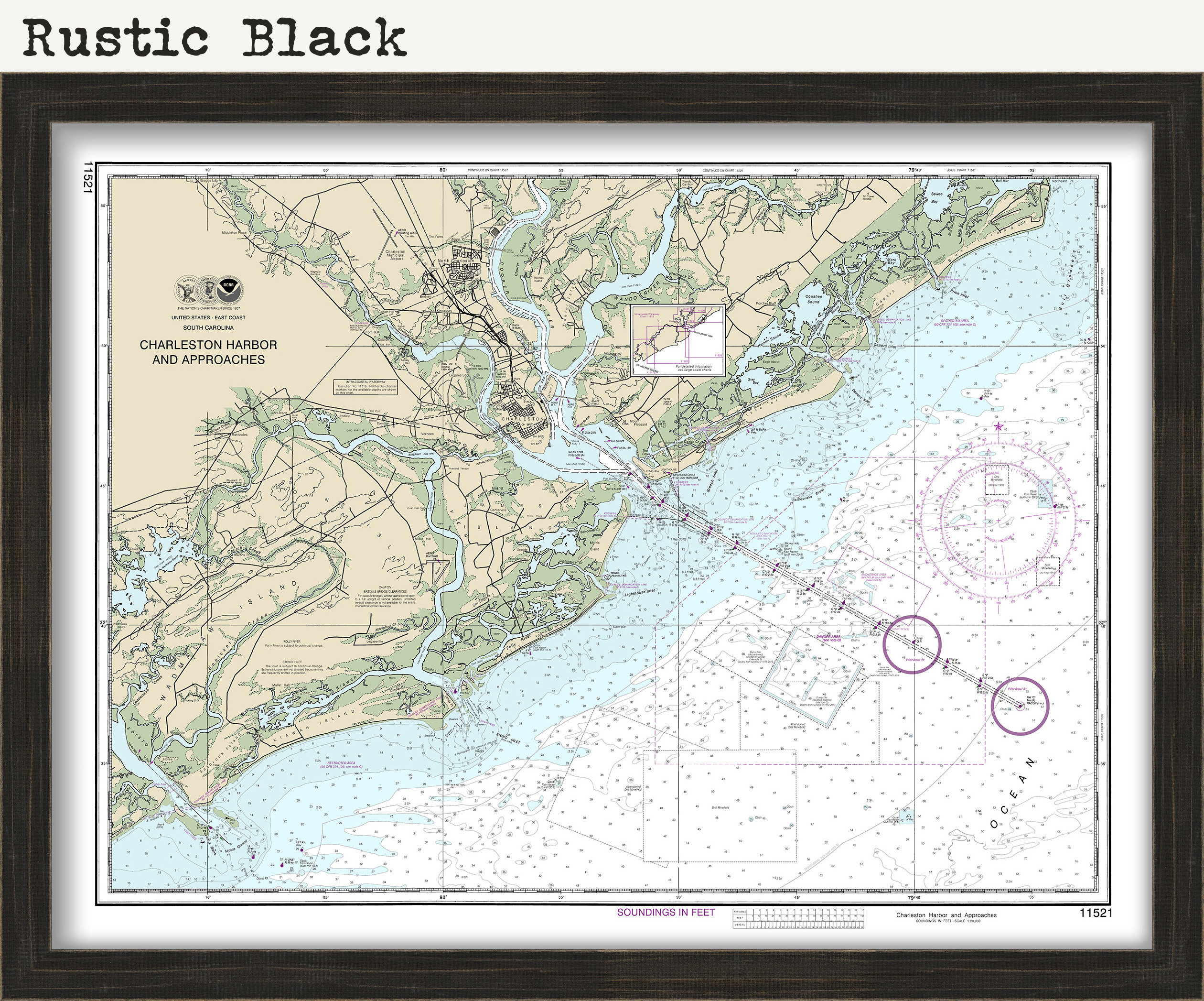
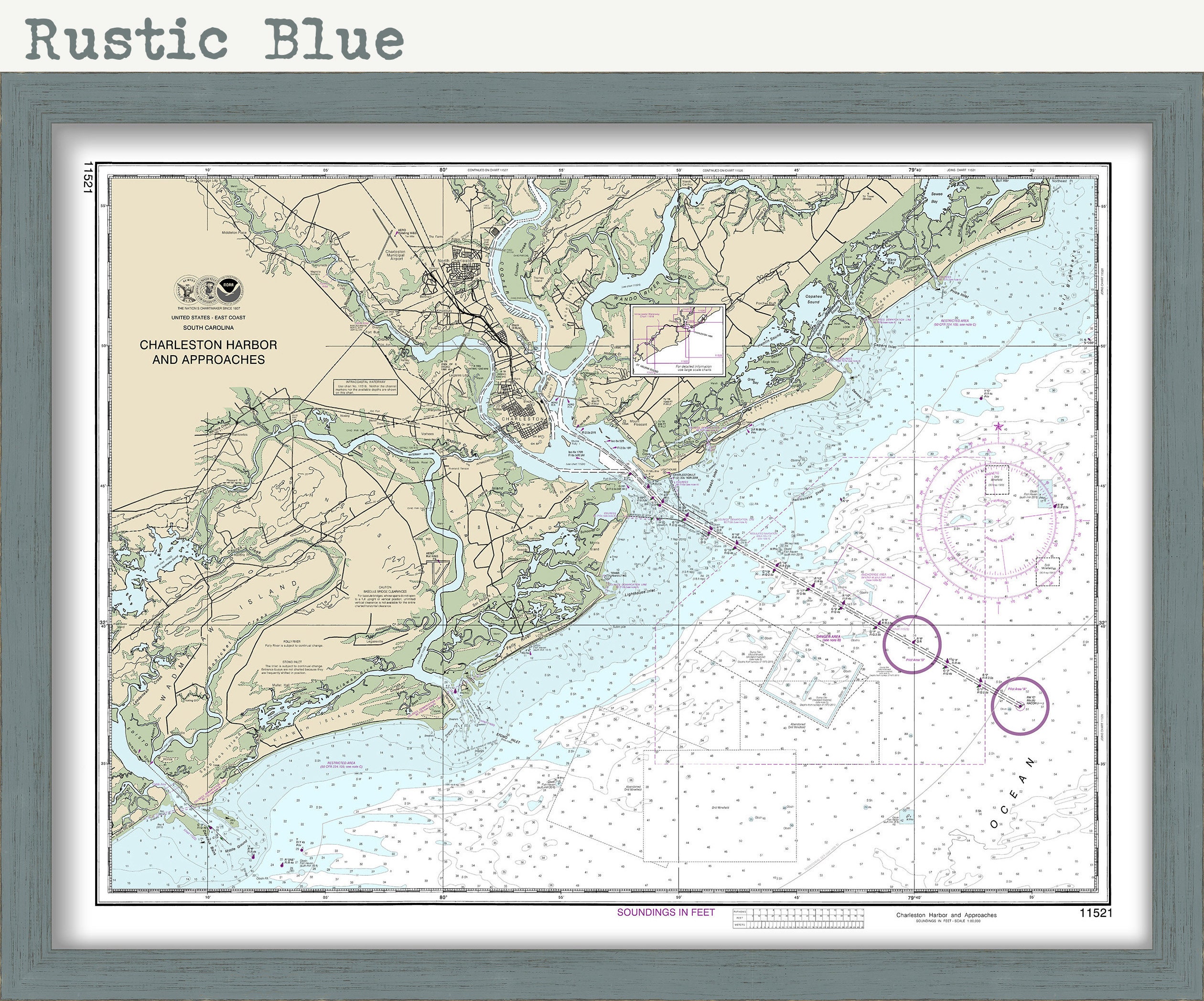
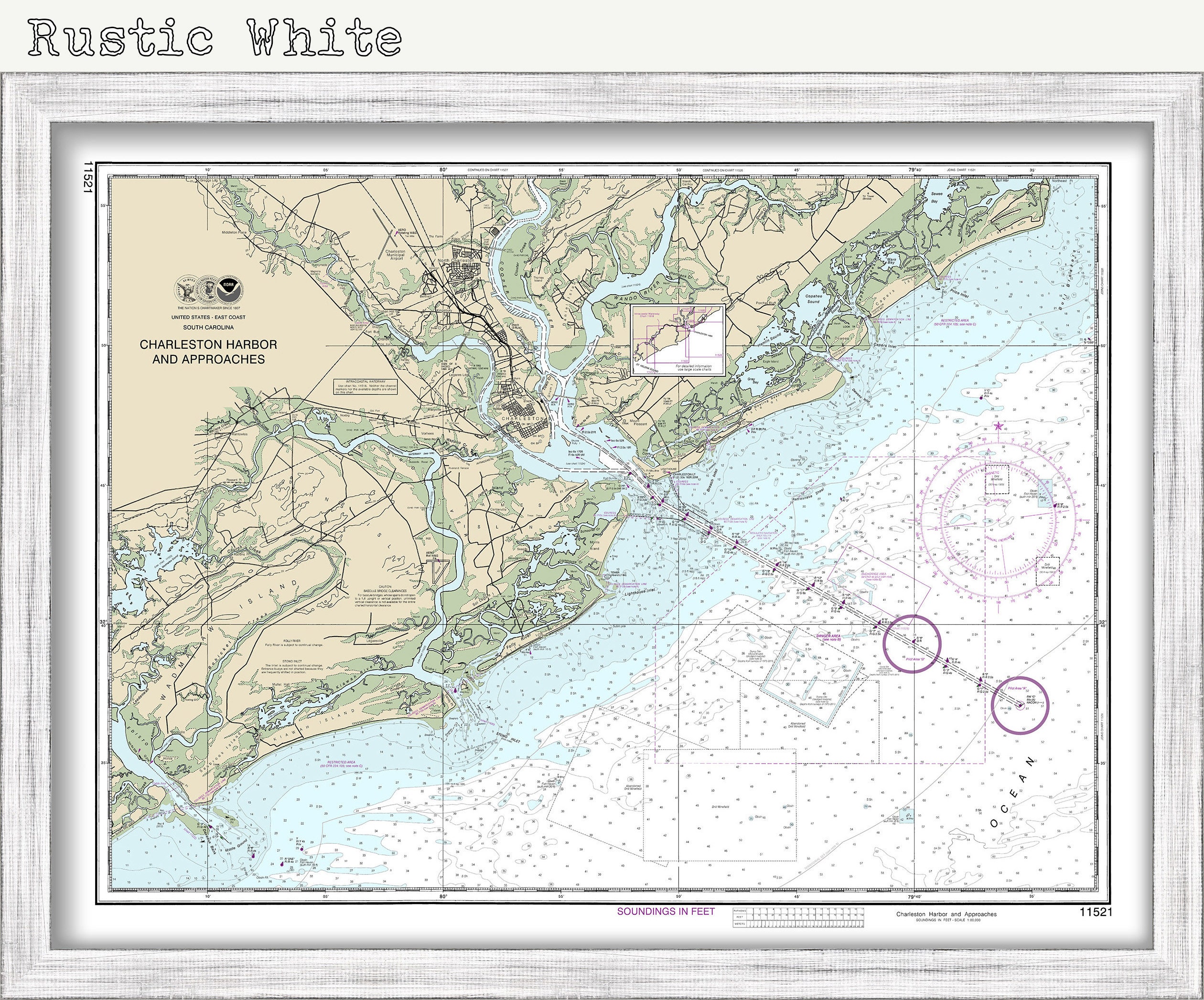
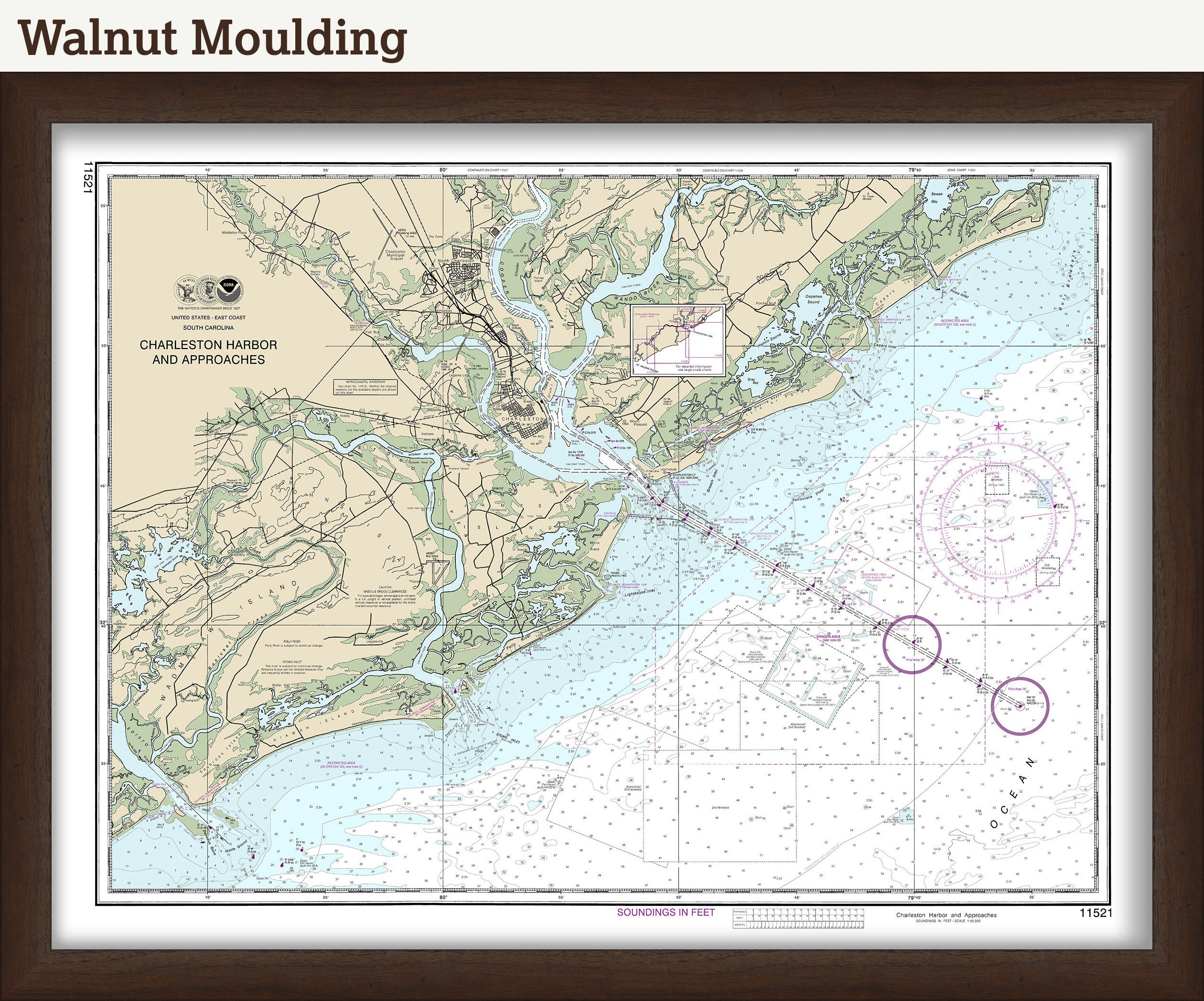

CHARLESTON HARBOR, South Carolina - Nautical Chart 2015
$37.00
A reproduction of a Nautical Chart of CHARLESTON HARBOR, South Carolina originally published in 2015 by NOAA.
This image is printed on heavy matte fine art paper with archival inks.
Framing is available.
Framed replica maps include dry mounting, UV filtering glass, and your choice of six mouldings, wired and ready to hang upon delivery. All mouldings are approximately 1.5" wide. Please factor in an additional 3" to the listed size for framed items.
Custom sizes or larger sizes are available. If you are interested in a custom size or larger size, please let us know through the "ask a question" button in this listing.
Retailers who would like to carry our Maps and Prints, please contact us through the "ask a question" button in this listing, for information and discount
1130
Shipping from United States
Processing time
1-3 business days
Customs and import taxes
Buyers are responsible for any customs and import taxes that may apply. I'm not responsible for delays due to customs.
Payment Options
Returns & Exchanges
Returns & exchanges not accepted
But please contact me if you have problems with your order
I gladly accept cancellations
Request a cancellation within: 1 hours of purchase
Reviews (16)
Average:
Apr 25, 2026
Beautiful framed navigational map. Love the frame.
Isabella McCall
Feb 18, 2025
My second purchase from Old World Maps. Communication is great, and item purchased are top quality. Highly recommend!
Amber
Aug 21, 2024
Great Charleston Harbor Mat, Arrived Quick!
Amber
Nov 19, 2023
Great good wonderful good great
Abigail
Jul 26, 2023
Sanders Hughes