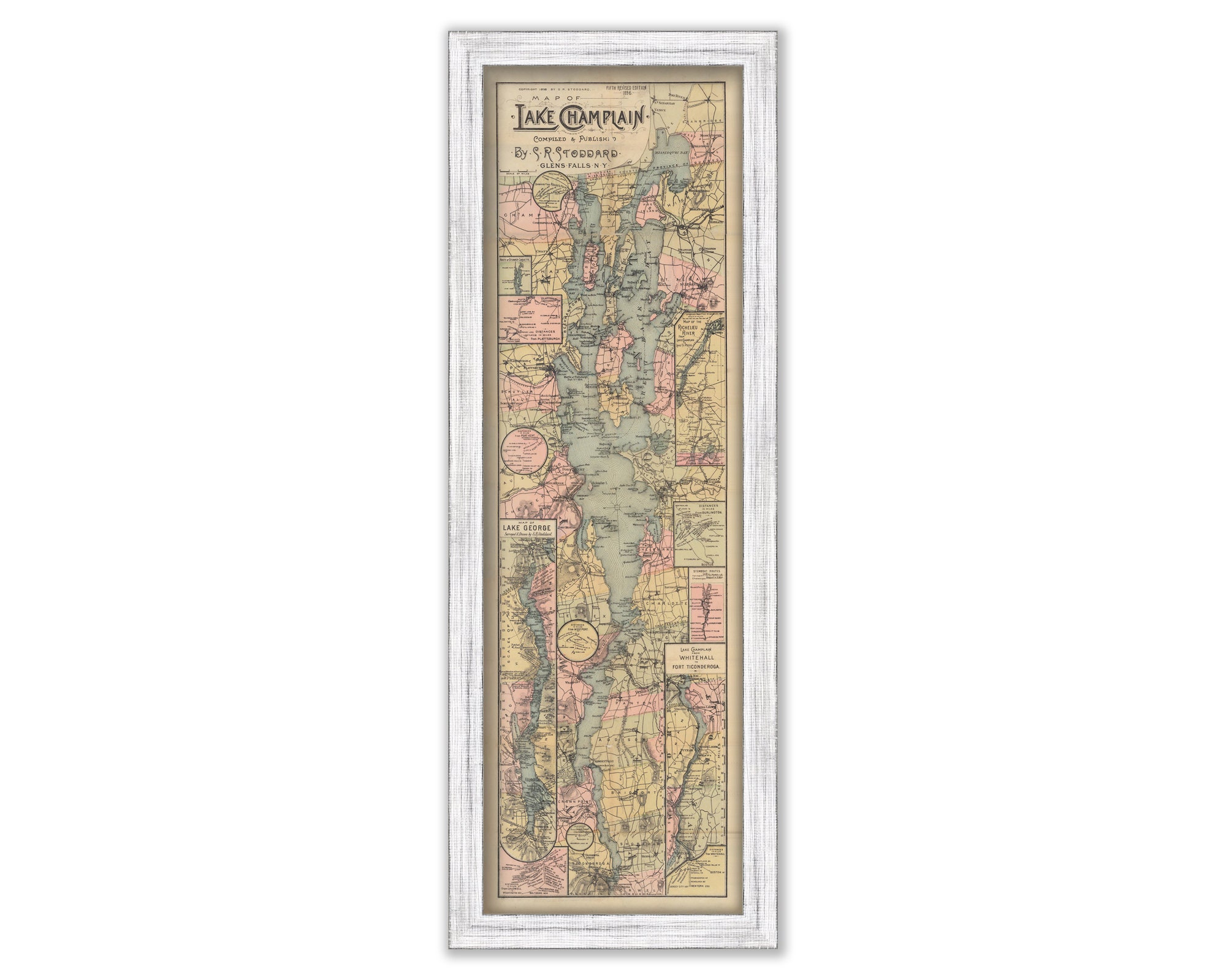
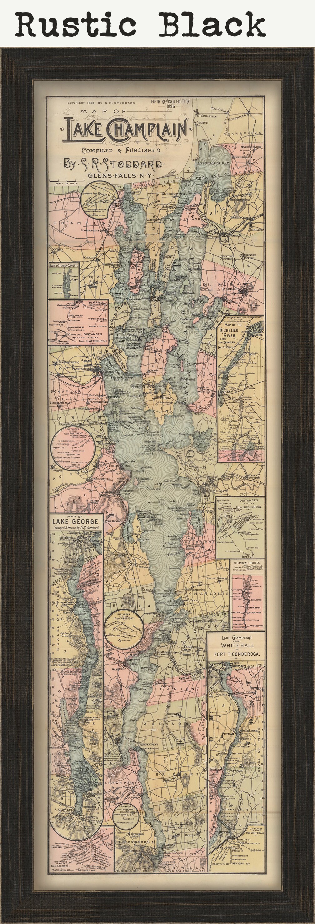
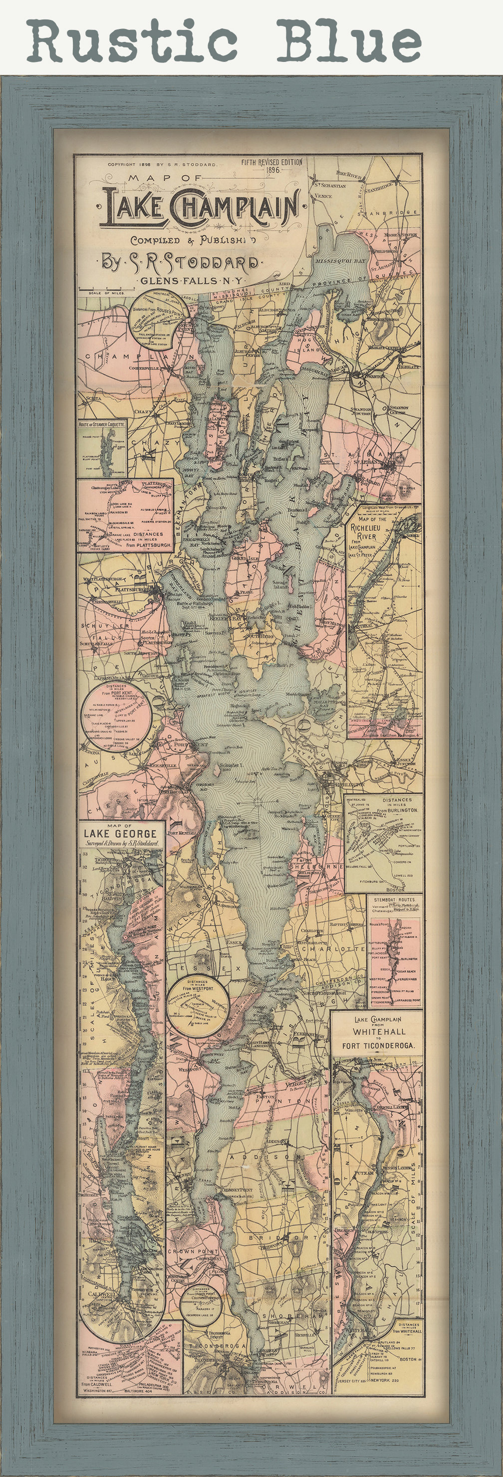
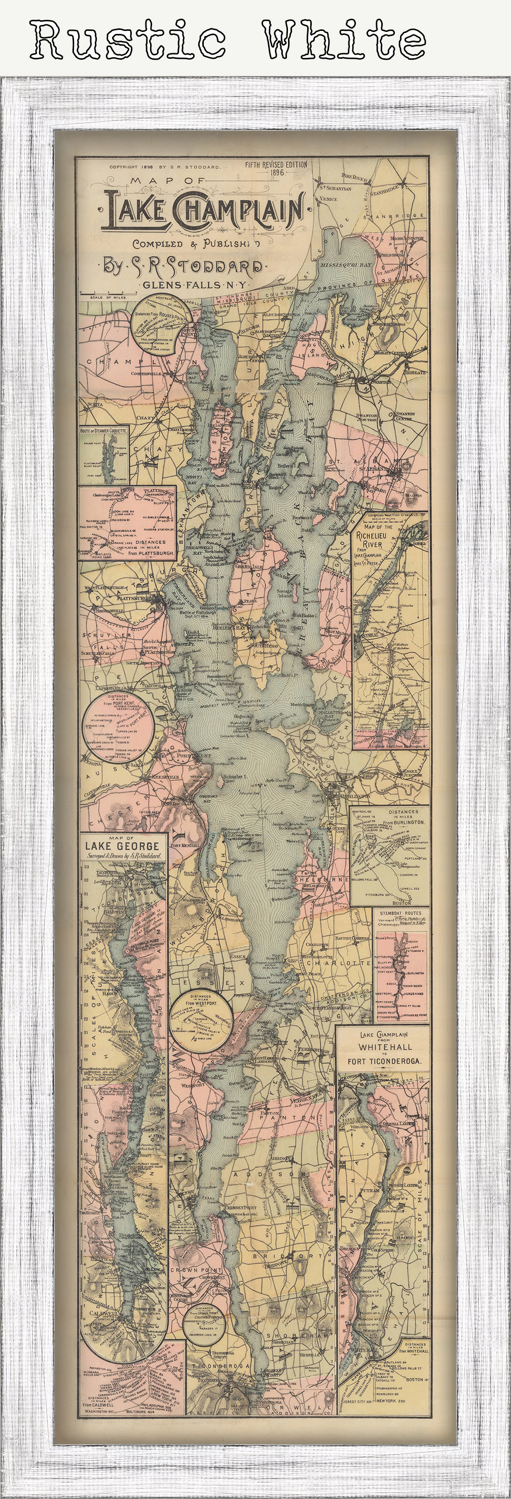

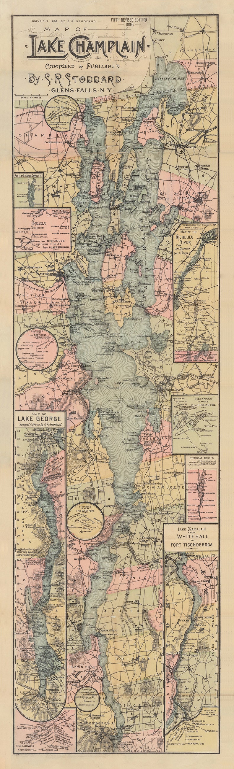
LAKE CHAMPLAIN and Lake GEORGE, Vermont/New York 1896 Map
$37.00
A reproduction of a map of LAKE CHAMPLAIN and LAKE GEORGE, Vermont and New York published in 1896 by S. R. Stoddard. A Victoria era map with so much detail. Lake Champlain is a natural freshwater lake in North America mainly within the borders of the United States but partially situated across the Canada–U.S. border, in the Canadian province of Quebec.
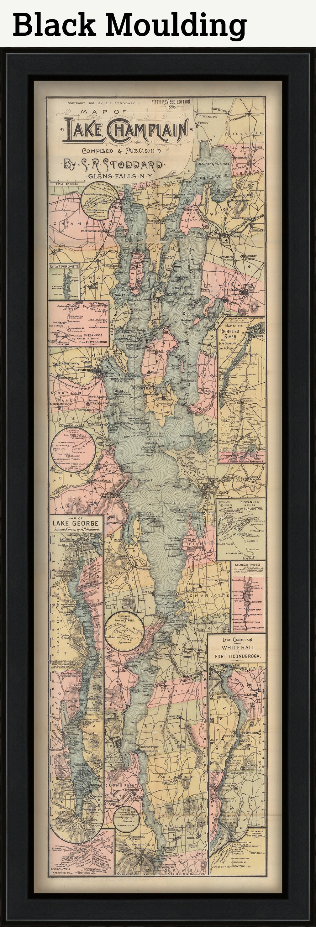
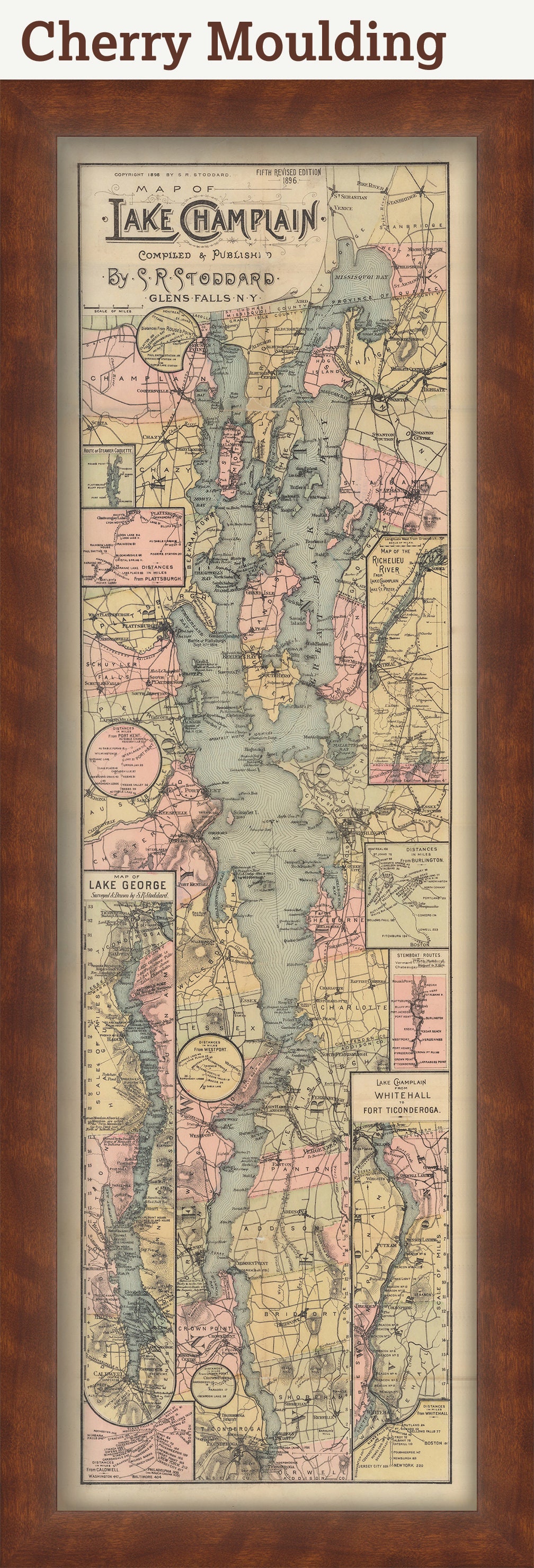
Framed maps include dry mounting, UV filtering glass, and your choice of mouldings, wired and ready to hang upon delivery. All mouldings are approximately 1.5" wide. Please factor in an additional 3" to the listed size for framed items.
Custom sizes are available. If you are interested in a custom size, please let us know through the "ask a question" button in this listing.
Retailers who would like to carry our Maps, please contact us through the "ask a question" button in this listing, for information and discounts.
0999
Shipping from United States
Processing time
1-3 business days
Customs and import taxes
Buyers are responsible for any customs and import taxes that may apply. I'm not responsible for delays due to customs.
Payment Options
Returns & Exchanges
Returns & exchanges not accepted
But please contact me if you have problems with your order
I gladly accept cancellations
Request a cancellation within: 1 hours of purchase
Reviews (18)
Average:
Feb 27, 2025
I was so happy with this framed map that I just ordered another one!
Greg Heinemann
Dec 20, 2024
Beautiful map of Lake Champlain. Highly recommend.
Becky Pfeil
Jul 16, 2024
Erich
Apr 11, 2024
Perfect for our camp on Lake Champlain
wendy comar
Mar 23, 2024
John