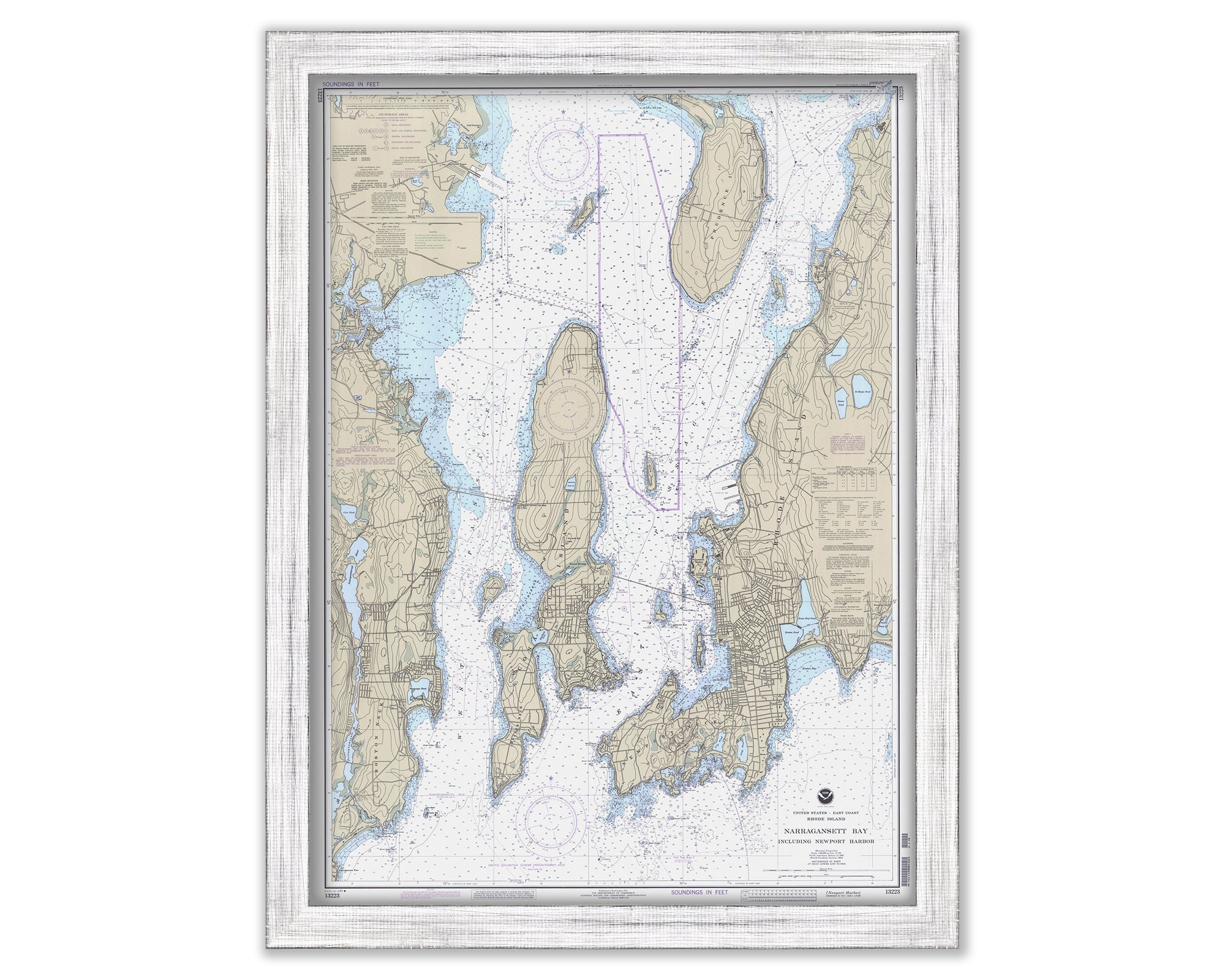
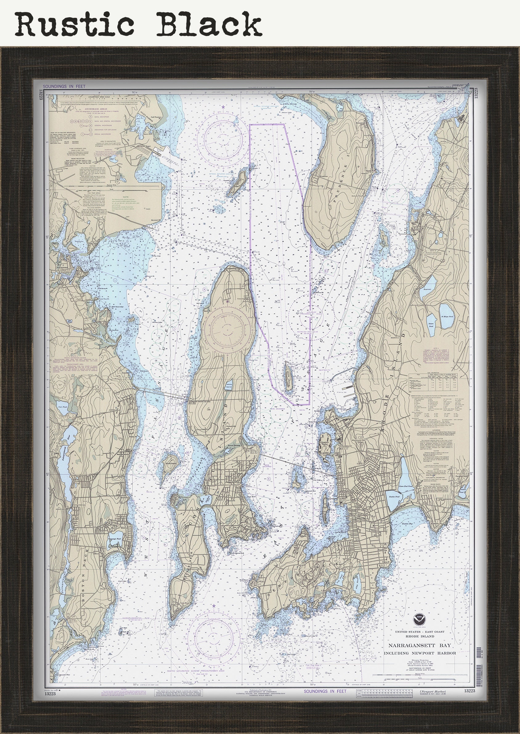
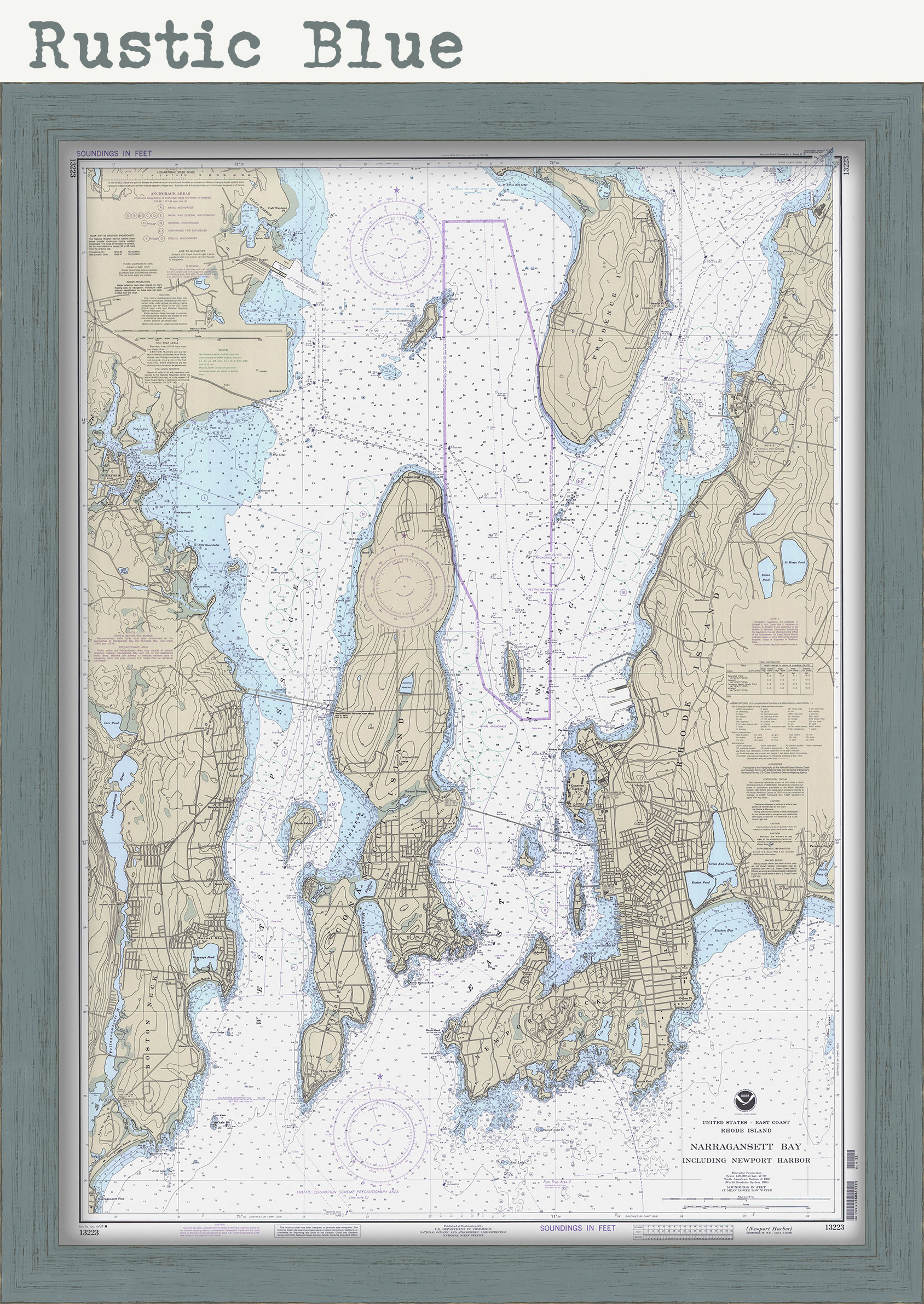
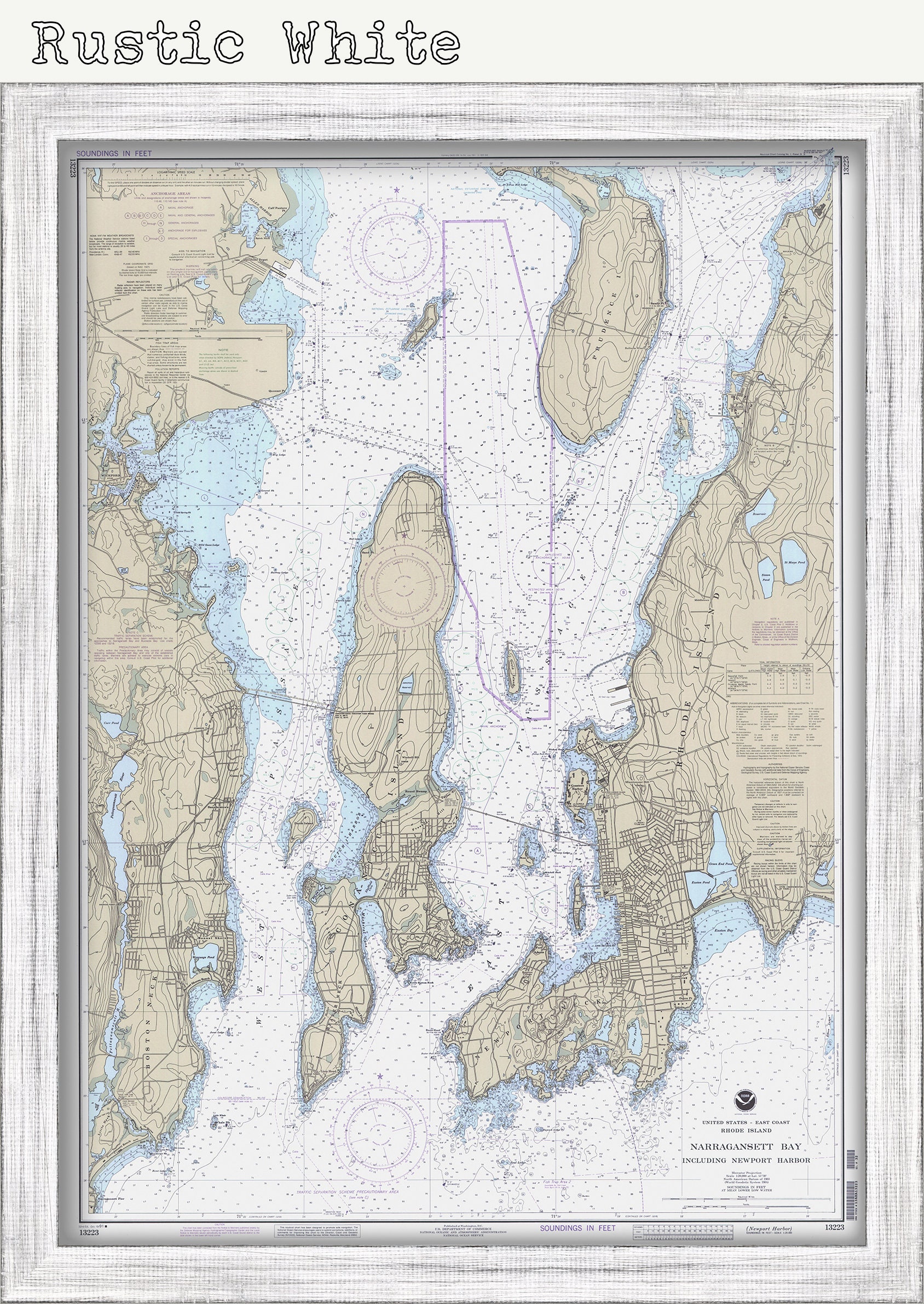
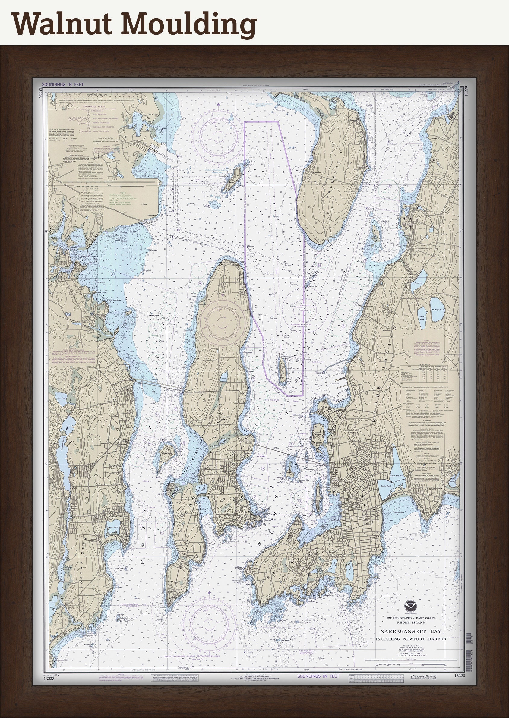
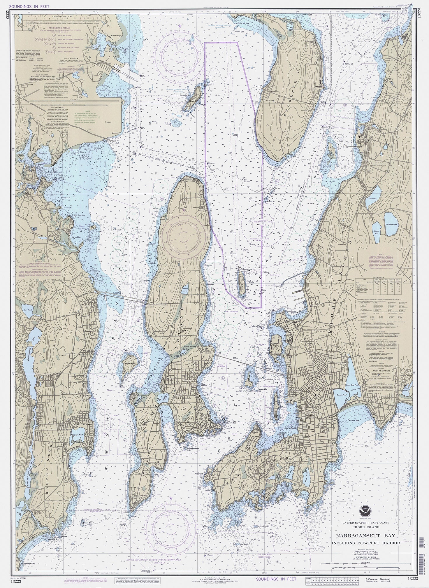
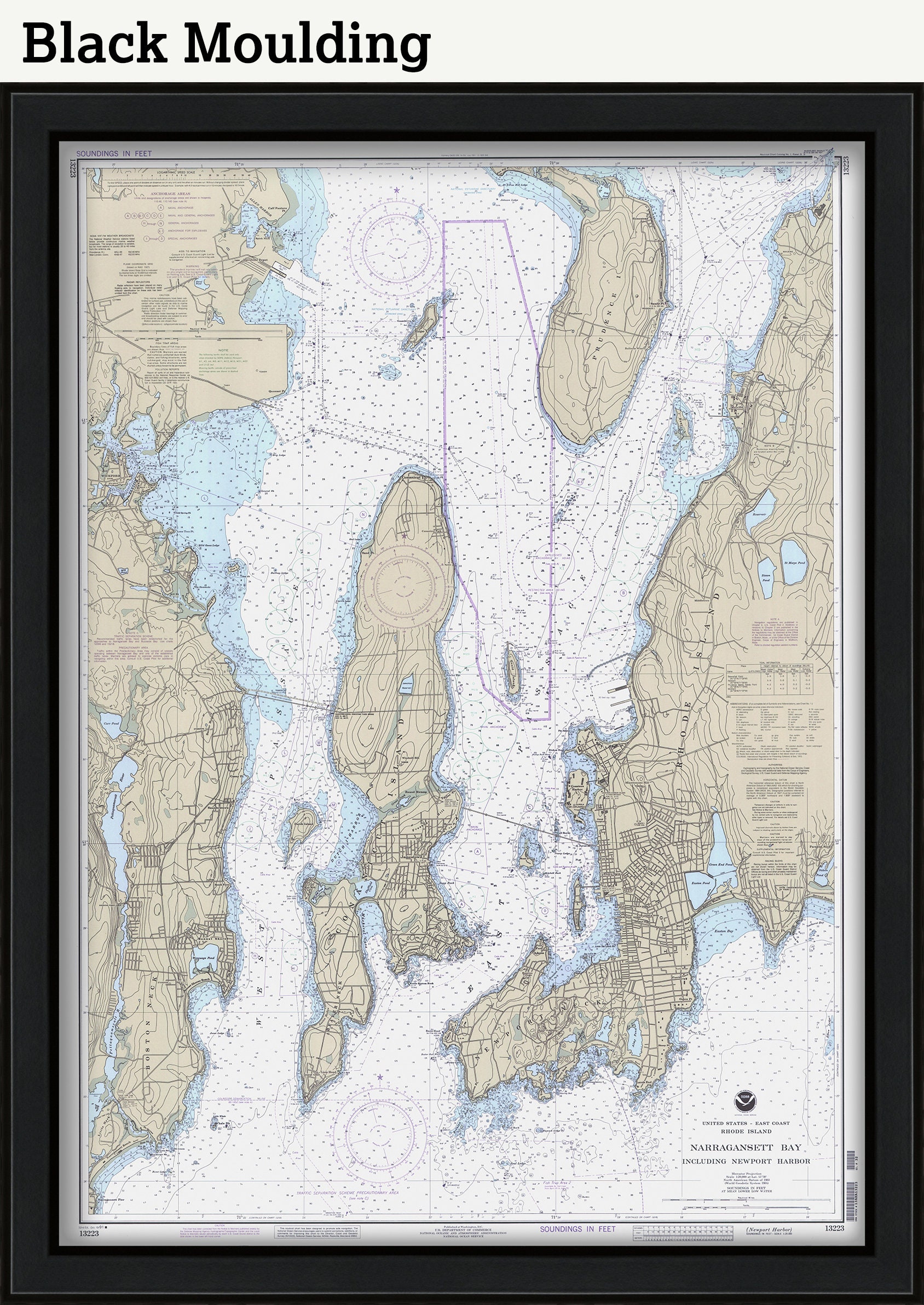
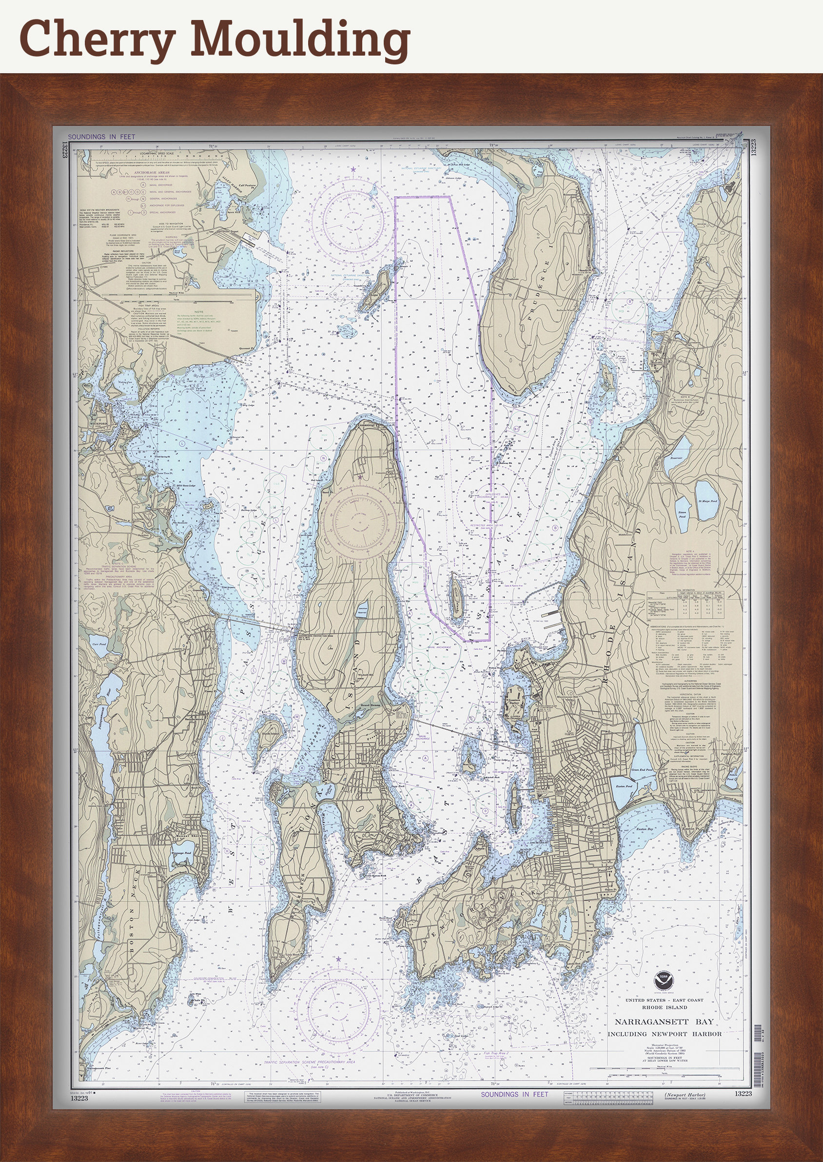
Narragansett Bay and Newport Harbor, Rhode Island - Nautical Chart by NOAA 1991
$44.00
A Nautical Chart of Narragansett Bay and Newport Harbor, Rhode Island - Nautical Chart by NOAA 1991.
This MAP is printed on heavy matte fine art paper with archival inks.
Framed replica maps include dry mounting, UV filtering glass, and your choice of six mouldings, wired and ready to hang upon delivery. All mouldings are approximately 1.5" wide. Please factor in an additional 3" to the listed size for framed items.
Custom sizes are available. If you are interested in a custom size, please let us know through the "ask a question" button in this listing.
In 1807, President Thomas Jefferson signed a bill for the "Survey of the Coast," thus establishing the United States Coast Survey. In its early decades, the Coast Survey was responsible for charting the coastlines. In 1970 the Coast Survey became part of NOAA.
Retailers who would like to carry our Maps, please contact us through the "ask a question" button in this listing, for information and discounts.
1165
Shipping from United States
Processing time
1-3 business days
Customs and import taxes
Buyers are responsible for any customs and import taxes that may apply. I'm not responsible for delays due to customs.
Payment Options
Returns & Exchanges
Returns & exchanges not accepted
But please contact me if you have problems with your order
I gladly accept cancellations
Request a cancellation within: 1 hours of purchase
Reviews (7)
Average:
Jun 20, 2024
Beautiful chart, nicely framed, thank you!!
Nancy Ricci
Nov 19, 2023
I loved the ones I ordered for myself so much that I ordered more to give as Christmas gifts this year!
Sam
Oct 20, 2023
Love this item exactly what I was looking for for my living room
Sam
Jan 5, 2023
Mindy Fitz
Nov 24, 2021
Just as described. Beautiful piece.
Elizabeth Hagerty