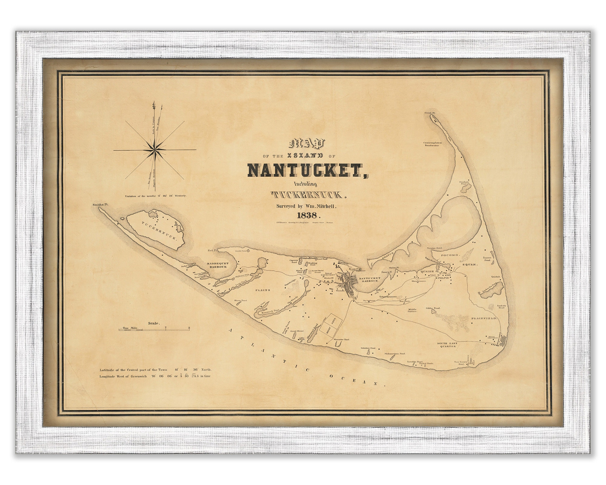
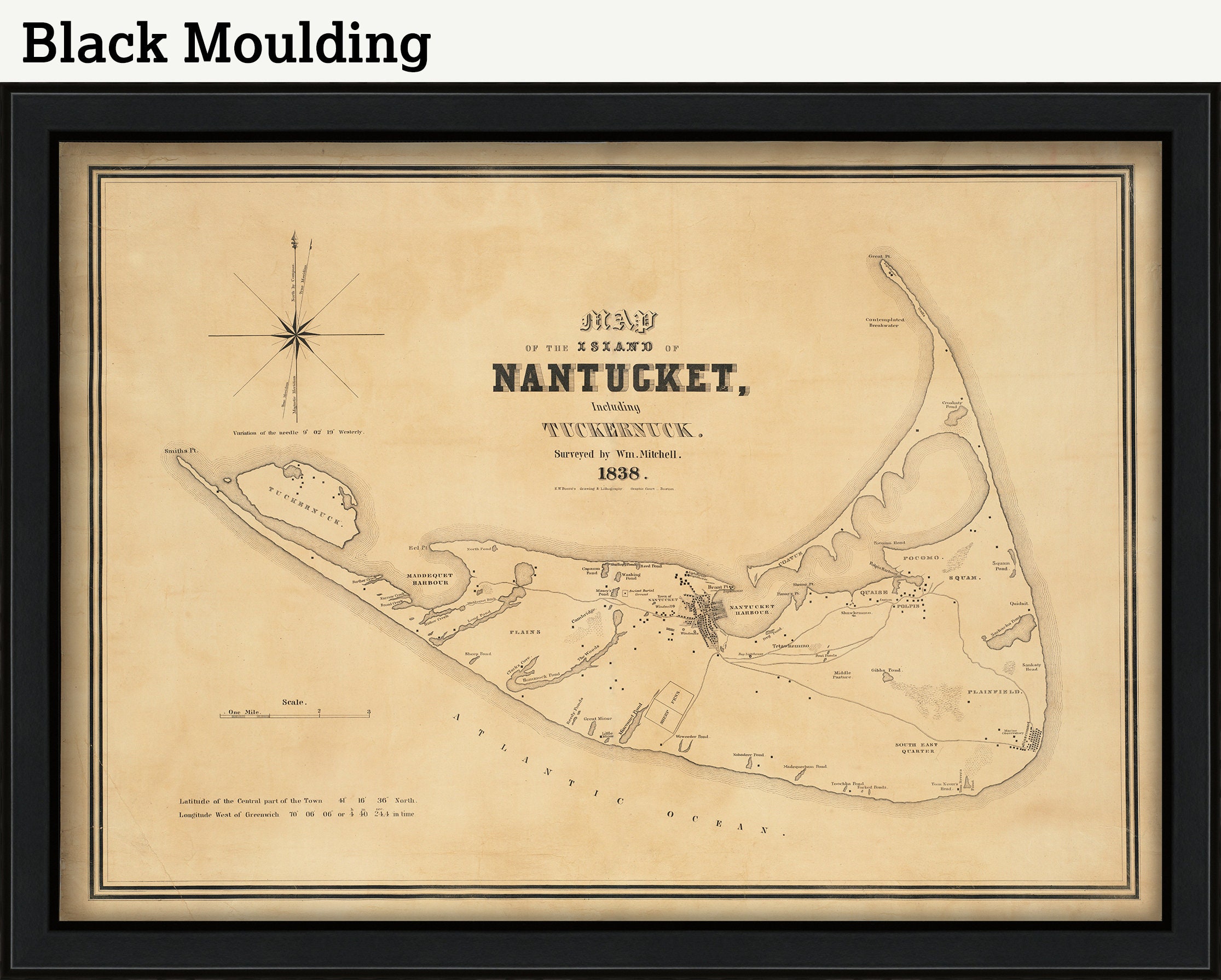
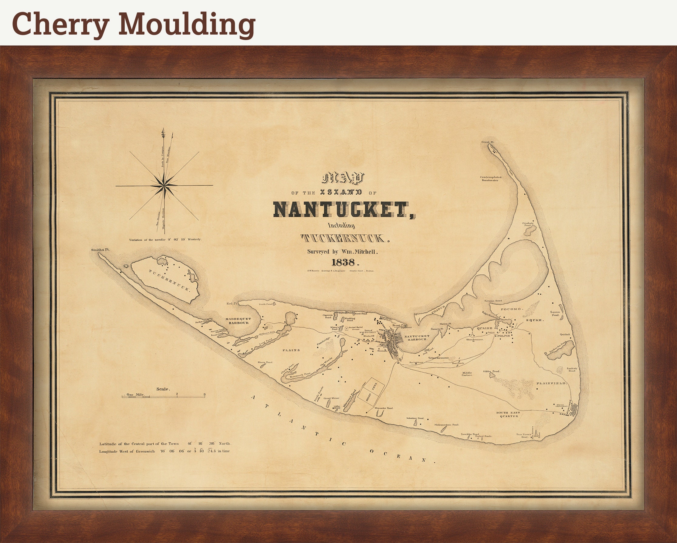
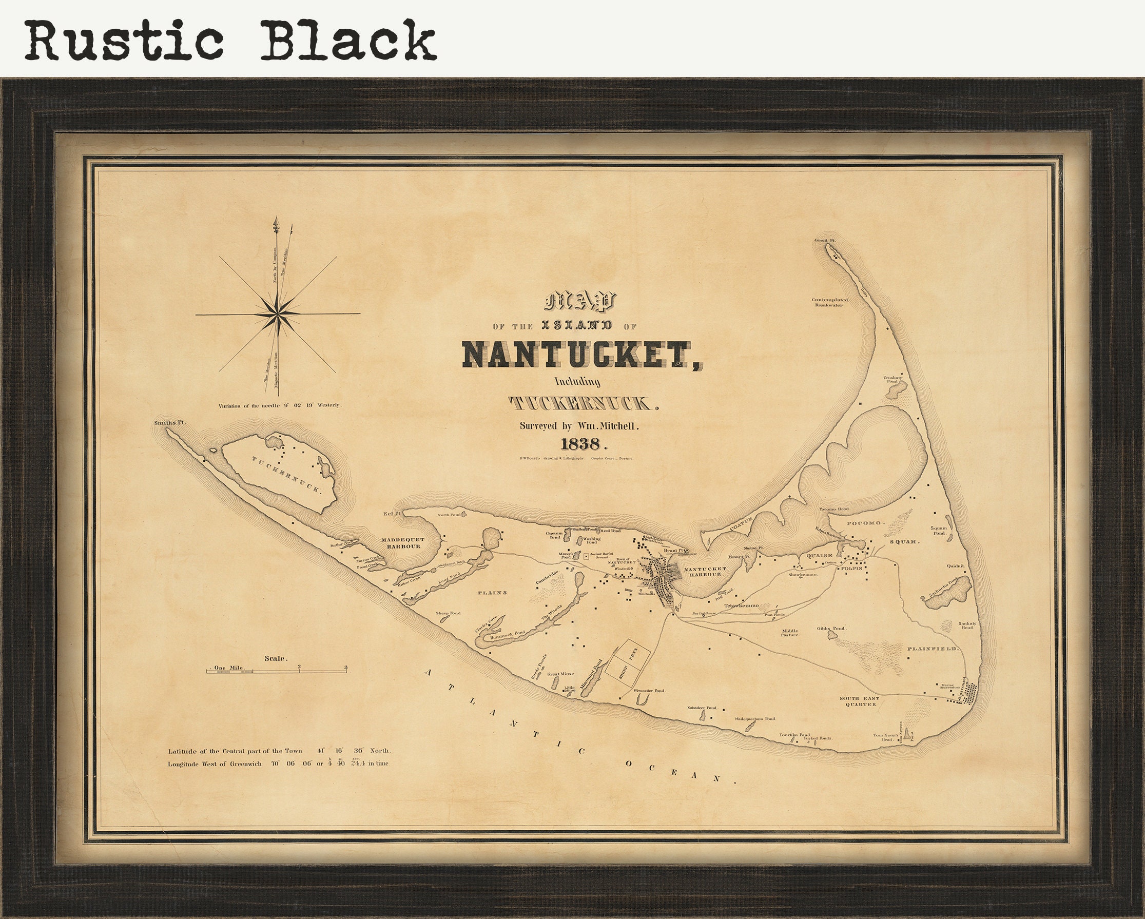
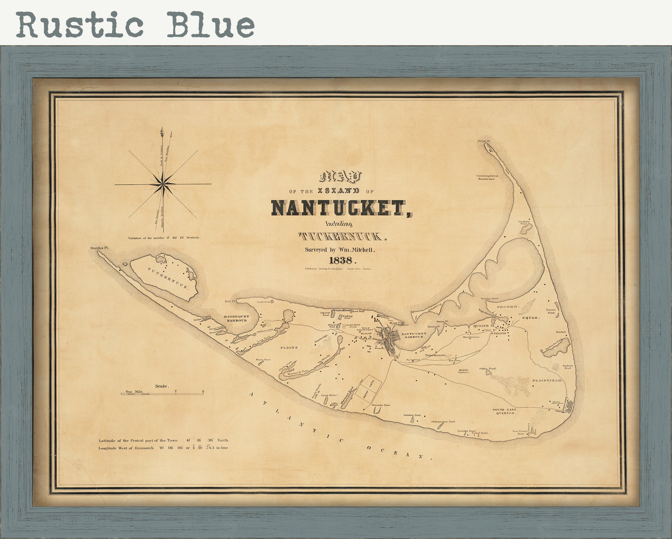
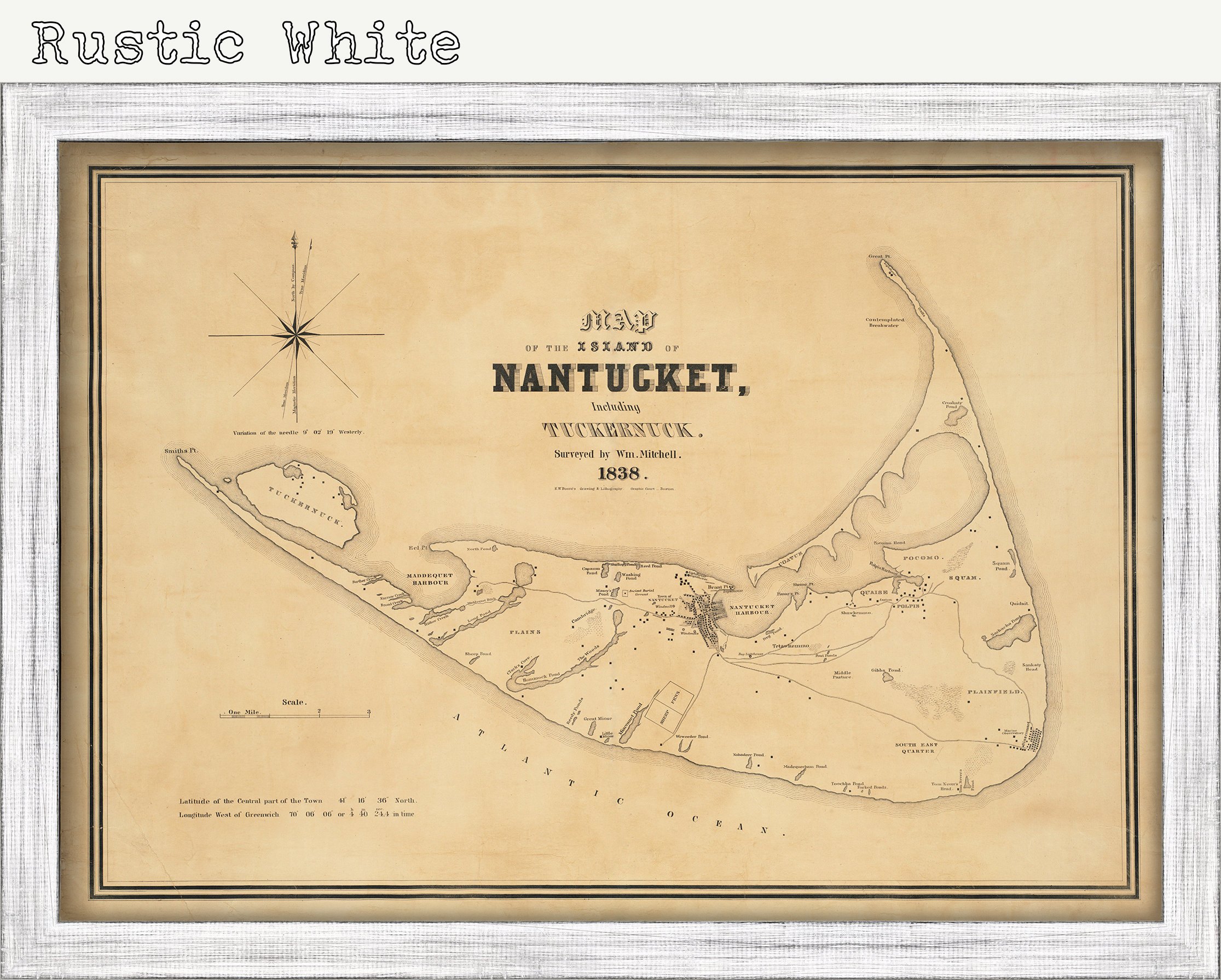
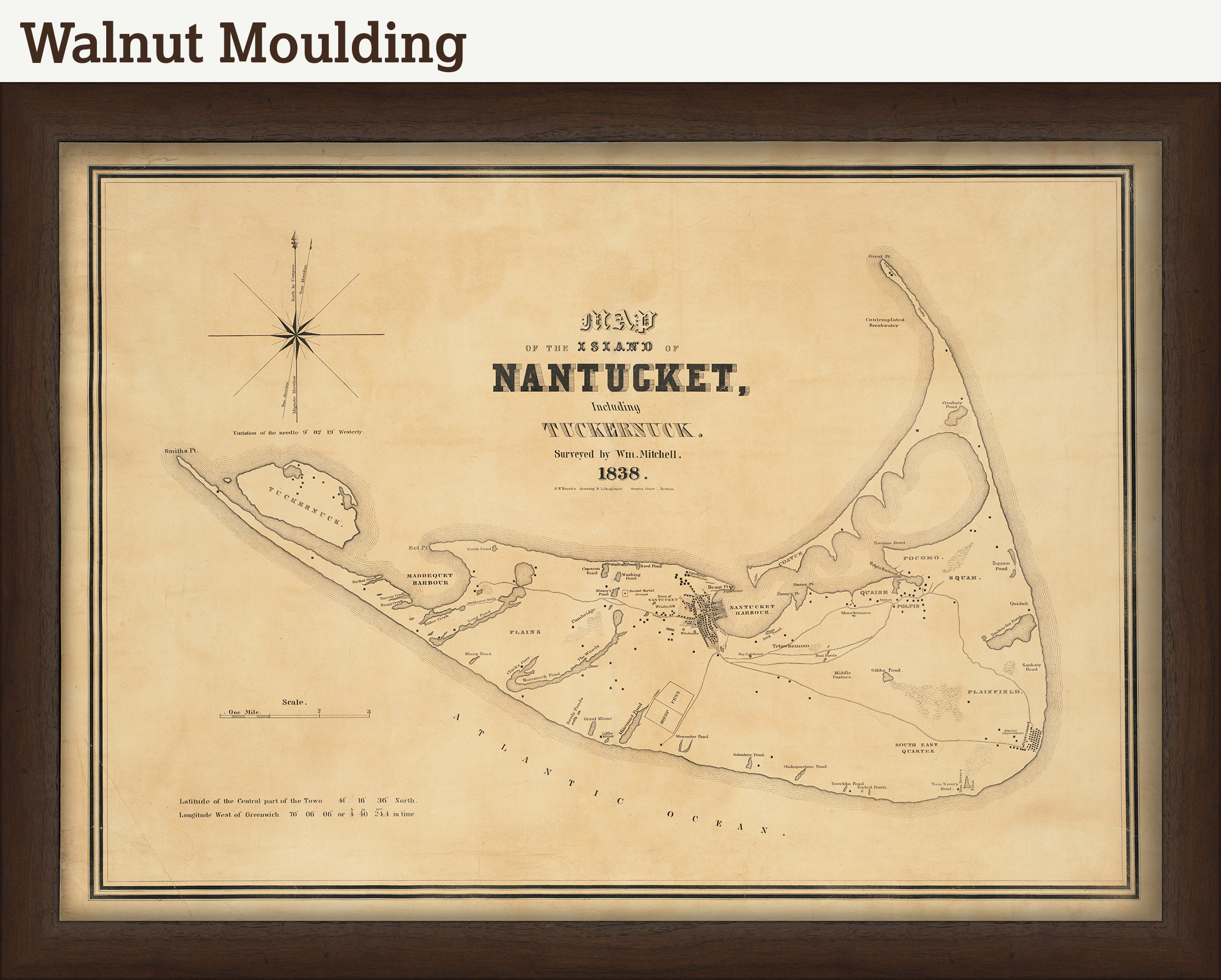
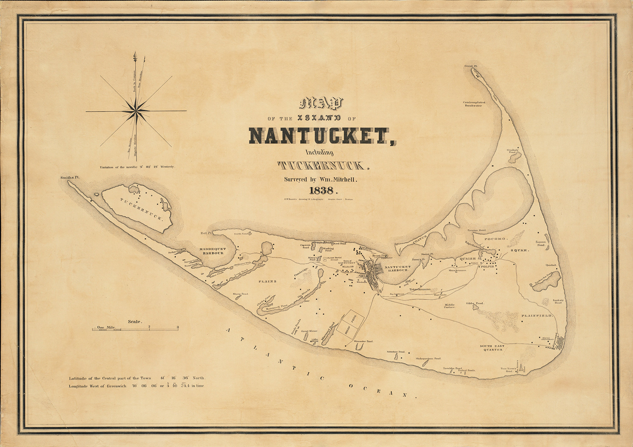
A reproduction of a Map of NANTUCKET ISLAND from 1838 by the William Mitchell. Drawn by Nantucket astronomer and mathematician William Mitchell (1791-1868), the map depicts the island’s complex coastline, major topographical features, roads, and residences. Landmarks include windmills, lighthouses, and a “contemplated breakwater” by Great Point.
This Map is printed on heavy matte fine art paper with archival inks.
CUSTOM FRAMING IS AVAILABLE
Framed maps include drymounting, UV filtering glass, and your choice of six mouldings, wired and ready to hang upon delivery. All mouldings are approximately 1.5" wide. Please factor in an additional 3" to the listed size for framed items.
All sizes are approximate, we round up or down to the nearest inch.
Custom sizes are available. If you are interested in a custom size, please let us know through the "ask a question" button in this listing.
Retailers who would like to carry our Maps, please contact us through the "ask a question" button in this listing, for information and discount.
1360
Shipping from United States
Processing time
1-3 business days
Customs and import taxes
Buyers are responsible for any customs and import taxes that may apply. I'm not responsible for delays due to customs.
Payment Options
Returns & Exchanges
Returns & exchanges not accepted
But please contact me if you have problems with your order
I gladly accept cancellations
Request a cancellation within: 1 hours of purchase