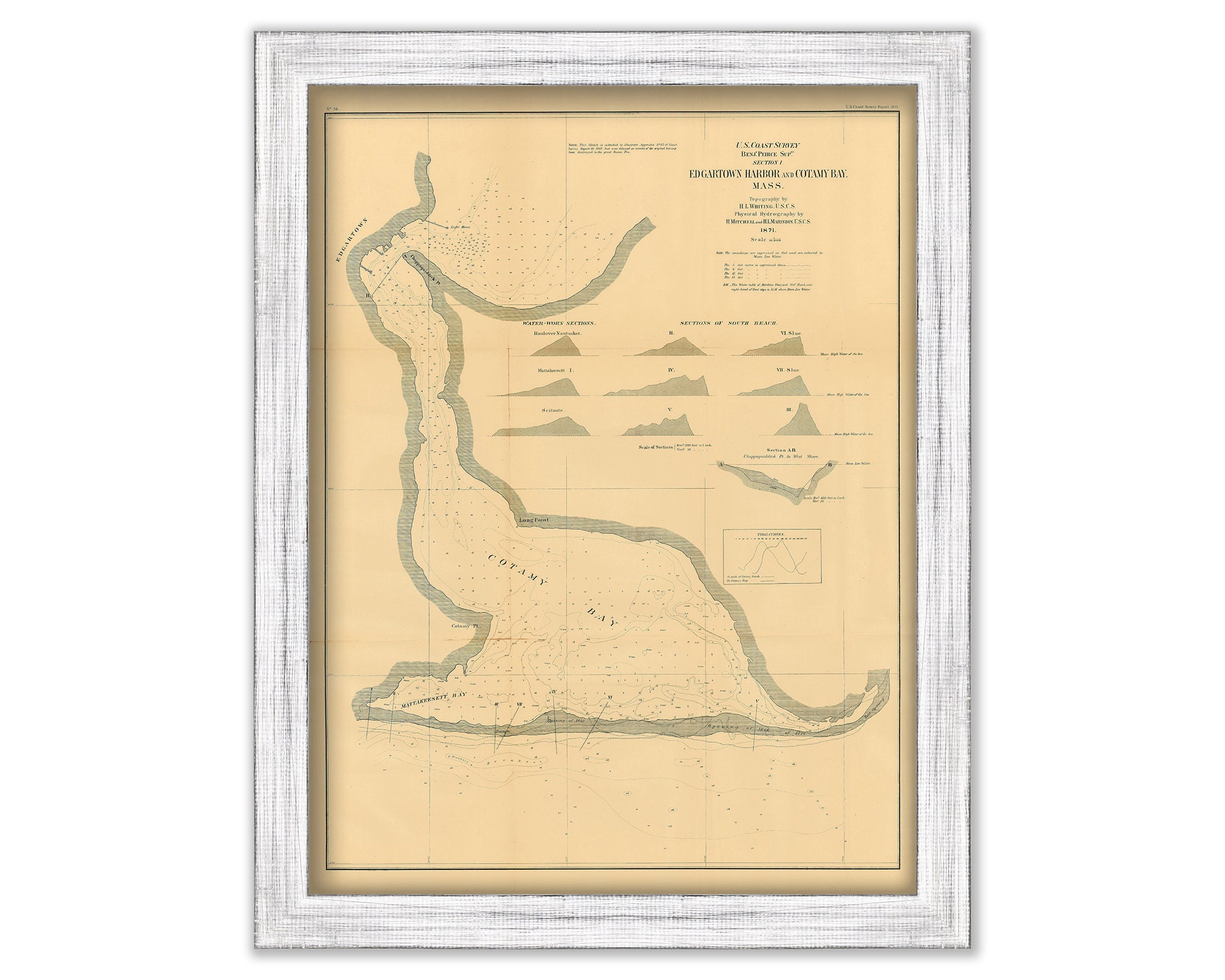
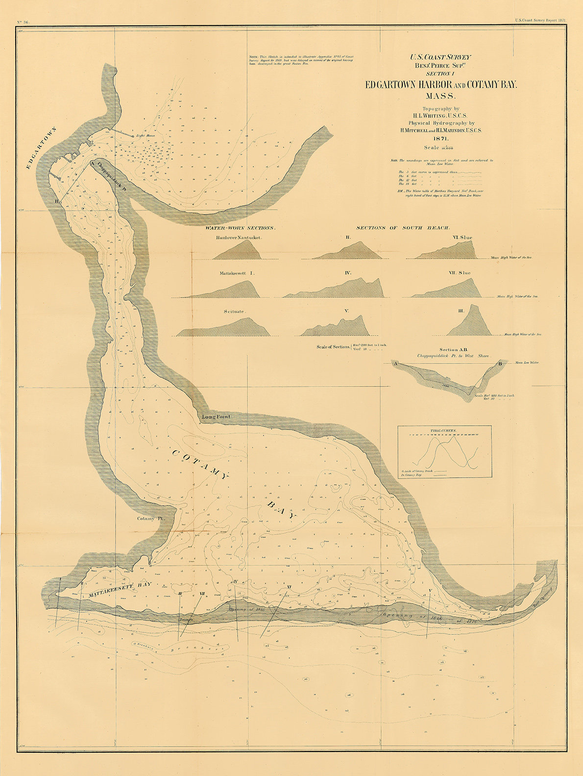
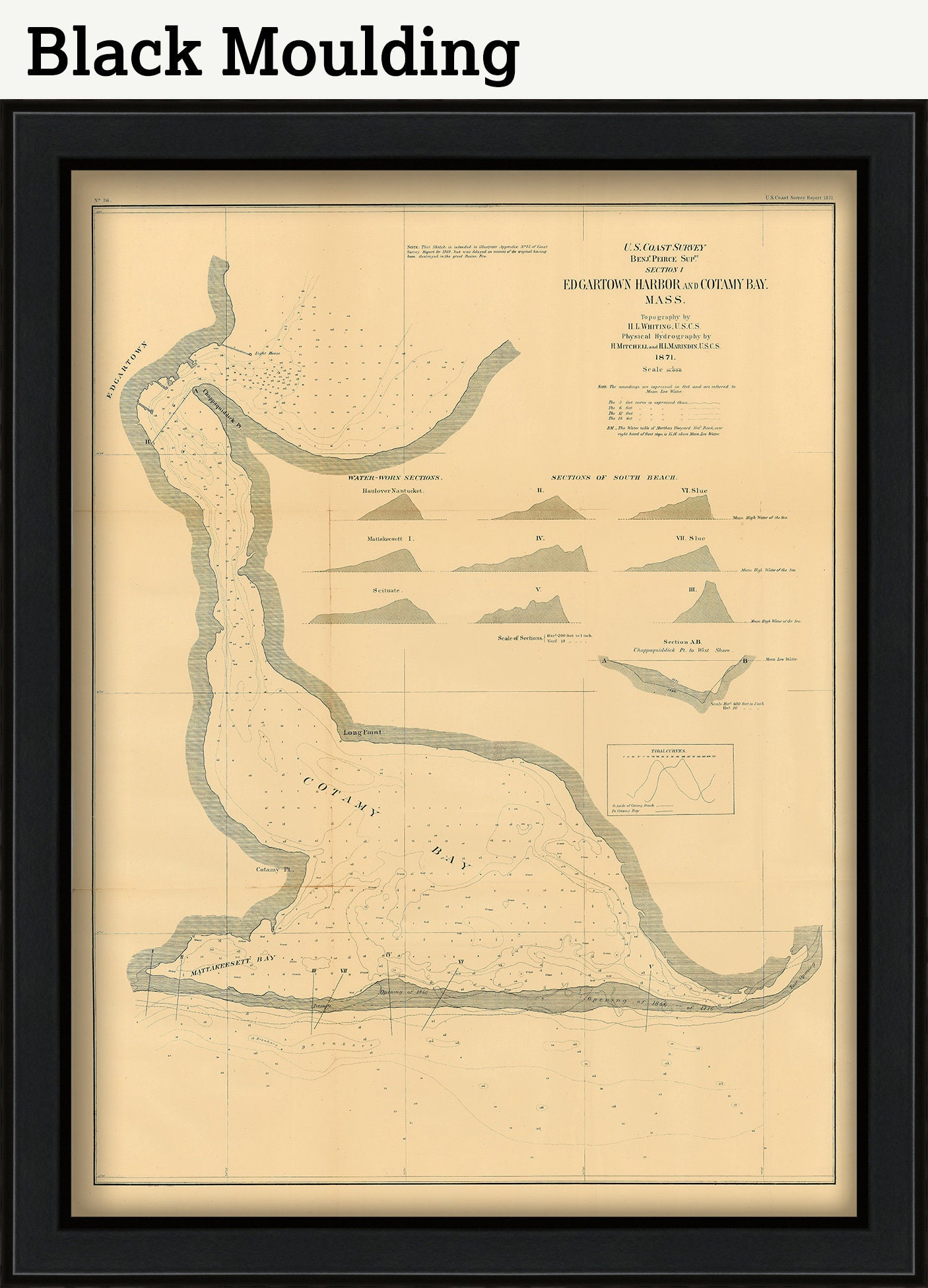
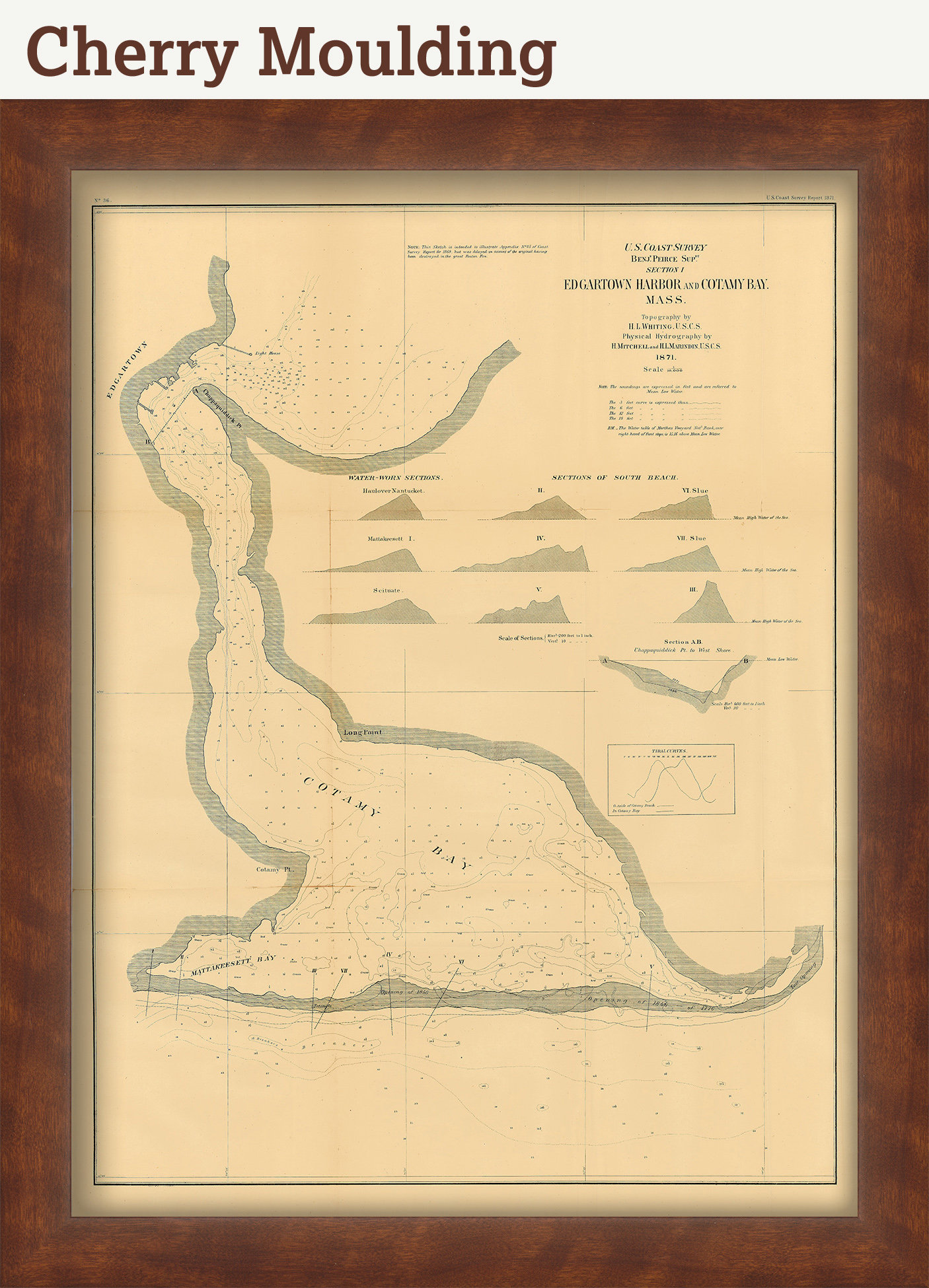
Edgartown Harbor and Cotemy Bay, Martha's Vineyard, Massachusetts 1871 Nautical Chart
$44.00
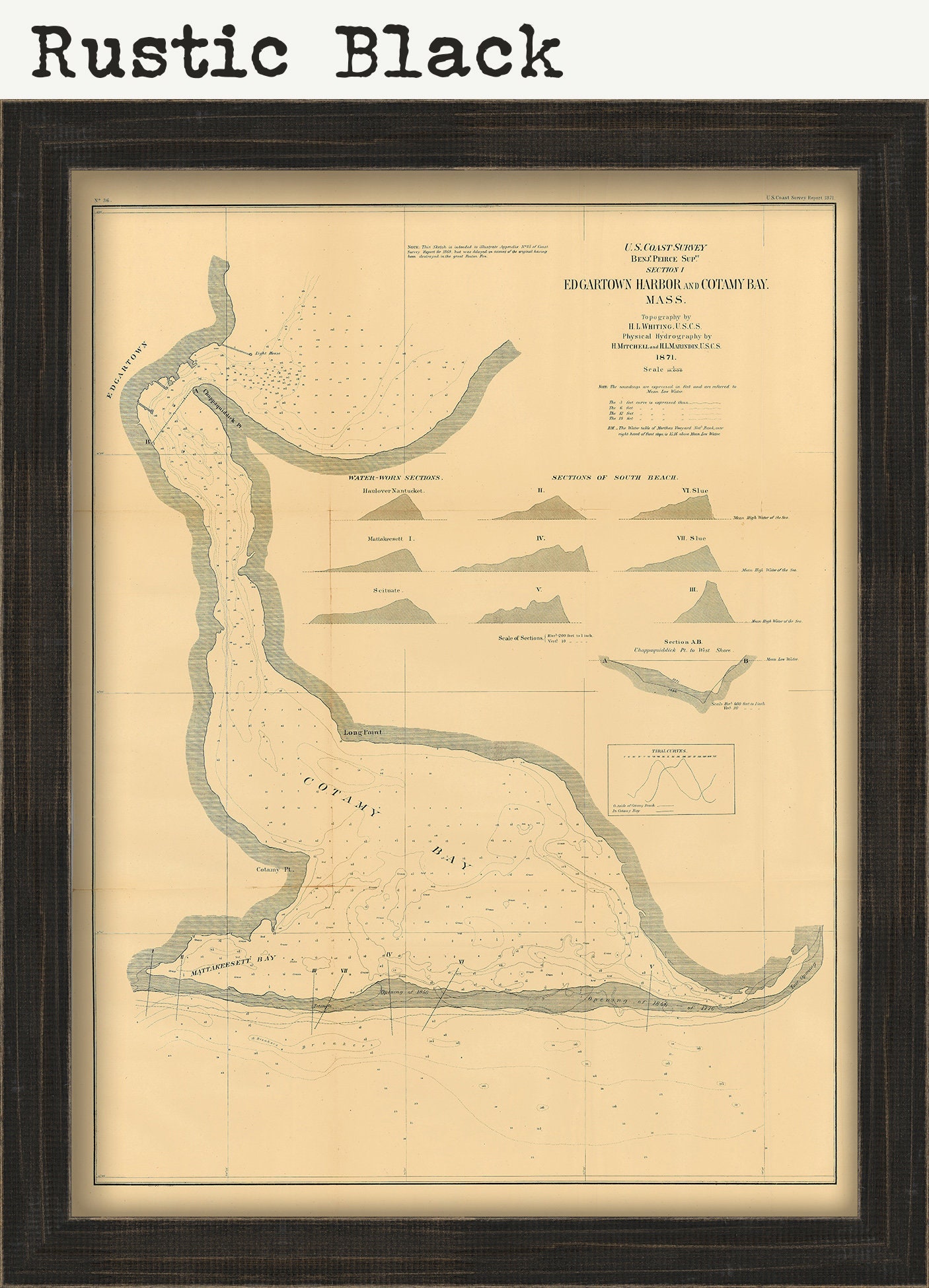
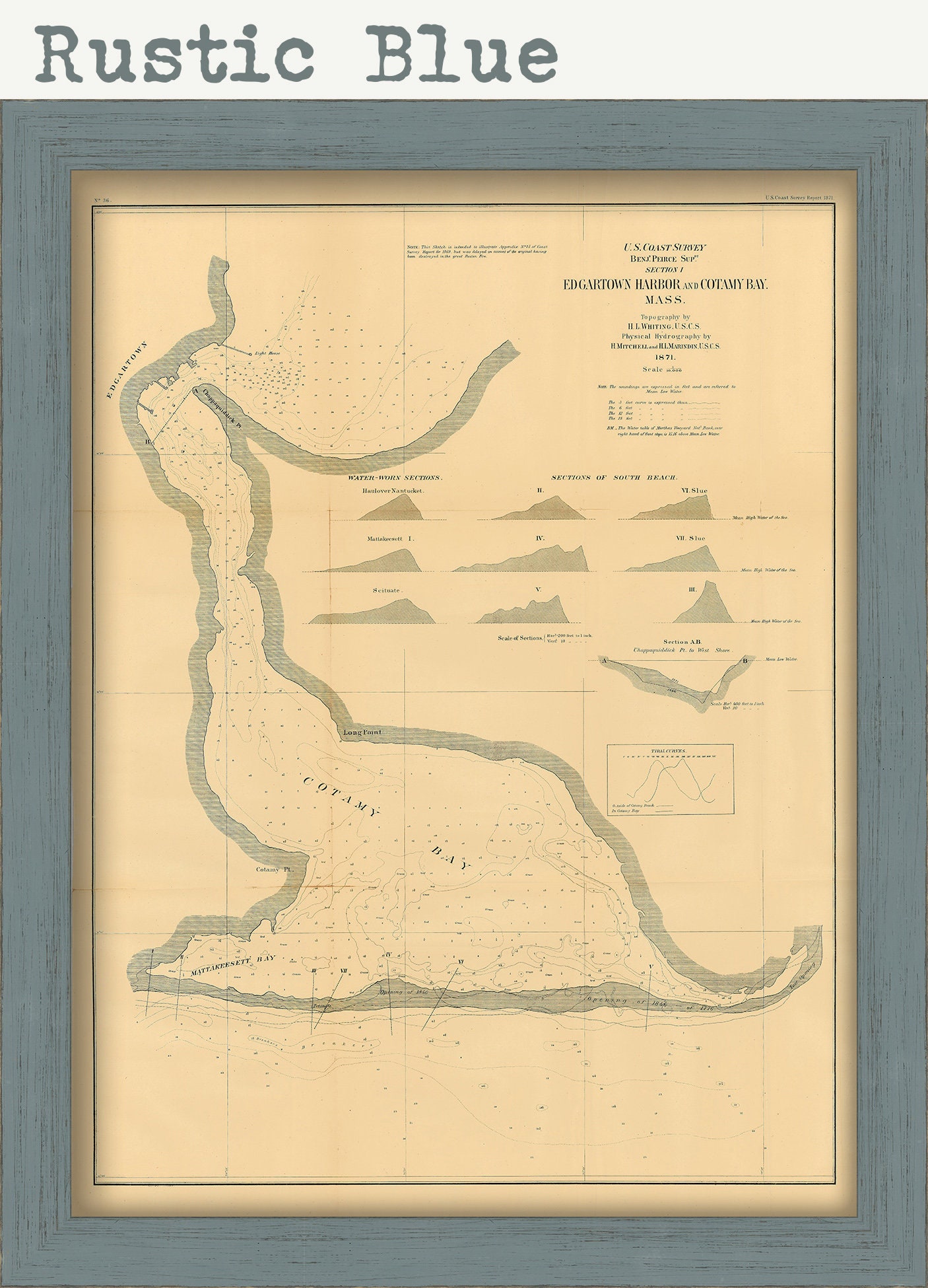
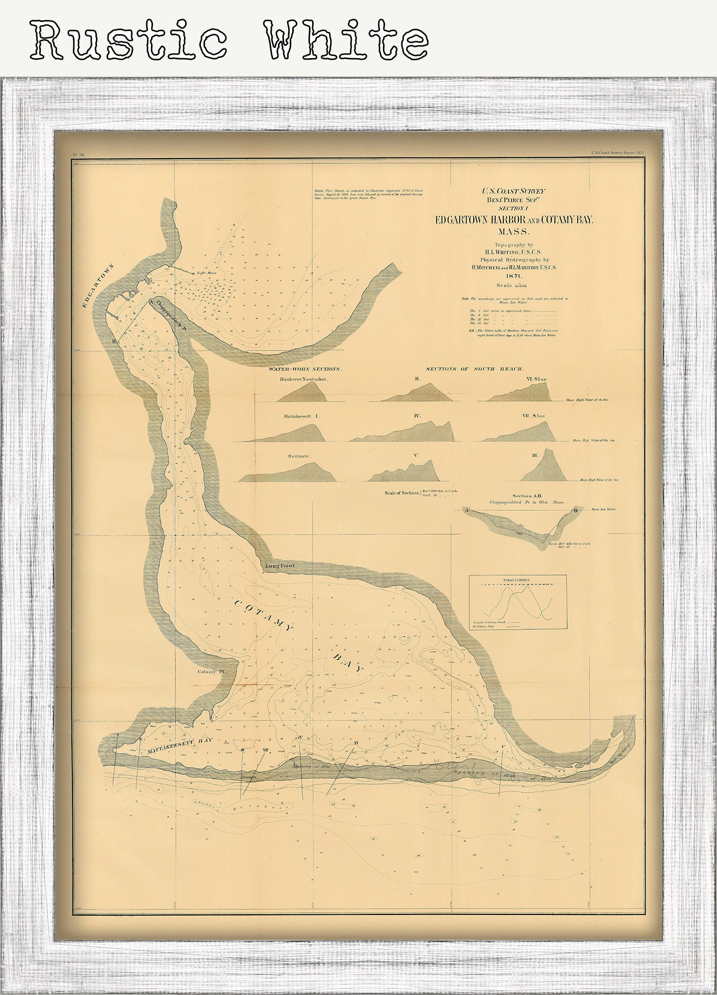
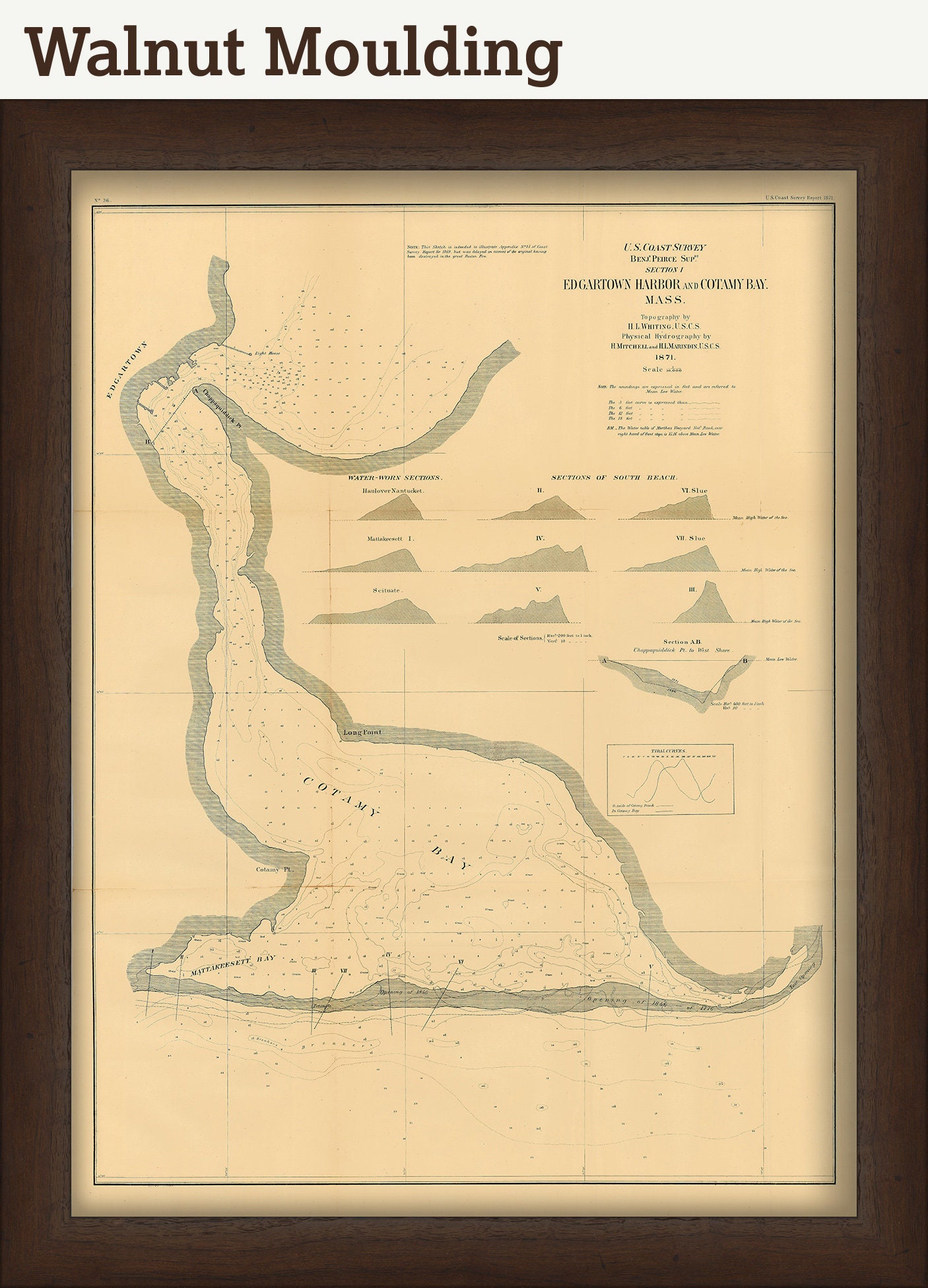
A Reproduction of a nautical chart of Edgartown Harbor and Cotemy Bay, Martha's Vineyard, Massachusetts published in 1871 by the U.S. Coast Survey. This chart shows topography, water depths, and nautical features. In 1807, President Thomas Jefferson signed a bill for the "Survey of the Coast," thus establishing the United States Coast Survey. In its early decades, the Coast Survey was responsible for charting the coastlines. In 1970 NOAA was established, bringing C&GS into the new scientific agency. Today, the Office of Coast Survey continues its traditional commitment to employing the highest levels of science and technology to improve marine safety and to tackle the new challenges of the 21st century.
This Chart is printed on heavy matte fine art paper with archival inks.
CUSTOM FRAMING IS AVAILABLE
Framed maps include drymounting, UV filtering glass, and your choice of six mouldings, wired and ready to hang upon delivery. All mouldings are approximately 1.5" wide. Please factor in an additional 3" to the listed size for framed items.
This map has been scanned From The ORIGINAL at 600 dpi using state of the art equipment {a Contex Large Format Scanner}. The replica map is printed on heavy matte fine art paper using archival pigment inks. This is one of over 5000 Original maps, charts, and posters in our collection.
Many reproduction maps that are available on Etsy are taken directly from public domain sources {NY Public Library, Library of Congress, etc}. Although great for research purposes, these image files frequently suffer from poor color accuracy, lens blur, and distortion. The maps in our collection have been scanned from the ORIGINAL, flat, at high resolution and with precisely calibrated color. This allows us to prints replicas that are virtually indistinguishable from the original maps.
The original version of this map from 1871 is sold.
FRAMED ORIGINAL maps include: museum quality backing board, UV filtering glass, and your choice of mouldings, wired and ready to hang upon delivery.
All sizes are approximate, we round up or down to the nearest inch.
Custom sizes are available. If you are interested in a custom size, please let us know through the "ask a question" button in this listing.
Retailers who would like to carry our Maps, please contact us through the "ask a question" button in this listing, for information and discounts.
0840
Shipping from United States
Processing time
1-3 business days
Customs and import taxes
Buyers are responsible for any customs and import taxes that may apply. I'm not responsible for delays due to customs.
Payment Options
Returns & Exchanges
Returns & exchanges not accepted
But please contact me if you have problems with your order
I gladly accept cancellations
Request a cancellation within: 1 hours of purchase