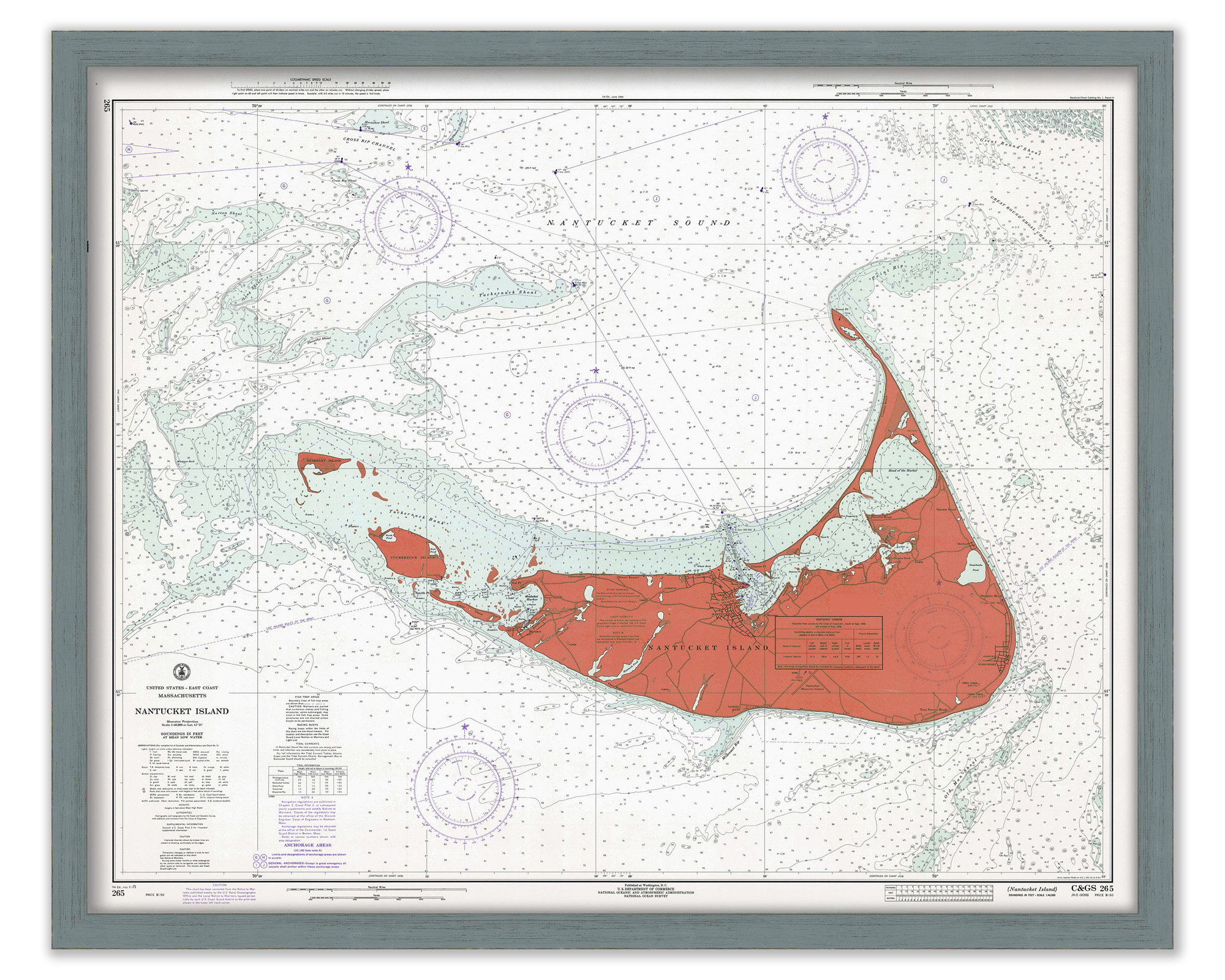
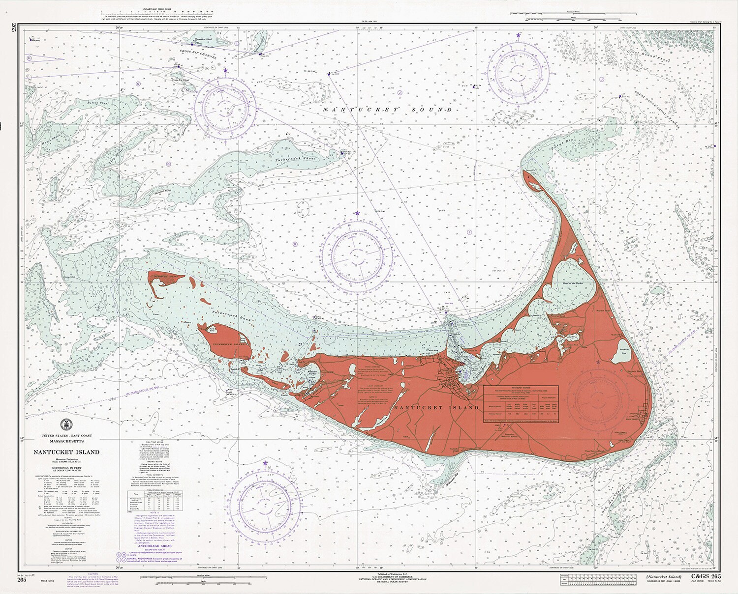

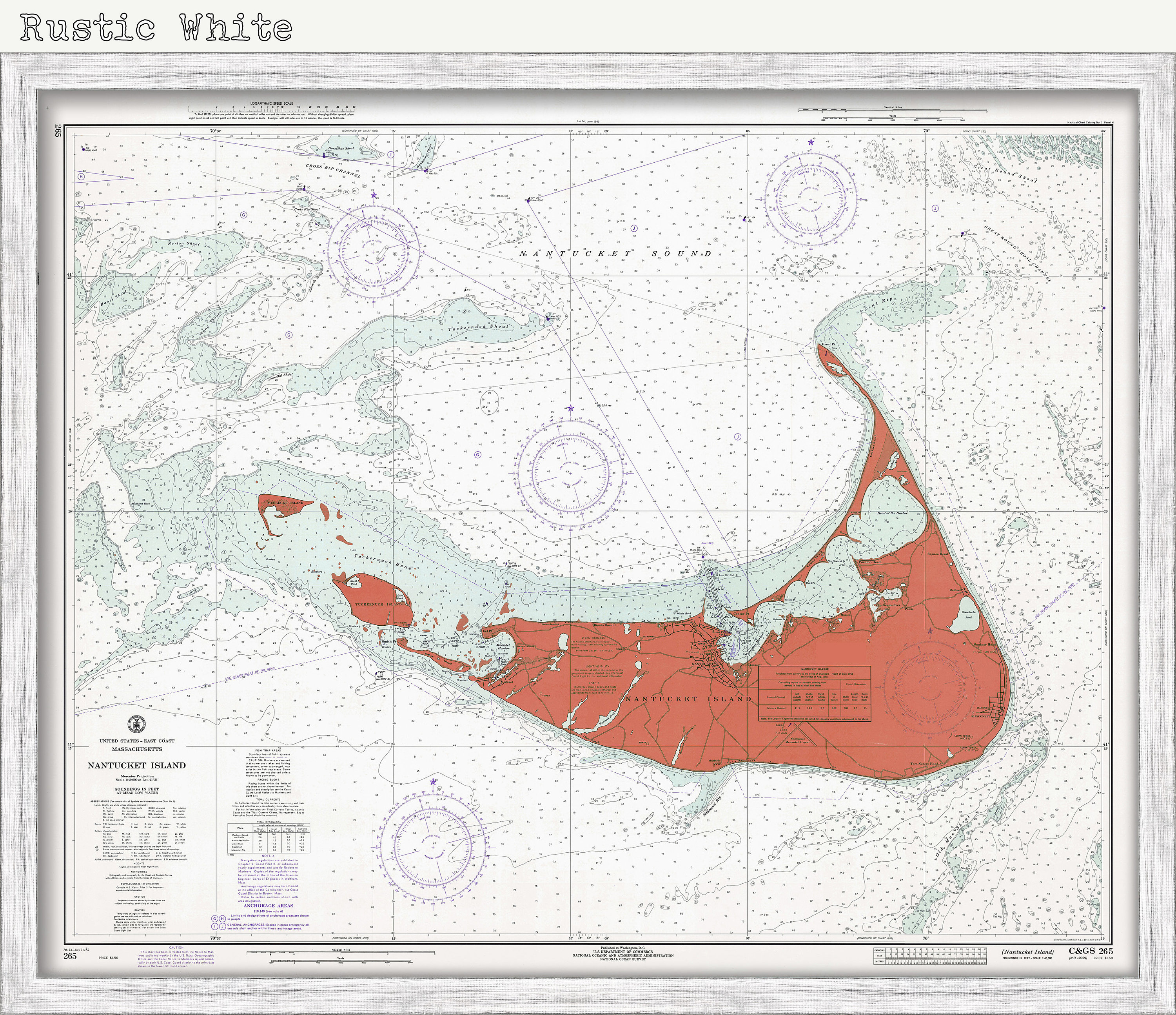

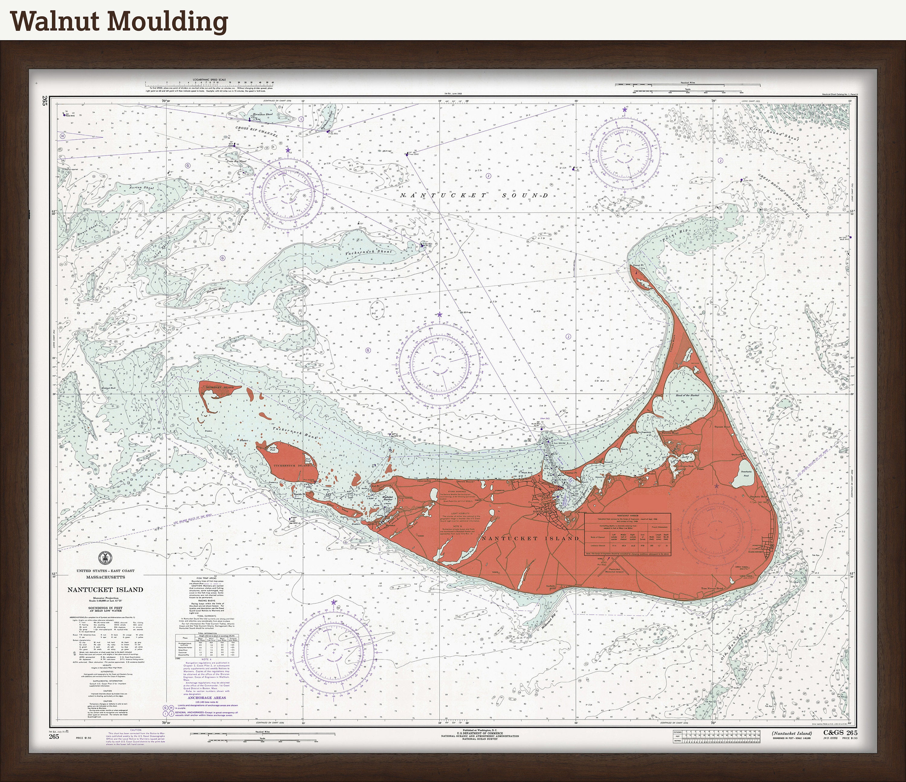
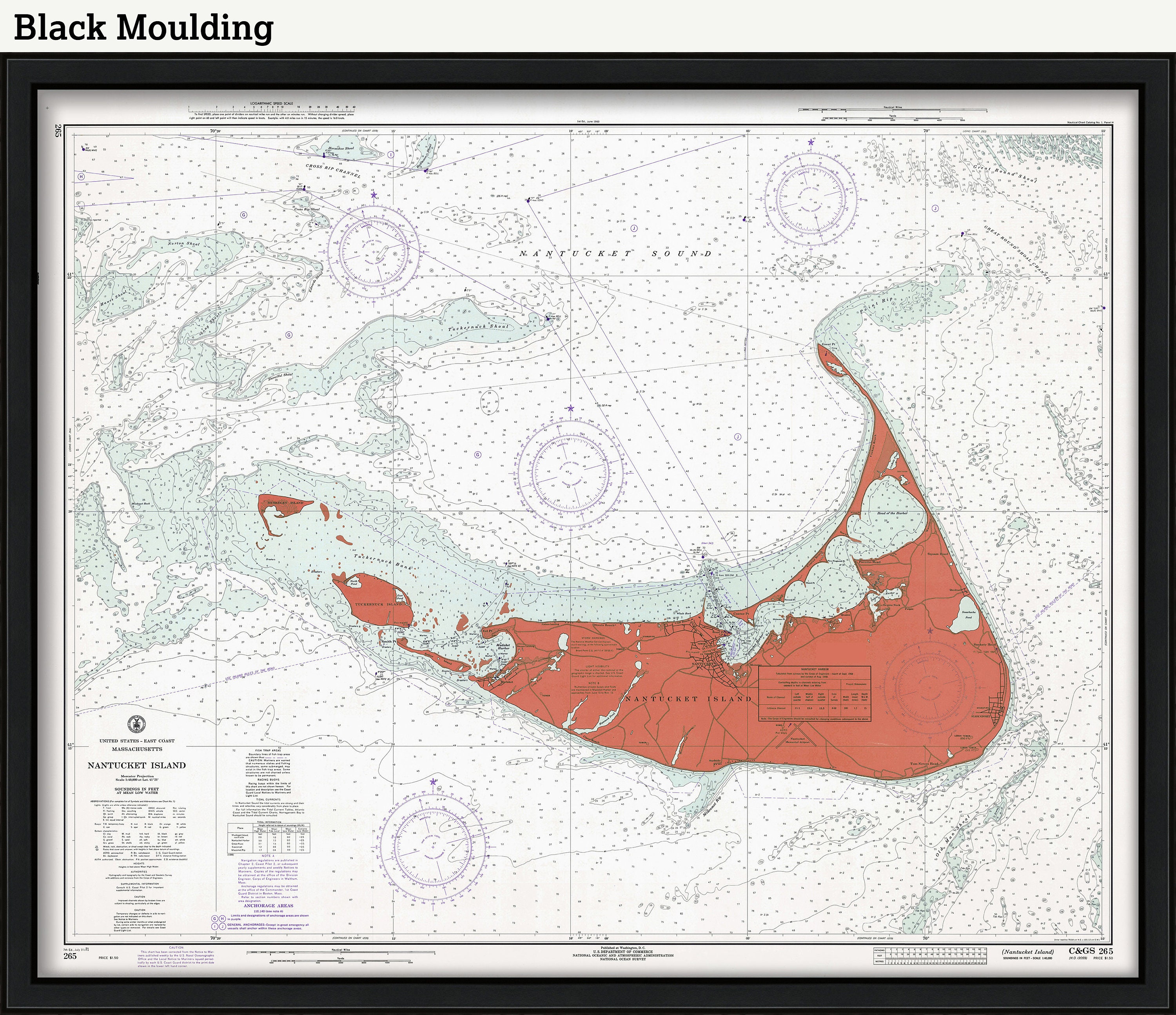
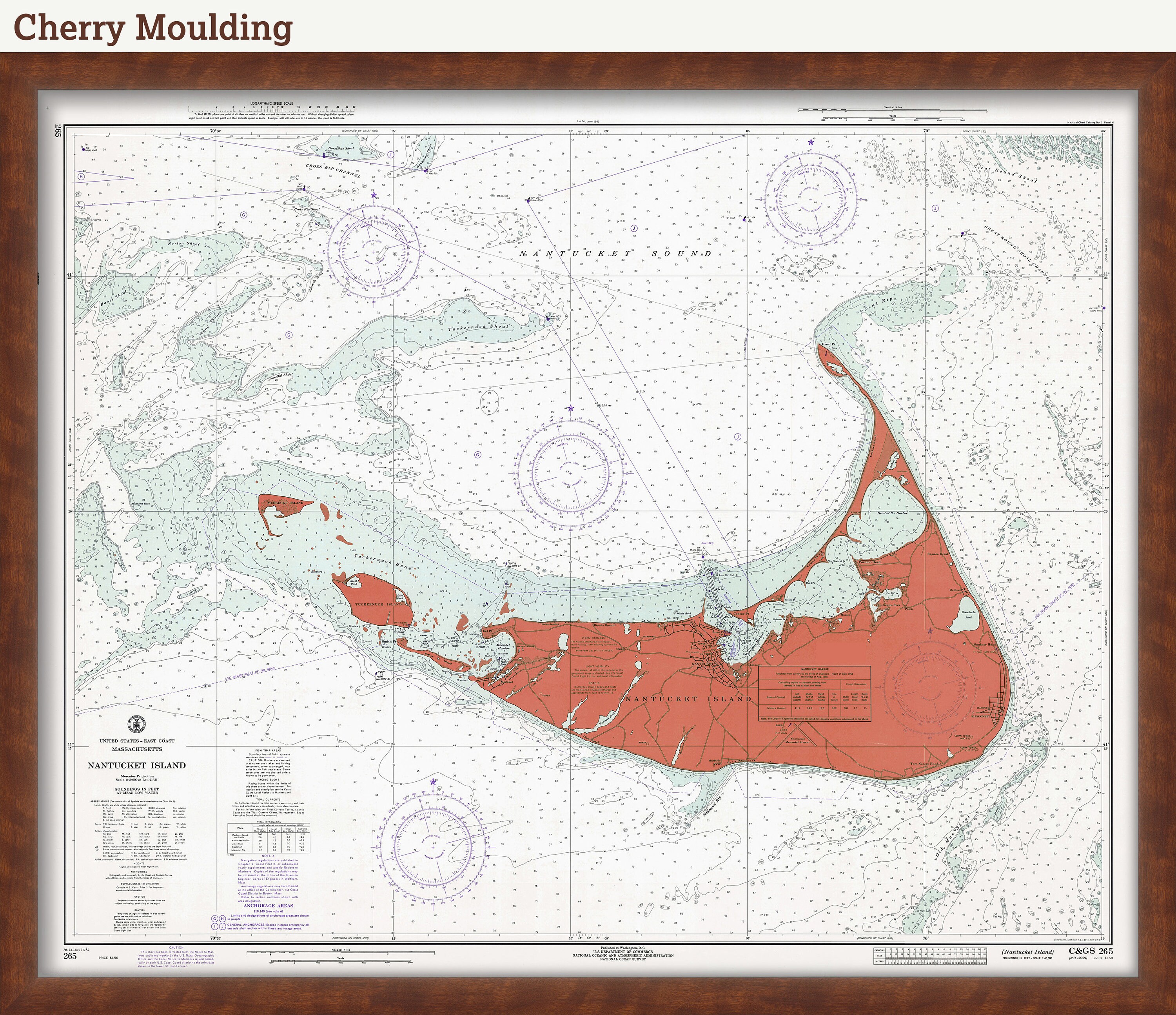
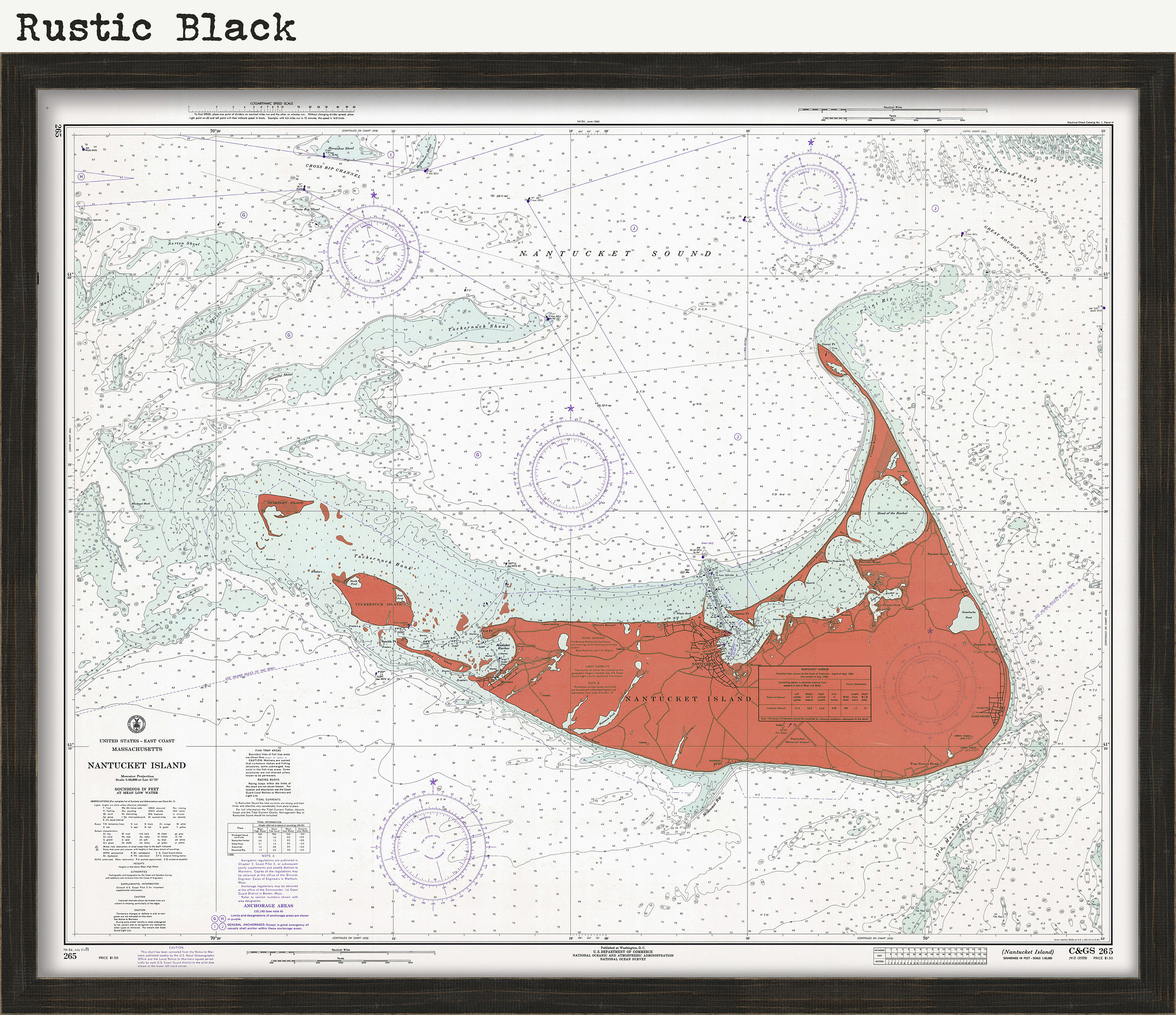
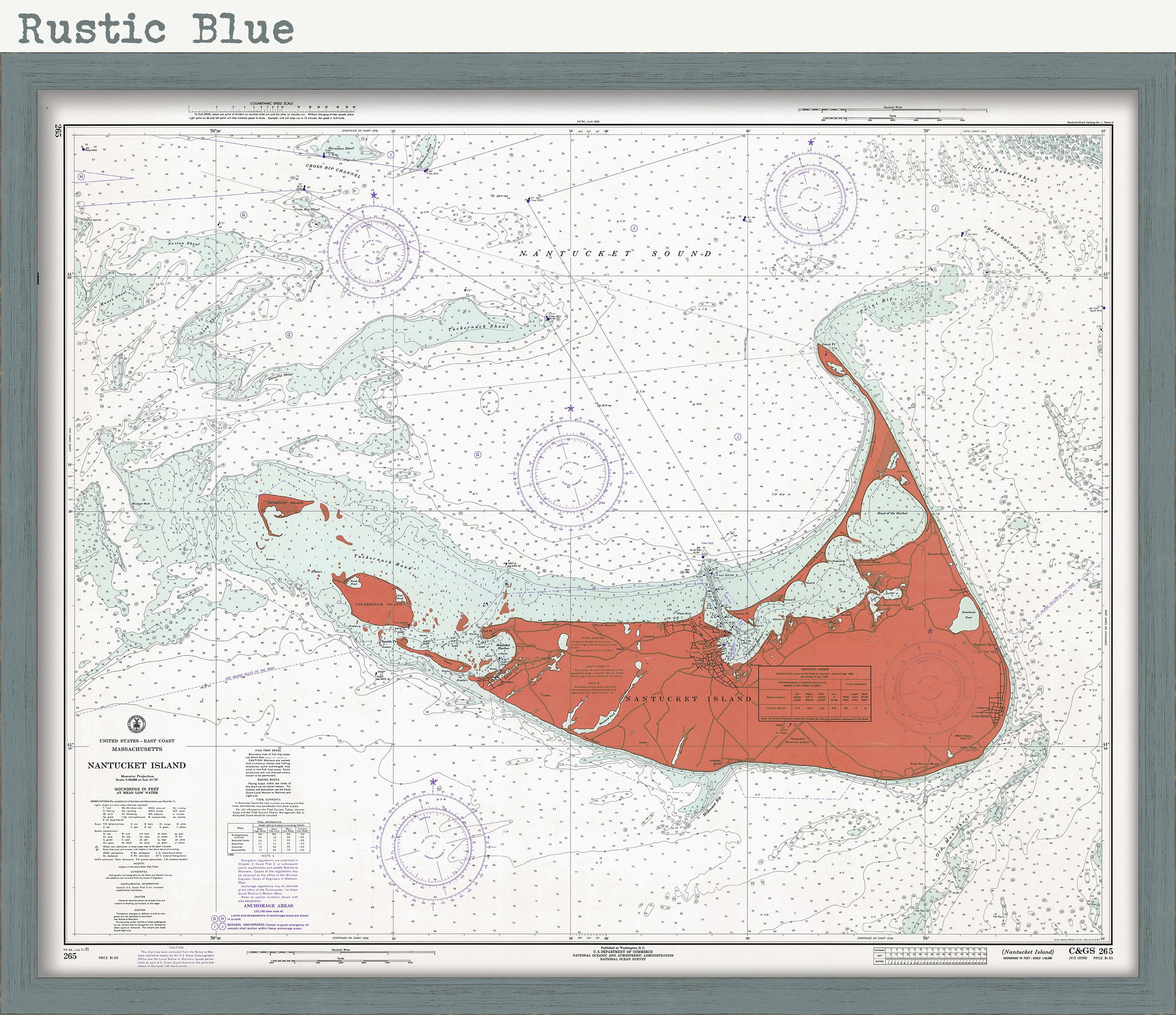
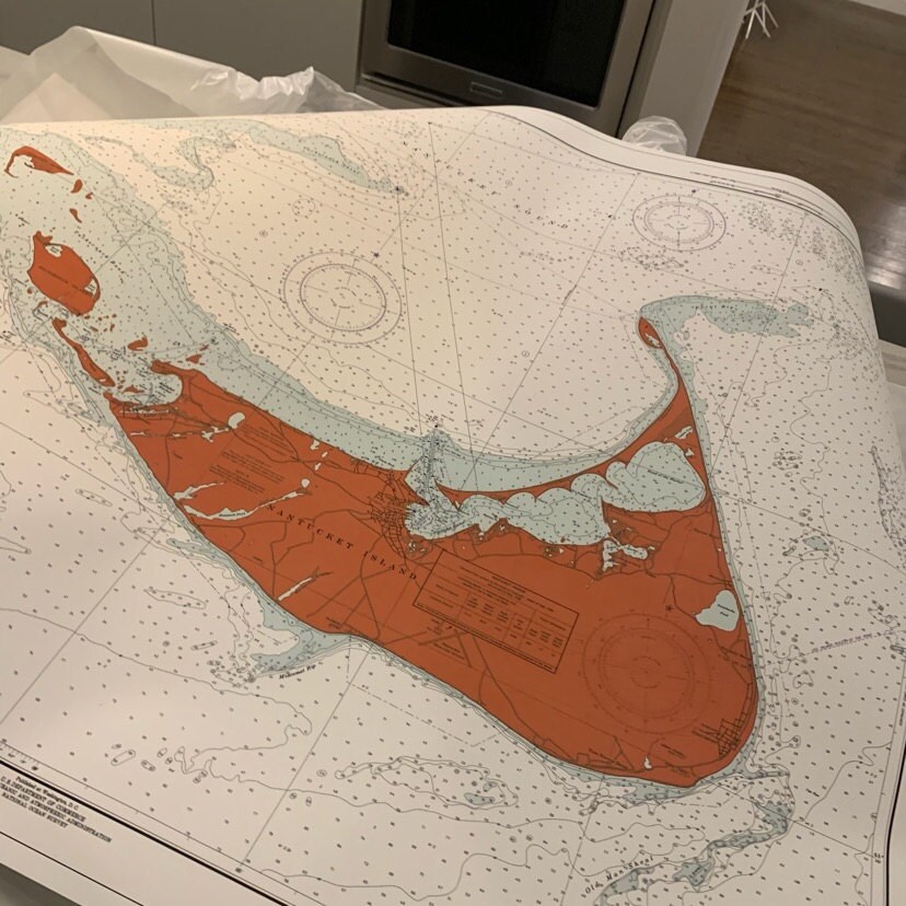
A NOAA Chart of Nantucket Island from 1971, not the color of original issue but one that may fit your mood or your decor. Be different make a bold decorating statement.
Original size is 44" wide by 35" tall
The replica map is printed on heavy matte fine art paper using archival pigment inks.
Framed maps include drymounting, UV filtering glass, and your choice of six mouldings, wired and ready to hang upon delivery. All mouldings are approximately 1.5" wide. Please factor in an additional 3" to the listed size for framed items.
Custom sizes are available. If you are interested in a custom size, please let us know through the "ask a question" button in this listing.
Retailers who would like to carry our Maps, please contact us through the "ask a question" button in this listing, for information and discounts.
On February 10, 1807, President Thomas Jefferson signed "An Act to provide for surveying the coasts of the United States. "President Richard Nixon formed NOAA in 1970, bringing C&GS into the new scientific agency. Today, the Office of Coast Survey continues its traditional commitment to employing the highest levels of science and technology to improve marine safety and to tackle the new challenges of the 21st century.
0353
Shipping from United States
Processing time
1-3 business days
Customs and import taxes
Buyers are responsible for any customs and import taxes that may apply. I'm not responsible for delays due to customs.
Payment Options
Returns & Exchanges
Returns & exchanges not accepted
But please contact me if you have problems with your order
I gladly accept cancellations
Request a cancellation within: 1 hours of purchase
Reviews (4)
Average:
Jul 15, 2023
Great quality and a beautiful map!
Emily McIsaac
Jun 23, 2021
AMAZING!! Will definitely order from your store again. Thank you!!
Alexandra Preschlack
Dec 25, 2019
Lovely! Great colors and wonderful quality.
kristinjuelson
Jul 13, 2019
Very high quality product! I love it!
marinabelli5