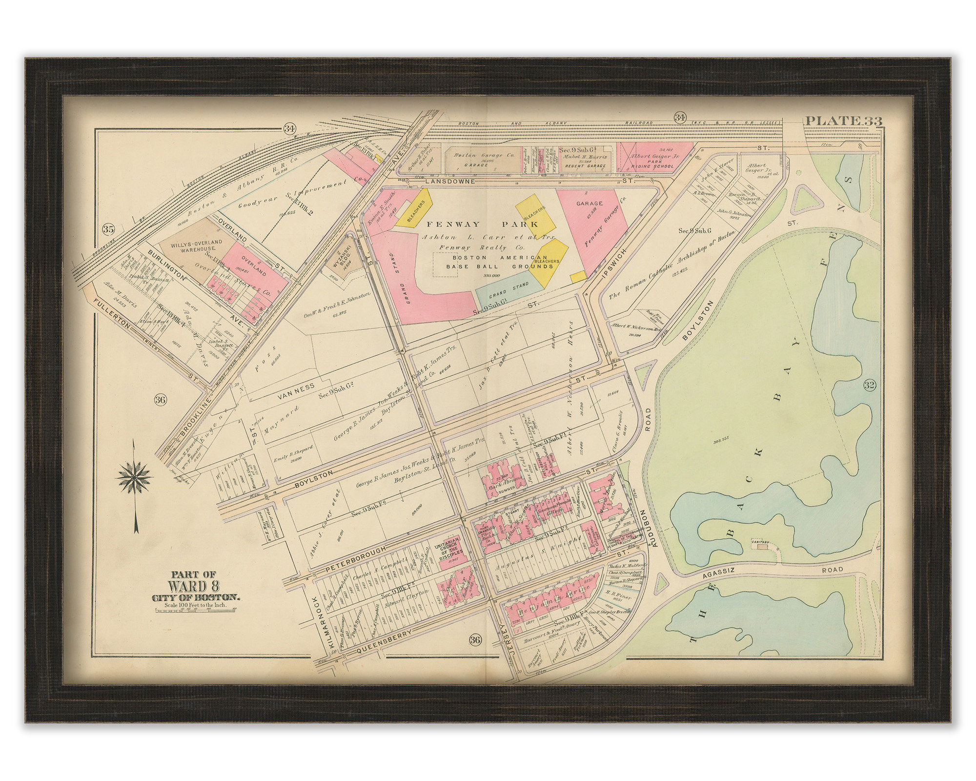
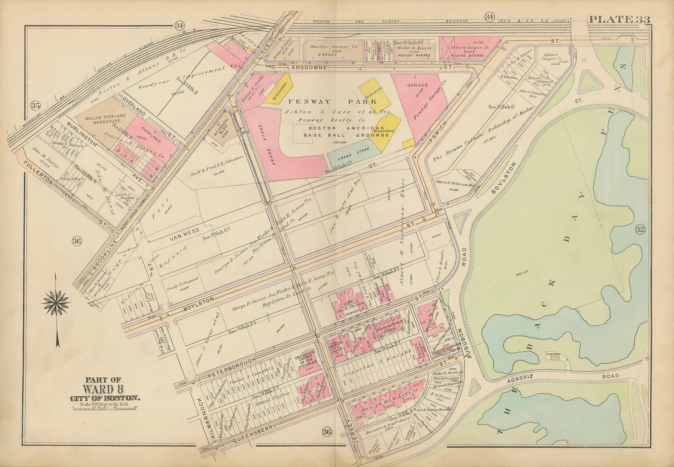
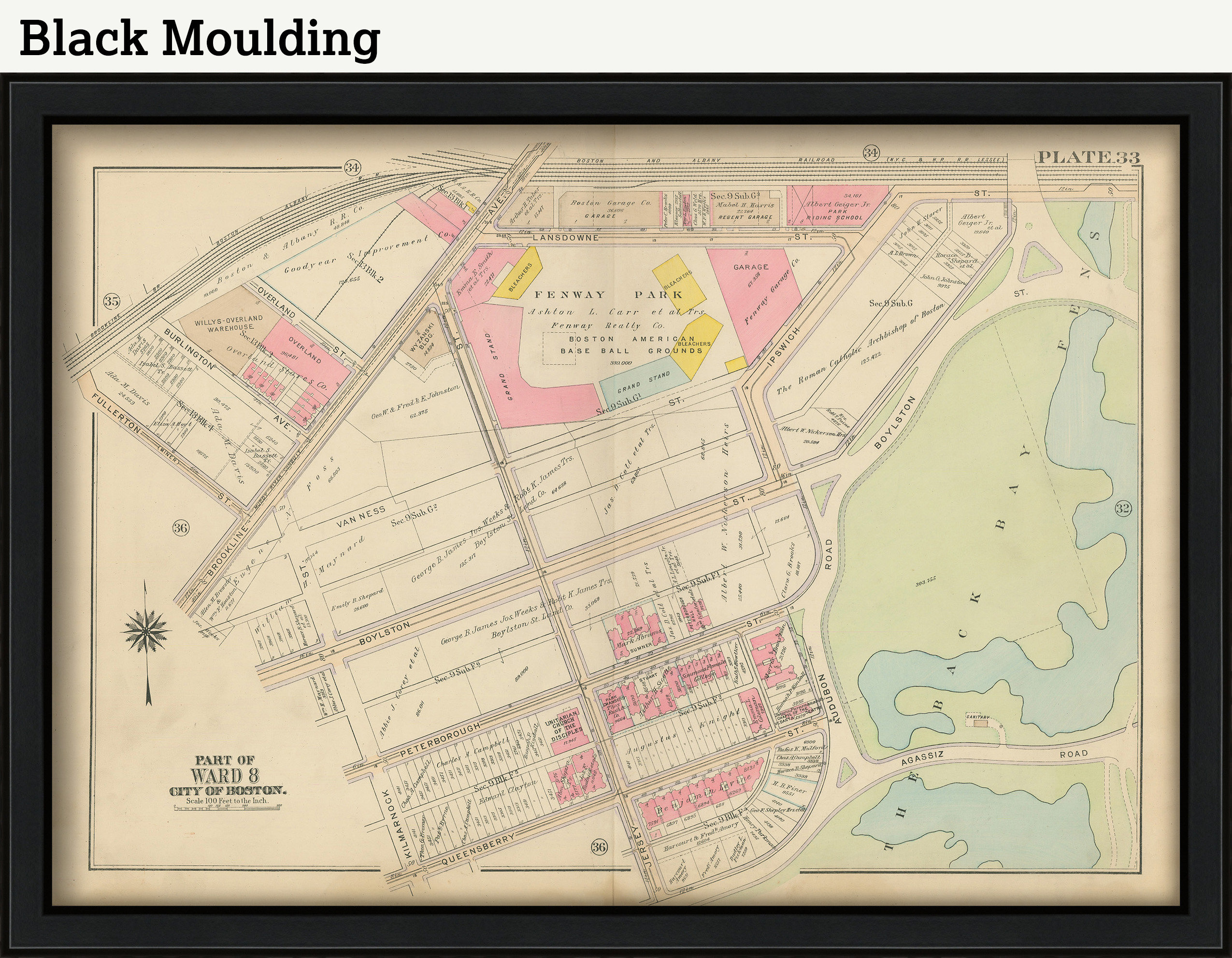
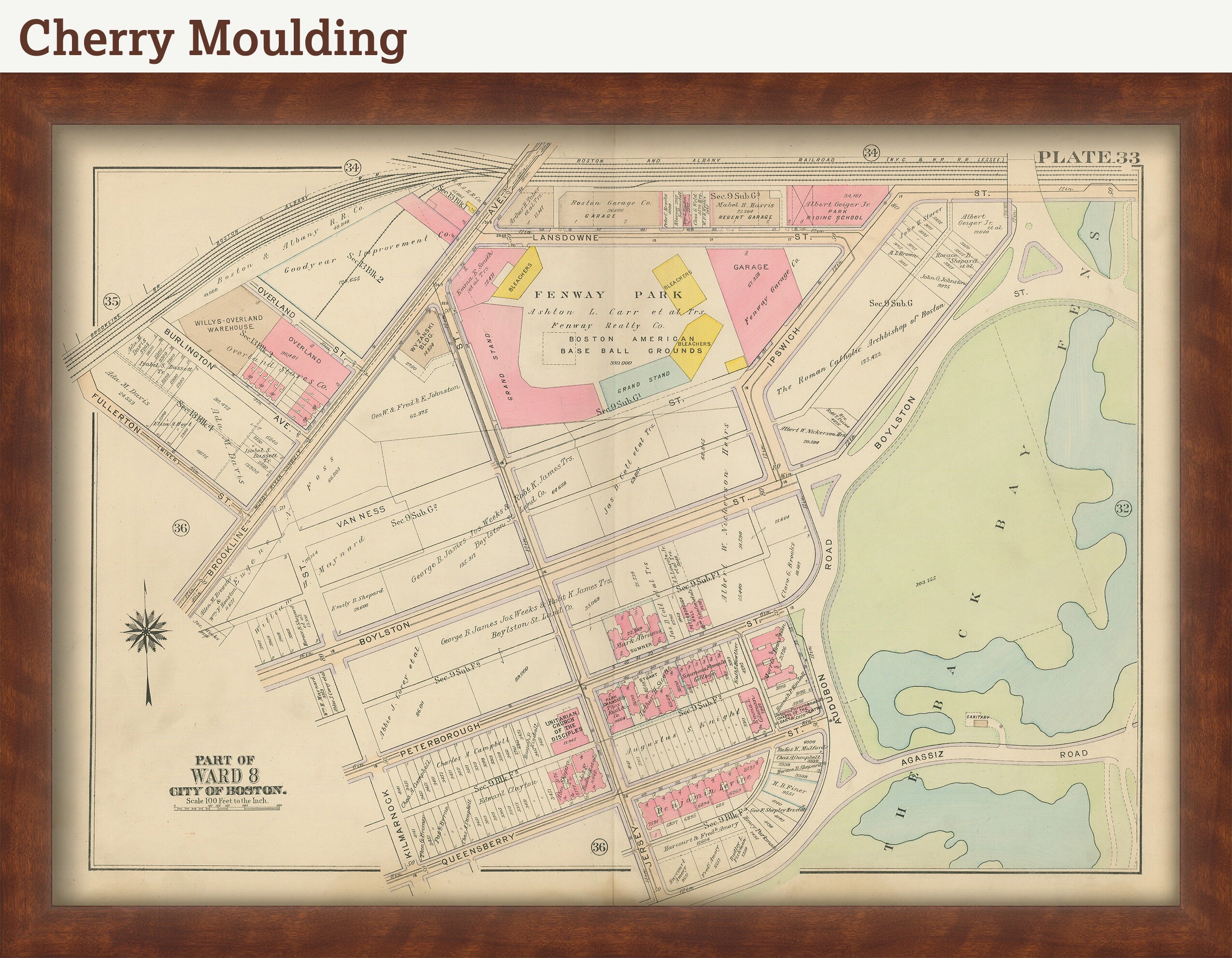
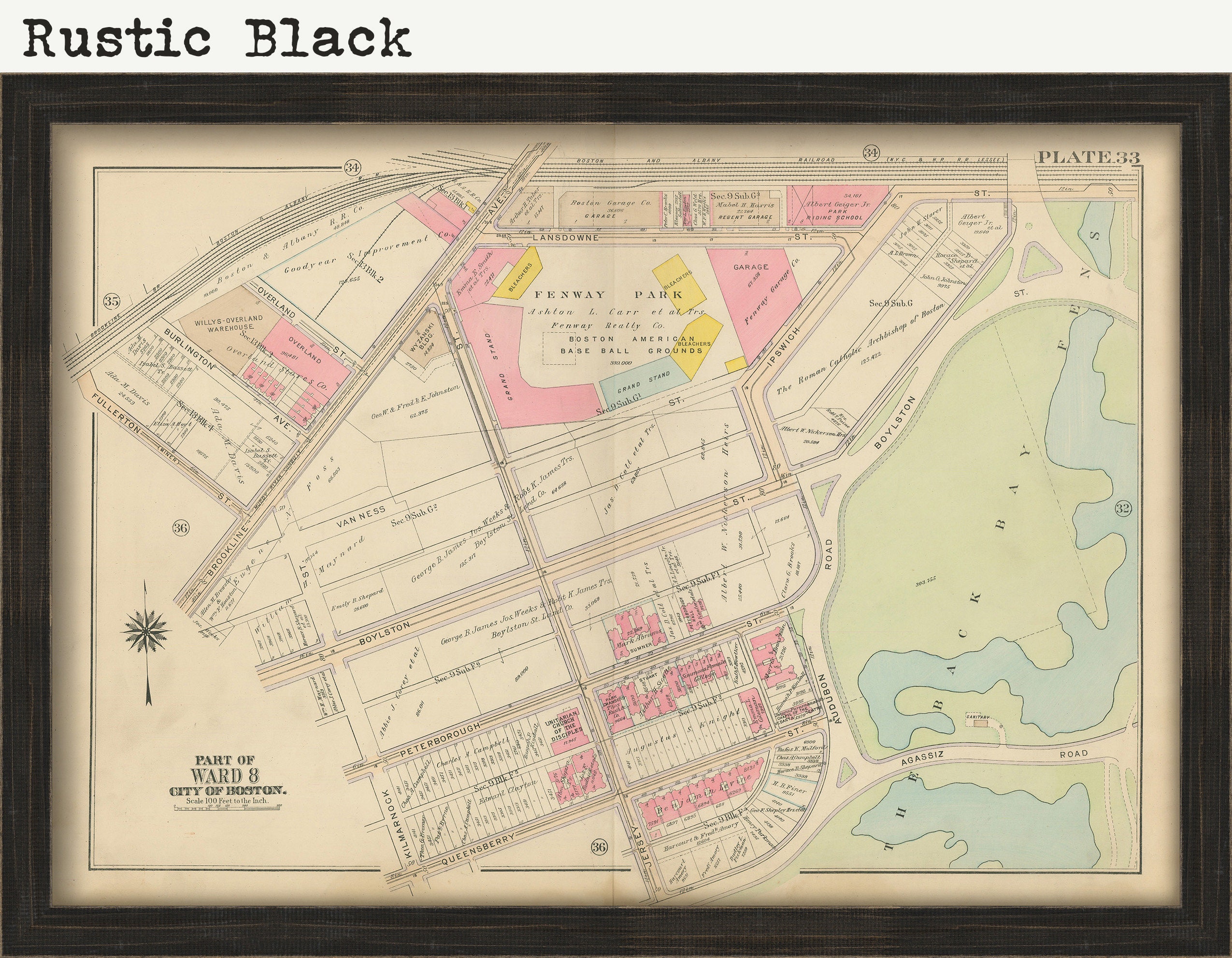
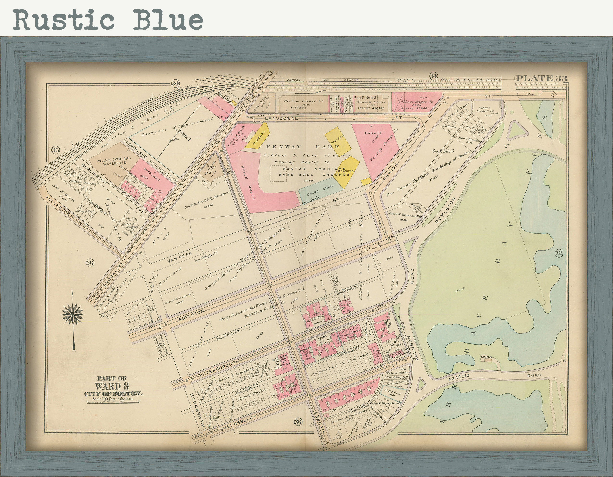
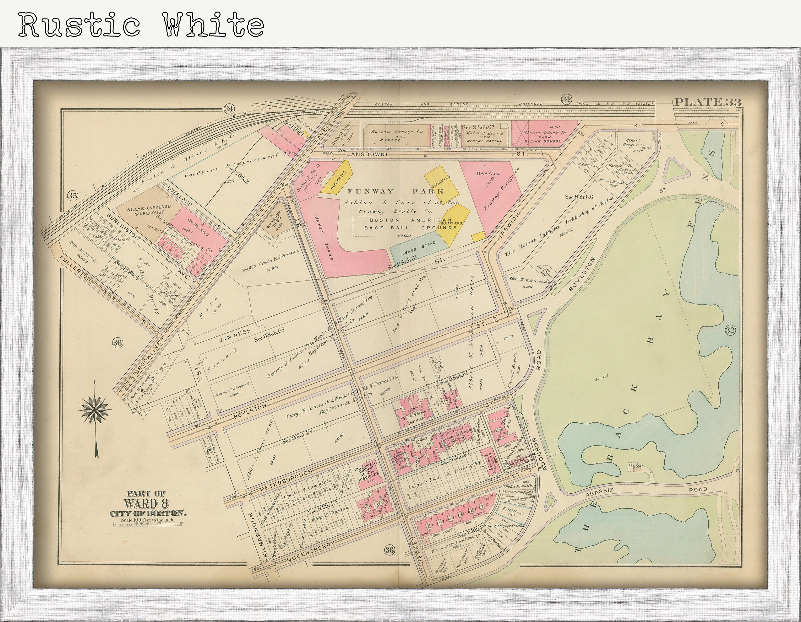
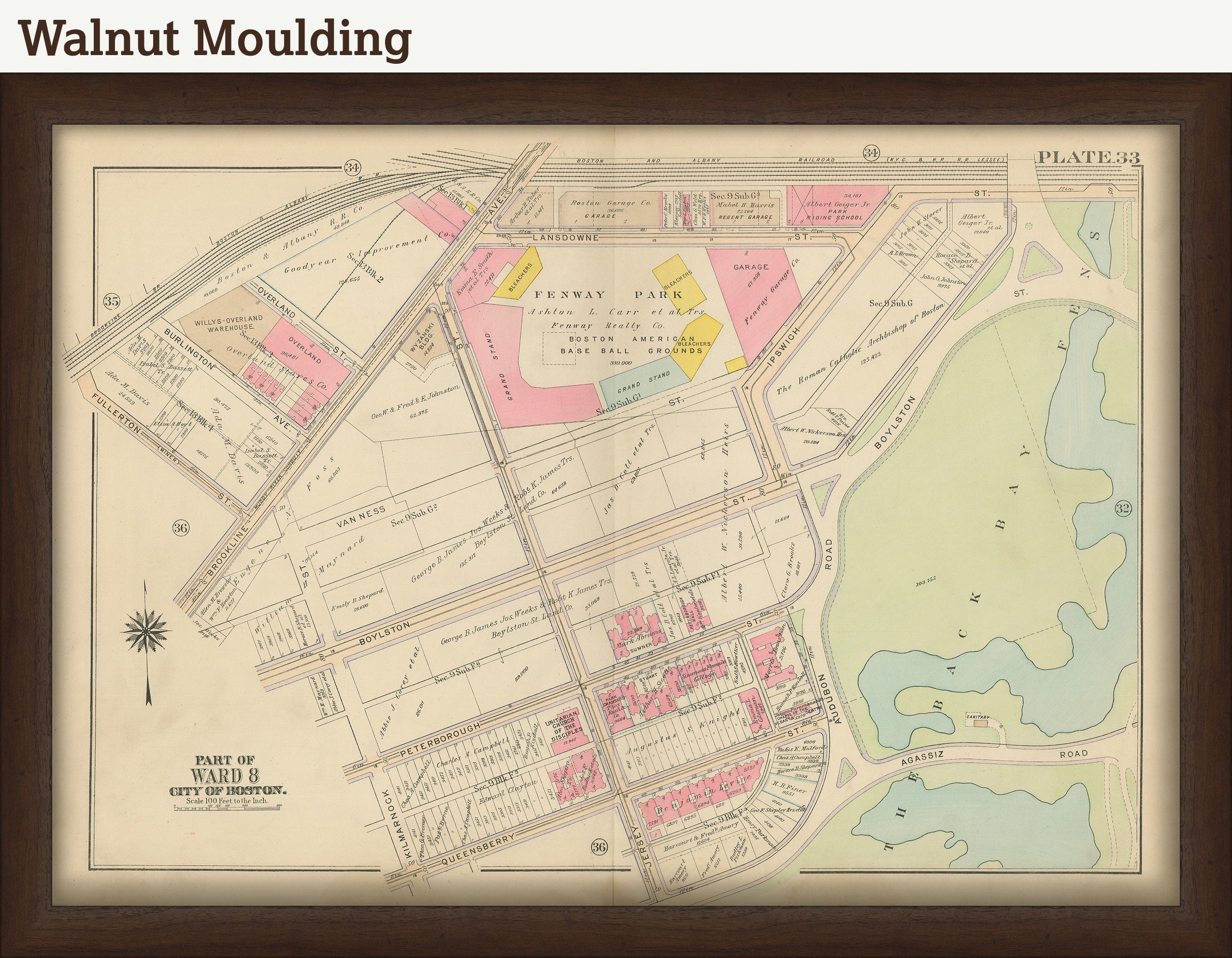
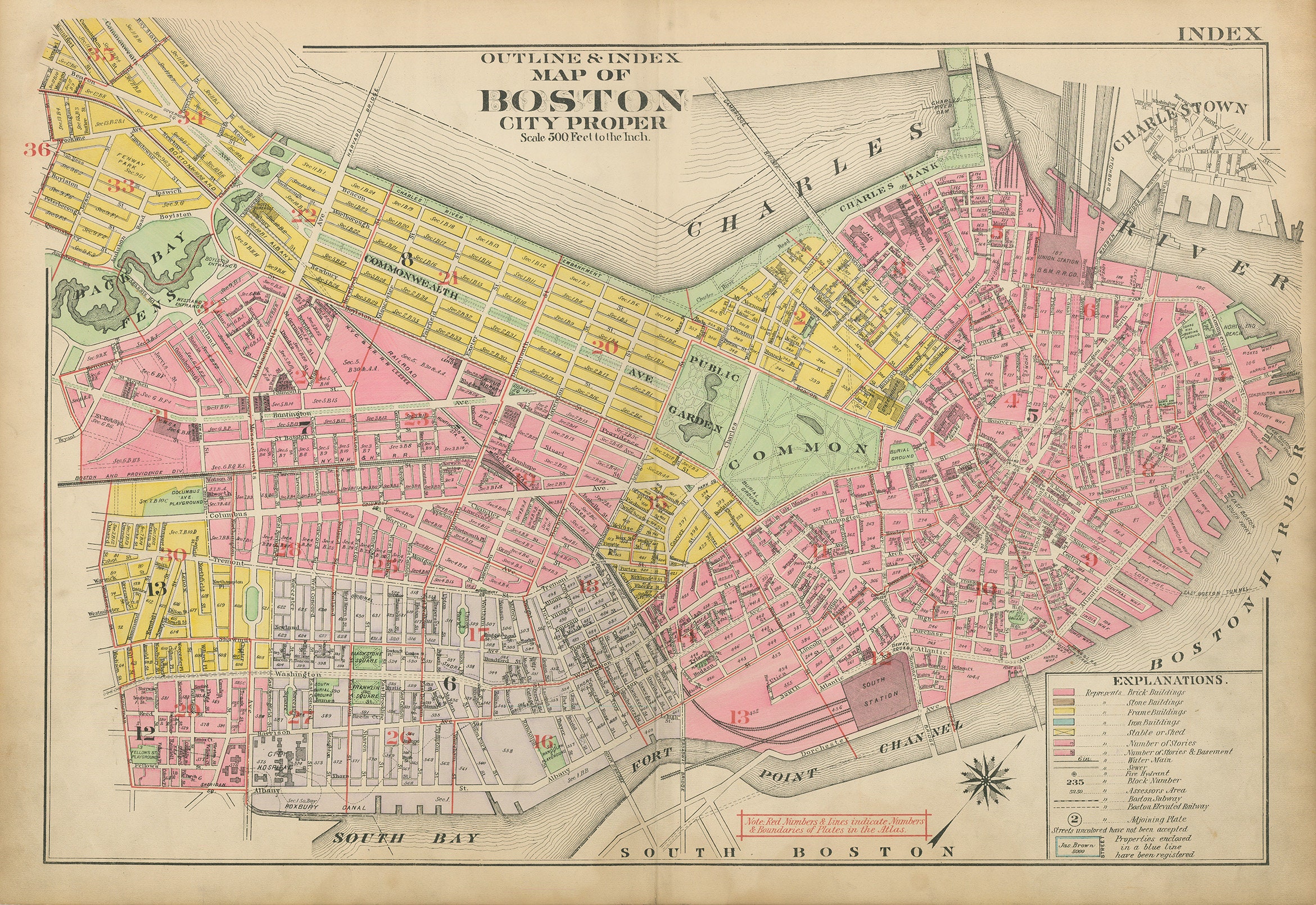
A reproduction of a hand-colored map of the City of BOSTON, Massachusetts, Plate 33, Fenway Park from the 1917 Atlas of the City of Boston, Massachusetts, Boston Proper and Back Bay by G. W. Bromley and Company.
Streets in this map: Agassiz Road, Audubon Road, Boylston Road, Street, Brookline Avenue, Burlington Ave, Butler, Fullerton, Ipswich, Jersey, Kilmarnock, Landsdowne, Peterborough, Queensberry
Landmarks in this map: Back Back Fens, Boston Storage Warehouse Co., Massachusetts Historical Society, The New Riding Club
Neighborhoods: Fenway
Please feel free to use our high resolution version of this map for your research or just to inspect it, If you are interested in purchasing the original map, the unedited scan of the map can be viewed here: please copy and paste this url into a new tab in your browser:
https://rmicusec.sirv.com/etsy/Boston_Proper_and_Back_Bay_1917/033MABB17.jpg
Dimensions of the GENUINE ORIGINAL Map are: 22 1/2" by 32 1/2".
The GENUINE ORIGINAL version of this map is sold.
THE ORIGINAL MAP HAS INDEX TABS ON BOTH SIDE OF IT {see high resolution version above} ANY COMPETENT PICTURE FRAMER SHOULD BE ABLE TO CUT A MAT TO COVER THEM. The Original Map is LINEN BACKED.
FRAMED ORIGINAL maps include: museum quality backing board, UV filtering glass, and your choice of mouldings, wired and ready to hang upon delivery.
Framed maps include dry mounting, UV filtering glass, and your choice of six mouldings, wired and ready to hang upon delivery. All mouldings are approximately 1.5" wide. Please factor in an additional 3" to the listed size for framed items.
This map has been scanned From OUR ORIGINAL at 600 dpi using state of the art equipment. The replica map is printed on heavy matte fine art paper using archival pigment inks. This is one of over 5000 Original maps, charts and posters in our collection.
Many reproduction maps that are available on Etsy are taken directly from public domain sources {NY Public Library, Library of Congress, etc}. Although great for research purposes, these image files frequently suffer from poor color accuracy, lens blur and distortion. The maps in our collection have been scanned from the ORIGINAL, flat, at high resolution and with precisely calibrated color. This allows us to prints replicas that are virtually indistinguishable from the original maps.
All sizes are approximate, we round up or down to the nearest inch.
Custom sizes are available. If you are interested in a custom size, please let us know through the "ask a question" button in this listing.
Retailers who would like to carry our Maps, please contact us through the "ask a question" button in this listing, for information and discounts.
033-MABB17
Shipping from United States
Processing time
1-3 business days
Customs and import taxes
Buyers are responsible for any customs and import taxes that may apply. I'm not responsible for delays due to customs.
Payment Options
Returns & Exchanges
Returns & exchanges not accepted
But please contact me if you have problems with your order
I gladly accept cancellations
Request a cancellation within: 1 hours of purchase
Reviews (3)
Average:
May 19, 2022
dan dougherty
Jan 6, 2022
Looks great! Can’t wait to have it framed.
MaryKay Wood
Dec 19, 2019
The map is amazing! Shipping was also lightning fast...thank you! :)
Katherine Amato