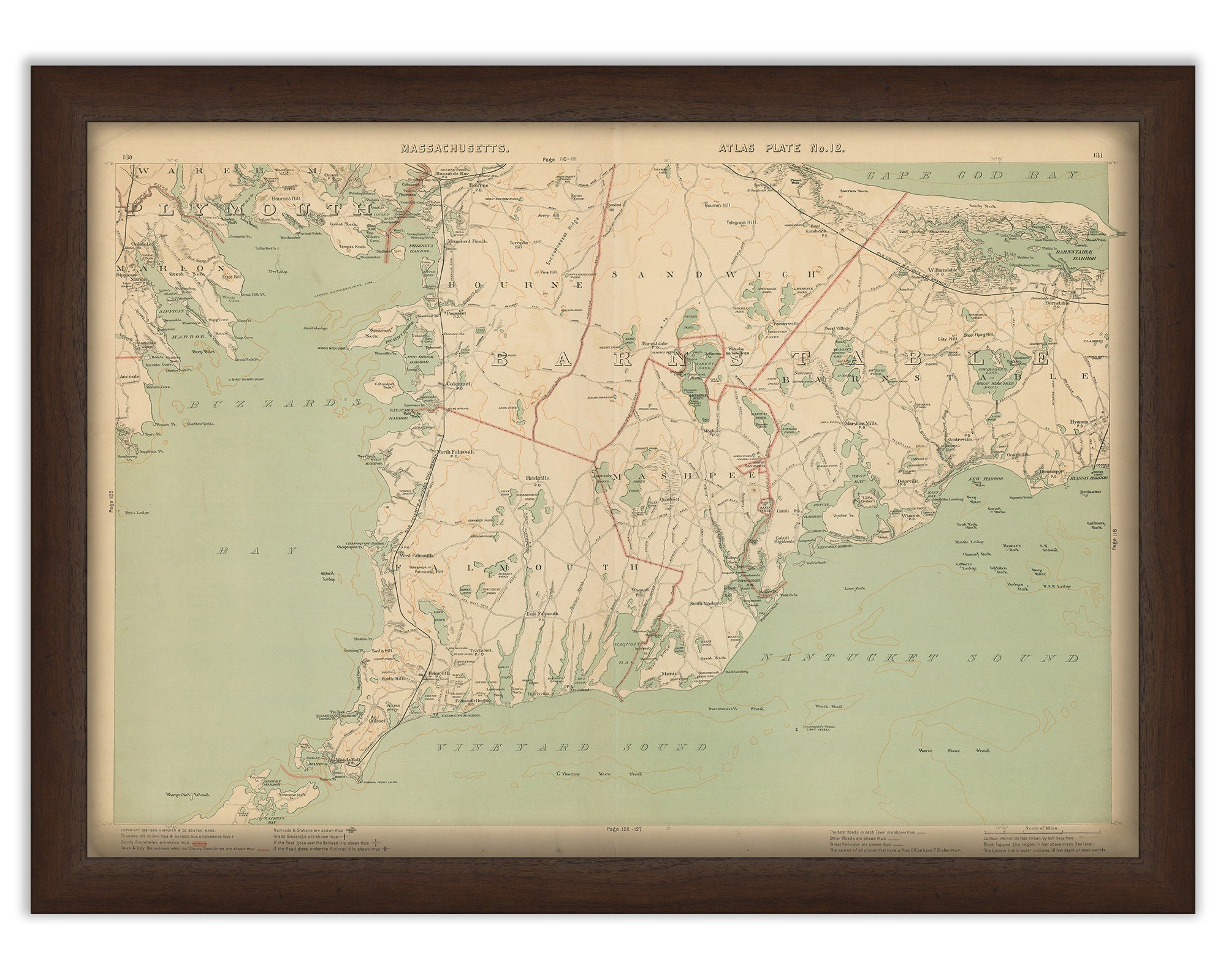
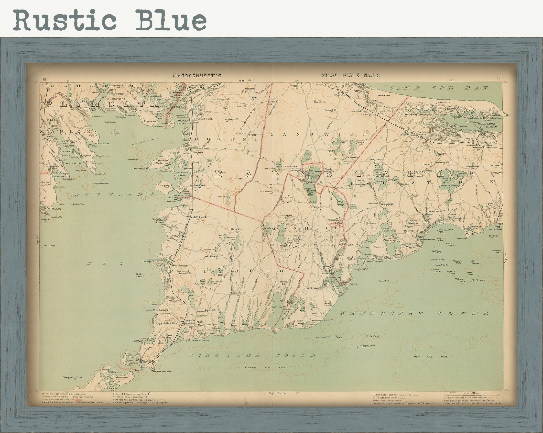
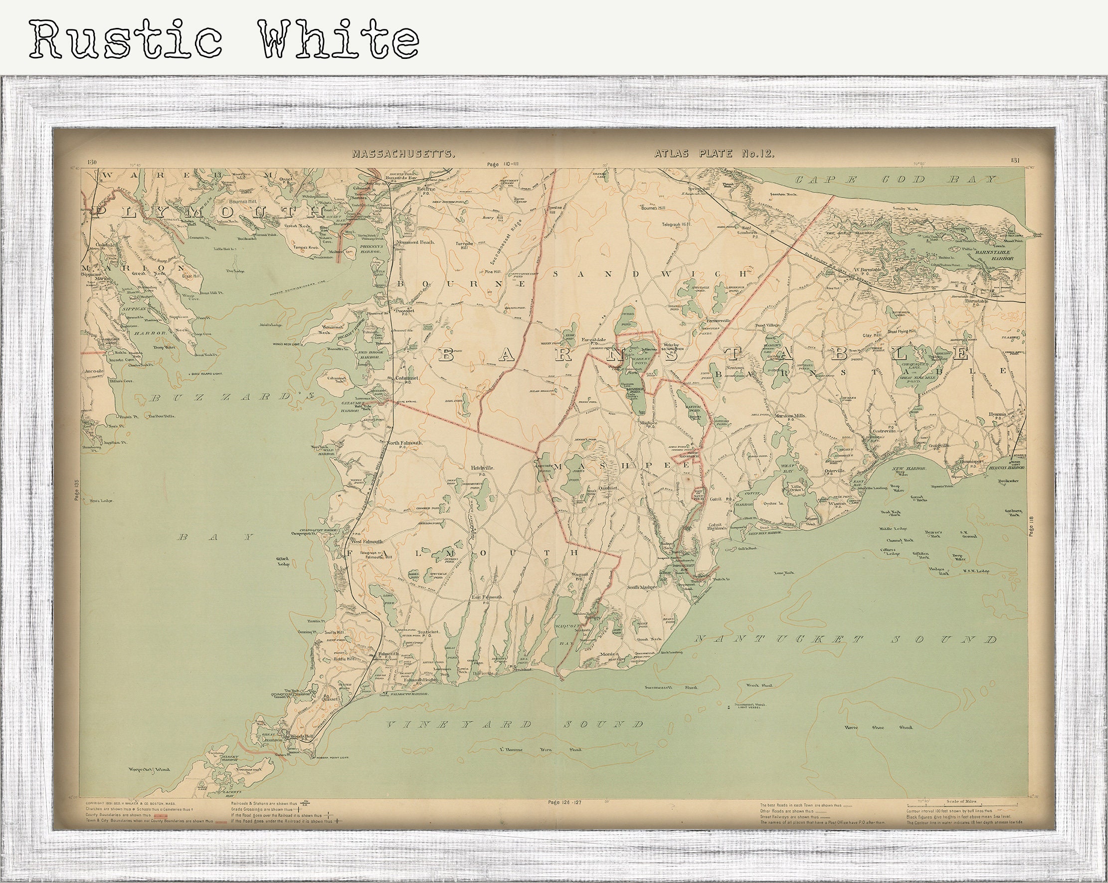
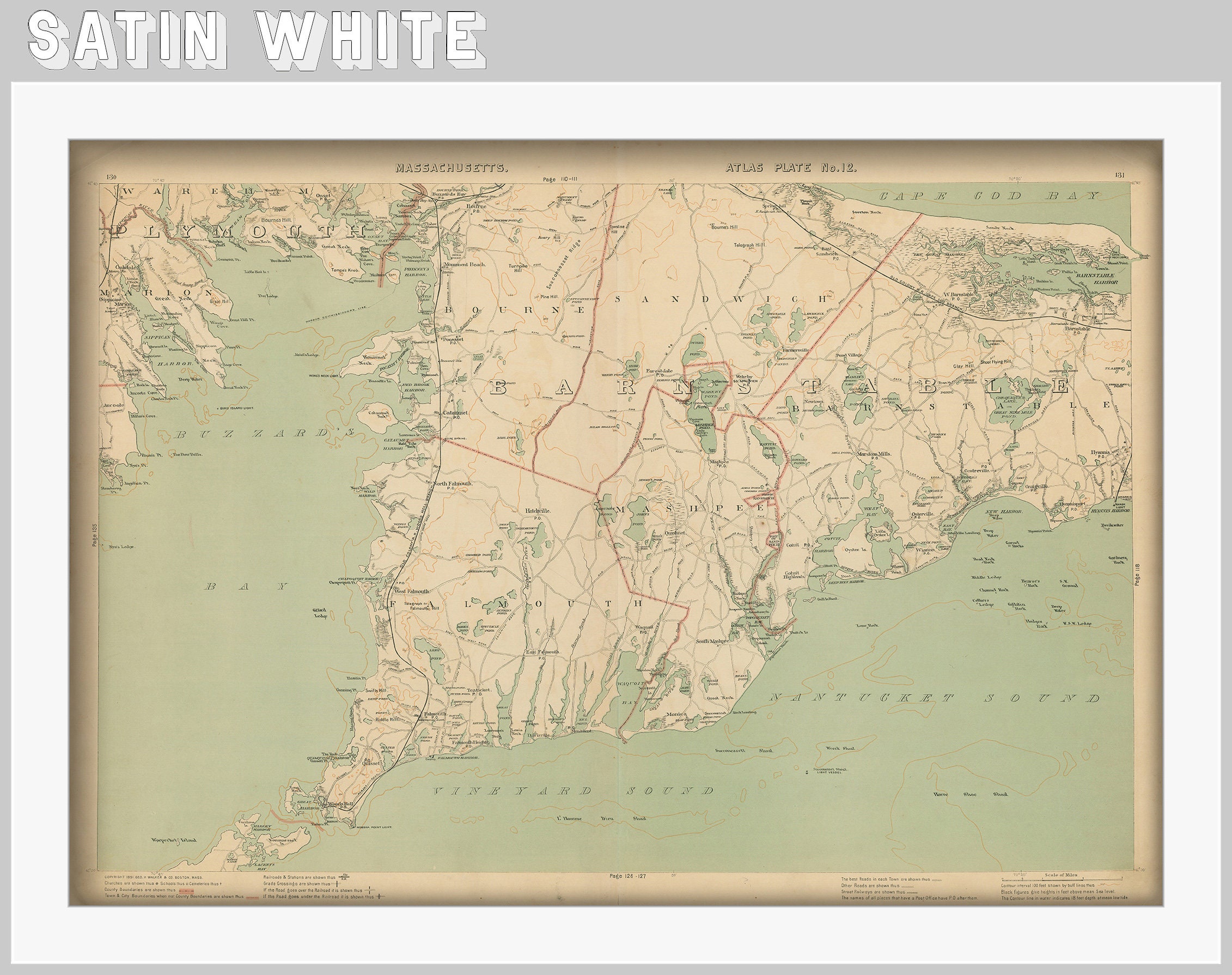
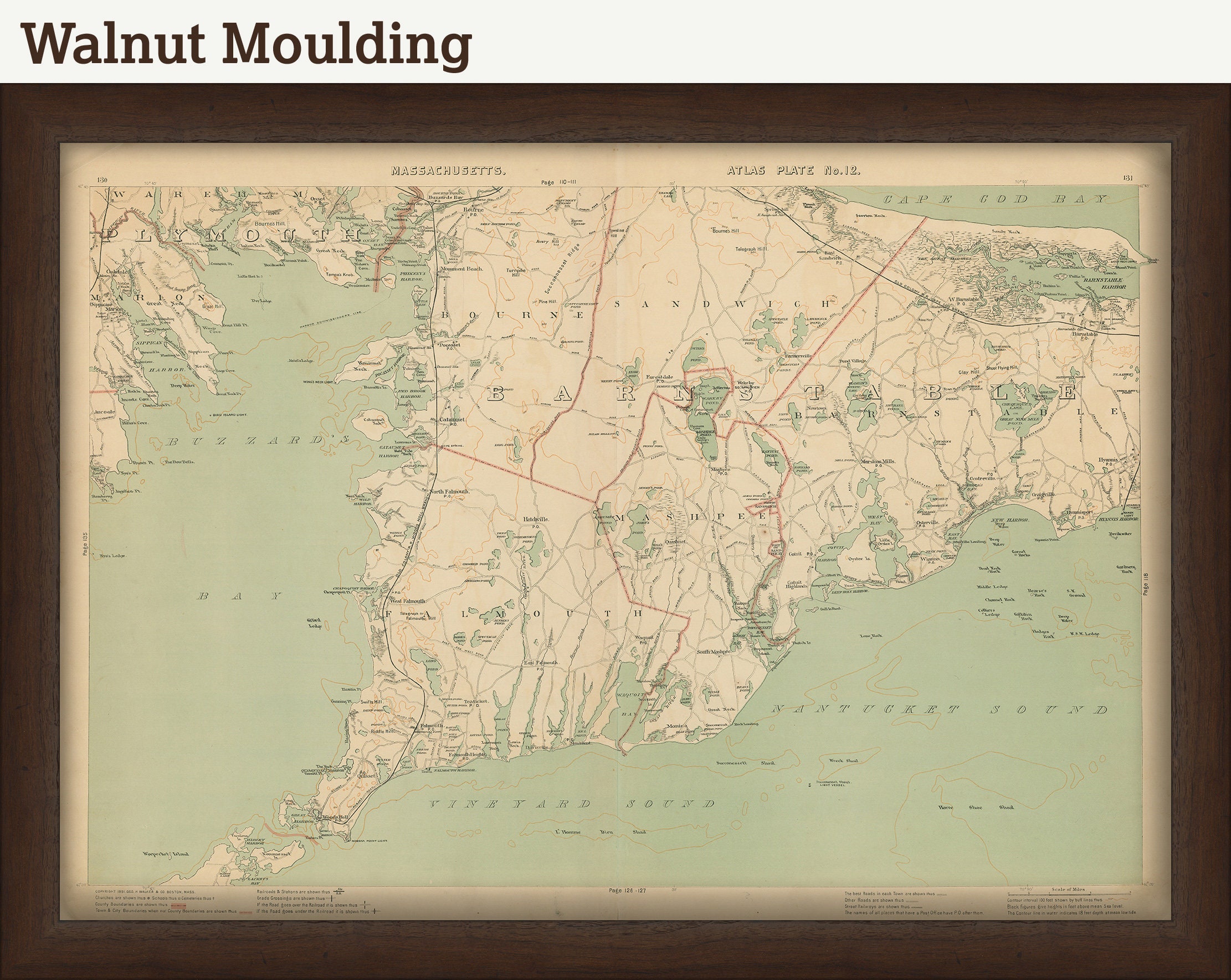
Genuine original UPPER CAPE COD, Massachusetts Map 1891 by Geo H. Walker & Co.
$196.00
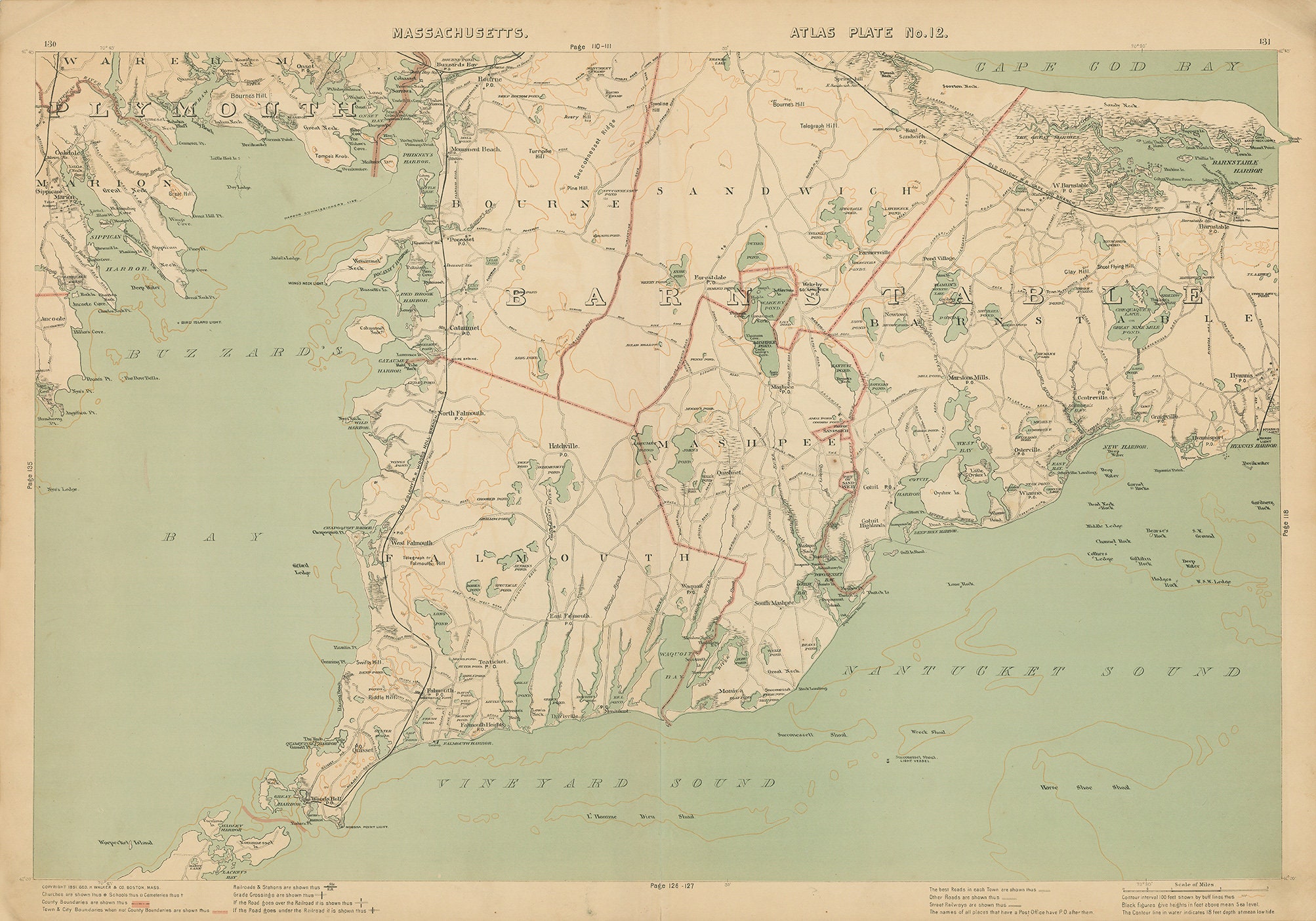
GENUINE ORIGINAL UPPER CAPE COD MAP published in the 1891 Massachusetts Topographical Atlas by Geo H. Walker & Co. This 1891 map of UPPER CAPE COD, shows roads, landmarks, water bodies, post offices, railroad. Includes the towns of FALMOUTH, BOURNE, MASHPEE, and SANDWICH.
CONDITION: light stains in margins, slight creases, slightly folded corners.
Dimensions of the Map are: 28" wide by 19.5" tall
Framed Dimensions are: 31" wide by 22.5" tall.
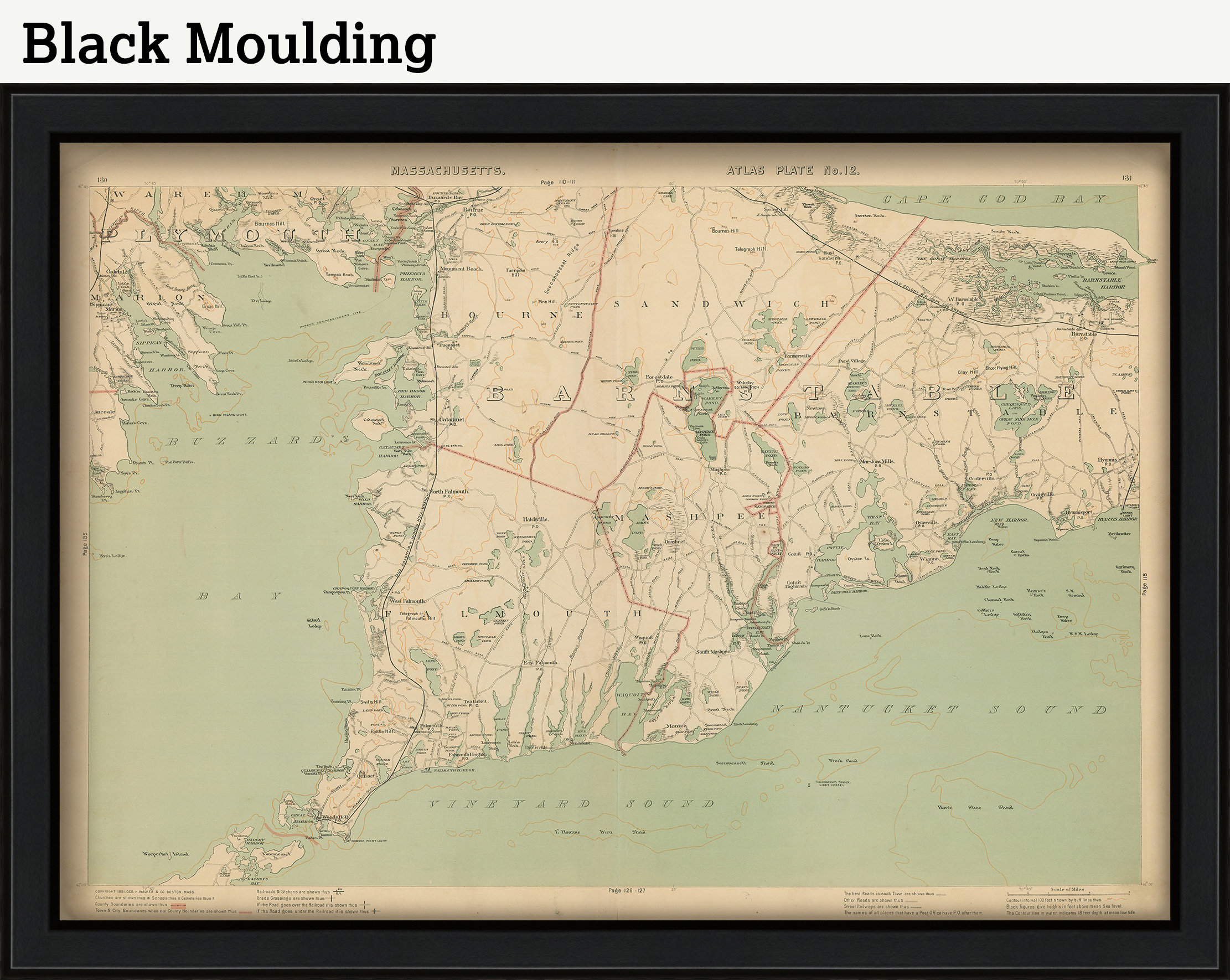
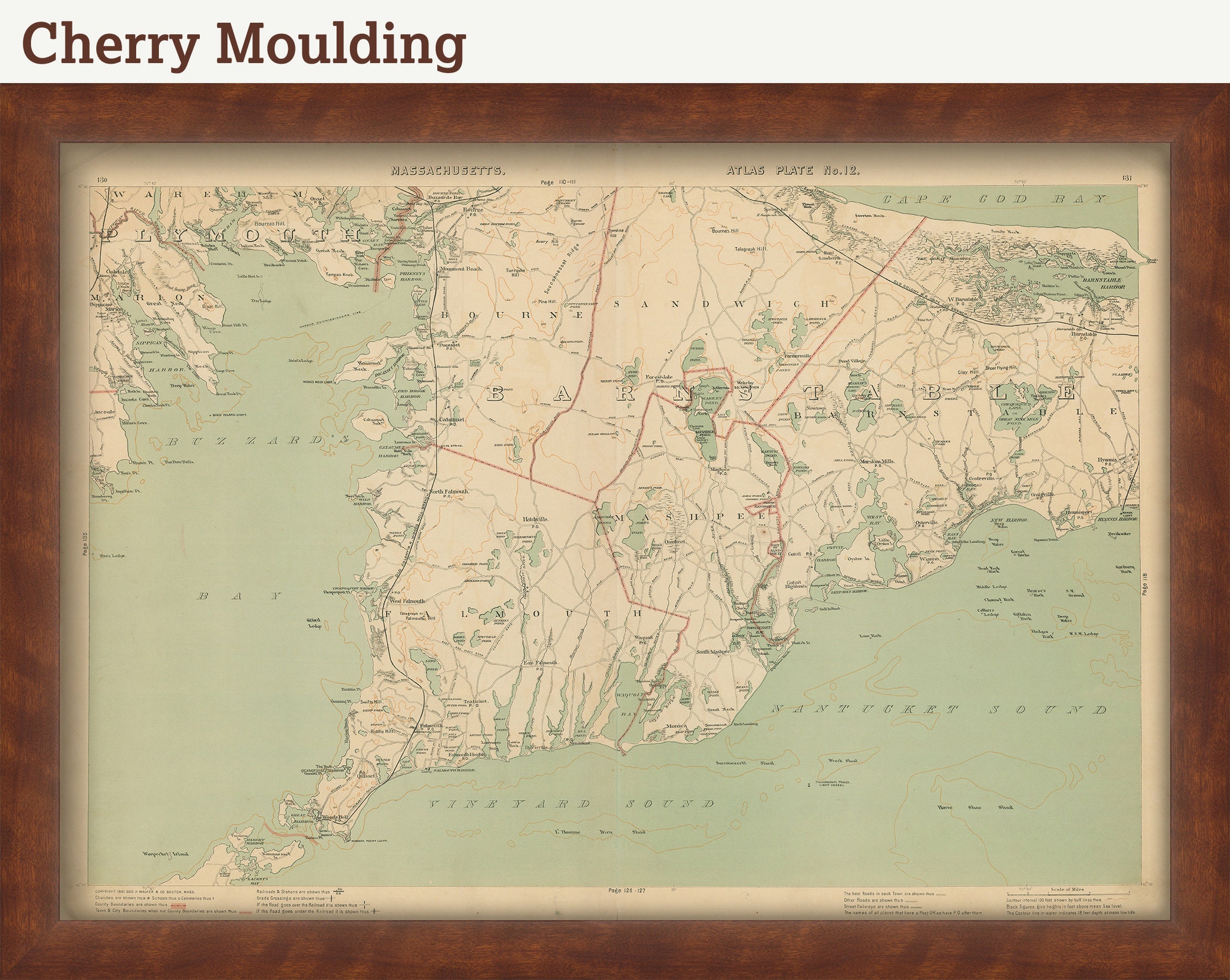
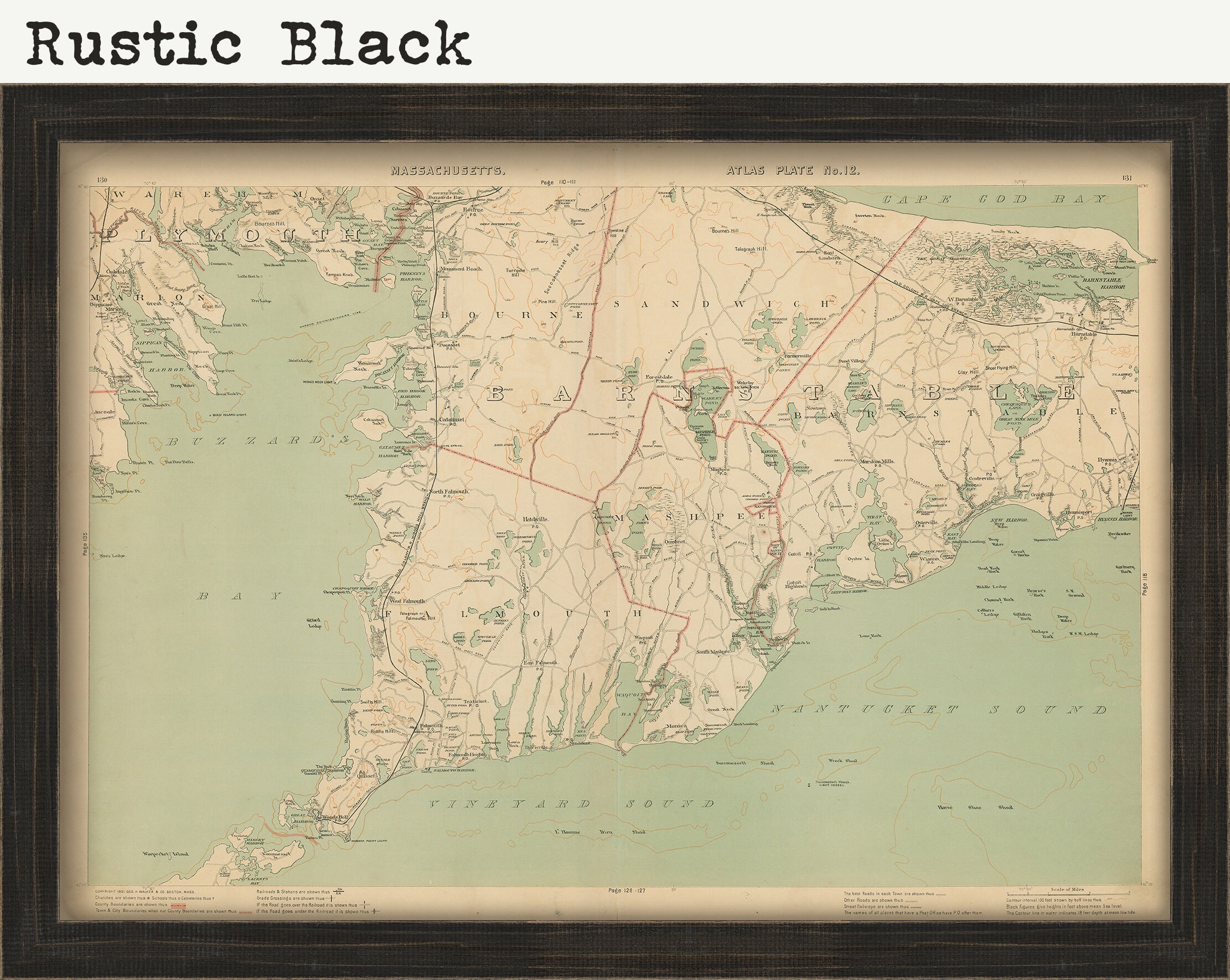
FRAMED ORIGINAL maps include: museum quality backing board, UV filtering glass, and your choice of mouldings, wired and ready to hang upon delivery.
If you would like to inspect a higher resolution version of this map, please copy and paste this url into a new tab in your browser:
003-oringinal
Shipping from United States
Processing time
1-3 business days
Customs and import taxes
Buyers are responsible for any customs and import taxes that may apply. I'm not responsible for delays due to customs.
Payment Options
Returns & Exchanges
Returns & exchanges not accepted
But please contact me if you have problems with your order
I gladly accept cancellations
Request a cancellation within: 1 hours of purchase