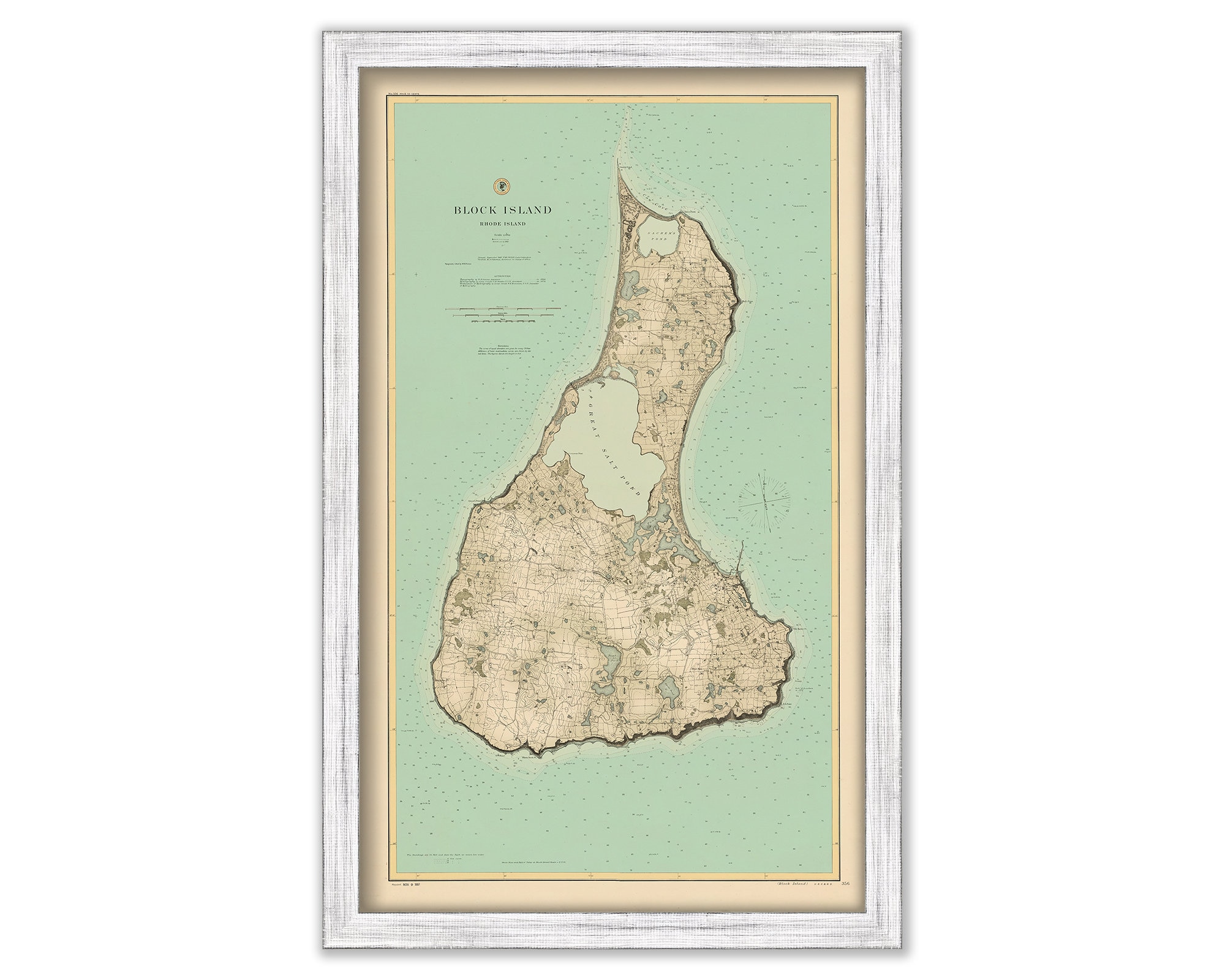

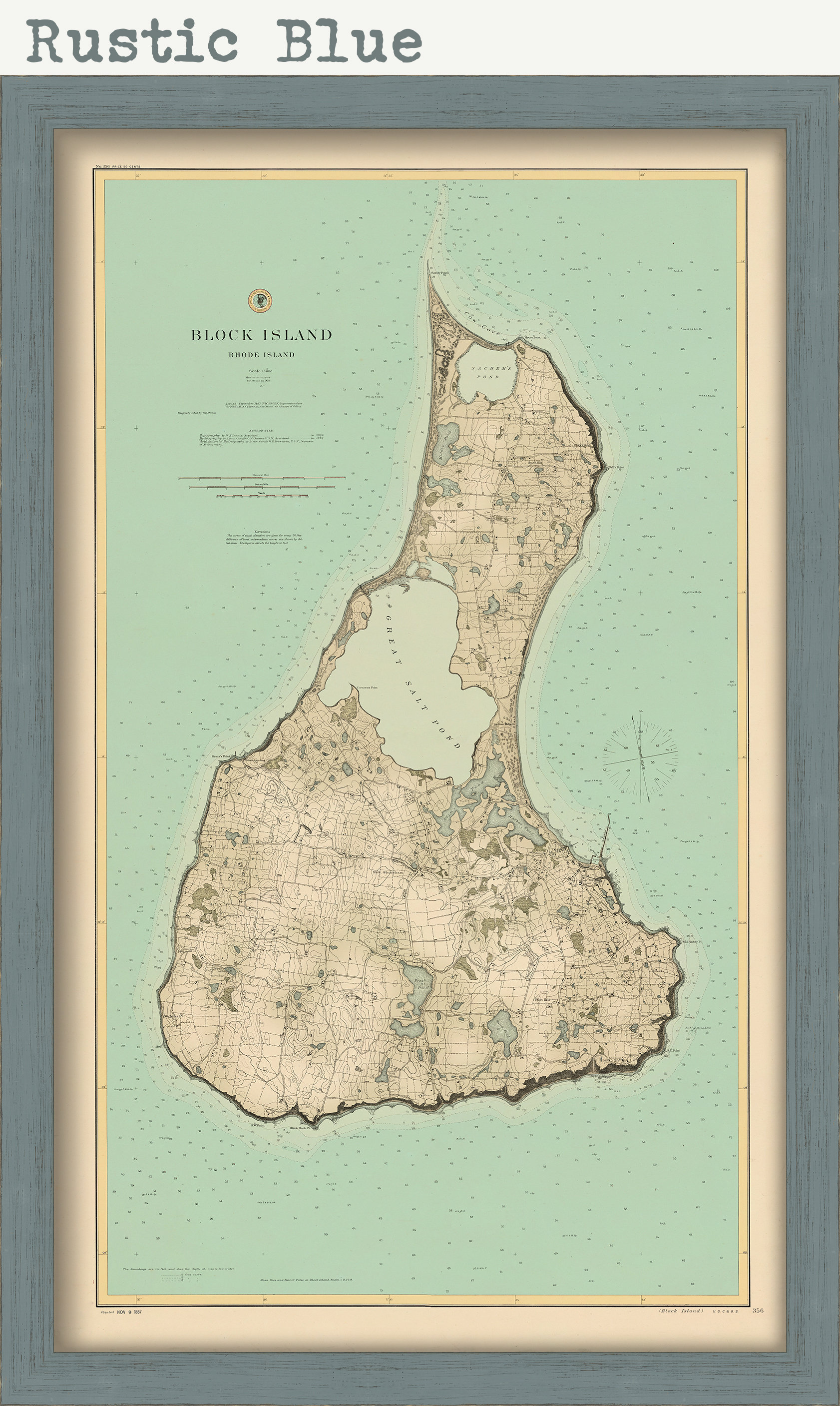
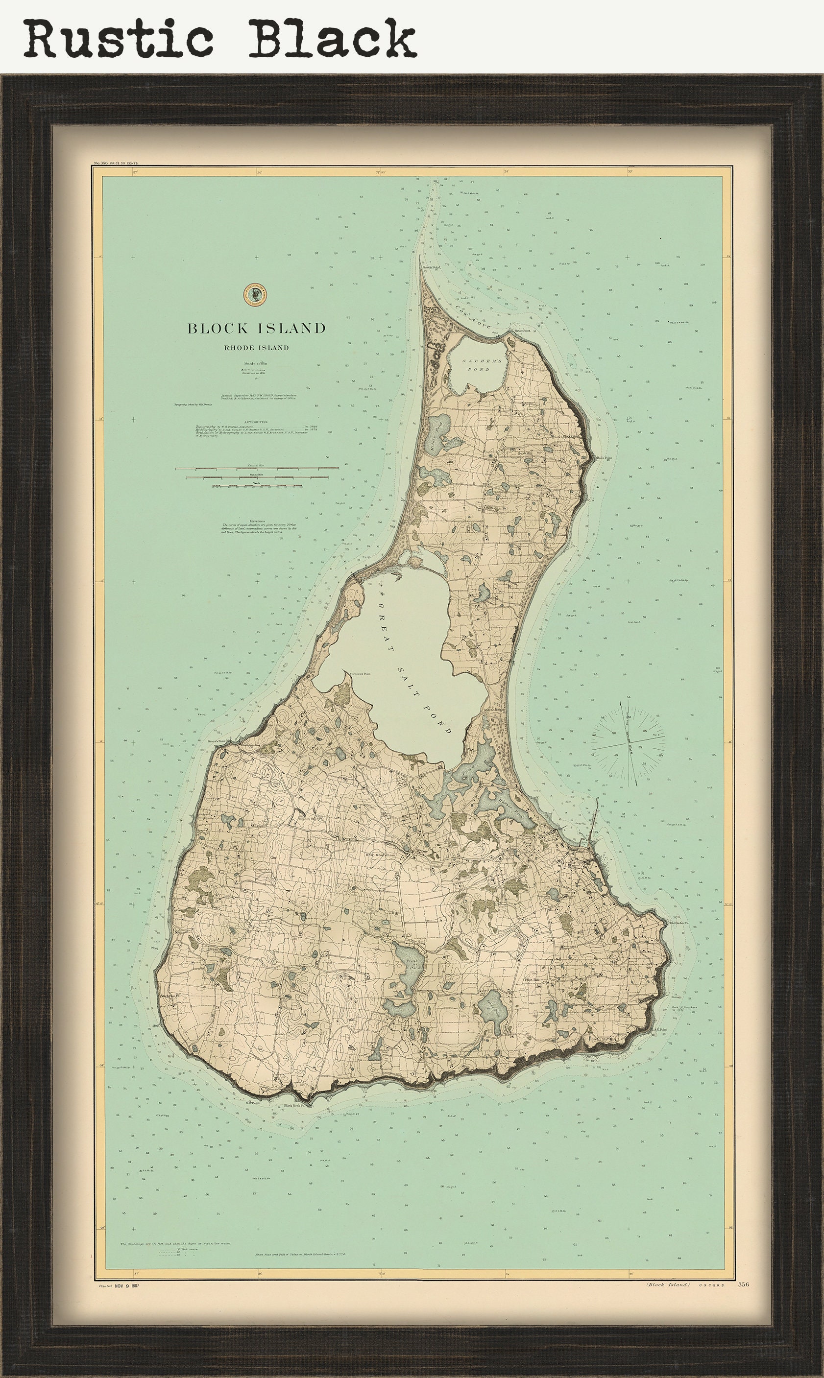
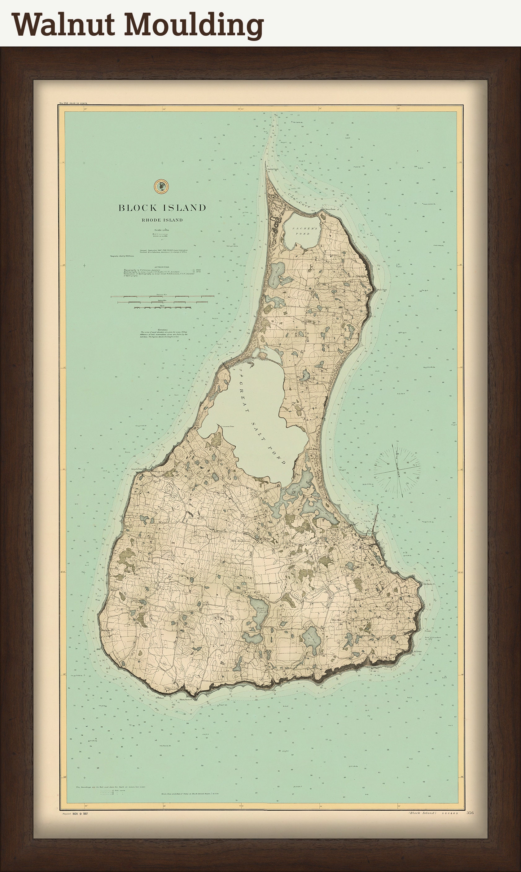
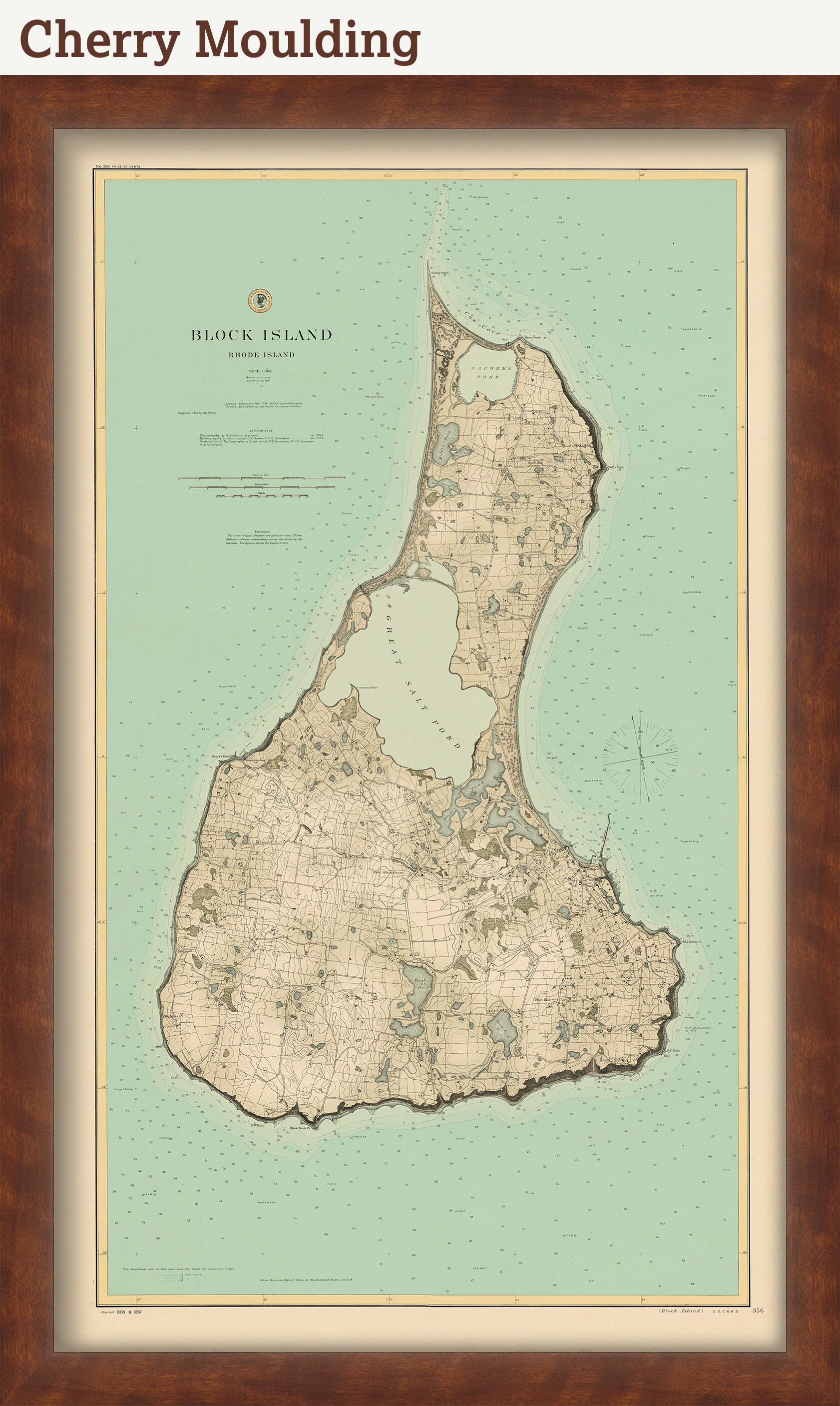
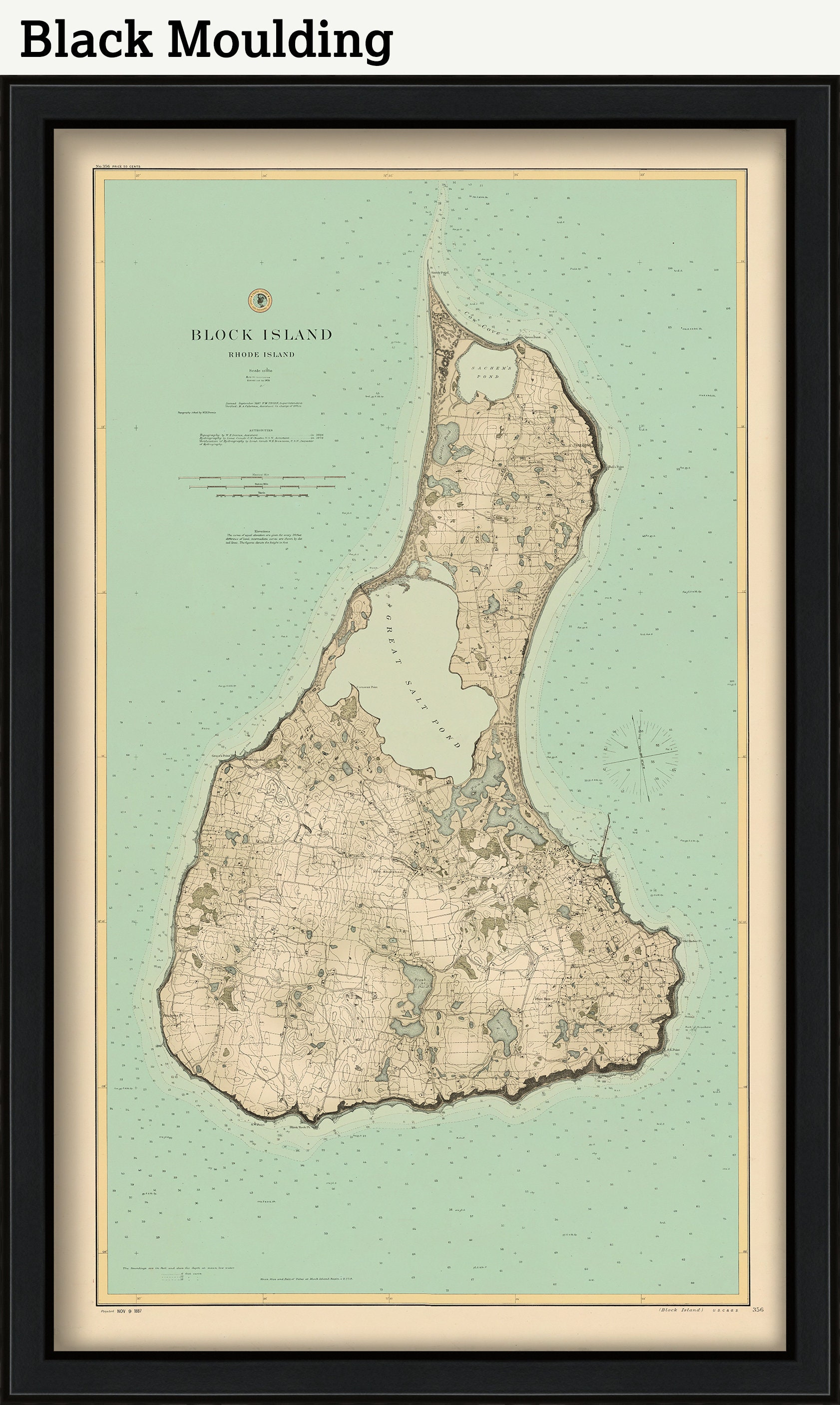
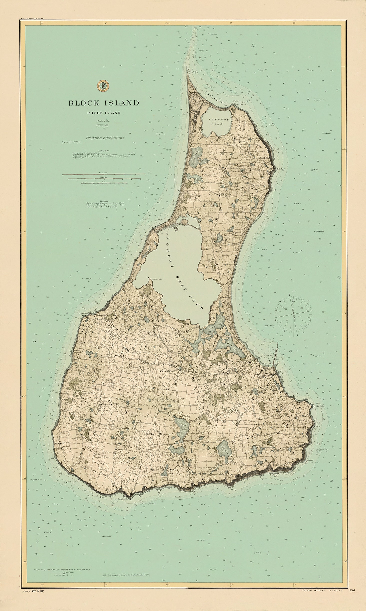
BLOCK ISLAND, Rhode Island - 1887 Nautical Chart - Colored Version
$38.00
A replica of an antique nautical chart of BLOCK ISLAND, Rhode Island. This charts was originally published in 1887 by the office of the United States Coast and Geodetic Survey. Originally monochromatic, we have added a splash of color to the map.
A point of interest in this chart: Great Salt Pond is not directly accessible from the Atlantic Ocean. The channel connecting the two bodies of water was not successfully dredged until 1895.
This chart is printed on heavy matte fine art paper with archival inks
Framed posters include drymounting, UV filtering glass, and your choice of six mouldings, wired and ready to hang upon delivery. All mouldings are approximately 1.5" wide. Please factor in an additional 3" to the listed size for framed items.
Retailers who would like to carry our Maps, please contact us through the "ask a question" button in this listing, for information and discounts.
A watermarked, high resolution file can be downloaded at this URL:
https://rmicusec.sirv.com/etsy/Block%20Island%20-%20Colored%20Version.jpg
The file make take a few moments to download as it is fairly large.
0660
Shipping from United States
Processing time
1-3 business days
Customs and import taxes
Buyers are responsible for any customs and import taxes that may apply. I'm not responsible for delays due to customs.
Payment Options
Returns & Exchanges
Returns & exchanges not accepted
But please contact me if you have problems with your order
I gladly accept cancellations
Request a cancellation within: 1 hours of purchase
Reviews (4)
Average:
Jan 24, 2022
Beautiful map! Will acquire others from different times.
Guyton
Aug 8, 2021
Stunning and exactly what I wanted!
cassondracavanagh
Jul 25, 2021
great map, odd size frame but beautiful
Jennifer B
Dec 14, 2020
Shipped fast, well packaged. I absolutely love it. The rusting blue frame is nice. It's subtle and not "too" blue.
Carol Skelly