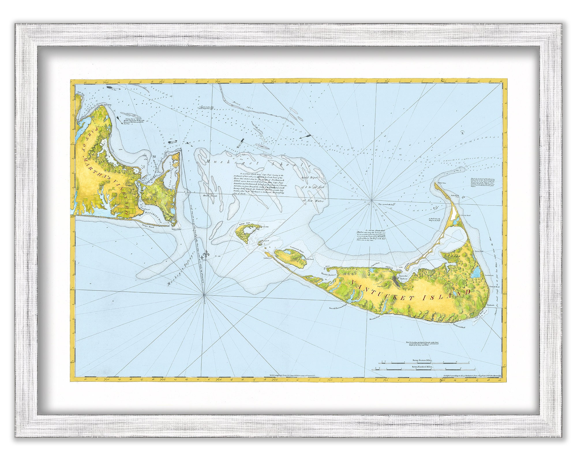
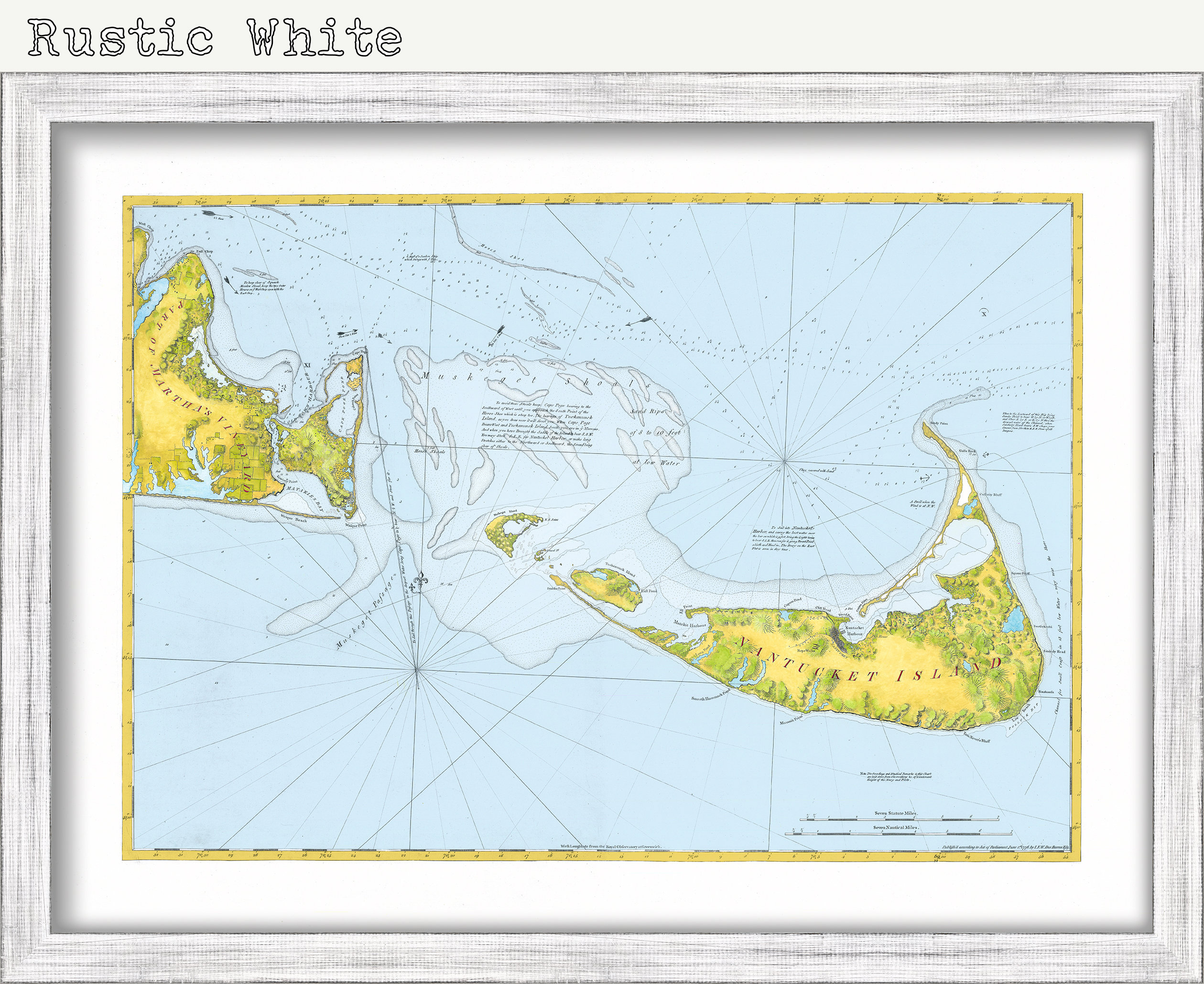

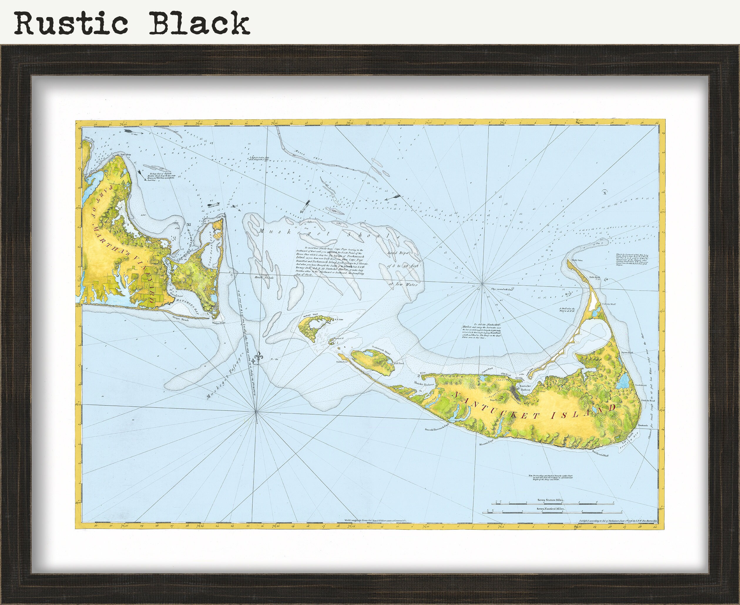
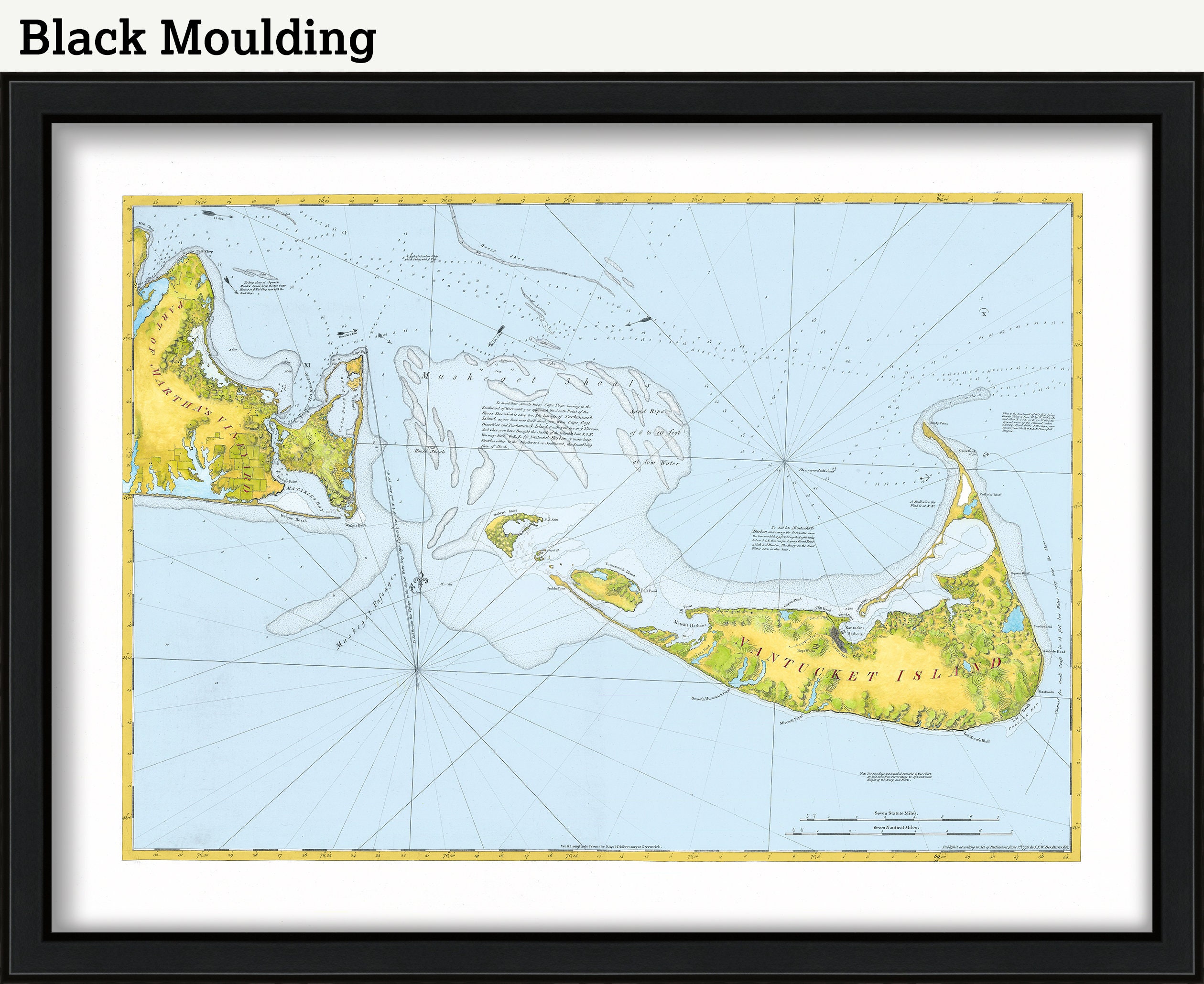
Map of Nantucket and Eastern part of Martha's Vineyard - J.F.W. Des Barres 1776 - Colored Version - Vibrant Colors
$48.00
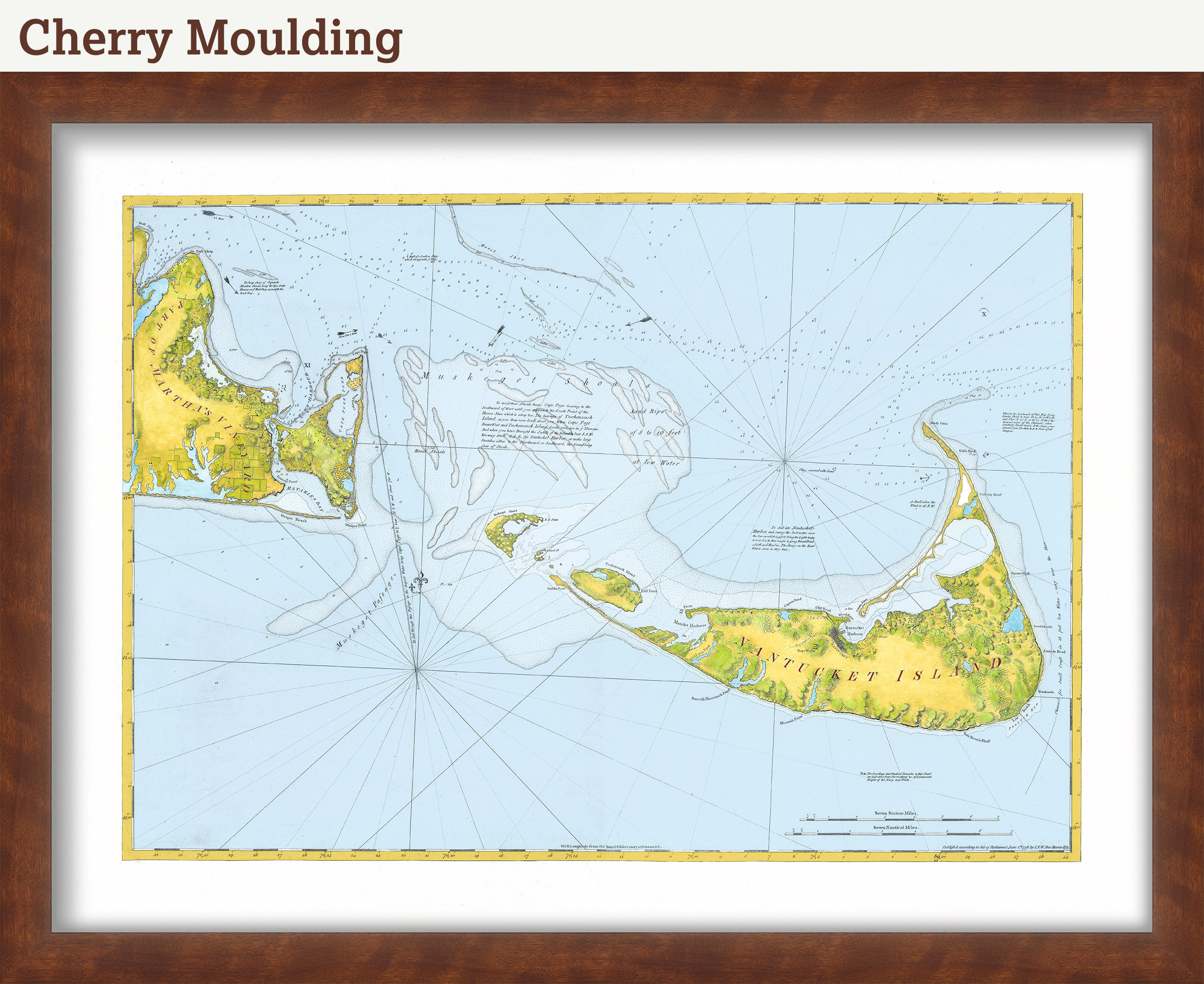
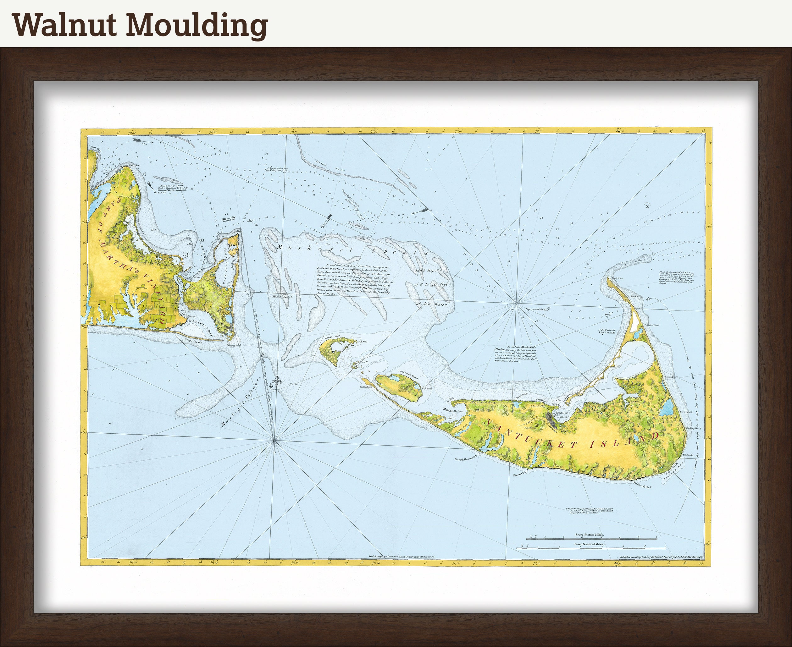
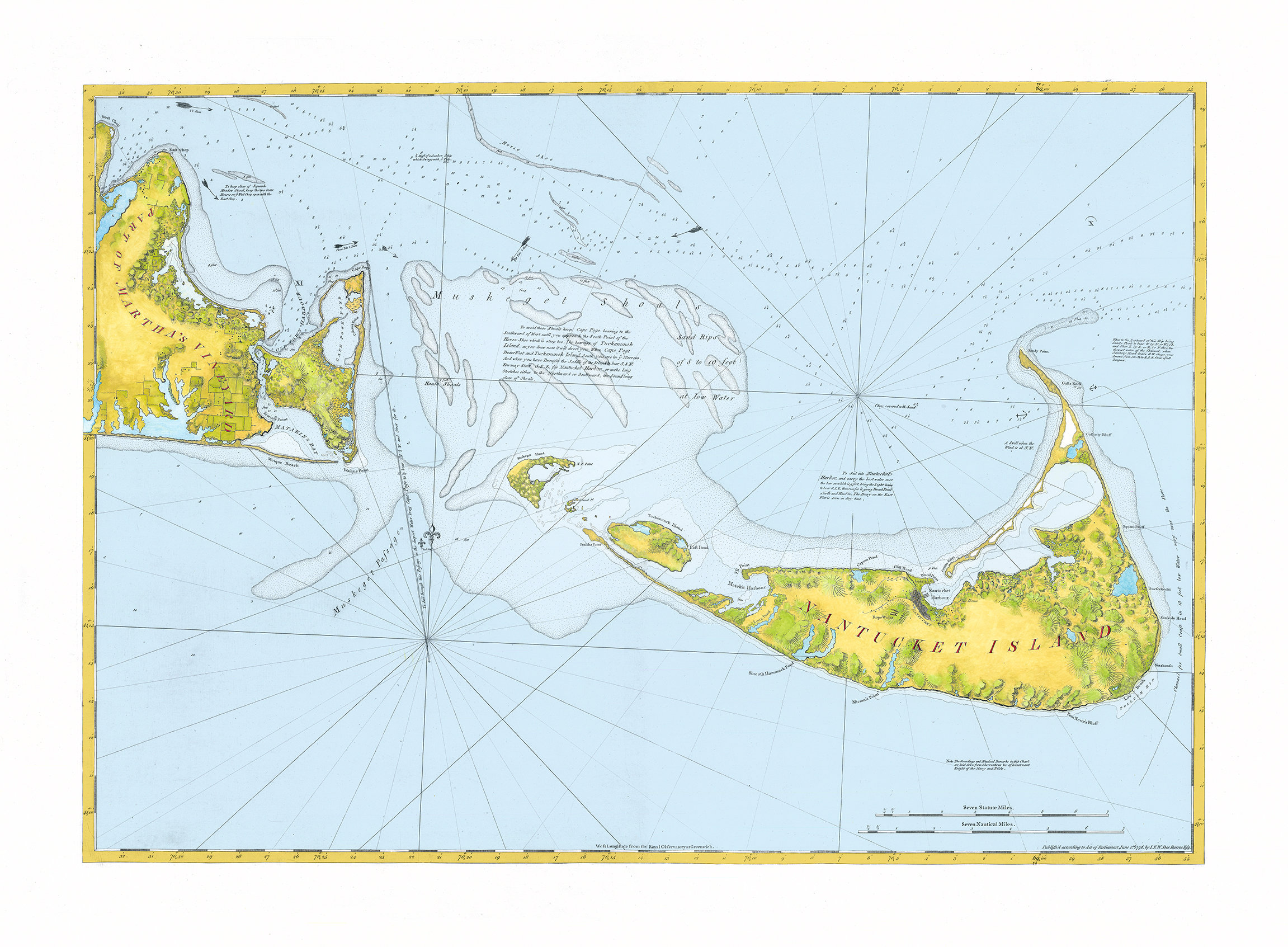
A reproduction of an antique map of Nantucket and the Eastern part of Martha's Vineyard by J.F.W. Des Barres originally published in 1776. It was featured in the folio the "Atlantic Neptune", a historic collection of maps of North Eastern North America renowned for their high level and detail and extreme accuracy for the time period. This nautical chart provides detailed instructions for ships navigating the dangerous, shallow shoals off the southern coast of Massachusetts in the late 18th Century. Originally published as a monochromatic engraving, we have enhanced this version with a splash of crisp and modern color.
Framed posters include drymounting, UV filtering glass, and your choice of six mouldings, wired and ready to hang upon delivery. All mouldings are approximately 1.5" wide. Please factor in an additional 3" to the listed size for framed items.
Retailers who would like to carry our Maps, please contact us through the "ask a question" button in this listing, for information and discounts.
0632
Shipping from United States
Processing time
1-3 business days
Customs and import taxes
Buyers are responsible for any customs and import taxes that may apply. I'm not responsible for delays due to customs.
Payment Options
Returns & Exchanges
Returns & exchanges not accepted
But please contact me if you have problems with your order
I gladly accept cancellations
Request a cancellation within: 1 hours of purchase