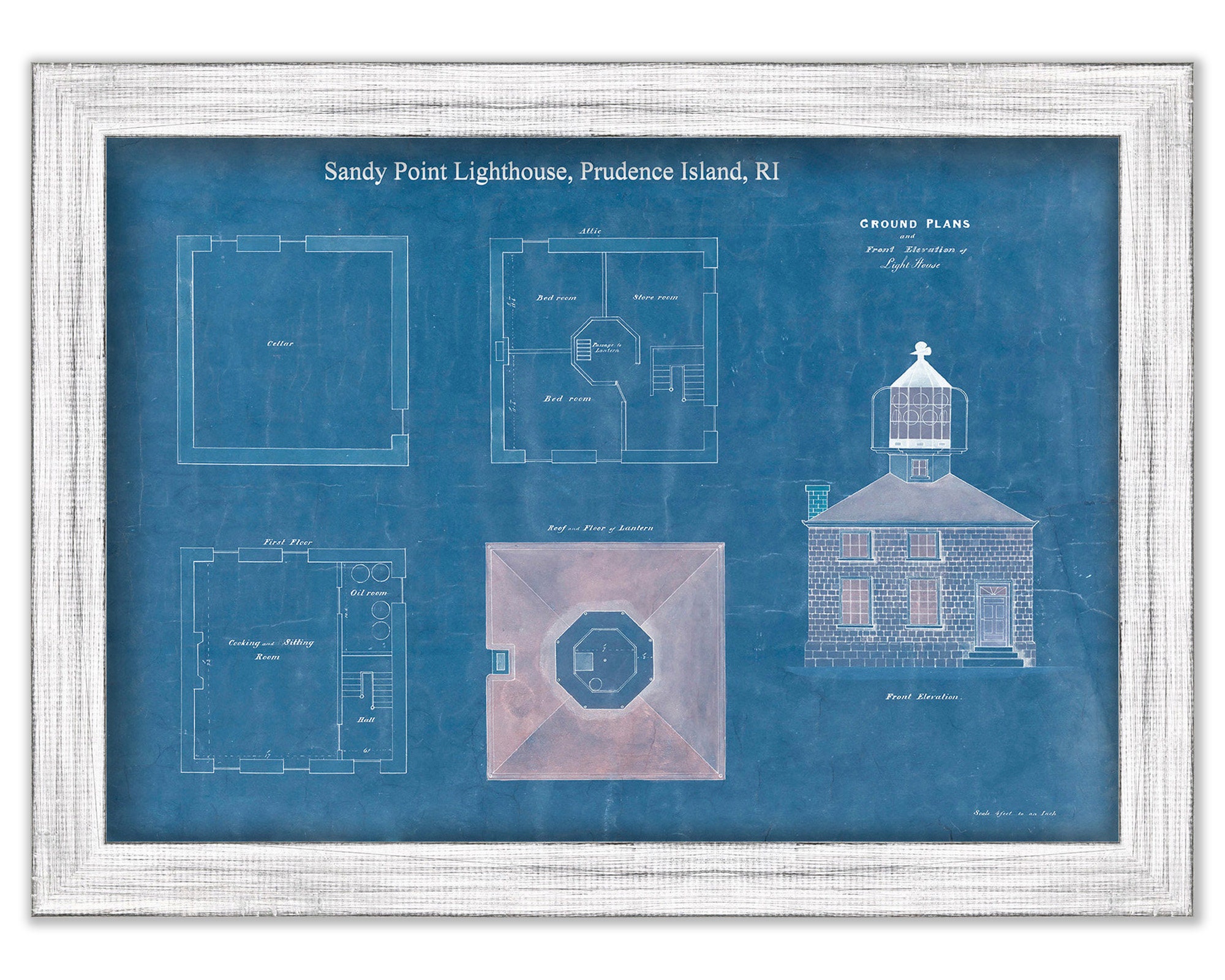
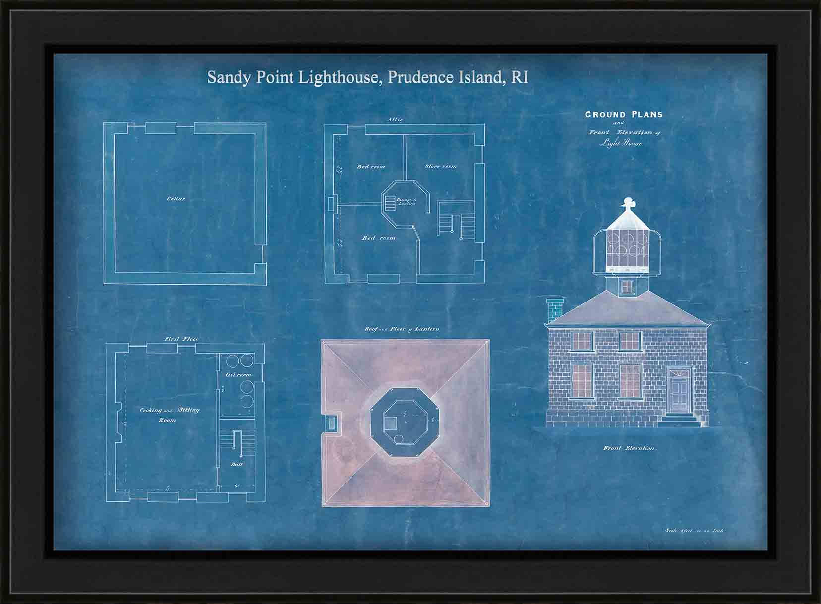


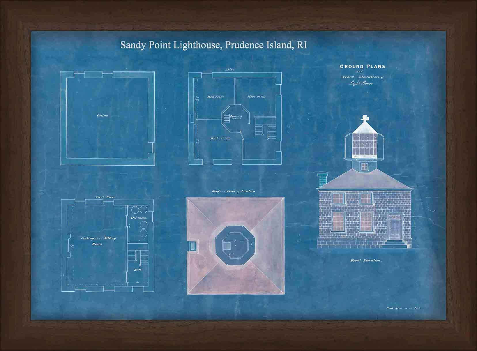
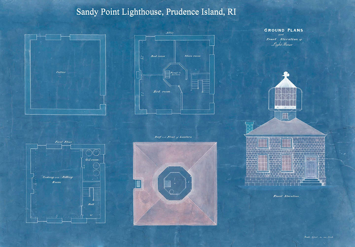
Sandy Point Lighthouse, Prudence Island, RI - Architectural Drawing Blueprint 1852
$40.00
Architectural Drawing Blueprint 1852 of Sandy Point Lighthouse, Prudence Island, RI. The Prudence Island Lighthouse, more commonly known locally as the Sandy Point Lighthouse, is located on Prudence Island, Rhode Island and is the oldest lighthouse tower in the state. Sandy Point is nicknamed Chibacoweda, meaning "little place separated by a passage", because the location is a little more than one mile offshore.
Dimensions of the Map are: 20" wide by 14" tall. The replica (i.e. reproduction) version of this map is available for $24
Framed Dimensions are: 23" wide by 17" tall. Replica maps are available framed for an additional $100.
Framed maps include drymounting, UV filtering glass, and your choice of five mouldings, wired and ready to hang upon delivery.
This map has been scanned at 300 dpi using state of the art equipment. The replica map is printed on heavy matte fine art paper using archival pigment inks.
Custom sizes are available. If you are interested in a custom size, please let us know through the "ask a question" button in this listing.
Retailers who would like to carry our Maps, please contact us through the "ask a question" button in this listing, for information and discounts.
0597
Shipping from United States
Processing time
1-3 business days
Customs and import taxes
Buyers are responsible for any customs and import taxes that may apply. I'm not responsible for delays due to customs.
Payment Options
Returns & Exchanges
Returns & exchanges not accepted
But please contact me if you have problems with your order
I gladly accept cancellations
Request a cancellation within: 1 hours of purchase