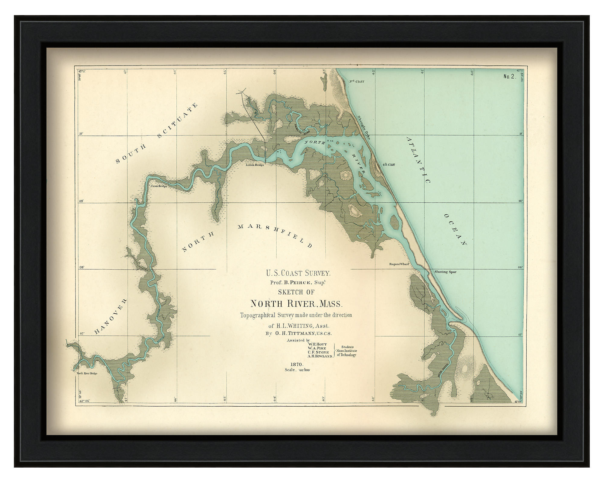
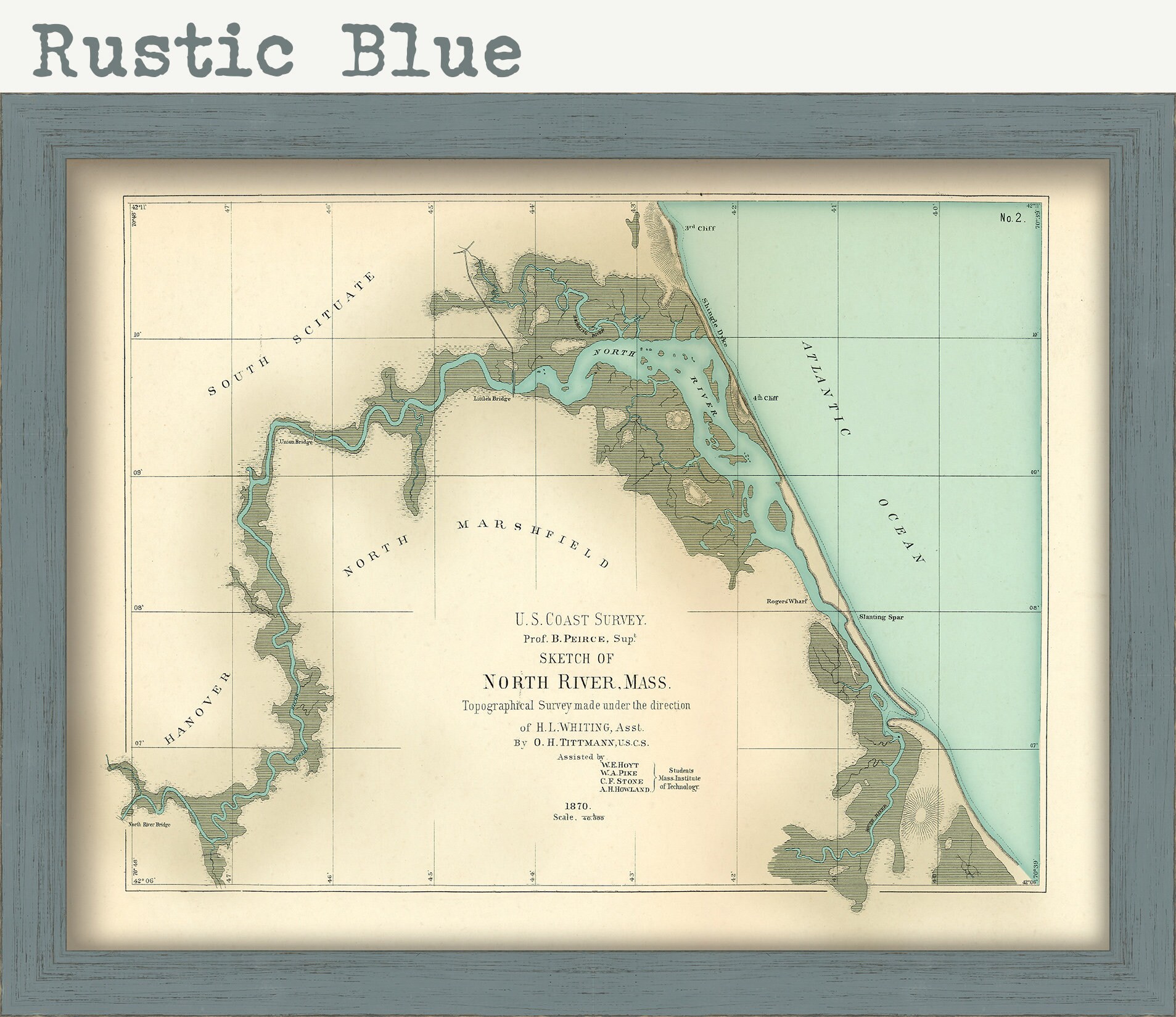
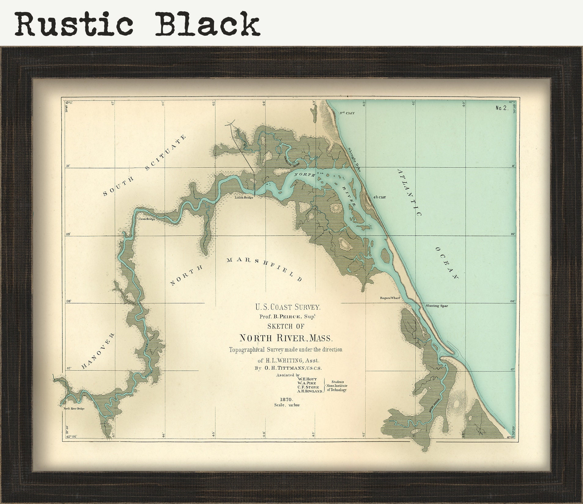
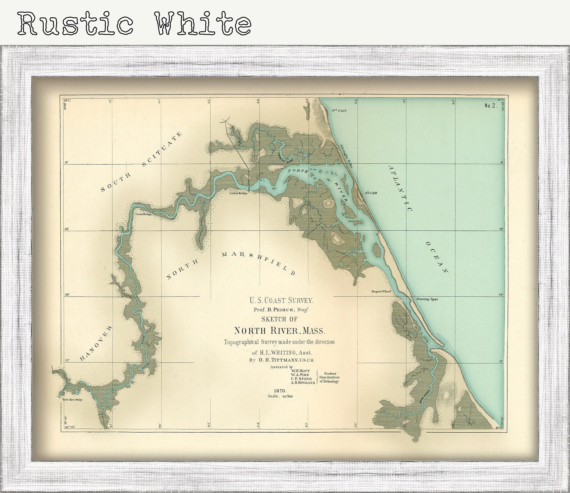
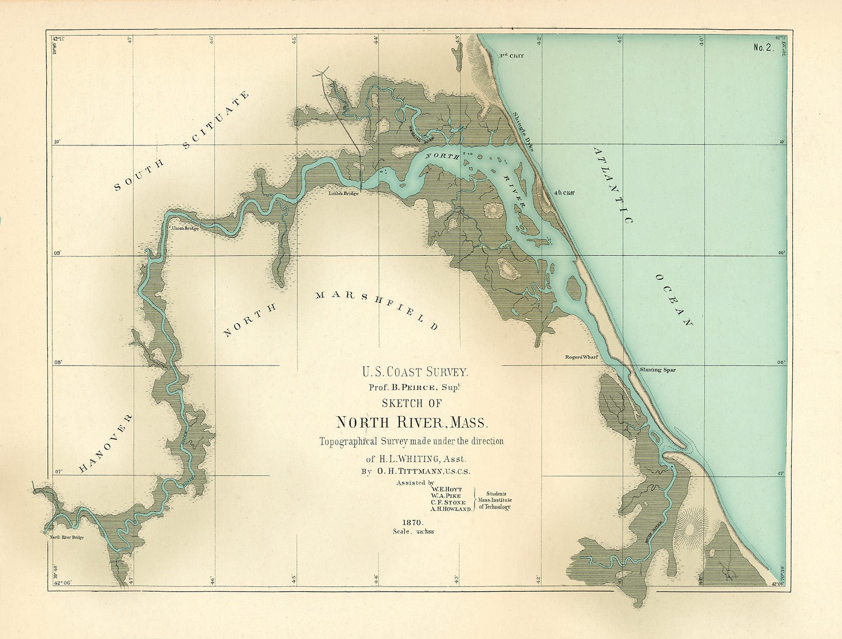
A Reproduction of a colored chart of the North River, Scituate/Marshfield, Massachusetts published in 1872. Prior to the Portland Gale of 1898, the North River flowed south between Scituate's Humarock section and Marshfield, Massachusetts, joining the South River and entering the ocean several miles to the south of the current opening. The storm breached a thin strip of beach, which connected Scituate's Third and Fourth Cliffs, leaving Humarock an island. Eventually the old inlet has silted in, forcing the South River to flow north between Marshfield and Humarock, where it now joins the North River to enter the ocean between Third and Fourth Cliffs
Framed maps include drymounting, UV filtering glass, and your choice of five mouldings, wired and ready to hang upon delivery.
This map has been scanned From The Original at 600 dpi using state of the art equipment. The replica map is printed on heavy matte fine art paper using archival pigment inks. This is one of over 5000 Original maps, charts and posters in our collection.
Custom sizes are available. If you are interested in a custom size, please let us know through the "ask a question" button in this listing.
Retailers who would like to carry our Maps, please contact us through the "ask a question" button in this listing, for information and discounts.
0585
Shipping from United States
Processing time
1-3 business days
Customs and import taxes
Buyers are responsible for any customs and import taxes that may apply. I'm not responsible for delays due to customs.
Payment Options
Returns & Exchanges
Returns & exchanges not accepted
But please contact me if you have problems with your order
I gladly accept cancellations
Request a cancellation within: 1 hours of purchase
Reviews (4)
Average:
Nov 2, 2023
Received fast and is perfect
rdkelly03
Aug 16, 2022
Exactly as described, great service.
cbshelley
Jun 21, 2022
Sean landers
Jun 10, 2021
Erin Sulmonte