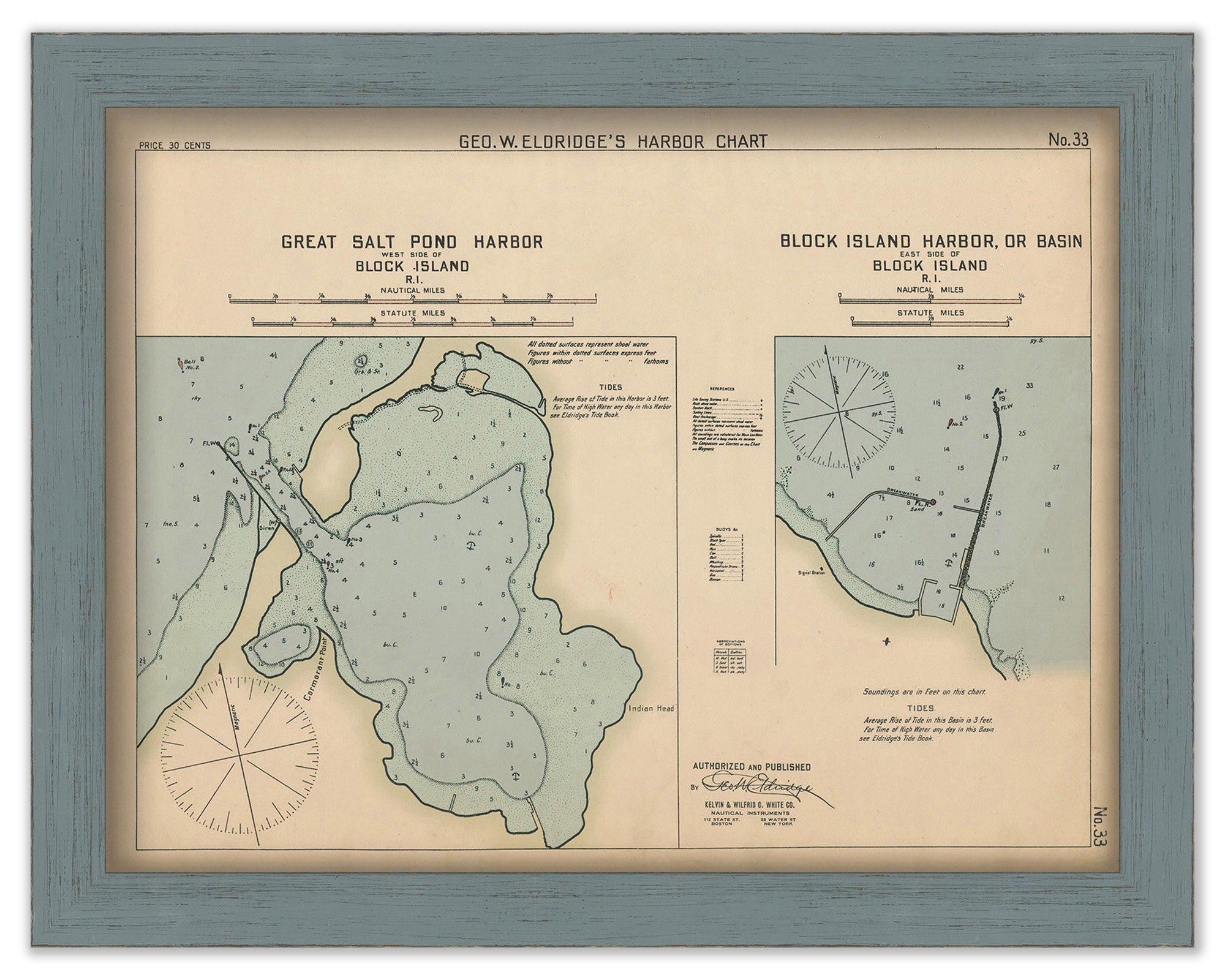
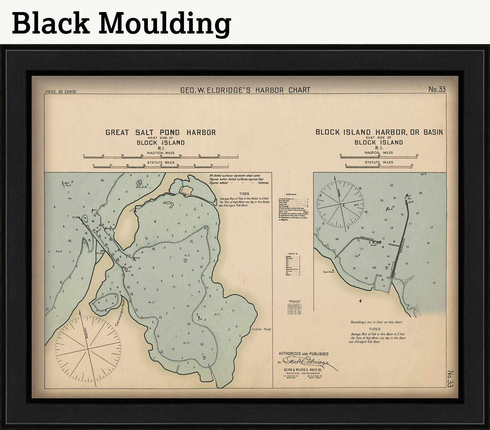
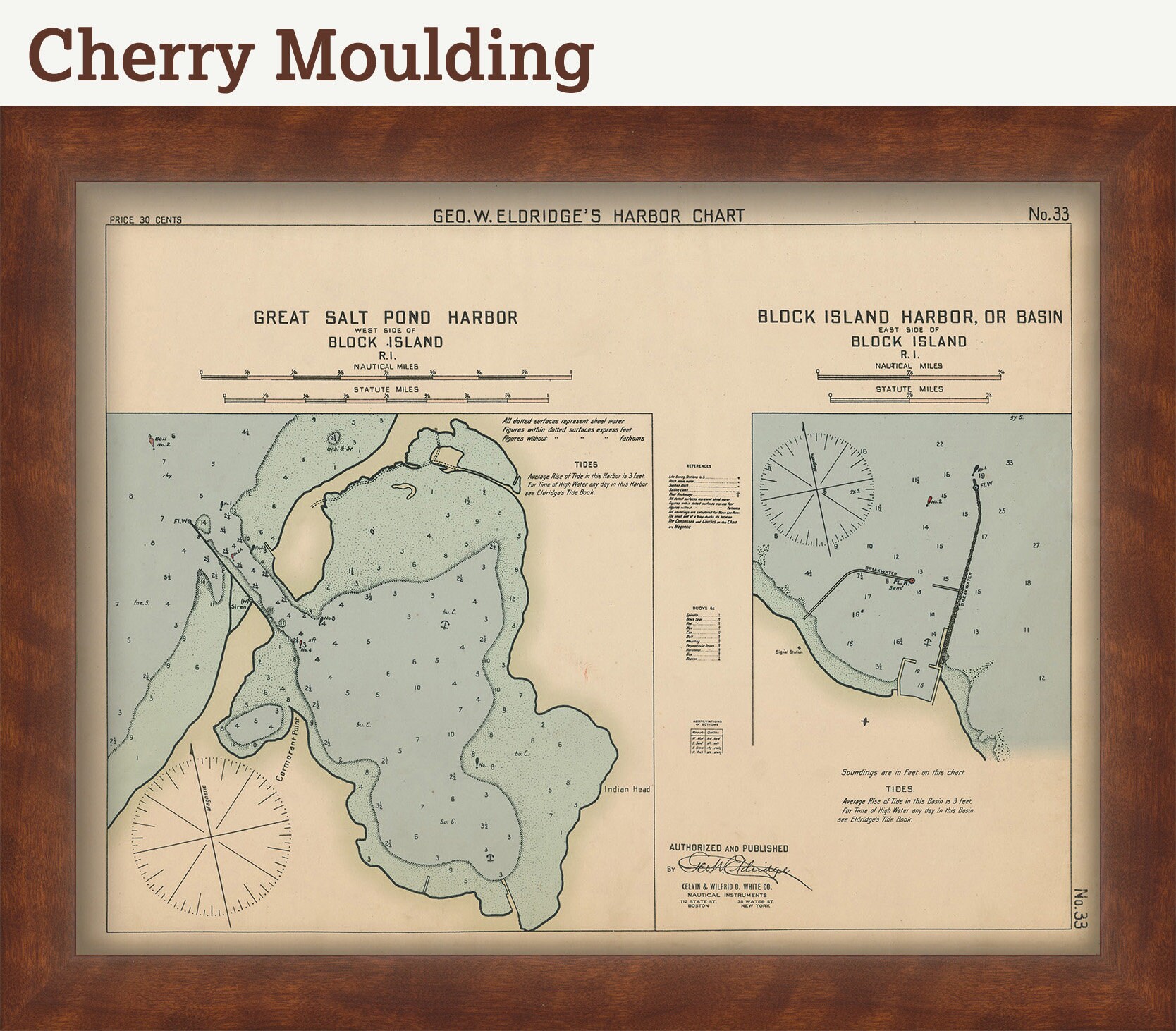
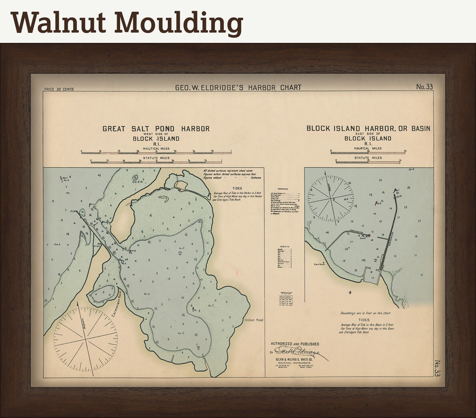
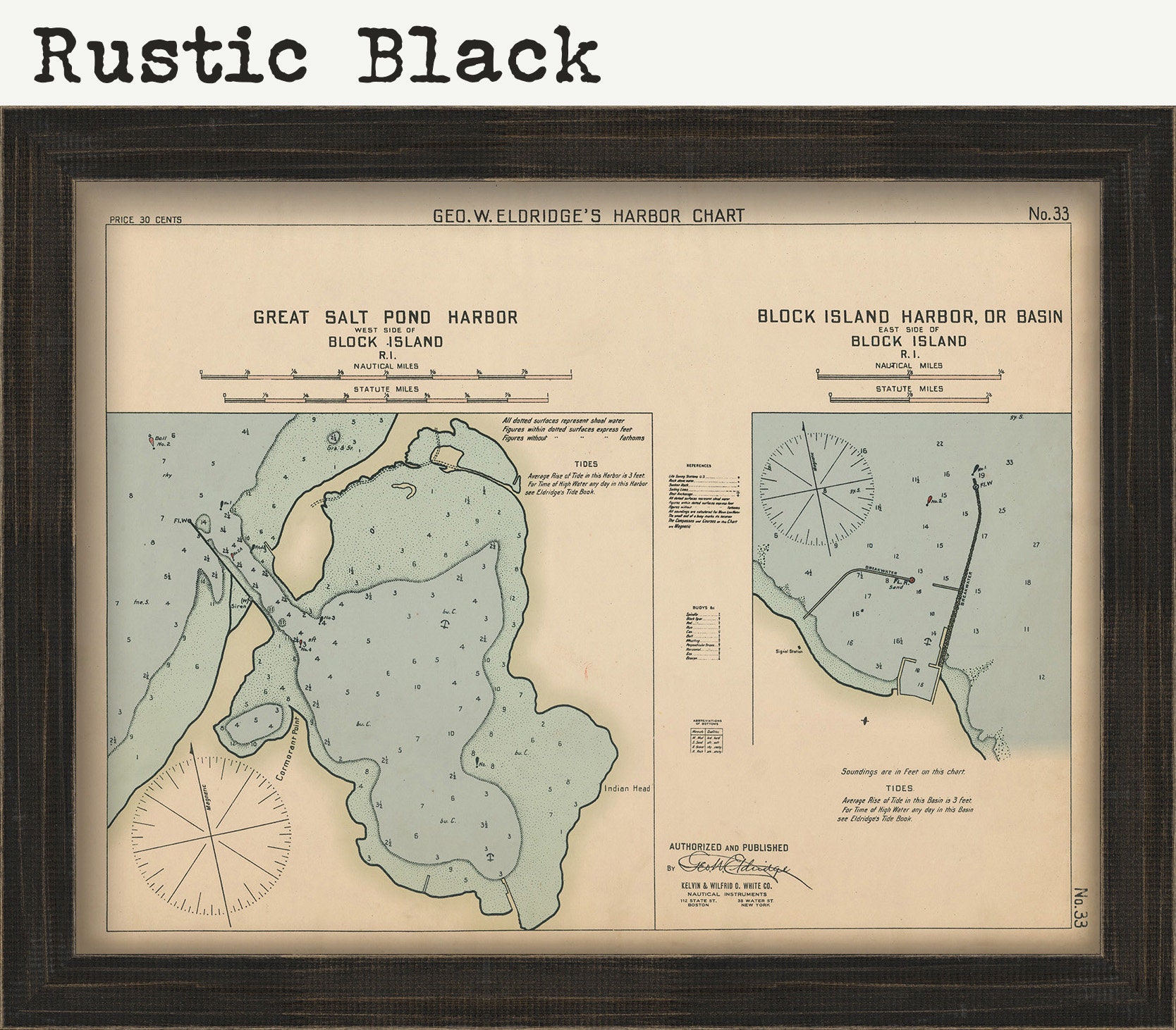
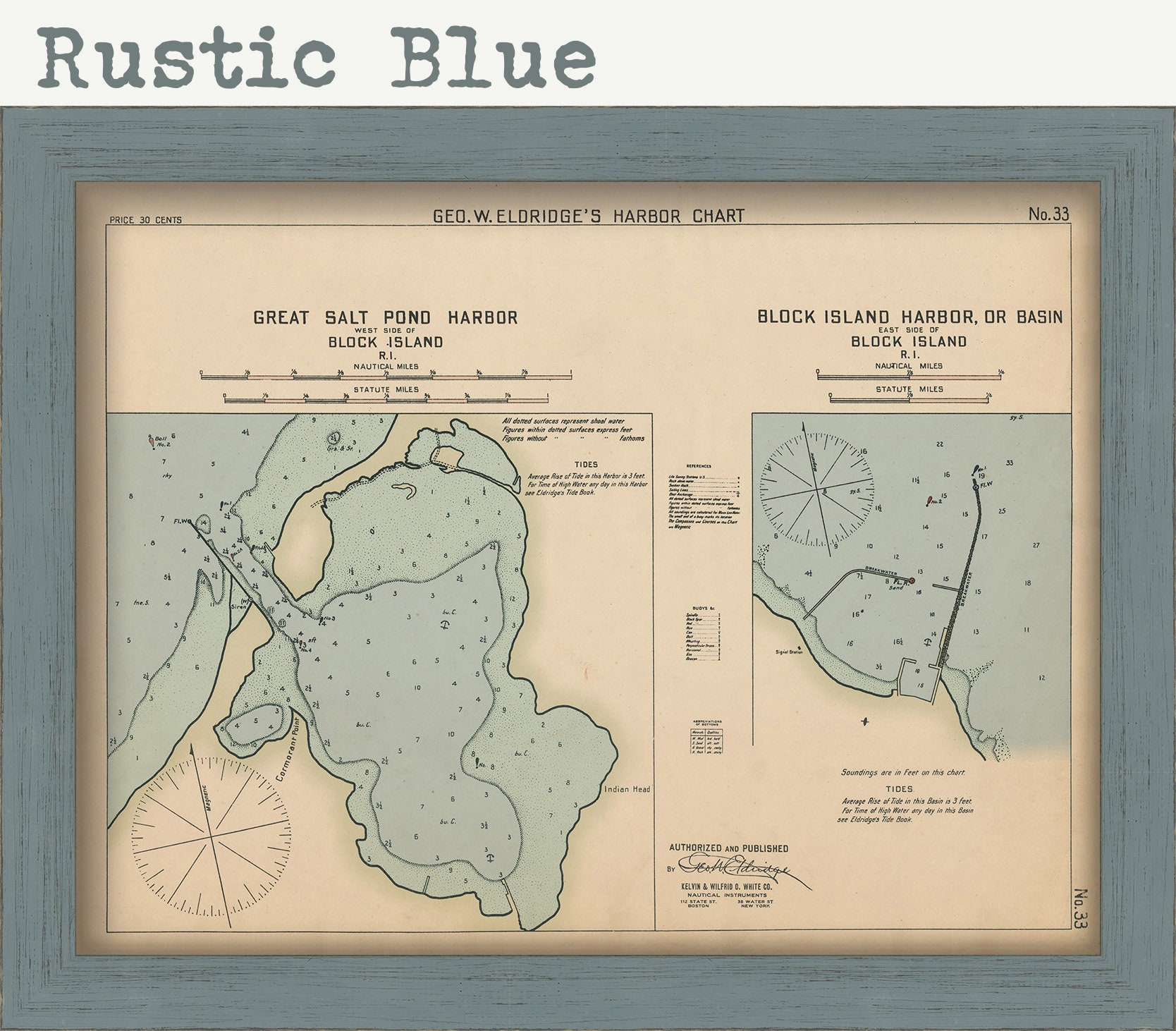
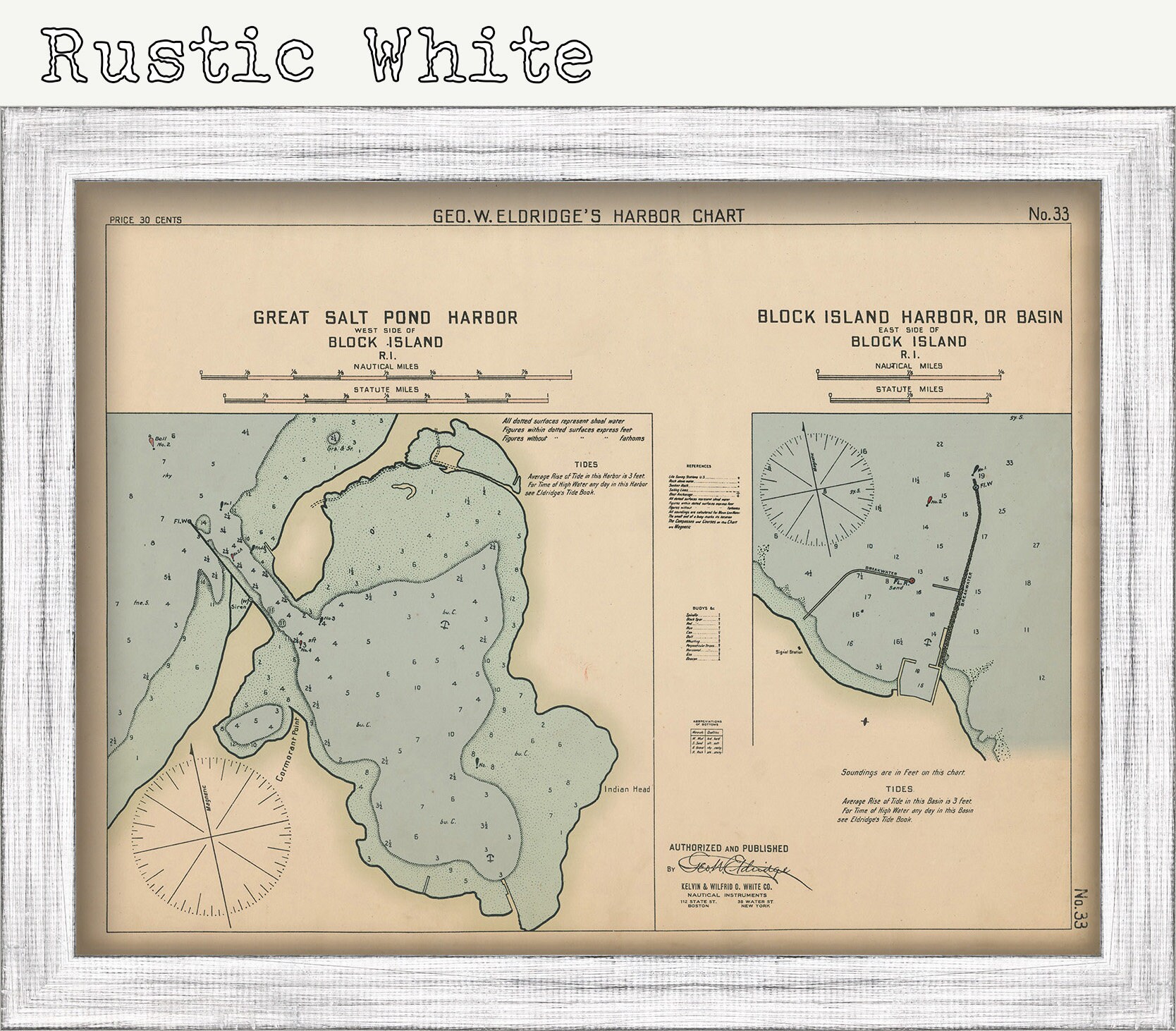
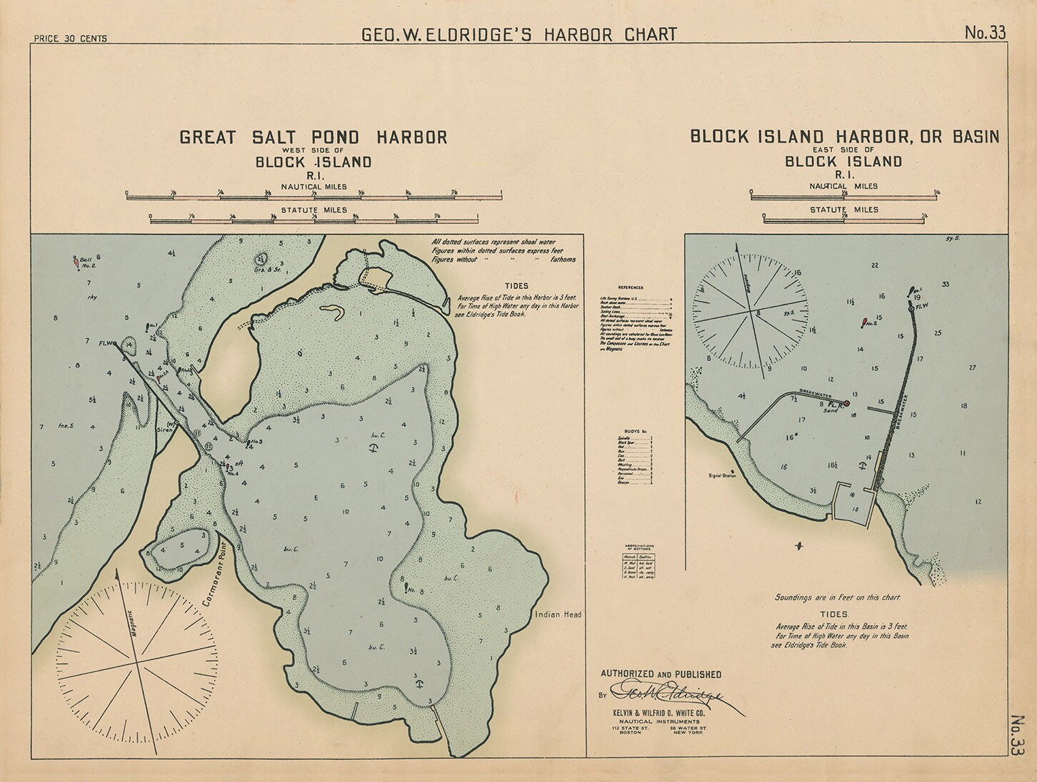
Block Island Harbor - Nautical Chart by George W. Eldridge 1901 0330
$50.00
A Nautical Chart of Block Island harbor by George W. Eldridge originally published in 1901. This map is from the atlas "Geo. W. Eldrige's Harbor-Chart Book, New York to Boston". Eldridge Charts are renowned for bold lines and a clear and concise style.
Original Dimensions of the Map are: 20" wide by 15" tall.
Framed Dimensions are: 23" wide by 18" tall.
Framed maps include drymounting, UV filtering glass, and your choice of five mouldings, wired and ready to hang upon delivery.
This map has been scanned From The Original at 600 dpi using state of the art equipment. The replica map is printed on heavy matte fine art paper using archival pigment inks. This is one of over 5000 Original maps, charts and posters in our collection.
Custom sizes are available. If you are interested in a custom size, please let us know through the "ask a question" button in this listing.
Retailers who would like to carry our Maps, please contact us through the "ask a question" button in this listing, for information and discounts.
0330
Shipping from United States
Processing time
1-3 business days
Customs and import taxes
Buyers are responsible for any customs and import taxes that may apply. I'm not responsible for delays due to customs.
Payment Options
Returns & Exchanges
Returns & exchanges not accepted
But please contact me if you have problems with your order
I gladly accept cancellations
Request a cancellation within: 1 hours of purchase
Reviews (1)
Average:
Nov 18, 2022
great frame, timely delivery, exactly what I wanted
dorisblombardi