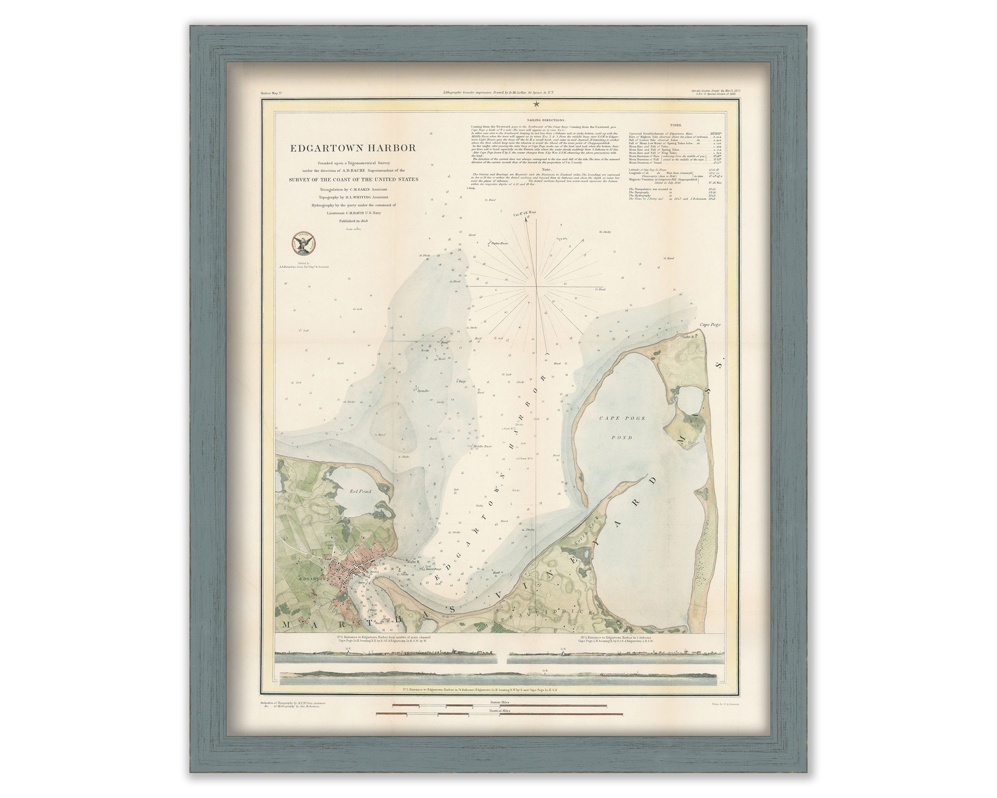
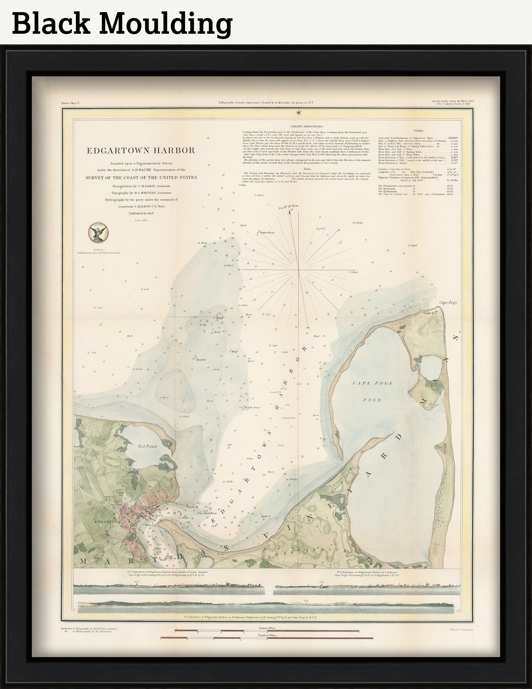
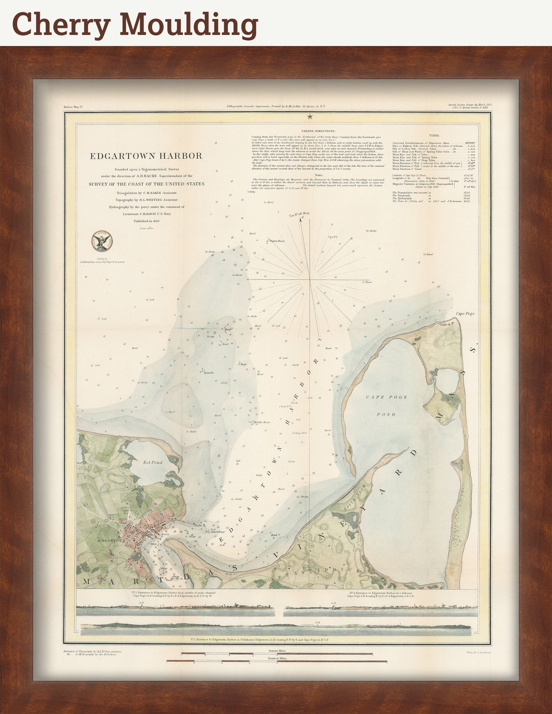
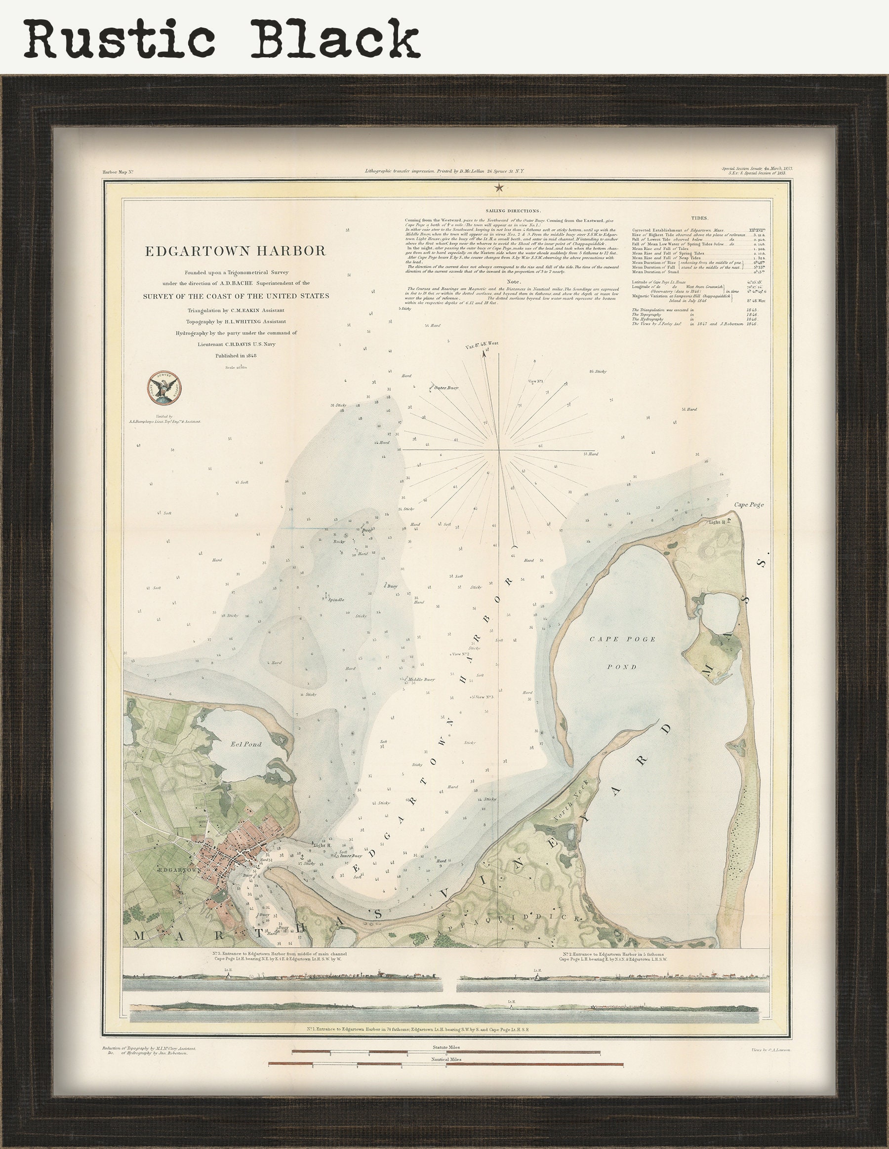
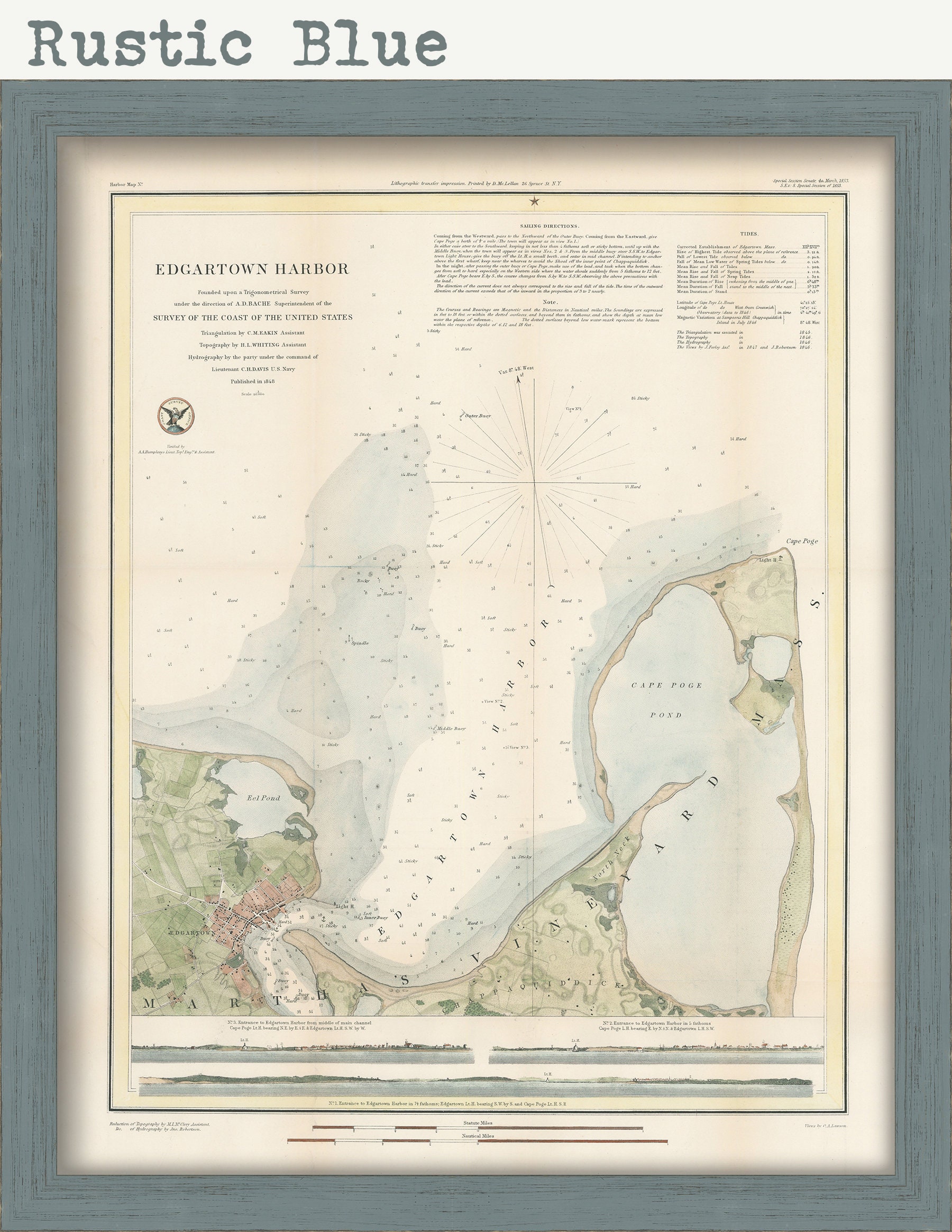
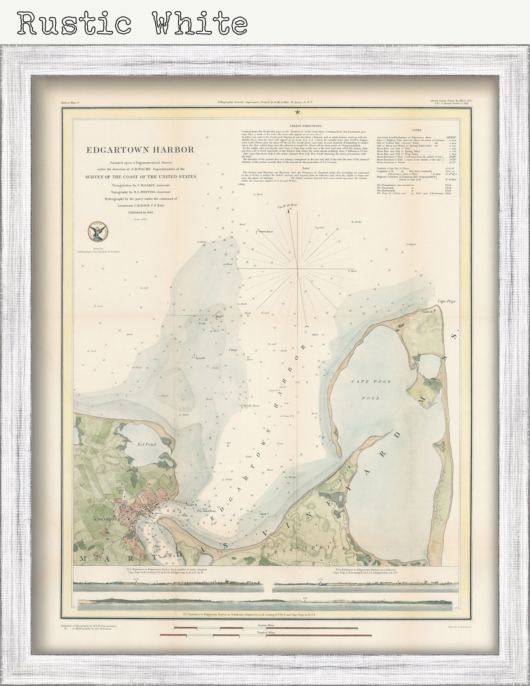
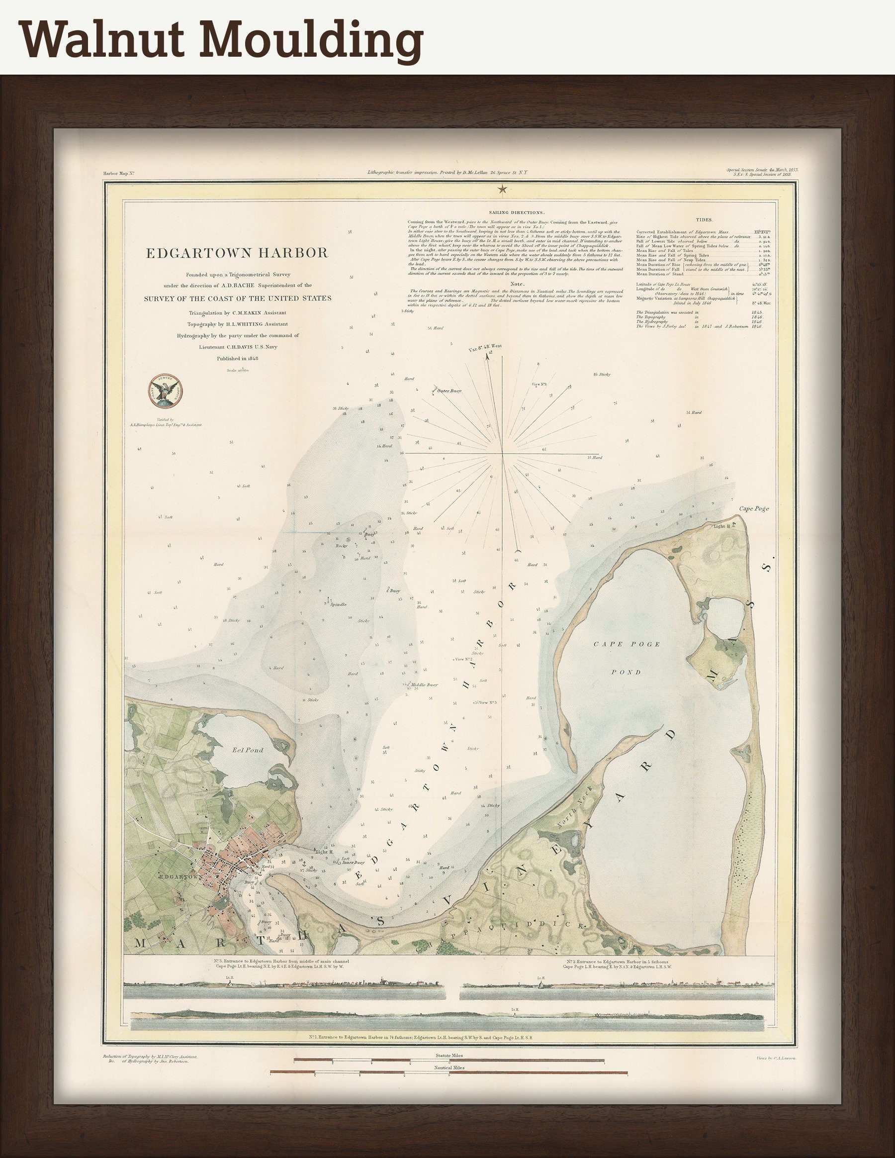
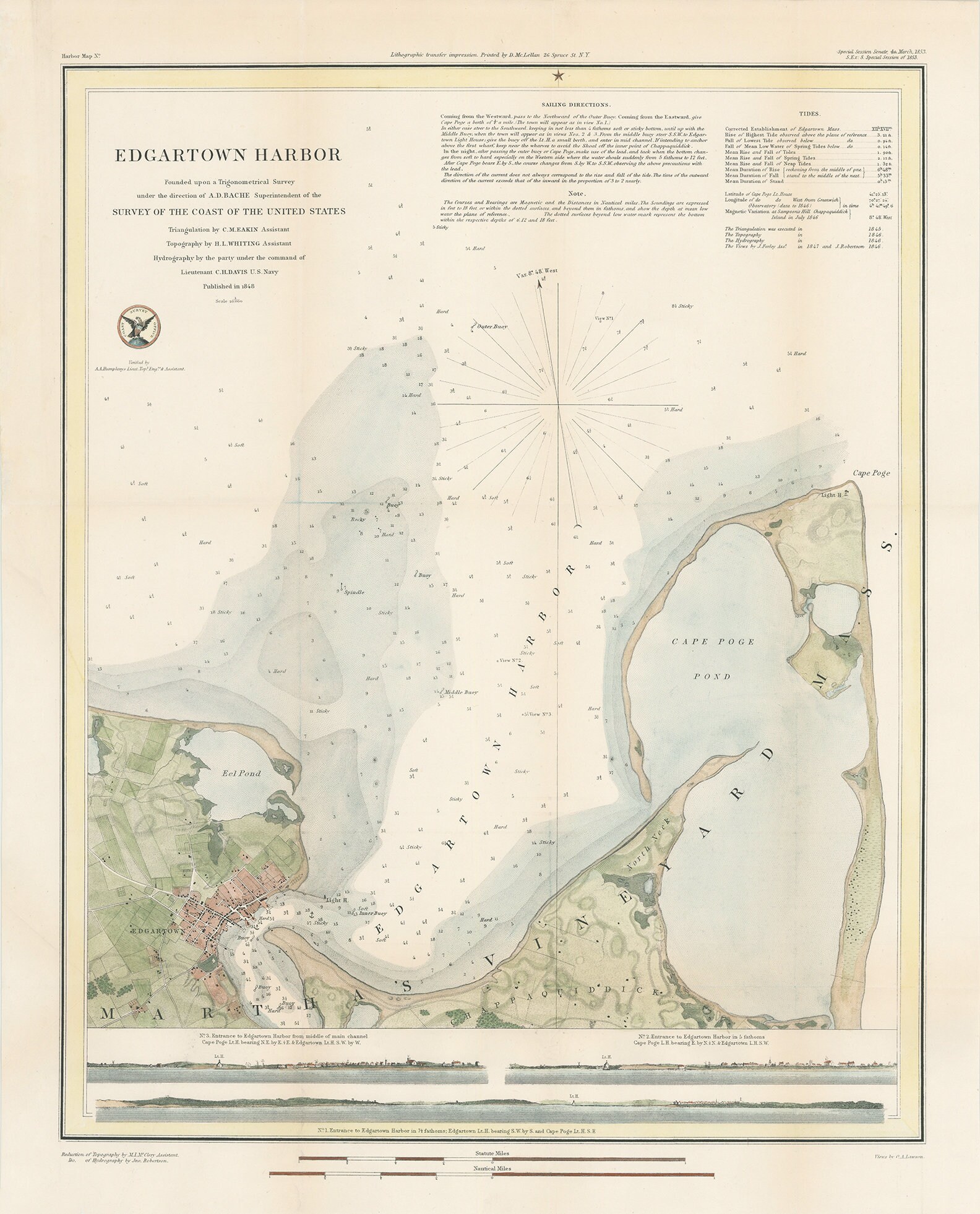
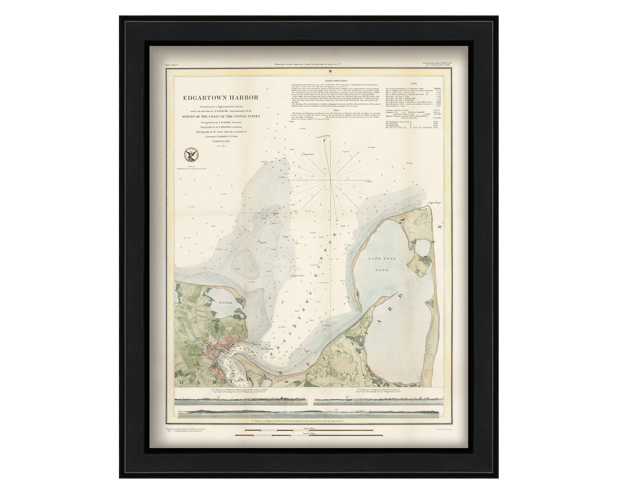
Edgartown Harbor, Martha's Vineyard, Massachusetts Chart published in 1848
$38.00
A Replica of a hand colored Nautical Chart of Edgartown Harbor, Martha's Vineyard, Massachusetts published in 1848.
This image is printed on heavy matte fine art paper with archival inks.
Framing is available. Framed maps include dry mounting, UV filtering glass, and your choice of mouldings, wired and ready to hang upon delivery. All mouldings are approximately 1.5" wide. Please factor in an additional 3" to the listed size for framed items.
This map has been scanned From The ORIGINAL at 600 dpi using state of the art equipment {a Contex Large Format Scanner}. The replica map is printed on heavy matte fine art paper using archival pigment inks. This is one of over 5000 Original maps, charts and posters in our collection.
Many reproduction maps that are available on Etsy are taken directly from public domain sources {NY Public Library, Library of Congress, etc}. Although great for research purposes, these image files frequently suffer from poor color accuracy, lens blur and distortion. The maps in our collection have been scanned from the ORIGINAL, flat, at high resolution and with precisely calibrated color. This allows us to print replicas that are virtually indistinguishable from the original maps.
Custom sizes are available. If you are interested in a custom size, please let us know through the "ask a question" button in this listing.
Retailers who would like to carry our Maps, please contact us through the "ask a question" button in this listing, for information and discounts.
1559
Shipping from United States
Processing time
1-3 business days
Customs and import taxes
Buyers are responsible for any customs and import taxes that may apply. I'm not responsible for delays due to customs.
Payment Options
Returns & Exchanges
Returns & exchanges not accepted
But please contact me if you have problems with your order
I gladly accept cancellations
Request a cancellation within: 1 hours of purchase