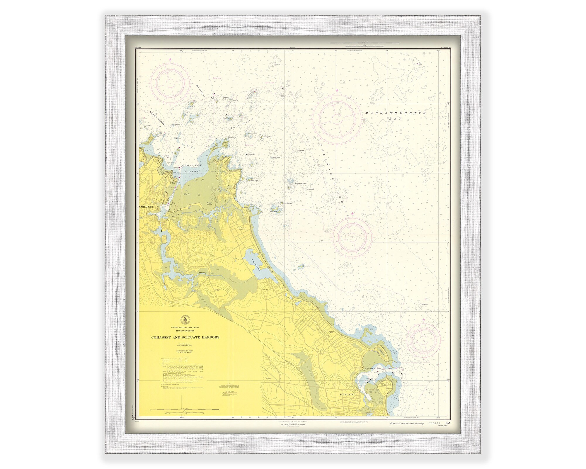
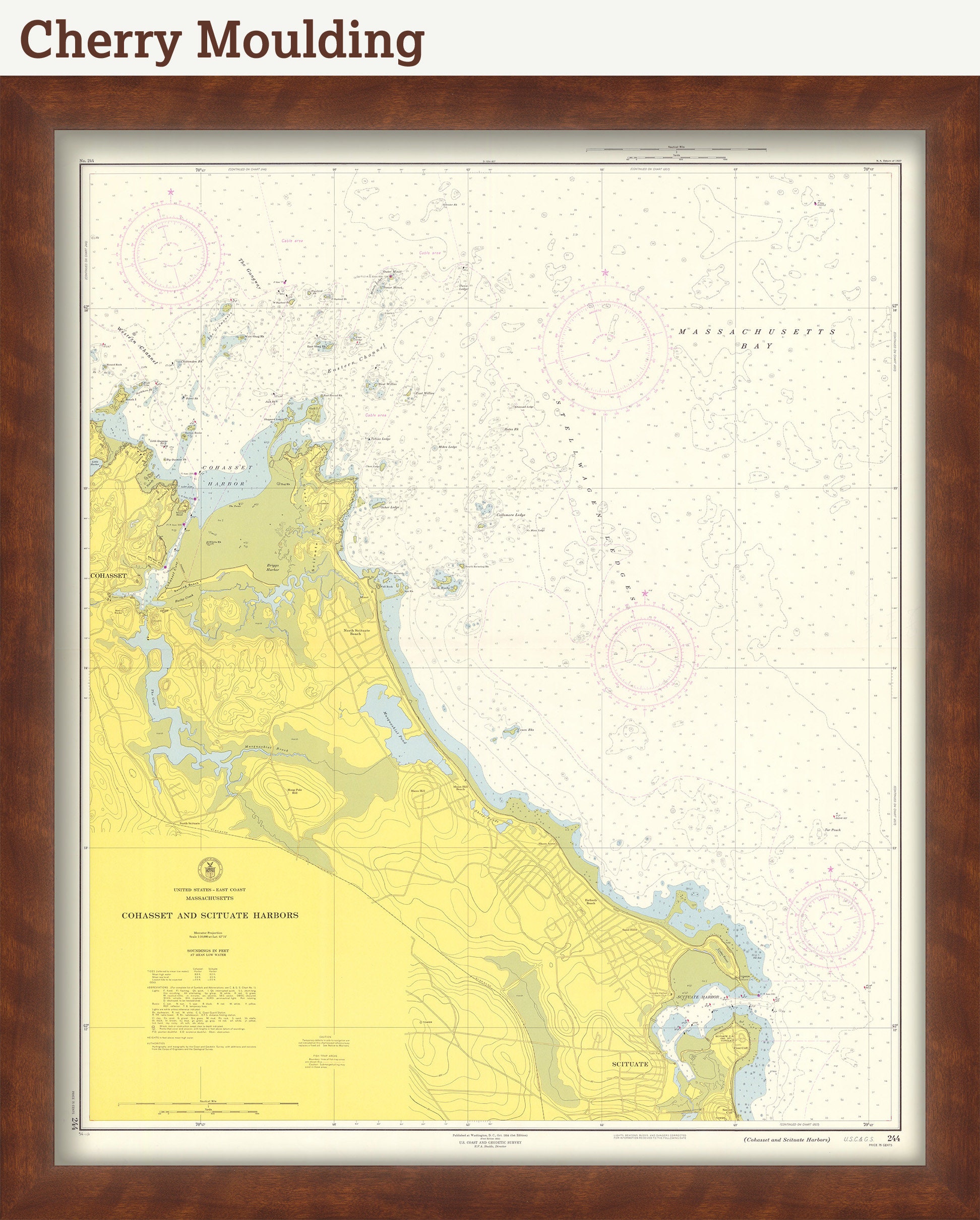
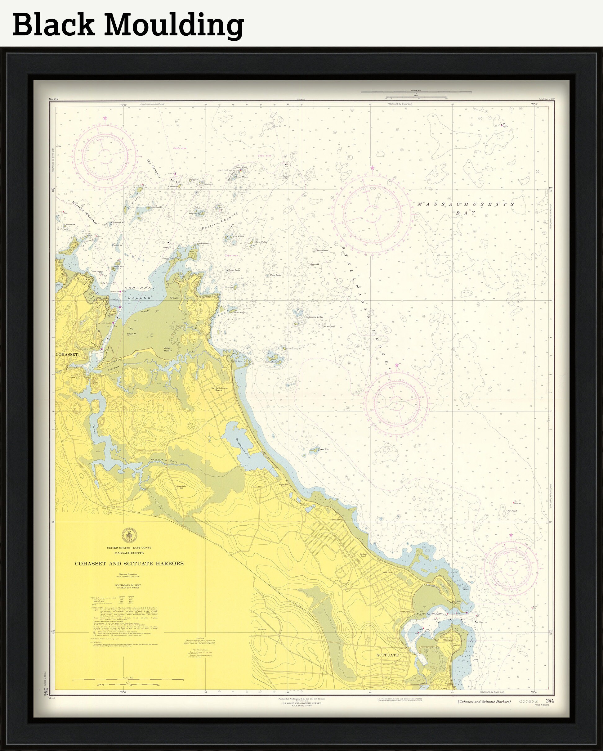
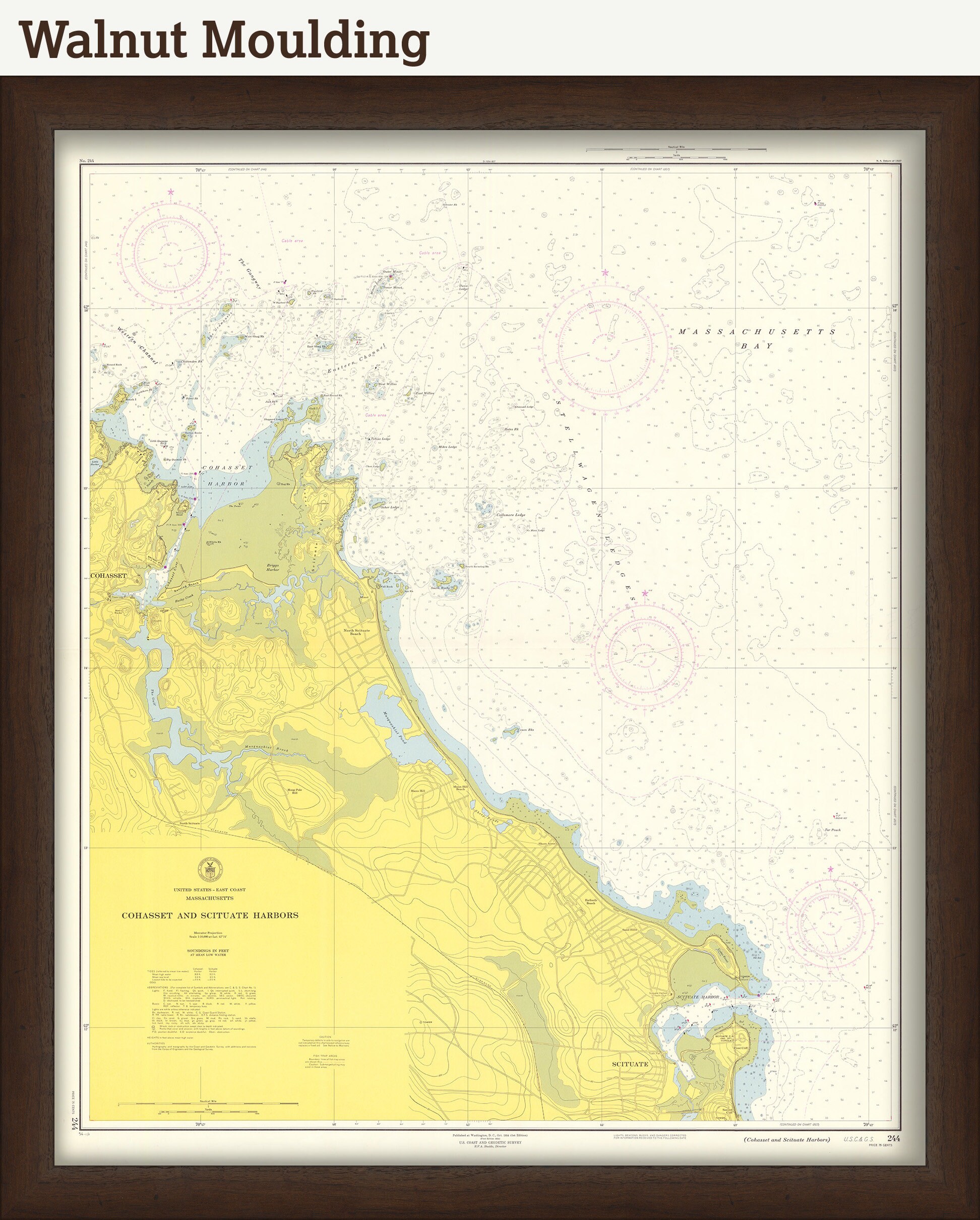
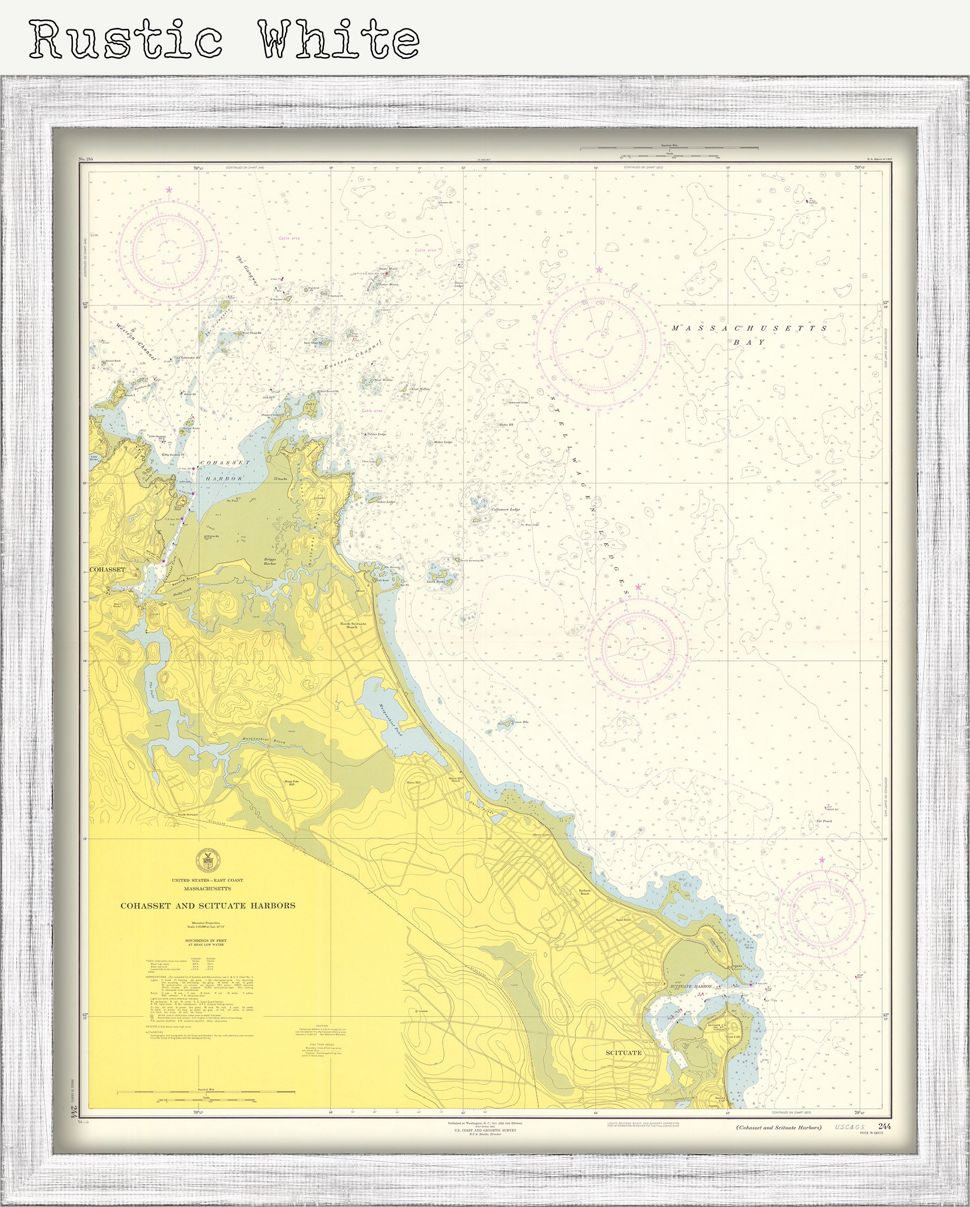
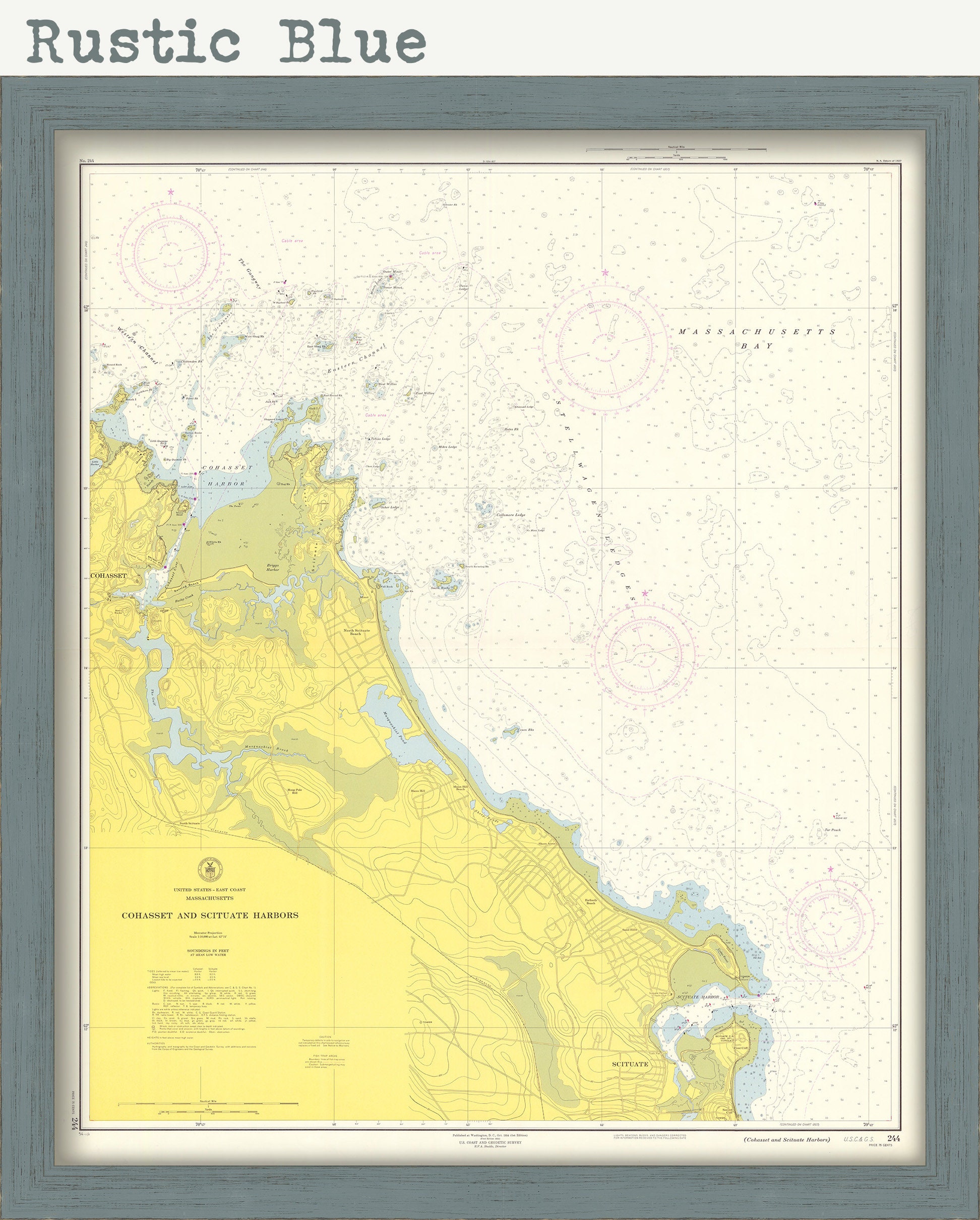
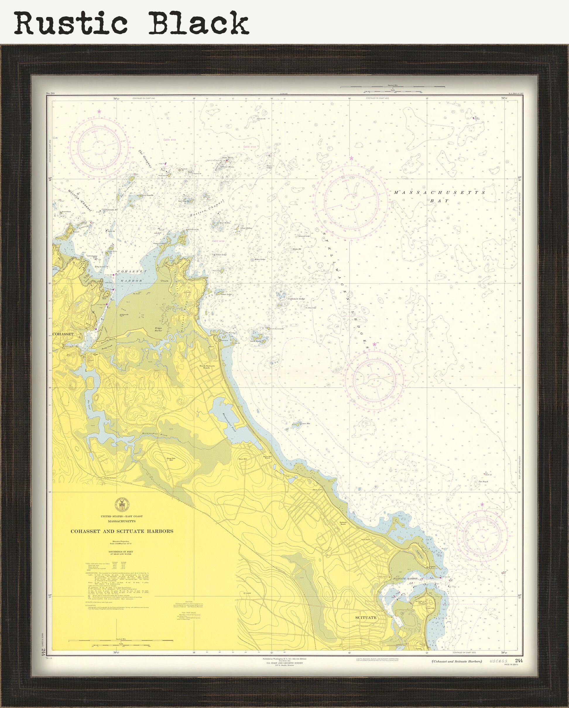
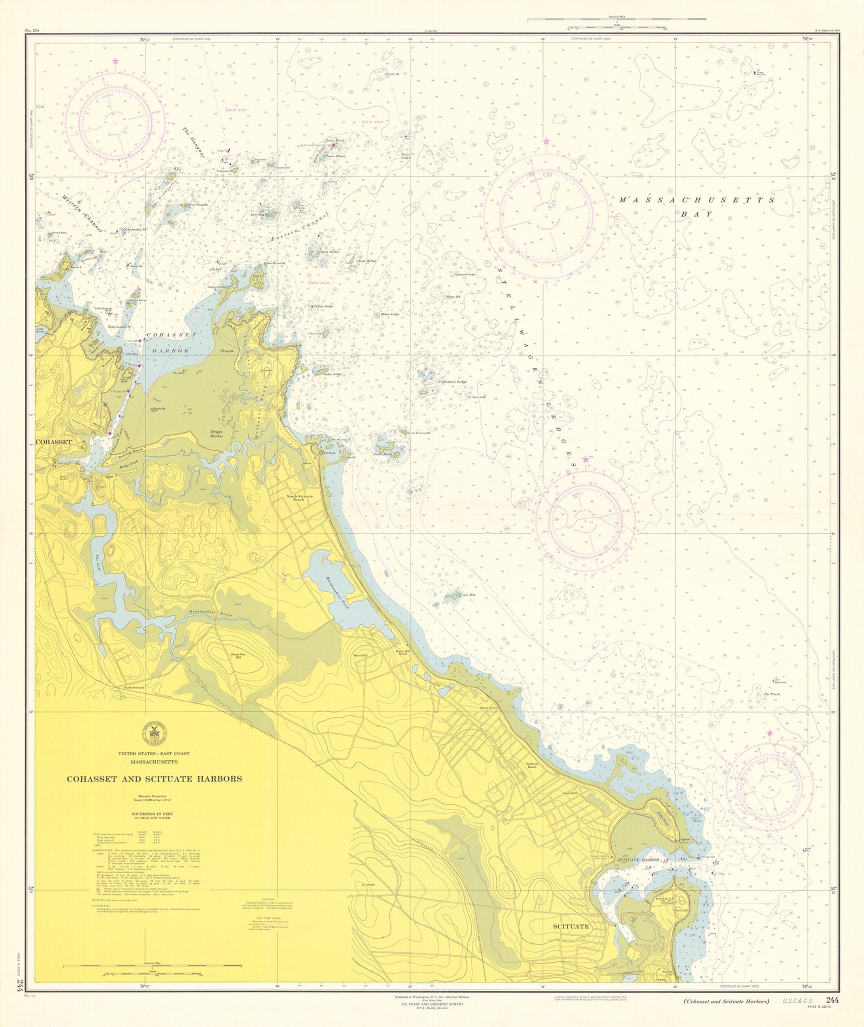
COHASSET and SCITUATE HARBORS, Massachusetts 1954 Nautical Chart
$38.00
A Reproduction Nautical Chart of COHASSET and SCITUATE Harbors by U.S. Coast and Geodetic Survey originally published in 1954.
The original size of the chart is 35" wide by 42" tall
This map has been scanned at 300 dpi using state of the art equipment. The replica map is printed on heavy matte fine art paper using archival pigment inks.
0430
Shipping from United States
Processing time
1-3 business days
Customs and import taxes
Buyers are responsible for any customs and import taxes that may apply. I'm not responsible for delays due to customs.
Payment Options
Returns & Exchanges
Returns & exchanges not accepted
But please contact me if you have problems with your order
I gladly accept cancellations
Request a cancellation within: 1 hours of purchase