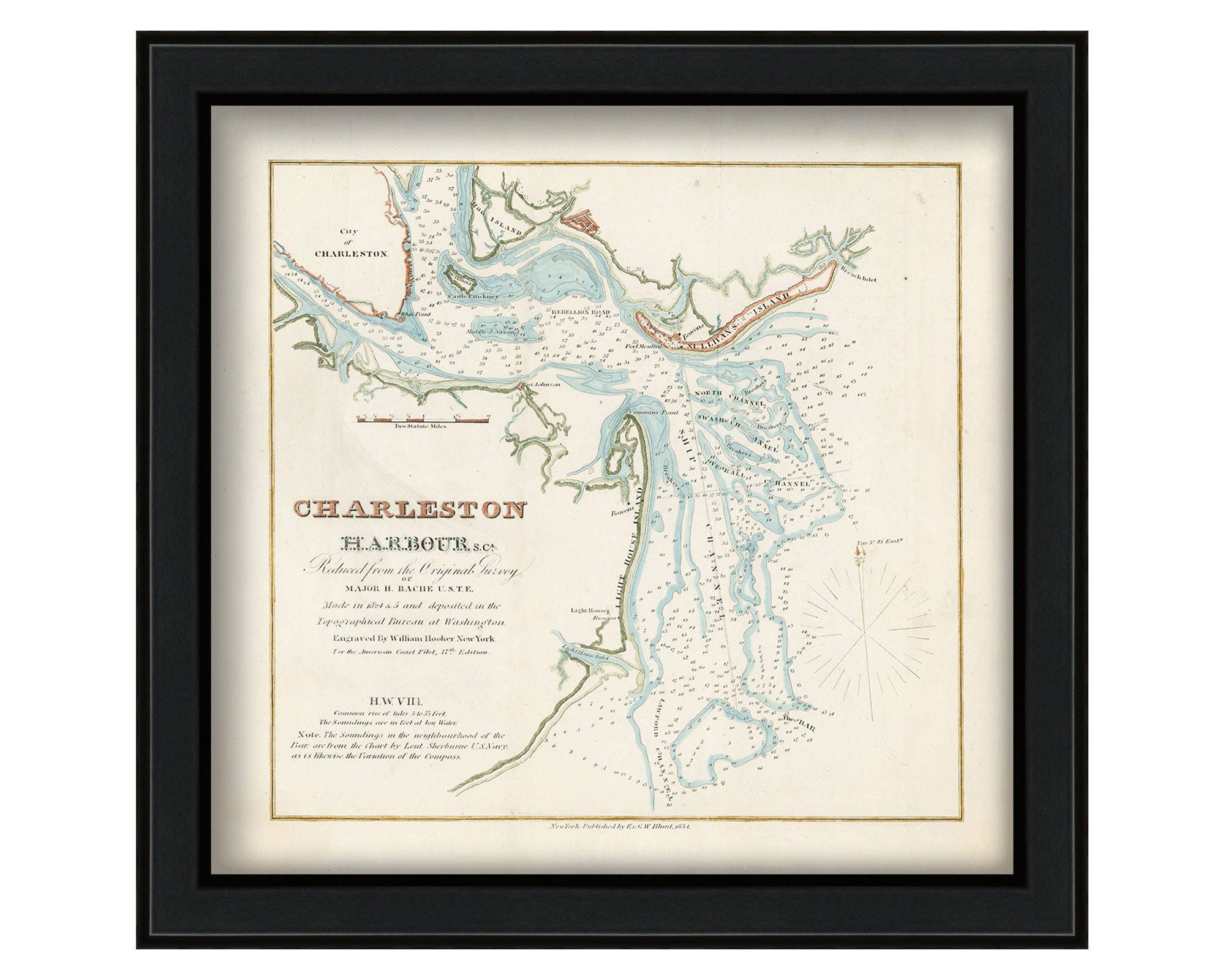
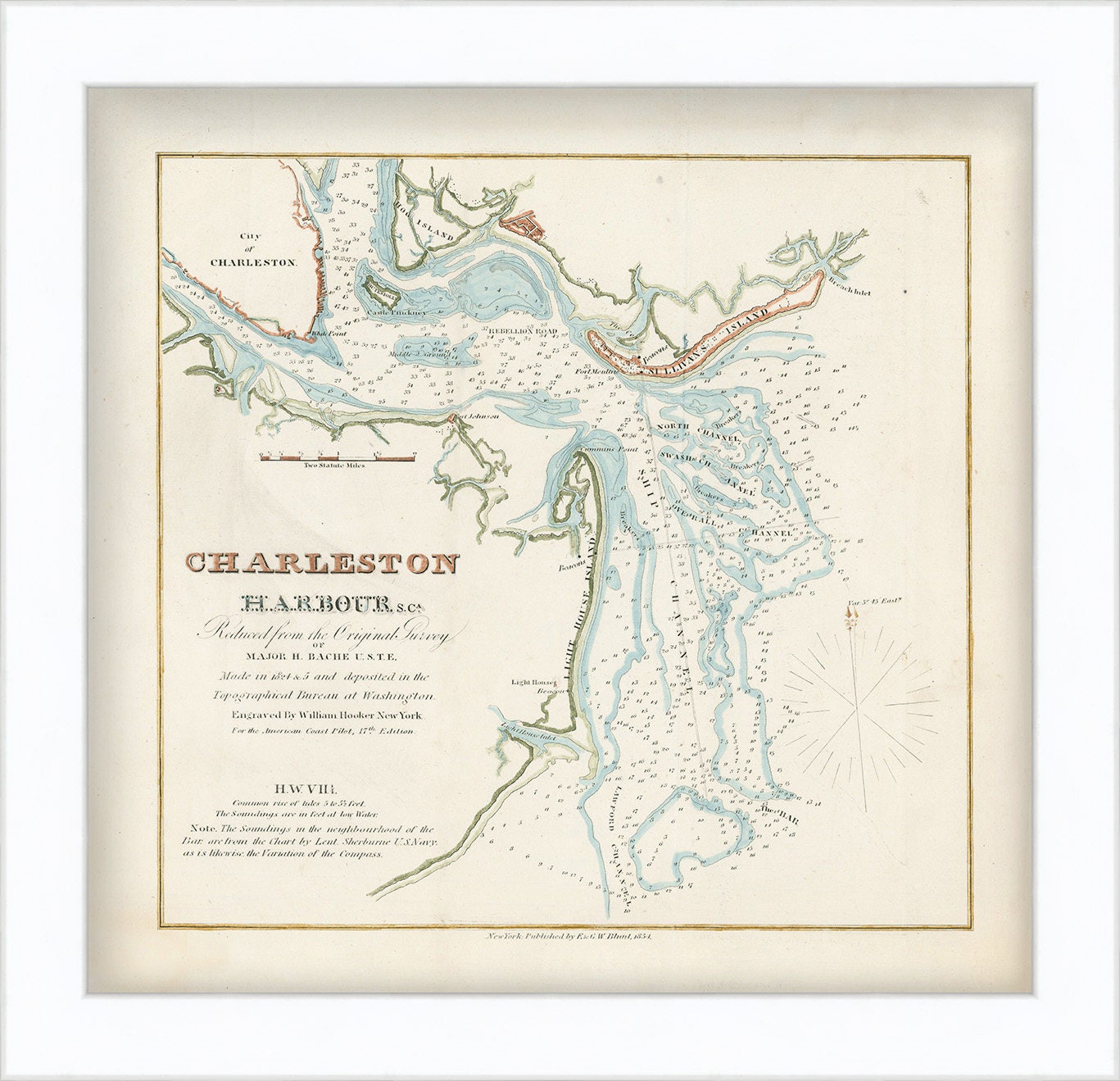
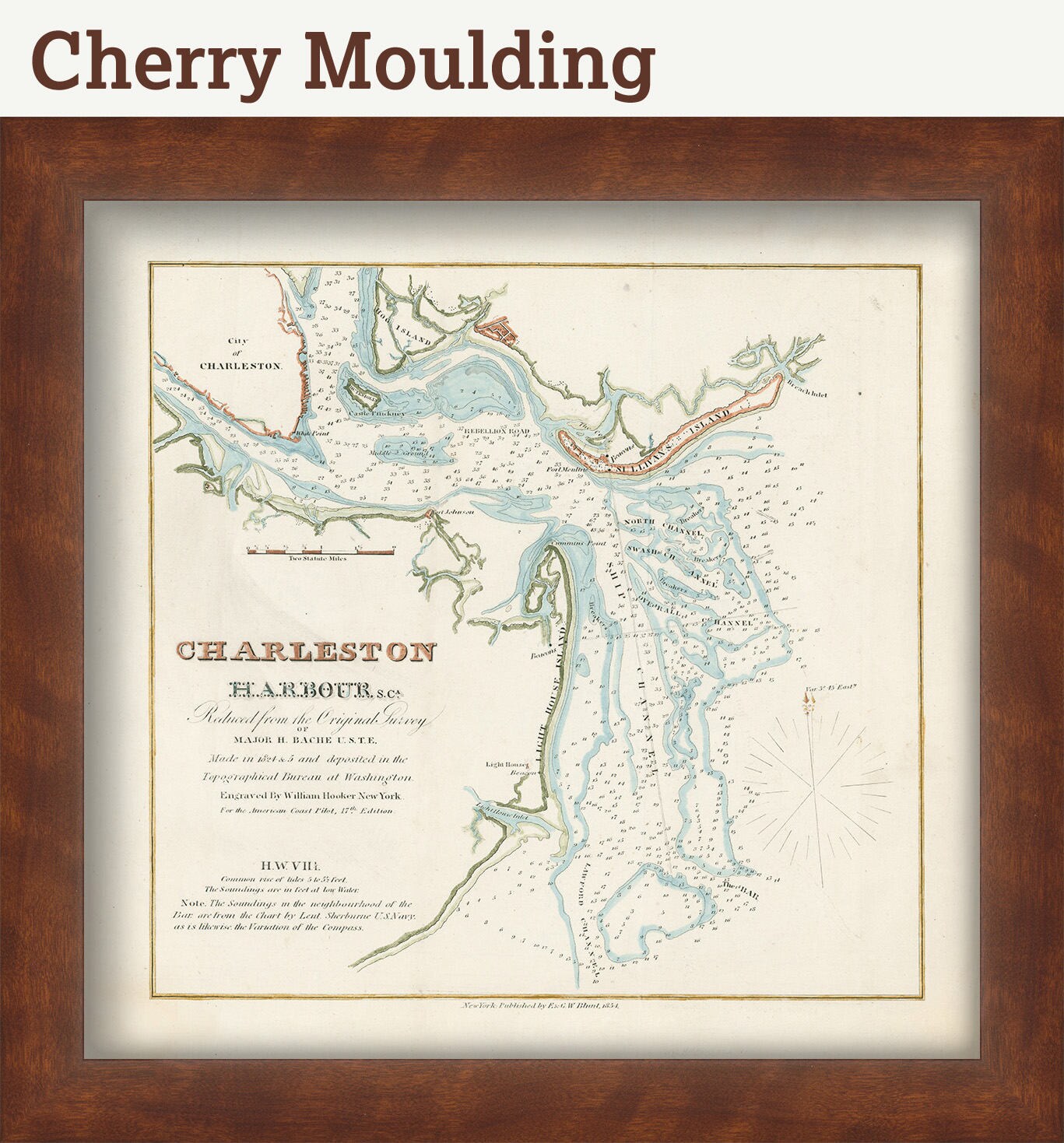
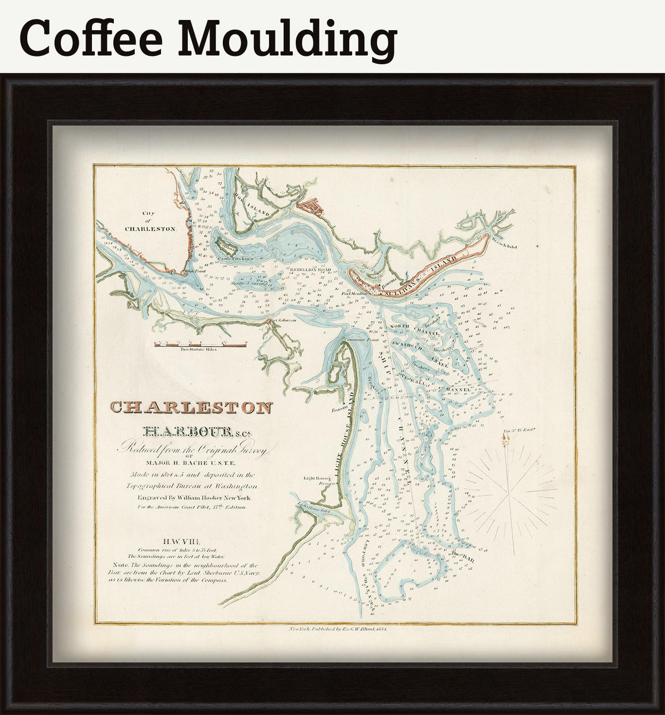
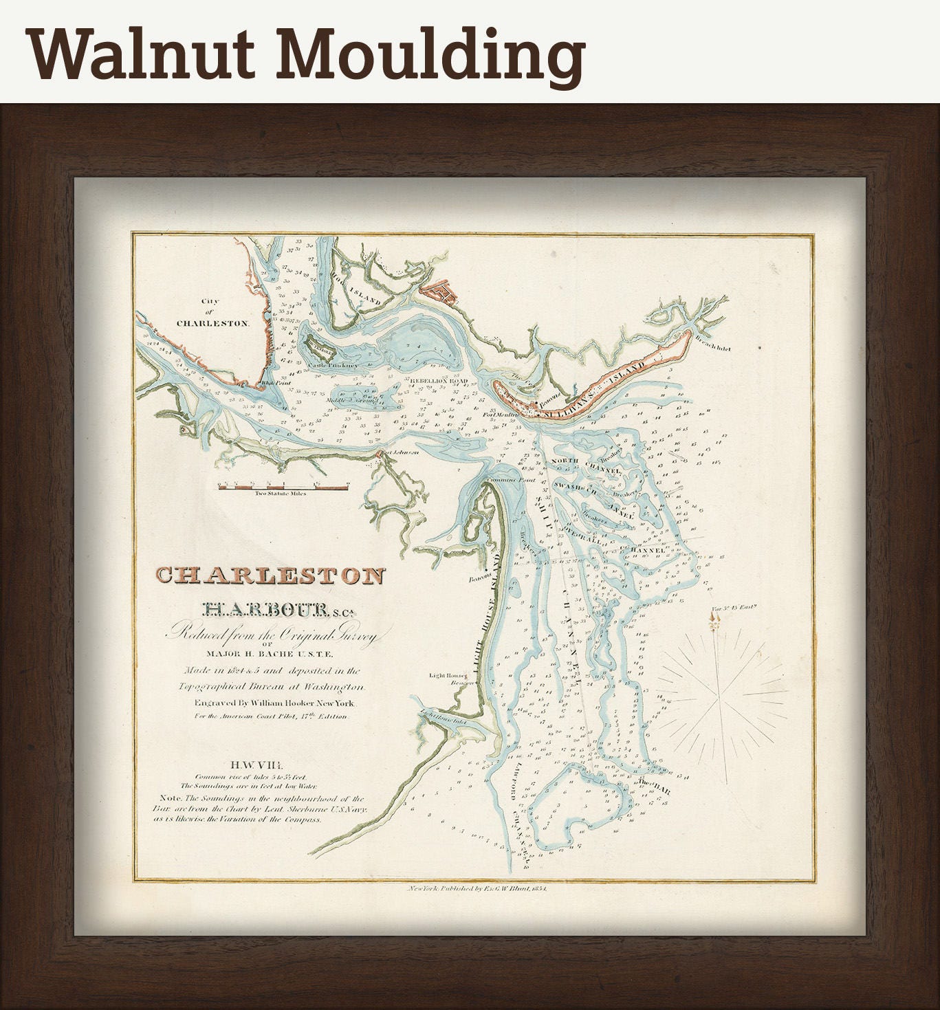
CHARLESTON HARBOR, South Carolina 1825 - Nautical Chart by Edmund Blunt
$33.00
A Reproduction Nautical Chart of Charleston Harbor, South Carolina by Edmund Blunt originally published in 1825.
Edmund Blunt [1799-1866] was the son of New York publisher Edmund March Blunt. He worked as a surveyor for his father’s company and eventually became assistant to Ferdinand Rudolph Hassler on the U.S. Coast Survey.
Original Dimensions of the Map are: 16" wide by 15" tall. The replica (i.e. reproduction) version of this map is available for $25
Framed Dimensions are:19" wide by 18" tall. Replica maps are available framed for an additional $125.
Framed maps include drymounting, UV filtering glass, and your choice of five mouldings, wired and ready to hang upon delivery.
This map has been scanned From The Original at 600 dpi using state of the art equipment. The replica map is printed on heavy matte fine art paper using archival pigment inks. This is one of over 5000 Original maps, charts and posters in our collection.
Custom sizes are available. If you are interested in a custom size, please let us know through the "ask a question" button in this listing.
Retailers who would like to carry our Maps, please contact us through the "ask a question" button in this listing, for information and discounts.
0531
Shipping from United States
Processing time
1-3 business days
Customs and import taxes
Buyers are responsible for any customs and import taxes that may apply. I'm not responsible for delays due to customs.
Payment Options
Returns & Exchanges
Returns & exchanges not accepted
But please contact me if you have problems with your order
I gladly accept cancellations
Request a cancellation within: 1 hours of purchase
Reviews (1)
Average:
Sep 16, 2022
Jenna Wilson