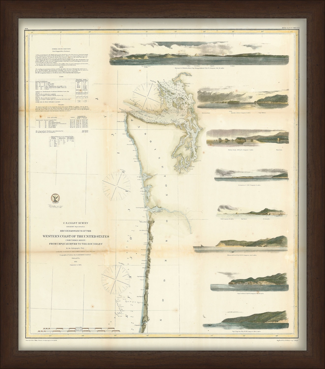
Western Coast of the United States, WASHINGTON and OREGON Nautical Chart 1855- Umpquah River to the Boundary
$50.00
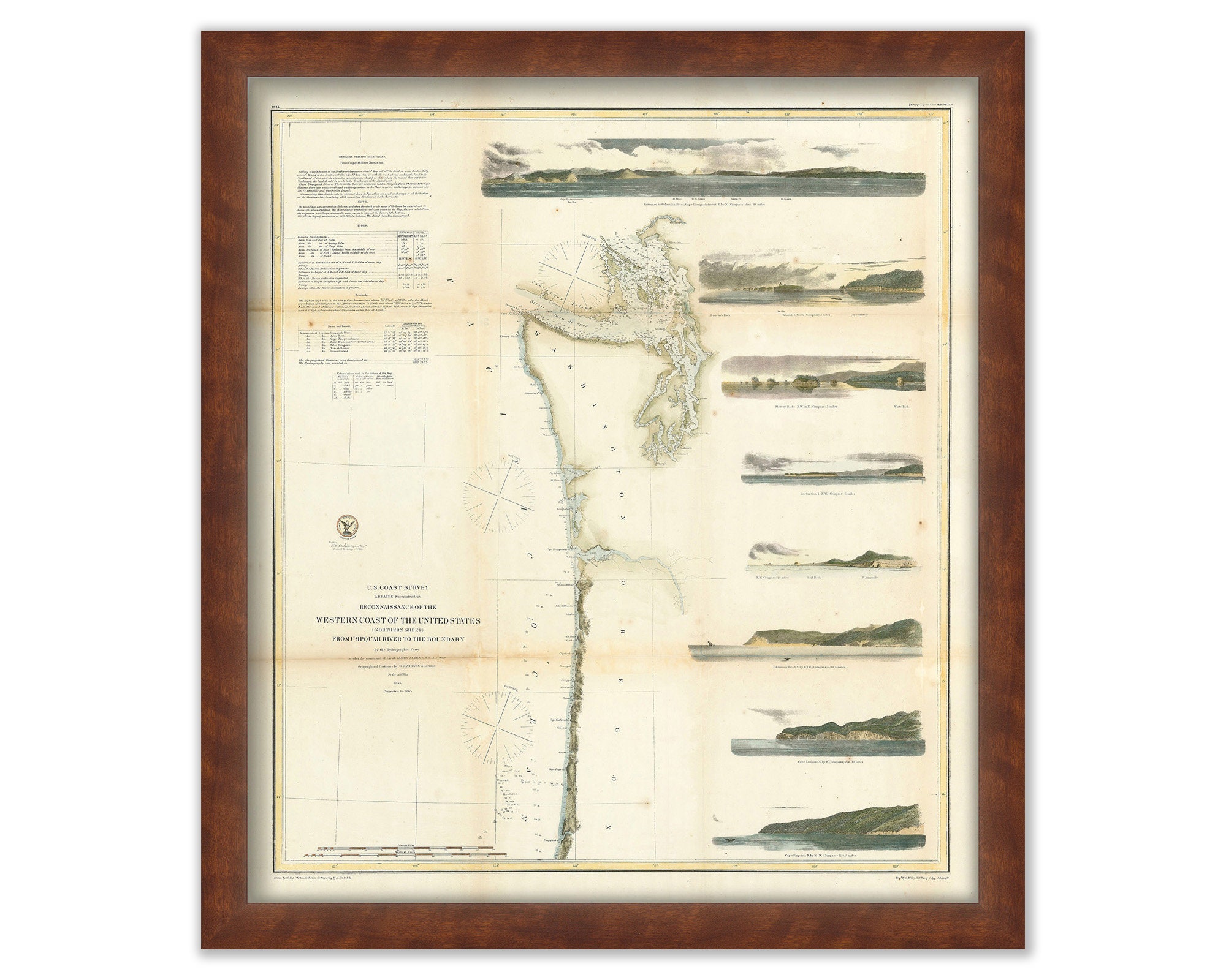
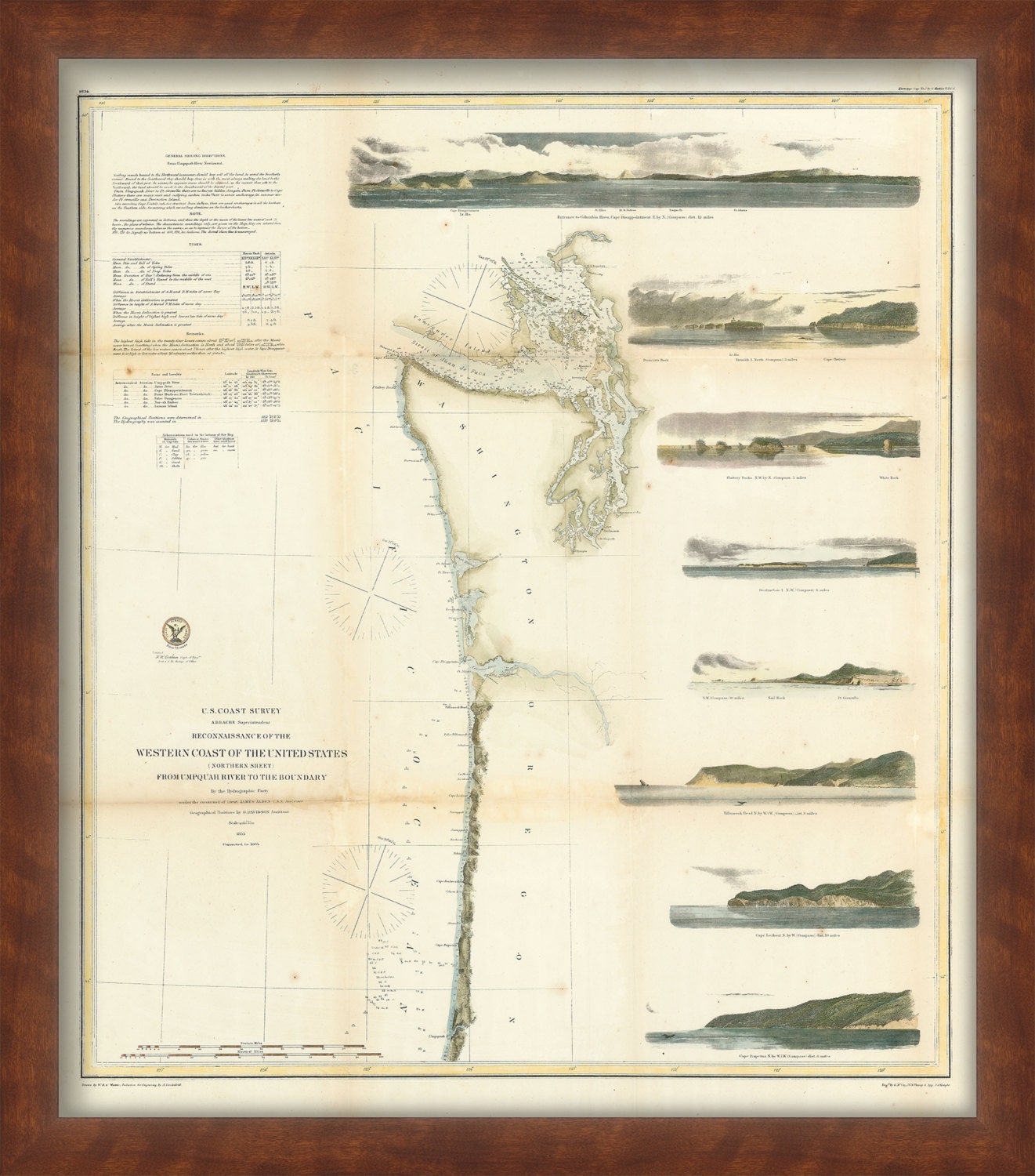
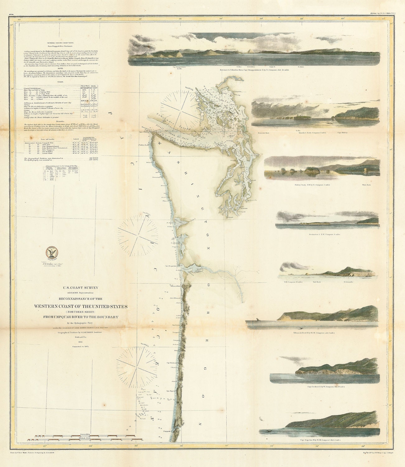
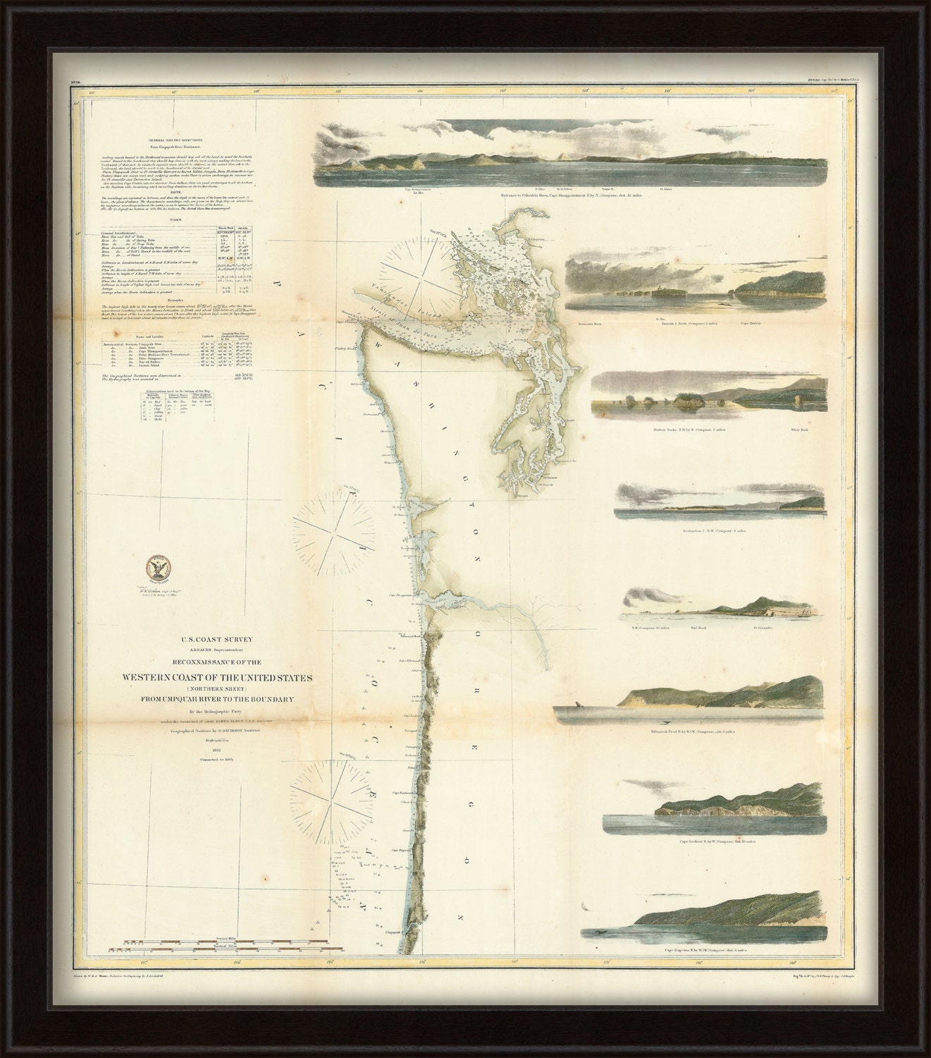
A reproduction of a hand colored nautical chart of the western coast of the United States-Umpquah River to the Boundary, originally published in 1855. Dimensions: 26.5" wide x 23.5" high. Printed on a heavy 230 gsm fine art paper with archival pigment inks. Our extensive collection has been digitalized in house using a high definition large format scanner for optimal image quality. Framing options are available. Framed items include: choice of frame, drymounting, UV protectant glass, ready to hang.
Framed Dimensions are: 29.5" wide by 26.5" tall
Custom sizes are available. If you are interested in a custom size, please let us know through the "ask a question" button in this listing
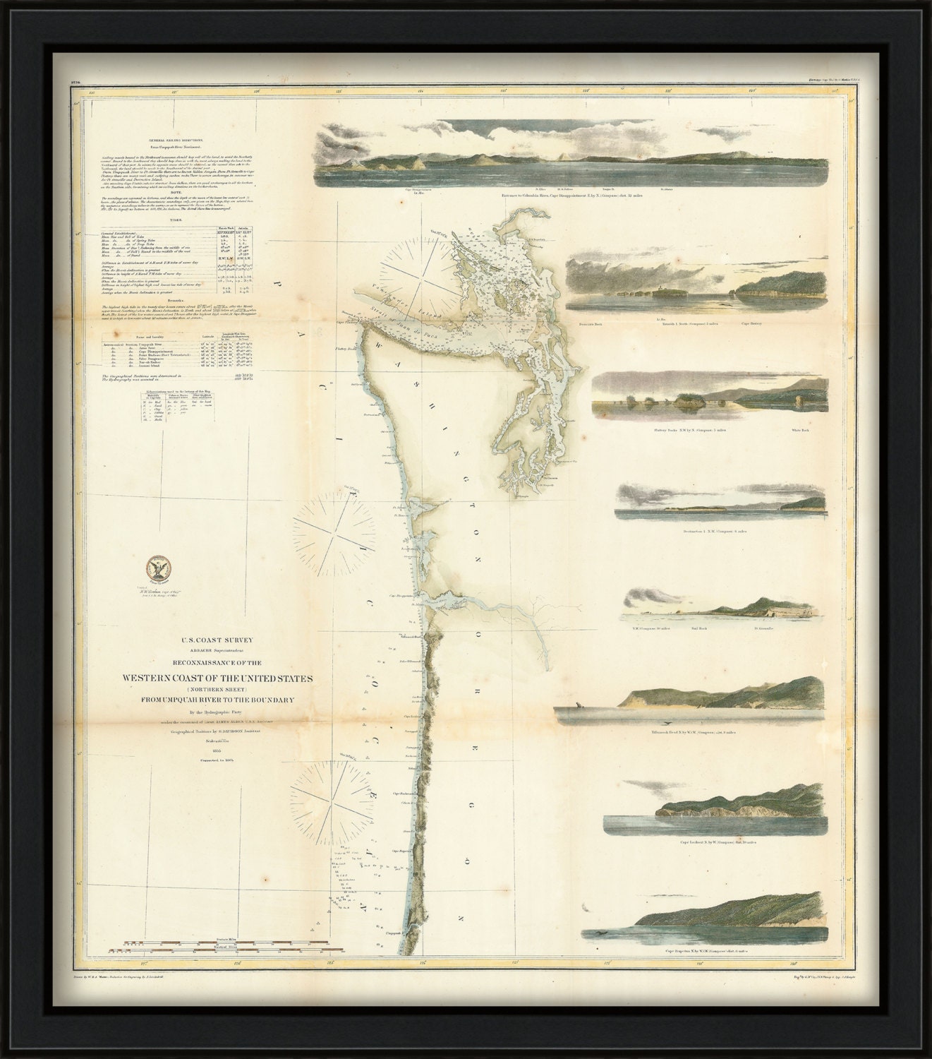
The replica (i.e. reproduction) version of this map is available for $32.
This map has been scanned at 300 dpi using state of the art equipment. The replica map is printed on heavy matte fine art paper using archival pigment inks.
Replica maps are available framed for $195.
If you would like to inspect a higher resolution version of this map, please copy and paste this url into a new tab in your browser:
http://rmicusec.sirv.com/etsy/10164.jpg
0522
Shipping from United States
Processing time
1-3 business days
Customs and import taxes
Buyers are responsible for any customs and import taxes that may apply. I'm not responsible for delays due to customs.
Payment Options
Returns & Exchanges
Returns & exchanges not accepted
But please contact me if you have problems with your order
I gladly accept cancellations
Request a cancellation within: 1 hours of purchase